 Block
Windham, Connecticut
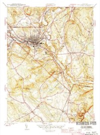
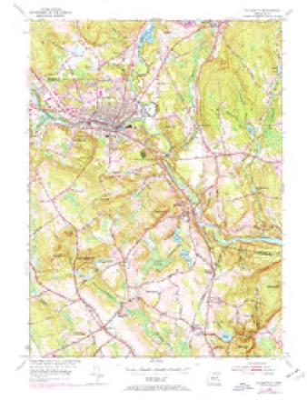
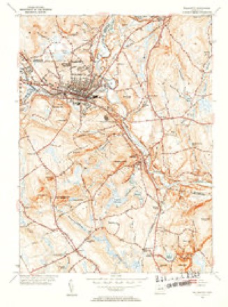
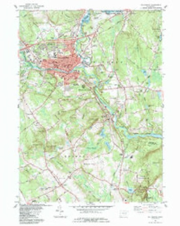
30 topographic sheets cover this place, the earliest surveyed in 1892 and the latest in 1994. It stands in Windham town. It lies in ZIP code area 06280. It lies near Mullin Hill. The Survey maps it on the Willimantic quadrangle.
On record in Windham
Buildings and businesses the archive holds for this place. Each opens its own page, with the source record it came from.
On the National Register 5 records
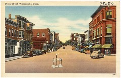 Main Street Historic District (Boundary Increase)listed 1992
 Willimantic Armorylisted 1985
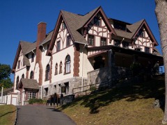 Willimantic Elks Clublisted 2005
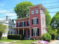 Windham Center Historic Districtlisted 1979
- March Route of Rochambeau's Army: Scotland Roadlisted 2003
Topographic sheets covering this place
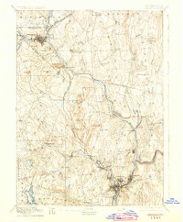
12 surveys from 30 printed sheetsMatched by testing this settlement's coordinate against the published boundary of every sheet in the United States Geological Survey's historical collection. Each opens the scanned sheet at the Survey.
- 1892 USGS Norwich quadrangle1:62500, 8 printings
- 1945 USGS Willimantic quadrangle1:31680, 3 printings
- 1947 USGS Hartford quadrangle1:250000, 2 printings
- 1948 USGS Hartford quadrangle1:250000, 2 printings
- 1953 USGS Willimantic quadrangle1:24000, 3 printings
- 1953 USGS Willimantic quadrangle1:31680, 2 printings
- 1961 USGS Hartford quadrangle1:250000
- 1962 USGS Hartford quadrangle1:250000, 3 printings
- 1965 USGS Hartford quadrangle1:250000, 2 printings
- 1984 USGS Willimantic quadrangle1:24000
- 1986 USGS Hartford quadrangle1:100000
- 1994 USGS Hartford quadrangle1:100000, 2 printings







In the county-history sources
50,220 words on this townshipHistory of Windham County, Connecticut .., published 1889 names this settlement in its chapter on Windham Town. These are the passages that mention it, exactly as the scans read.
THE town of Windham, one of the smallest in geographical size, but the largest in population, wealth and business importance, occupies the extreme southwest corner of Windham county. Its area is about two and three-fourths square miles. The beautiful valley of the Willimantic river extends along the southern part, entering at the extreme western point and leaving at the southeastern corner. This river affords abundant water power for many factories, and to this circumstance is due the building up and prosperity of the town. The Natchaug, a considerable stream, joins it a short distance east of the borough limits of Willimantic. Back from the river the town is broken into successive ridges of hills, rising about two hundred feet above the general level of the intervening valleys. Besides the borough of Willimantic, in the southwest part, the smaller villages of North Windham in the northern part, South Windham in the southern part and Windham in the central part, are in this town. Otherwise the surface of the town is mostly covered with forest growth which affords some valuable timber. The agricultural interests of the town are not prominent. The New York & New England railroad extends through the western and northern parts and the Providence Division and the
Passage source: History of Windham County, Connecticut .., published 1889.
New London Northern run along the WiUimantic valley in the southern part. The geographical size of the original town of Windham has been greatly diminished by the formation of the towns of Scotland, Hampton and Chaplin.
Passage source: History of Windham County, Connecticut .., published 1889.
The acquisition of the Indian title to the territory occupied by Windham has been set forth in a previous chapter so fully that It will only be necessary here to repeat that the territory in question was a gift by will of the Indian Joshua to sixteen gentlemen of Norwich, who were intrusted with the business of settling a plantation upon it. The first settlement upon it is said to have been made by one John Gates, an English refugee, in the autumn of 1688. From that, settlement progressed slowly for three years, when there were upon the tract about thirty settlers. None of the men named in the bequest, however, became actual settlers. In the autumn of 1691 application was made for a town charter, but the grant was not immediately made. In the following spring, however, the petition was granted, the general court of Connecticut on the 12th of May, 1692, enacting that township privileges be granted to the petitioners, and that the town should be called Windham. These petitioners were Joshua Ripley, John Cates, Jeremiah Ripley, Jonathan Crane, Joseph Huntington, William Backus, Jonathan Ginnings, Thomas Huntington, Richard Hendee, John Backus and John Larrabee.
Passage source: History of Windham County, Connecticut .., published 1889.
Machine-read from a century-old scan, so expect the errors a machine makes: misspelled names, dropped words, stray characters.
Read the whole chapter on Windham Town - it names this place 123 more 123 times.
Fires near this place
96 since 1992Regional context, not property-specific evidence. The federal wildfire occurrence database lists 96 fires within 5 miles of Windham between 1992 and 2020, burning about 241 acres in total. 2 started naturally. 10 were recorded as arson. Distance is straight-line from the map coordinates, so a fire counted here may appear on a neighbouring settlement's page as well.
| Reported cause | Fires |
|---|---|
| Missing data/not specified/undetermined | 42 |
| Misuse of fire by a minor | 14 |
| Arson/incendiarism | 10 |
| Recreation and ceremony | 9 |
| Smoking | 6 |
| Debris and open burning | 5 |
| Equipment and vehicle use | 3 |
| Railroad operations and maintenance | 3 |
| Natural | 2 |
| Power generation/transmission/distribution | 2 |
The most recent of them, most recent first, with the day each was reported and the service that recorded it.
| Date | Cause | Size | Reported by | Name on the report |
|---|---|---|---|---|
| 8 September 2020 | Missing data/not specified/undetermined | under an acre | Connecticut Division of Forestry | 124 CHAPMAN STREET |
| 4 September 2018 | Recreation and ceremony | under an acre | Connecticut Division of Forestry | 69 CIRCLE DRIVE |
| 3 September 1995 | Arson/incendiarism | 2.0 acres | Connecticut Division of Forestry | not named |
| 16 September 2020 | Recreation and ceremony | 94 acres | Connecticut Division of Forestry | AIRLINE TRAIL |
| 9 August 1998 | Recreation and ceremony | 1.0 acres | Connecticut Division of Forestry | not named |
| 5 August 2016 | Recreation and ceremony | 1.0 acres | Connecticut Division of Forestry | HAIN MATERIAL CORP, IN THE REAR OF |
| 29 August 1995 | Arson/incendiarism | 1.0 acres | Connecticut Division of Forestry | not named |
| 4 July 2017 | Missing data/not specified/undetermined | under an acre | Connecticut Division of Forestry | 75 MURPHY HILL RD |
Settlements close enough to share some of these fires:
Mines and quarries near this place
10 of 36 shownRegional context, not property-specific evidence. The federal mineral resources record lists 36 workings within 5 miles of Windham: 27 past producers, 8 producers, 1 unknown. 8 still produce. What was taken out: Stone, Stone, Dimension, Sand and Gravel, Construction, Granite. Distance is straight-line from the map coordinates, so a quarry counted here may appear on a neighbouring settlement's page as well.
| Where | Site | Commodity | Status | Recorded |
|---|---|---|---|---|
| Larrabee Quarry | Granite | Past Producer | ||
| Hain Sand & Gravel | Sand and Gravel, Construction | Unknown | ||
| Hain Sand and Gravel Pit | Sand and Gravel, Construction | Producer | ||
| Plains Road Pit | Sand and Gravel, Construction | Producer | ||
| South Windham Pit | Sand and Gravel, Construction | Past Producer | Sedimentary | |
| South Windham Pit | Sand and Gravel, Construction | Producer | ||
| Windham Sand and Stone, Inc. Pit | Sand and Gravel, Construction | Past Producer | Sedimentary | |
| Windham Sand and Stone, Inc. Pit | Sand and Gravel, Construction | Producer | ||
| Alaskite Or Quartz Monzonite Gneiss Rock Quarry No. Aj-001 | Stone | Producer | ||
| Alaskite Or Quartz Monzonite Gneiss Rock Quarry No. Aj-002 | Stone | Producer |
Storms near this place
24 since 1997Regional context, not property-specific evidence. The National Weather Service names Windham in 24 storm reports between 1997 and 2024: 14 thunderstorm wind, 5 hail, 4 flood, 1 flash flood. No death or injury is recorded in these reports. Each account below is quoted exactly as the forecast office filed it, from the NOAA Storm Events Database, and each date opens the federal record of that event.
| When | Event | Place named | Harm | What the report says |
|---|---|---|---|---|
| September 2018 | Flood | Windham | $40,000 | At 8:00 PM EST, Jennings Lane in Windham was flooded, impassable, and closed due to a possible washout. |
| July 2011 | Thunderstorm Wind | Windham | $30,000 | Many trees in South Windham were downed by thunderstorm winds. Also, a large branch was downed onto the steps of town hall. |
| June 2009 | Flash Flood | Windham | $30,000 | Many roads were impassable across Mansfield and Willimantic. A store on Storrs Road in Mansfield was flooded and a house on Jackson Street in Willimantic was flooded. |
| February 2008 | Flood | Windham | $20,000 | In Windham, Routes 6 and 32 were flooded. Several streets and yards were flooded with six inches of water in Putnam. In the Moosup area of Plainfield, several yards were flooded. Freedley Road in Pomfret was closed due to flooding. |
| June 2012 | Thunderstorm Wind | Windham | $15,000 | Trees and wires near the new school in Windham were downed by thunderstorm winds. |
| July 2006 | Thunderstorm Wind | Windham | $15,000 | no account filed |
| August 2012 | Thunderstorm Wind | Windham | $10,000 | Trees and wires on Washington Street were downed by thunderstorm winds. |
| May 2006 | Thunderstorm Wind | Windham | $8,000 | no account filed |
| May 2006 | Thunderstorm Wind | Windham | $5,000 | no account filed |
| August 2005 | Thunderstorm Wind | Windham | $5,000 | no account filed |
| July 2005 | Thunderstorm Wind | South Windham | $5,000 | no account filed |
| July 2023 | Thunderstorm Wind | North Windham | $3,000 | In North Windham, a tree was down on a mobile home. |
| July 2022 | Thunderstorm Wind | Windham | $800 | In Windham, a tree and wires were down on South Windham Road. Report relayed by amateur radio. |
| November 2021 | Thunderstorm Wind | South Windham | $800 | In South Windham, a tree was down on wires on Babcock Hill Road. |
| July 2023 | Thunderstorm Wind | Windham | $500 | In Willimantic, a tree was down on Plains Road. |
| July 2023 | Thunderstorm Wind | North Windham | $500 | In Willimantic, a tree was downed on Old Boston Post Rd. |
| June 2024 | Thunderstorm Wind | Windham | $300 | In Willimantic, a tree was down across a road. |
| September 2018 | Flood | Windham | - | At 8:33 PM EST, Indian Hollow Road in Windham was reported flooded and impassable with debris in the road. |
| June 2009 | Hail | Windham | - | Penny to quarter size hail fell in South Windham. |
| March 2008 | Flood | Windham | - | Several streets were flooded in Windham, including Route 32, part of which was closed because of the flooding. |
| July 2003 | Hail | Windham | - | no account filed |
| June 1998 | Hail | Windham | - | no account filed |
| May 1997 | Hail | North Windham | - | no account filed |
| August 1997 | Hail | Windham | - | no account filed |
Nearest settlements
The eight closest, with where each one stands in the county. Distances are straight-line, computed from the Geographic Names Information System coordinates.
| Map | Place | Distance | Sheets |
|---|---|---|---|
| South Windham | 1.6 miles | 30 | |
| Willimantic | 2.8 miles | 30 | |
| Johnson Park | 3.2 miles | 30 | |
| North Windham | 3.4 miles | 30 | |
| Scotland | 4.0 miles | 28 | |
| Sherman Corner | 5.0 miles | 29 | |
| South Chaplin | 5.5 miles | 29 | |
| Bedlam Corner | 5.5 miles | 29 |
Provenance
This settlement is recorded in the Geographic Names Information System as feature 212184. The sheet list is computed by point-in-boundary test against the United States Geological Survey's historical topographic inventory. Both are works of the United States government and carry no copyright under 17 U.S.C. 105.
Wildfire. Short, Karen C. 2022. Spatial wildfire occurrence data for the United States, 1992-2020 [FPA_FOD_20221014]. 6th Edition. Fort Collins, CO: Forest Service Research Data Archive. https://doi.org/10.2737/RDS-2013-0009.6 Collected with United States Government funding and usable without additional permissions or fees.
Mines and quarries. USGS Mineral Resources Data System (MRDS) https://mrdata.usgs.gov/mrds/ A work of the United States government, no copyright under 17 U.S.C. 105.
Storms. NOAA National Centers for Environmental Information, Storm Events Database https://www.ncei.noaa.gov/stormevents/ A work of the United States government, no copyright under 17 U.S.C. 105. Narratives are quoted verbatim from the National Weather Service report and are not edited or summarised.