BlockBefore
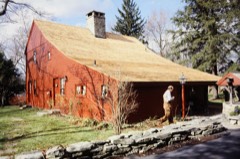
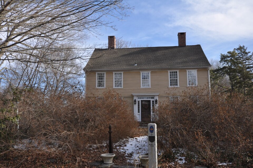
Photograph of Daniel Basset House
Photograph by Magicpiano, CC BY-SA 4.0. Via Wikimedia Commons.

Daniel Basset House

Listed on the National Register of Historic Places in 2002.

From the record

“The Daniel Basset House is a historic house at 1024 Monroe Turnpike in Monroe, Connecticut, built in 1775. It is significant for its association with events in the American Revolutionary War.”

Wikipedia article Daniel Basset House, CC BY-SA 4.0.

One of 298 National Register listings published here for Fairfield County · listed in 2002 · category: Building.

Sources: the Wikipedia article · the case file at the National Archives · the National Register database, National Park Service


The listing

  • What is counted as historic. The nomination lists 3 buildingss as contributing to the listing.
  • Listed as. Basset, Daniel, House - the National Register files a house under its owner's surname.
  • Address. 1024 Monroe Turnpike, Monroe, 06468
  • When was it listed? August 2002
  • Category. building
  • Also known as. Rochambeau's Army in Connecticut, 1780-1782 MPS
  • Town. Monroe town
  • National Register reference number. 02000870 - the number the National Park Service assigned this property when it was listed, and the key its nomination file is catalogued under at the National Archives.

Fires near this property

71 since 1994

Regional context, not property-specific evidence. The federal wildfire occurrence database lists 71 fires within 5 miles of Daniel Basset House between 1994 and 2020, burning about 35 acres in total. None started naturally. None was recorded as arson. Distance is straight-line from the map coordinates, so a fire counted here may appear on a neighbouring settlement's page as well.

Reported cause Fires
Missing data/not specified/undetermined66
Smoking2
Debris and open burning2
Railroad operations and maintenance1

The most recent of them, most recent first, with the day each was reported and the service that recorded it.

DateCause SizeReported by Name on the report
4 September 2015Missing data/not specified/undeterminedunder an acreConnecticut Division of Forestrynot named
3 September 2020Missing data/not specified/undeterminedunder an acreConnecticut Division of Forestry838 MAIN STREET
29 September 2015Missing data/not specified/undeterminedunder an acreConnecticut Division of Forestrynot named
19 September 2020Missing data/not specified/undetermined1.5 acresConnecticut Division of Forestry51 OLD TANNERY ROAD
16 September 2020Missing data/not specified/undetermined1.5 acresConnecticut Division of ForestryHERITANG DRIVE
7 August 2020Missing data/not specified/undeterminedunder an acreConnecticut Division of ForestryWHITEFIELD DRIVE
28 August 2016Missing data/not specified/undeterminedunder an acreConnecticut Division of Forestry57 MONROE TURNPIKE TRUMBULL
23 August 2020Missing data/not specified/undeterminedunder an acreConnecticut Division of Forestry37 MARATHON ROAD

Every fire recorded in Fairfield County

Mines and quarries near this property

10 of 35 shown

Regional context, not property-specific evidence. The federal mineral resources record lists 35 workings within 5 miles of Daniel Basset House: 29 past producers, 3 occurrences, 3 producers. 3 still produce. What was taken out: Sand and Gravel, Construction, Bismuth, Quartz, Stone. Distance is straight-line from the map coordinates, so a quarry counted here may appear on a neighbouring settlement's page as well.

Where SiteCommodity StatusRecorded
Arsenopyrite Mine No. Ek-017Arsenic, Iron, SulfurPast Producer
Burnett Fluorite Chalcopyrite OccurrenceFluorine-Fluorite, Copper, Iron, SulfurOccurrenceChalcopyrite, Fluorite, Malachite
Connecticut Infusoria Co. MineDiatomitePast Producer
Devils Den Limestone QuarryLimestone, DimensionPast Producer
Lane's Bismuth and Sulfide Mine In MonroeBismuth, Sulfur, IronPast ProducerMassive Quartz Lense
Lane's MineTungstenPast Producer
Lane's MineLead, Bismuth, Stone, TungstenPast Producer
Marble QuarryMarble, DimensionPast Producer
Monroe (Lane's Mine)Silver, Bismuth, TungstenOccurrenceQuartz Vein
Pegmatite Quarry East VillageBeryllium, Feldspar, MicaPast Producer

Every working recorded in Fairfield County

Storms near this property

15 since 1994

Regional context, not property-specific evidence. The National Weather Service names Monroe, the town this property stands in, in 15 storm reports between 1994 and 2024: 11 thunderstorm wind, 2 hail, 1 tornado, 1 flash flood. No death or injury is recorded in these reports. Each account below is quoted exactly as the forecast office filed it, from the NOAA Storm Events Database, and each date opens the federal record of that event.

WhenEvent Place namedHarm What the report says
August 2024Thunderstorm WindMonroe$5,000Trees, wires and utility poles down on Main Street. Trees down on Old Oak Street. Large tree blocking Lantern Hill Road.
October 2020Thunderstorm WindMonroe$5,000A couple of trees and powerlines down in town. Time estimated by radar.
July 2024Thunderstorm WindMonroe$3,000A 911 Call Center reports three trees down in Monroe.
September 2021Thunderstorm WindMonroe$2,000A large tree snapped in half on Countryside Drive.
June 2011Thunderstorm WindMonroe$1,500There were reports of two trees down in a backyard along Richards Road in Monroe.
August 2024Thunderstorm WindMonroe$1,000Picture of a large tree snapped in half on Woodsgrove Road in Shelton CT.
June 2024Thunderstorm WindMonroe$1,000Power outage caused by downed trees and tree limbs.
July 2012Thunderstorm WindMonroe$1,000A gust of 70 mph was measured, felling a tree.
June 2010Thunderstorm WindMonroe$500Wires were reported down on a car.
August 2024Flash FloodMonroe-Multiple motorists stranded with water rescues ongoing in Monroe. Fire department responding with extra equipment to assist with the rescues.
July 2010HailMonroe-Quarter size hail was reported.
June 2005HailMonroe-Thunderstorms produced penny size hail as they moved through Monroe.
July 1996Tornado (F1)Monroe-The NWS confirmed that a small F1 tornado touched down in Northwest Monroe.The tornado originated near Bridal Path Trail and Quarter Horse Drive in Northwest Monroe and moved northeast across Hattertown Road. Damage was confined mostly to trees along the path. The determination was made primarily based on rotational tree damage patterns and eyewitness accounts. Elsewhere in the Monroe area, straight line wind damage occurred. West winds estimated at 75 to 100 MPH knocked down numerous large trees, some of which fell on power lines and houses. Several of the large trees were weeping willows with shallow root systems. All trees were observed pointing east. Some areas affected included parts of Lovers Lane, Far Horizon Drive, Moss Road, Cross Hill Road and Elm Street.
June 1994Thunderstorm WindMonroe-Several power lines were reported down in the Greenwich area and about 2500 electric customers lost power. Numerous large tree branches were blown down in Monroe. Up to 30,000 electric utility customers statewide lost power for a brief time. There were 9000 outages in Guilford and 1000 outages in Branford after lightning struck a 27,000 volt line.
May 1994Thunderstorm WindMonroe-A wire was reported down in the Stevenson area. ,

Every storm recorded in Fairfield County

Map coverage status

No historic map-sheet match is published for this property yet. That does not mean no map exists. This record needs a coordinate-quality review before it can be joined to a sheet boundary. Browse the county's mapped places while that work is pending.

Listed places nearby

6 within 8 miles

Other National Register properties close enough to walk or drive between, ordered by distance from this one. Both positions come from the same geocoding pass that matched these properties to their map sheets.

Photograph PropertyDistance Listed
Monroe Center Historic District1.2 miles1977
Nathan B. Lattin Farm1.6 miles1990
Stevenson Dam Hydroelectric Plant2.8 miles2000
Thomas Hawley House4.2 miles1980
Huntington Center Historic District4.8 miles2000
David Mallett Jr. House5.4 miles1986

Sources for this property

National Archives recordThe nomination case file for reference 02000870 in Record Group 79.
Wikipedia articleCommunity-written account of this property, licensed CC BY-SA.
Fairfield CountyAll 298 listed properties in this county.

Provenance

  • Listing record. National Park Service National Register of Historic Places, listed-properties dataset, current to 2026-05-22.
  • Map join. Address geocoded through the United States Census geocoder, then tested against the published boundary of every sheet in the USGS Historical Topographic Map Collection.
  • How this page is made. Listing fields come from federal records; map-sheet coverage is a labelled coordinate-to-boundary calculation, not a source-field claim.
  • Wildfire. Short, Karen C. 2022. Spatial wildfire occurrence data for the United States, 1992-2020 [FPA_FOD_20221014]. 6th Edition. Fort Collins, CO: Forest Service Research Data Archive. https://doi.org/10.2737/RDS-2013-0009.6 Collected with United States Government funding and usable without additional permissions or fees.
  • Mines and quarries. USGS Mineral Resources Data System (MRDS) https://mrdata.usgs.gov/mrds/ A work of the United States government, no copyright under 17 U.S.C. 105.
  • Storms. NOAA National Centers for Environmental Information, Storm Events Database https://www.ncei.noaa.gov/stormevents/ A work of the United States government, no copyright under 17 U.S.C. 105. Narratives are quoted verbatim from the National Weather Service report and are not edited or summarised.