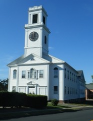
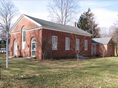
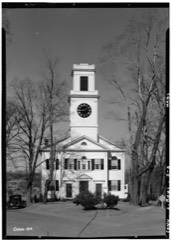
Listed on the National Register of Historic Places in 2005.
From the record
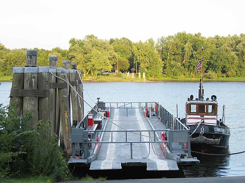
“The Glastonbury-Rocky Hill Ferry Historic District is a historic district in Glastonbury and Rocky Hill, Connecticut, encompassing a landscape with more than 300 years of colonial and post-colonial history. It includes the ferry landings and water traversed by the Rocky Hill - Glastonbury Ferry, one of the longest-running ferry services the nation, and the surrounding farmscapes and ferry landing village.”
Wikipedia article Glastonbury-Rocky Hill Ferry Historic District, CC BY-SA 4.0.
One of 451 National Register listings published here for Hartford County · listed in 2005 · category: District.
National Register reference number.05001046- the number the National Park Service assigned this property when it was listed, and the key its nomination file is catalogued under at the National Archives.
With this caution, the persons above named and their associates seem to have proceeded deliberately in the work of organization, having previously! located their meeting-liouse on the ground afterward known as the " Green." The founders of the town having come from the neighborhood of Glastonbury in England, the General Court, in June, 1692, with a disregard for correct spelling, in which the succeeding generations down to the present have sympathized, named the " town at Nabuc, over against Wethersfield," " Glassenbury." ^ The name is practically unique in this country, there being no other post-office of that name, and only one other town, Glastenbury, situated among the Green Mountains in Vermont.
Glastonbury was the first town in the colony of Connecticut formed by the division of another town. Its earlier history and traditions are inseparably a part of those of the mother-town, and as such are amply treated in Mr. Adams's history of Wethersfield. We have the satisfaction of knowing that territorially we sprang from, and are connected with, the oldest town in this Commonwealth, and that nothing but the ceaseless tide of the Connecticut River was the occasion of our separation. The territory included in Glastonbury is six miles in width from north to south, and eight miles in lengtli from east to west. These measurements are by estimate, and probably are actually exceeded by a large fraction of a mile, especially as to length. In 1803 a part of the southeast corner was detached, to form, with portions of Hebron and Colchester, the town of Marlborough ; to which another small portion was added some ten years later, and in 1859 a small farm owned by Henry Finley. Aside from these, no change has been made, except by a resolve of the General Assembly in 1874, fixing the river as the boundary on the west between the towns of Wethersfield and Glastonbury. The town is bounded north by East Hartford and Manchester ; east by Bolton, Hebron, and Marlborough ; south by Marlborough, Chatham, and Portland ; west by the Connecticut River, or the towns of Wethersfield, Rocky Hill, and Cromwell. It has almost every variety of surface, from the level plains of its northwestern portion, the elevated table-land of Nipsic, to the rugged ridges of Minnechaug, Seankum or Dark Hollow, and Meshomasic, and the hilly region approaching the river at Red Hill in Nayaug. The activity of the fathers in " lifting up their axes upon the thick trees " at an early period denuded the country of its forests, so that miles in extent could be swept with a glance of the eye. Its soil is as varied as its surface, - from the fertile meadows on the river to the beautiful and productive second lift of land between these and the meadow hill, and the lighter, sandj, and loamy lands upon the higher ground extending to the foot of the hills. In the eastern and southern portion it becomes more rocky, with occasional patches entirely free from stones. In the northeastern portion its fertility is principally confined to the valleys between the rugged hills of Minnechaug and Kongscut and the table-land to the north and west ; and in the southern part along the valley of the Roaring Brook adjoined by the table-lands in the romantic vale of Wassuc, and the higher grounds in the southern part of the town. The mountains, as they are called in this State, together with their spurs, are connected with the great eastern range which comes down from the valley of the Chicopee River in Massachusetts and is broken through by the Connecticut River at the " Straits " below Middletown. They afford, from their summits and declivities, unsurpassed views of the Connecticut valley. The streams which flow through the town, following the natural course of the valleys from northeast to southwest, form a pleasing feature in the landscape.
Regional context, not property-specific
evidence. The
federal wildfire occurrence database
lists 15 fires within 5 miles of Glastonbury-Rock Hill Ferry Historic District
between 1993 and 2020, burning about 188 acres in total. None started naturally. 3 were recorded as arson.
Distance is straight-line from the map coordinates, so a fire counted
here may appear on a neighbouring settlement's page as well.
Reported cause
Fires
Missing data/not specified/undetermined
6
Arson/incendiarism
3
Recreation and ceremony
2
Debris and open burning
2
Smoking
1
Power generation/transmission/distribution
1
The most recent of
them, most recent first, with the day each was reported and the service
that recorded it.
Regional context, not property-specific
evidence. The federal mineral resources record lists
68 workings within 5 miles of Glastonbury-Rock Hill Ferry Historic District: 57 past producers, 7 producers, 4 prospects.
7 still produce. What was taken out: Feldspar, Stone, Dimension, Sand and Gravel, Construction, Granite. Distance is straight-line from the
map coordinates, so a quarry counted here may appear on a neighbouring
settlement's page as well.
Regional context, not property-specific
evidence. The National Weather Service names
Glastonbury, the town this property stands in, in 11 storm reports between 2000 and 2023: 9 thunderstorm wind, 2 hail.
No death or injury is recorded in these reports. Each account below is quoted exactly as the forecast office
filed it, from the NOAA Storm Events Database, and each date
opens the federal record of that event.
No historic map-sheet match is published
for this property yet. That does not mean no map exists. This record needs
a coordinate-quality review before it can be joined to a sheet boundary.
Browse the county's mapped places while that work is
pending.
Listed places nearby
6 within 8 miles
Other National Register properties close
enough to walk or drive between, ordered by distance from this one. Both
positions come from the same geocoding pass that matched these properties
to their map sheets.
Listing record. National Park Service National Register of Historic Places, listed-properties dataset, current to 2026-05-22.
Map join. Address geocoded through the United States Census geocoder, then tested against the published boundary of every sheet in the USGS Historical Topographic Map Collection.
How this page is made. Listing fields come from federal records; map-sheet coverage is a labelled coordinate-to-boundary calculation, not a source-field claim.
Wildfire. Short, Karen C. 2022. Spatial wildfire occurrence data for the United States, 1992-2020 [FPA_FOD_20221014]. 6th Edition. Fort Collins, CO: Forest Service Research Data Archive. https://doi.org/10.2737/RDS-2013-0009.6 Collected with United States Government funding and usable without additional permissions or fees.
Mines and quarries. USGS Mineral Resources Data System (MRDS) https://mrdata.usgs.gov/mrds/ A work of the United States government, no copyright under 17 U.S.C. 105.
Storms. NOAA National Centers for Environmental Information, Storm Events Database https://www.ncei.noaa.gov/stormevents/ A work of the United States government, no copyright under 17 U.S.C. 105. Narratives are quoted verbatim from the National Weather Service report and are not edited or summarised.
 Block