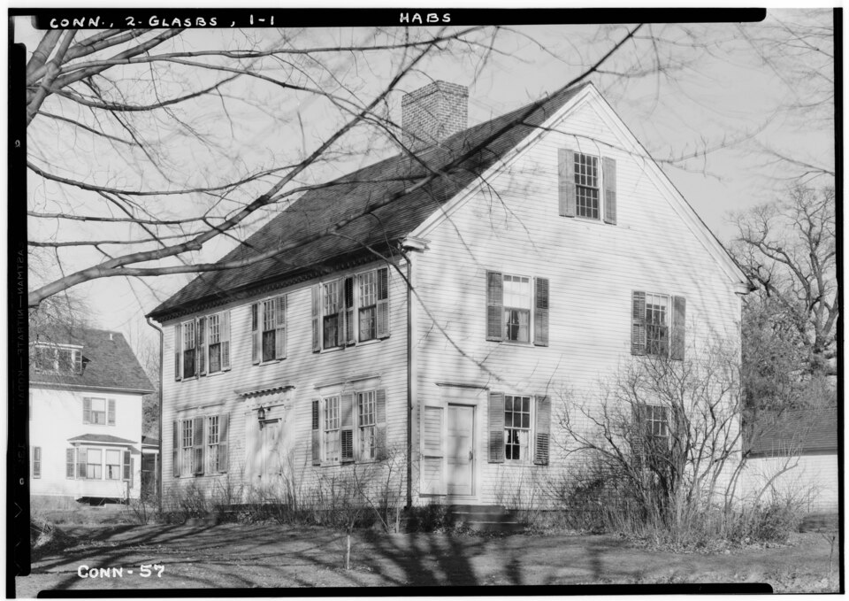
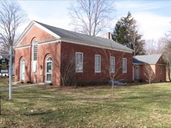
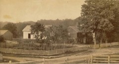
Listed on the National Register of Historic Places in 1977.
From the record
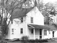
“The Welles-Shipman-Ward House is a historic house museum at 972 Main Street in South Glastonbury, Connecticut. Built in 1755, it is a well-preserved example of Georgian architecture, with the largest period fireplace in Connecticut.”
Wikipedia article Welles-Shipman-Ward House, CC BY-SA 4.0.
One of 451 National Register listings published here for Hartford County · listed in 1977 · category: Building.
National Register reference number.77001418- the number the National Park Service assigned this property when it was listed, and the key its nomination file is catalogued under at the National Archives.
The old Hollister house at South Glastonbury is said to have been built in 1675, in which case it was probably erected by John Hollister, the second of that name, son of one of the early settlers of Wethersfield. He is said not to have lived constantlv on this side, although he owned and improved land here. He is distinguished as having been the de- feiidant and the vanquished party in a lawsuit before the General Court, with the redoubtable Gershom Bulkeley as his antagonist. This mansion is said to be the oldest wooden house now standing in this State, and is in excellent repair ; and bids fair, accidents not preventing, to stand as long again. Another famous dwelling was the old Talcott house, built about 1699, which occupied the site of the present residence of the venerable Jared G. Talcott, and was built by Samuel Talcott for his son Benjamin Talcott, grandson of the lirst settler, John Talcott, who came from England in 1632. This house was fortified in the earlier part of its history, and bore the sharp compliment of an Indian tomahawk upon one of its doors. The now standing near Welles Corner, formerly occupied by Jared Welles, was built by Samuel Welles for his son Thaddeus, a great-grandson of Governor Thomas Welles, and brother of Colonel Thomas Welles, who occupied the old mansion removed by David C. Brainard within a short time. Welles Corner, with its elegant and ancient elms, is the site of the domicile of the first ancestor of the Welles family resident in Glastonbury, though the present house has hardly completed the century. Besides the ancient houses built by John Goslce, Samuel Talcott, and Thomas Hollister, in the eastern part, there are a number of very respectable antiquity in different parts of the town.
The first meeting-house was erected on the Green, at or about the time of the Rev. Mr. Stevens's ordination, in October, 1693. It was enlarged in 1706, and stood until destroyed by fire on the night of Dec. 9, 1734. The second meeting-house, by compromise between the north and south, and by the decision of the General Court, was erected on the main street, about one fourth of a mile south of the Green, standing half in the street, just north of the old Moseley tavern,^ where David H. Carrier now lives. It was used as a church for more than a century, having been built in 1735. On the division of the society in 1836, by the establishment of the society at South Glastonbury, it was abandoned as a meeting-house, and during the year 1837 was demolished. The town, on the establishment of the East Farms as a society, had no further care of ecclesiastical matters, neither did it resume the charge of schools and cemeteries until a hundred and twenty years later. The meeting-house spoken of was forty-four feet wide and lifty-six long, and twenty-four feet in height between joints. It was clapboarded without and ceiled within, the walls being filled (a very proper thing in those stoveless days), and the whole " finished in a manner suitable for a Christian people to worship God in." It was furnished with a high pulpit, overshadowed by a sounding-board at the west end, pews for the dignitaries, and seats and galleries on three sides for those of lesser magnitude, and included a seat in the southeast corner, somewhat raised, for the colored servants.
Regional context, not property-specific
evidence. The
federal wildfire occurrence database
lists 14 fires within 5 miles of Welles-Shipman-Ward House
between 1993 and 2020, burning about 183 acres in total. None started naturally. 2 were recorded as arson.
Distance is straight-line from the map coordinates, so a fire counted
here may appear on a neighbouring settlement's page as well.
Reported cause
Fires
Missing data/not specified/undetermined
6
Recreation and ceremony
2
Debris and open burning
2
Arson/incendiarism
2
Smoking
1
Power generation/transmission/distribution
1
The most recent of
them, most recent first, with the day each was reported and the service
that recorded it.
Regional context, not property-specific
evidence. The federal mineral resources record lists
65 workings within 5 miles of Welles-Shipman-Ward House: 53 past producers, 7 producers, 5 prospects.
7 still produce. What was taken out: Feldspar, Stone, Dimension, Sand and Gravel, Construction, Granite. Distance is straight-line from the
map coordinates, so a quarry counted here may appear on a neighbouring
settlement's page as well.
No historic map-sheet match is published
for this property yet. That does not mean no map exists. This record needs
a coordinate-quality review before it can be joined to a sheet boundary.
Browse the county's mapped places while that work is
pending.
Listed places nearby
6 within 8 miles
Other National Register properties close
enough to walk or drive between, ordered by distance from this one. Both
positions come from the same geocoding pass that matched these properties
to their map sheets.
Listing record. National Park Service National Register of Historic Places, listed-properties dataset, current to 2026-05-22.
Map join. Address geocoded through the United States Census geocoder, then tested against the published boundary of every sheet in the USGS Historical Topographic Map Collection.
How this page is made. Listing fields come from federal records; map-sheet coverage is a labelled coordinate-to-boundary calculation, not a source-field claim.
Wildfire. Short, Karen C. 2022. Spatial wildfire occurrence data for the United States, 1992-2020 [FPA_FOD_20221014]. 6th Edition. Fort Collins, CO: Forest Service Research Data Archive. https://doi.org/10.2737/RDS-2013-0009.6 Collected with United States Government funding and usable without additional permissions or fees.
Mines and quarries. USGS Mineral Resources Data System (MRDS) https://mrdata.usgs.gov/mrds/ A work of the United States government, no copyright under 17 U.S.C. 105.
 Block