 Block
From the record
One of 47 National Register listings published here for Tolland County · listed in 2025 · category: District.
Sources: the National Register database, National Park Service
Listed on the National Register of Historic Places in 2025.
One of 47 National Register listings published here for Tolland County · listed in 2025 · category: District.
Sources: the National Register database, National Park Service
Regional context, not property-specific evidence. The federal wildfire occurrence database lists 116 fires within 5 miles of Stafford Springs Historic District between 1999 and 2020, burning about 123 acres in total. None started naturally. 9 were recorded as arson. Distance is straight-line from the map coordinates, so a fire counted here may appear on a neighbouring settlement's page as well.
| Reported cause | Fires |
|---|---|
| Missing data/not specified/undetermined | 77 |
| Debris and open burning | 10 |
| Arson/incendiarism | 9 |
| Recreation and ceremony | 7 |
| Equipment and vehicle use | 4 |
| Misuse of fire by a minor | 3 |
| Smoking | 3 |
| Railroad operations and maintenance | 2 |
| Other causes | 1 |
The most recent of them, most recent first, with the day each was reported and the service that recorded it.
| Date | Cause | Size | Reported by | Name on the report |
|---|---|---|---|---|
| 8 September 2015 | Missing data/not specified/undetermined | under an acre | Connecticut Division of Forestry | not named |
| 7 September 2015 | Missing data/not specified/undetermined | under an acre | Connecticut Division of Forestry | not named |
| 5 September 2007 | Arson/incendiarism | under an acre | Connecticut Division of Forestry | not named |
| 3 September 2016 | Missing data/not specified/undetermined | 1.2 acres | Connecticut Division of Forestry | LADD RD TOLLAND CT |
| 28 September 2017 | Missing data/not specified/undetermined | under an acre | Connecticut Division of Forestry | 20 HIGHLAND TERRACE |
| 26 September 2007 | Debris and open burning | 1.5 acres | Connecticut Division of Forestry | not named |
| 2 September 2007 | Recreation and ceremony | under an acre | Connecticut Division of Forestry | not named |
| 9 August 2015 | Missing data/not specified/undetermined | under an acre | Connecticut Division of Forestry | not named |
Regional context, not property-specific evidence. The federal mineral resources record lists 11 workings within 5 miles of Stafford Springs Historic District: 7 past producers, 3 producers, 1 unknown. 3 still produce. What was taken out: Sand and Gravel, Construction, Stone, Stone, Dimension. Distance is straight-line from the map coordinates, so a quarry counted here may appear on a neighbouring settlement's page as well.
| Where | Site | Commodity | Status | Recorded |
|---|---|---|---|---|
| Firestone Quarries | Stone, Dimension | Past Producer | ||
| Murray Hill Quarry | Stone, Dimension | Past Producer | ||
| West Stafford Pit | Stone | Producer | ||
| West Stafford Quarry | Stone | Past Producer | ||
| Becker Pit | Sand and Gravel, Construction | Producer | ||
| Donlon Pit | Sand and Gravel, Construction | Past Producer | ||
| Joseph E Mihaliak Pit | Sand and Gravel, Construction | Past Producer | ||
| Lipton Pit & Plant | Sand and Gravel, Construction | Unknown | ||
| Pitz Pit | Sand and Gravel, Construction | Producer | ||
| Skyline Quarry | Sand and Gravel, Construction | Past Producer |
Regional context, not property-specific evidence. The National Weather Service names Stafford, the town this property stands in, in 8 storm reports between 1993 and 2020: 5 thunderstorm wind, 1 heavy rain, 1 hail, 1 flash flood. No death or injury is recorded in these reports. Each account below is quoted exactly as the forecast office filed it, from the NOAA Storm Events Database, and each date opens the federal record of that event.
| When | Event | Place named | Harm | What the report says |
|---|---|---|---|---|
| July 2012 | Flash Flood | Stafford | $25,000 | Route 190 and Stafford Road in Stafford was flooded with two feet of water, cars were stuck in the flood waters. In Stafford Springs, the parking lot in front of the Stafford Springs Savings Bank was flooded with one foot of water. |
| July 2018 | Thunderstorm Wind | West Stafford | $2,000 | At 2:45 PM EST, a thunderstorm over Stafford Springs brought a tree down on wires on Diamond Ledge Road. |
| June 2009 | Thunderstorm Wind | Stafford | $1,000 | A tree on Gulf Road was downed by thunderstorm winds, blocking the road. |
| November 2020 | Thunderstorm Wind | West Stafford | $800 | In Stafford Springs, a tree was down on wires on Cooper Lane. |
| May 2009 | Hail | Stafford | - | Penny sized hail fell on the Monson/Stafford line. |
| August 1993 | Thunderstorm Wind | Stafford | - | Numerous large trees downed and three people were injured by lightning at the Stafford Motor Speedway. Time of the lightning occurrence listed is approximate. Two men and a woman were hurled about 6 feet when a bolt of lightning struck a tree, cracking it down the middle as they leaned on a wooden picnic table to which a metal pole was attached. Two of the people were treated for burns at Johnson Memorial Hospital in Stafford. |
| September 1999 | Heavy Rain | Stafford | - | no account filed |
| August 1996 | Thunderstorm Wind | Stafford | - | no account filed |
No historic map-sheet match is published for this property yet. That does not mean no map exists. This record needs a coordinate-quality review before it can be joined to a sheet boundary. Browse the county's mapped places while that work is pending.
Other National Register properties close enough to walk or drive between, ordered by distance from this one. Both positions come from the same geocoding pass that matched these properties to their map sheets.
| Photograph | Property | Distance | Listed |
|---|---|---|---|
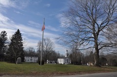 | Willington Common Historic District | 5.6 miles | 1990 |
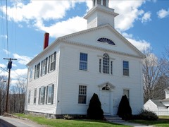 | Tolland County Courthouse | 6.3 miles | 1977 |
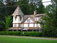 | Tolland Green Historic District | 6.4 miles | 1997 |
 | South Willington Historic District | 6.7 miles | 2017 |
 | Somers Historic District | 7.6 miles | 1982 |
| National Archives record | The nomination case file for reference 100011768 in Record Group 79. |
| Tolland County | All 47 listed properties in this county. |