BlockBefore
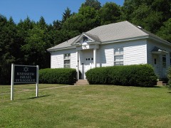
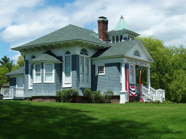
Photograph of Somers Historic District
Photograph by Jerry Dougherty, CC BY 2.5. Via Wikimedia Commons.

Somers Historic District

Listed on the National Register of Historic Places in 1982.

From the record

“The Somers Historic District encompasses the historic civic and social center of the town of Somers, Connecticut. It stretches along Main Street, with extensions along Springfield Road and Battle Street, and includes a significant number of vernacular Federal and Greek Revival houses.”

Wikipedia article Somers Historic District, CC BY-SA 4.0.

One of 47 National Register listings published here for Tolland County · listed in 1982 · category: District.

Sources: the Wikipedia article · the case file at the National Archives · the National Register database, National Park Service

The listing

  • Address. Main and Battle Sts., Bugbee Lane, and Springfield Rd., Somers, 06071
  • When was it listed? September 1982
  • Category. district
  • Town. Somers town
  • Architectural style. Greek Revival architecture
  • National Register reference number. 82004389 - the number the National Park Service assigned this property when it was listed, and the key its nomination file is catalogued under at the National Archives.

Fires near this property

79 since 1999

Regional context, not property-specific evidence. The federal wildfire occurrence database lists 79 fires within 5 miles of Somers Historic District between 1999 and 2020, burning about 71 acres in total. 3 started naturally. 2 were recorded as arson. Distance is straight-line from the map coordinates, so a fire counted here may appear on a neighbouring settlement's page as well.

Reported cause Fires
Missing data/not specified/undetermined49
Equipment and vehicle use9
Recreation and ceremony6
Debris and open burning4
Smoking4
Natural3
Arson/incendiarism2
Other causes1
Fireworks1

The most recent of them, most recent first, with the day each was reported and the service that recorded it.

DateCause SizeReported by Name on the report
9 September 2015Equipment and vehicle use5.0 acresMassachusetts Bureau of Forest Fire Controlnot named
8 September 2007Naturalunder an acreConnecticut Division of Forestrynot named
7 September 2015Missing data/not specified/undeterminedunder an acreConnecticut Division of Forestrynot named
27 September 2007Missing data/not specified/undeterminedunder an acreConnecticut Division of Forestrynot named
25 September 2007Missing data/not specified/undeterminedunder an acreConnecticut Division of Forestrynot named
19 September 2015Missing data/not specified/undeterminedunder an acreConnecticut Division of Forestrynot named
17 September 2020Recreation and ceremonyunder an acreMassachusetts Bureau of Forest Fire ControlMINNECHAUG MT FIRE
4 August 2015Missing data/not specified/undeterminedunder an acreConnecticut Division of Forestrynot named

Every fire recorded in Tolland County

Mines and quarries near this property

10 of 20 shown

Regional context, not property-specific evidence. The federal mineral resources record lists 20 workings within 5 miles of Somers Historic District: 15 past producers, 4 producers, 1 unknown. 4 still produce. What was taken out: Sand and Gravel, Construction, Stone, Dimension, Stone, Crushed/Broken, Talc-Soapstone. Distance is straight-line from the map coordinates, so a quarry counted here may appear on a neighbouring settlement's page as well.

Where SiteCommodity StatusRecorded
Diabase Rock Quarry No. Bi-003Stone, Crushed/BrokenPast ProducerDiabase
Silicified Fault Rock Quarry No. Bi-001Stone, Crushed/BrokenPast Producer
Soapstone Quarry #Bi-002Talc-SoapstonePast Producer
Soapstone Quarry #Bi-004Talc-SoapstonePast Producer
West Stafford PitStoneProducer
West Stafford QuarryStonePast Producer
Diabase Rock Quarry #Bi-003Stone, DimensionPast Producer
Murray Hill QuarryStone, DimensionPast Producer
Paving Material QuarryStone, DimensionPast Producer
Soapstone Rock Quarry No. Bi-002Stone, DimensionPast ProducerSoapstone, Steatite

Every working recorded in Tolland County

Storms near this property

17 since 2002

Regional context, not property-specific evidence. The National Weather Service names Somers, the town this property stands in, in 17 storm reports between 2002 and 2021: 13 thunderstorm wind, 2 tornado, 1 hail, 1 heavy rain. No death or injury is recorded in these reports. Each account below is quoted exactly as the forecast office filed it, from the NOAA Storm Events Database, and each date opens the federal record of that event.

WhenEvent Place namedHarm What the report says
July 2021Tornado (EF0)Somers$45,000In Somers, a weak tornado touched down in the evening. Amateur radio operators followed up on a tip from a trained Skywarn spotter via social media and then uncovered many reports. We then spoke with Somers Fire Department officials, an eyewitness who observed the tornado, and viewed several online videos. The following information summarizes all of these reports.||The tornado touched down on Colonial Drive, then tracked to the north-northeast, impacting Lake Drive just south of Shady Lake, Kibee Drive, a portion of Main Street (Route 190), Battle Street, and ended in the vicinity of Hickory Hill Drive. This was a path length of 1.9 miles. The approximate path width was 75 yards. Damage photos led to estimates of maximum wind speeds of 75 to 80 mph, which put this on the mid to upper range of the EF-0 category of the Enhanced Fujita Scale. The time, based on radar, fire department logs, and an eyewitness account, was from 611 PM to 618 PM EDT. ||Several large pine trees were downed on Colonial Drive and two cars were destroyed by the falling trees. Approximately 19 trees were snapped, twisted, and uprooted on Lake Drive. A resident of Lake Drive heard a loud whirring noise and observed the tops of trees flying by the house. Shingles were missing on a house next door. A playscape was lifted up and landed approximately 50 feet away. On Main Street, a small corner of a roof was exposed, with additional damage along the length of the gutter. Farther to the northeast, a few large oak trees were snapped on Hickory Hill Drive. ||This storm was low-topped and did not produce any lightning...only heavy rain. However high humidity and just enough wind shear aloft were sufficient to cause this isolated spin-up.
July 2014Thunderstorm WindSomers$10,000Trees and wires on George Wood Road were downed by thunderstorm winds.
July 2014Thunderstorm WindSomers$10,000Trees were downed on Field Road, and trees and wires were blown down on Somers Road (Rt. 83) near the town line between Somers and Ellington.
May 2010Thunderstorm WindSomers$10,000Trees and wires on Main Street were downed by thunderstorm winds.
June 2006Thunderstorm WindSomers$10,000no account filed
October 2020Thunderstorm WindSomers$5,000In Somers, multiple trees were down in several locations across the town.
May 2018Thunderstorm WindSomers$5,000At 3:40 PM EST trees and wires were reported down on Springfield Road at Turnpike Road in Somers.
May 2010Thunderstorm WindSomers$5,000Trees on Maple Street were downed onto wires by thunderstorm winds.
July 2005Thunderstorm WindSomers$5,000no account filed
June 2008Thunderstorm WindSomers$3,000Trees and wires were downed by thunderstorm winds.
July 2002Thunderstorm WindSomers$3,000no account filed
November 2020Thunderstorm WindSomers$800In Somers, a tree was down on wires on Springfield Road.
August 2021Heavy RainSomers-In Somers, a CWOP station recorded 5.80 inches of rain as of 1256 PM EDT (1153 AM EST).
May 2007Tornado (EF0)Somers-A Landspout, technically a tornado because it was a rotating column of air in contact with the ground and a cumuliform cloud, caused damage to a commercial barn at the intersection of Hall Hill Road and Brace Road. No injuries were reported. The rating is EF0 on the Enhanced Fujita Scale...with winds around 70 mph. 4 people witnessed a debris funnel.
June 2007Thunderstorm WindSomers-Trees and large branches downed in Tolland and Somers.
October 2007Thunderstorm WindSomers-A couple of trees were downed by thunderstorm winds.
June 2006HailSomers-no account filed

Every storm recorded in Tolland County

Map coverage status

No historic map-sheet match is published for this property yet. That does not mean no map exists. This record needs a coordinate-quality review before it can be joined to a sheet boundary. Browse the county's mapped places while that work is pending.

Listed places nearby

4 within 8 miles

Other National Register properties close enough to walk or drive between, ordered by distance from this one. Both positions come from the same geocoding pass that matched these properties to their map sheets.

Photograph PropertyDistance Listed
Somersville Historic District2.3 miles1995
Ellington Center Historic District5.7 miles1990
Knesseth Israel Synagogue6.4 miles1995
Stafford Springs Historic District7.6 miles2025

Sources for this property

National Archives recordThe nomination case file for reference 82004389 in Record Group 79.
Wikipedia articleCommunity-written account of this property, licensed CC BY-SA.
Tolland CountyAll 47 listed properties in this county.

Provenance

  • Listing record. National Park Service National Register of Historic Places, listed-properties dataset, current to 2026-05-22.
  • Map join. Address geocoded through the United States Census geocoder, then tested against the published boundary of every sheet in the USGS Historical Topographic Map Collection.
  • How this page is made. Listing fields come from federal records; map-sheet coverage is a labelled coordinate-to-boundary calculation, not a source-field claim.
  • Wildfire. Short, Karen C. 2022. Spatial wildfire occurrence data for the United States, 1992-2020 [FPA_FOD_20221014]. 6th Edition. Fort Collins, CO: Forest Service Research Data Archive. https://doi.org/10.2737/RDS-2013-0009.6 Collected with United States Government funding and usable without additional permissions or fees.
  • Mines and quarries. USGS Mineral Resources Data System (MRDS) https://mrdata.usgs.gov/mrds/ A work of the United States government, no copyright under 17 U.S.C. 105.
  • Storms. NOAA National Centers for Environmental Information, Storm Events Database https://www.ncei.noaa.gov/stormevents/ A work of the United States government, no copyright under 17 U.S.C. 105. Narratives are quoted verbatim from the National Weather Service report and are not edited or summarised.