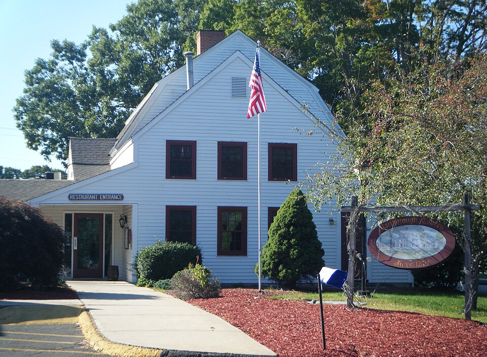
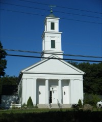
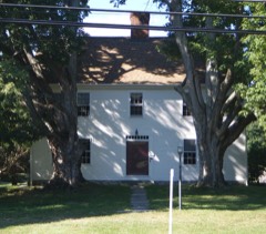
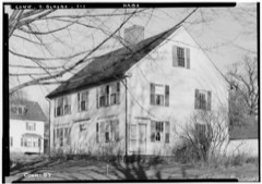
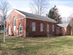
Listed on the National Register of Historic Places in 1978.
From the record
“The Marlborough Tavern, also known historically as the Col. Elisha Buell House, is a historic house and former tavern at 3 East Hampton Road in Marlborough, Connecticut.”
Wikipedia article Marlborough Tavern, CC BY-SA 4.0.
One of 451 National Register listings published here for Hartford County · listed in 1978 · category: Building.
National Register reference number.78002866- the number the National Park Service assigned this property when it was listed, and the key its nomination file is catalogued under at the National Archives.
The area of the town at its incorporation in 1803 was about eighteen square miles. Ten years later an addition was made from Glastonbury, increasing its area to twenty-two square miles ; the average length now being live and a half miles, and its average width four miles. It is very irregular in shape, and its rugged surface at some points swells into picturesque hills. The northern part, the natural boundary between Marlborough and Glastonbury, known as Dark Hollow, is a rare picture of disordered and broken masses of rocks rising to great heights, contrasting with wide stretches of woodland and waste open ground dotted with evergreens. Ravines cut this extensive tract of unimproved land in various directions running longitudinally through Glastonbury and Marlborough. These hills and ravines were barriers between the towns until the building of the Hartford and New London Turnpike. Marlborough Lake, so called, is a beautiful basin of clear water nearly a mile in length and a half-mile in width, set among rolling hills which rise gracefully to a considerable height in some places. The lake is fed by underground springs, and is without visible inlet. In some places the depth has never been ascertained. Pickerel fishing has long been enjoyed here, and more recently fine black bass have been taken. Granite quarries for home su])plies have been opened and have yielded a good quality of stone. Black lead, or plumbago, has been found in small quantities in some parts of the town.
On May 15, 1736, fourteen subscribers, " hereto Inhabitants in Colchester, Hebron and Glastonbury," f)etitioncd the General Assembly for a separate place of worship. " We would Humbly Shew to your Hon''* our Difficult Circumstances.^ our Living So far from any Pis of the publick worship of God. Some Living Seven, Some Eight miles k Several of us have so Weakley wives y* are not able to go to the Publick worship of God. . . . their are above sixty children in our neighborhood which are so small that they are not able to go to any ])lace of Publick worship." They asked tlie privilege of " hiring an orthodox minister to preach the word to k amongst us." The residents in Glastonbury (Eastbury society) were " John Waddoms, Abraham Skinner, daved dekason [Dickinson], Samuell Loveland, Joseph Whight [White] ;" in Colchester (First society), " Epaphras and Ichabod Lord;" in Hebron, "Benja neland, Wilam BeuU, Benjamin Nelan, Jr., John k Joseph Neland," also "Worthy Watters and Ebenezer Mudg," who were probably residents of Hebron. The Assembly granted the petitioners liberty to employ a minister, but did not release them from taxes for the support of the ministry in the ecclesiastical societies to which they respectively beloDged.2 The following year (1737) a petition to which thirty-two names were attached was presented. But onfe "- Benjamin nclan " appears, and " Ebenezer Mudg " is absent ; otherwise the names are those of the previous petition. And to these are added, - from Colchester, "Abraham and Daniel Day, Andrew Carrier, Andrew Carrier, Jr., Benjamin Carrier, from Glastonbury, " Charles Loveman [Loveland] ;" also " Robert Cogswell, Nathan Dunham, Sr., Rochel Jones, John and Deliverence Waters, Samuel Addams, John Addams (his mark), Daniel Addams, Joseph Kellogg, Samuel Buel, and Benj. Skinner." This petition was not granted ; but the perseverance of these pioneers shows itself in the repeated petitions which followed in 1740, 1745, 1746, and 1747. That of April, 1747, having been received favorably, the society was incorporated, and named Marlborough. The society without doubt took its name from Marlborough, Mass. ; tlie kirgest tax-payer in the society being David Bigelo\v,i a representative of a family conspicuous in the history of the old town of Marlborough, Mass. Ezra Carter, another influential member of the new society, came from the same town. ^ - ^^^/^ Oe-
Regional context, not property-specific
evidence. The
federal wildfire occurrence database
lists 152 fires within 5 miles of Marlborough Tavern
between 1994 and 2020, burning about 466 acres in total. None started naturally. 4 were recorded as arson.
Distance is straight-line from the map coordinates, so a fire counted
here may appear on a neighbouring settlement's page as well.
Reported cause
Fires
Missing data/not specified/undetermined
84
Debris and open burning
35
Recreation and ceremony
14
Smoking
9
Arson/incendiarism
4
Misuse of fire by a minor
3
Equipment and vehicle use
3
The most recent of
them, most recent first, with the day each was reported and the service
that recorded it.
Regional context, not property-specific
evidence. The federal mineral resources record lists
8 workings within 5 miles of Marlborough Tavern: 6 past producers, 2 prospects.
None of them still produces. What was taken out: Mica, Stone, Crushed/Broken, Stone, Dimension, Feldspar. Distance is straight-line from the
map coordinates, so a quarry counted here may appear on a neighbouring
settlement's page as well.
Regional context, not property-specific
evidence. The National Weather Service names
Marlborough, the town this property stands in, in 8 storm reports between 1995 and 2021: 3 thunderstorm wind, 2 hail, 2 flood, 1 flash flood.
No death or injury is recorded in these reports. Each account below is quoted exactly as the forecast office
filed it, from the NOAA Storm Events Database, and each date
opens the federal record of that event.
In Marlborough an amateur radio operator reported a rainfall total of 4.79 inches at 522 PM EDT (422 PM EST). The Foot Sawmill Brook went out of its banks and flooded a home on Stony Brook Drive. The water level rose to halfway up the garage doors. The basement was flooded to above the electrical circuits. There also was significant street flooding at a fire station located at the intersection of Jones Hollow Road and West Road. Some police and fire equipment was ruined at that station due to the flooding.
A severe thunderstorm produced large hail, gusty winds, and lightning strikes, which caused property damage. At Vernon, the hail began falling small and increased to baseball-size. Lightning struck three buildings in Somers and trees and wires were knocked down in East Windsor and Ellington. Baseball-size hail fell in Manchester. Trees and wires were knocked down in Bolton and Andover. The large hailstones broke windows and damaged many automobiles. Damage was estimated at up to several hundred thousand dollars.
No historic map-sheet match is published
for this property yet. That does not mean no map exists. This record needs
a coordinate-quality review before it can be joined to a sheet boundary.
Browse the county's mapped places while that work is
pending.
Listed places nearby
5 within 8 miles
Other National Register properties close
enough to walk or drive between, ordered by distance from this one. Both
positions come from the same geocoding pass that matched these properties
to their map sheets.
Listing record. National Park Service National Register of Historic Places, listed-properties dataset, current to 2026-05-22.
Map join. Address geocoded through the United States Census geocoder, then tested against the published boundary of every sheet in the USGS Historical Topographic Map Collection.
How this page is made. Listing fields come from federal records; map-sheet coverage is a labelled coordinate-to-boundary calculation, not a source-field claim.
Wildfire. Short, Karen C. 2022. Spatial wildfire occurrence data for the United States, 1992-2020 [FPA_FOD_20221014]. 6th Edition. Fort Collins, CO: Forest Service Research Data Archive. https://doi.org/10.2737/RDS-2013-0009.6 Collected with United States Government funding and usable without additional permissions or fees.
Mines and quarries. USGS Mineral Resources Data System (MRDS) https://mrdata.usgs.gov/mrds/ A work of the United States government, no copyright under 17 U.S.C. 105.
Storms. NOAA National Centers for Environmental Information, Storm Events Database https://www.ncei.noaa.gov/stormevents/ A work of the United States government, no copyright under 17 U.S.C. 105. Narratives are quoted verbatim from the National Weather Service report and are not edited or summarised.
 Block