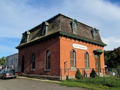
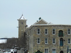
Listed on the National Register of Historic Places in 1979.
From the record
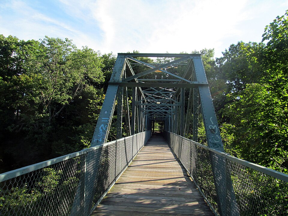
“The Willimantic Footbridge is a pedestrian bridge in the Willimantic section of Windham, Connecticut. Built in 1906, it extends from Main Street southward, across Riverside Drive, railroad tracks, and the Willimantic River, connecting downtown Willimantic to the residential area south of the river.”
Wikipedia article Willimantic Footbridge, CC BY-SA 4.0.
One of 82 National Register listings published here for Windham County · listed in 1979 · category: Structure.
National Register reference number.79002654- the number the National Park Service assigned this property when it was listed, and the key its nomination file is catalogued under at the National Archives.
THE town of Windham, one of the smallest in geographical size, but the largest in population, wealth and business importance, occupies the extreme southwest corner of Windham county. Its area is about two and three-fourths square miles. The beautiful valley of the Willimantic river extends along the southern part, entering at the extreme western point and leaving at the southeastern corner. This river affords abundant water power for many factories, and to this circumstance is due the building up and prosperity of the town. The Natchaug, a considerable stream, joins it a short distance east of the borough limits of Willimantic. Back from the river the town is broken into successive ridges of hills, rising about two hundred feet above the general level of the intervening valleys. Besides the borough of Willimantic, in the southwest part, the smaller villages of North Windham in the northern part, South Windham in the southern part and Windham in the central part, are in this town. Otherwise the surface of the town is mostly covered with forest growth which affords some valuable timber. The agricultural interests of the town are not prominent. The New York & New England railroad extends through the western and northern parts and the Providence Division and the
During that summer (1693) it was determined that the dividing line between the settlers in the wilderness from Hartford and from Norwich should be the Willimantic river^ the Norwich people holding on the east of it and the Hartford people holding on the west of it. In December the town passed regulations in regard to fences, cattle, swine, timber and the warning of town meetings. In the following spring we have the first record of the lay-out of a highway. This was ordered through Peter Grosse's division, extending from the Ponde-place to the Willimantic river near the falls. The meadows in this vicinity fur- nished the Windham settlers with a great part of their hay, and to facilitate its conveyance this highway was ordered " four rods wide from the hill to the river, seven rods wide down to the meadow and four rods wide between meadow and fence." Twelve acres below the falls were allowed to Mr. Crosse in compensation for land taken up by this highway.
Regional context, not property-specific
evidence. The
federal wildfire occurrence database
lists 105 fires within 5 miles of Willimantic Footbridge
between 1992 and 2020, burning about 231 acres in total. 2 started naturally. 9 were recorded as arson.
Distance is straight-line from the map coordinates, so a fire counted
here may appear on a neighbouring settlement's page as well.
Reported cause
Fires
Missing data/not specified/undetermined
48
Misuse of fire by a minor
14
Arson/incendiarism
9
Recreation and ceremony
8
Smoking
8
Debris and open burning
7
Power generation/transmission/distribution
3
Equipment and vehicle use
3
Railroad operations and maintenance
3
Natural
2
The most recent of
them, most recent first, with the day each was reported and the service
that recorded it.
Regional context, not property-specific
evidence. The federal mineral resources record lists
42 workings within 5 miles of Willimantic Footbridge: 33 past producers, 8 producers, 1 unknown.
8 still produce. What was taken out: Stone, Stone, Dimension, Sand and Gravel, Construction, Granite. Distance is straight-line from the
map coordinates, so a quarry counted here may appear on a neighbouring
settlement's page as well.
Regional context, not property-specific
evidence. The National Weather Service names
Willimantic, the town this property stands in, in 27 storm reports between 1996 and 2024: 10 thunderstorm wind, 6 flood, 5 flash flood, 4 hail.
No death or injury is recorded in these reports. Each account below is quoted exactly as the forecast office
filed it, from the NOAA Storm Events Database, and each date
opens the federal record of that event.
Numerous trees and wires in the Pleasant Street area were downed by thunderstorm winds. A few of these trees fell on houses. Trees and branches also were reported down on Route 6 and Riverside Drive. A rubber membrane roof was blown off an apartment house landing on Bridge Street. A tree fell onto a minivan on Windham Center Road. No one was injured, but one passenger was taken to the hospital for evaluation.
A microburst occurred in Willimantic. The 911 Call Center in Willimantic reported that a chimney fell into a roof on West Main Street at 608 PM EDT (508 PM EST). Police reported that the top of a utility pole was snapped off at the intersection of Pleasant Street and Lebanon Avenue. A tree and wires were down on Pleasant Street. A tree and wires also were down on West Avenue, South Street at Oxbow Drive, and Southridge Drive. Reports were relayed to NWS via amateur radio operators.
At 7:08 PM EST, Valley Street at Watson Street in Willimantic was closed due to flooding. A car was trapped in floodwaters on Valley Street, with water above the sidewalks. At 7:14 PM EST, Valley Street at Birch Street was also closed due to flooding.
No historic map-sheet match is published
for this property yet. That does not mean no map exists. This record needs
a coordinate-quality review before it can be joined to a sheet boundary.
Browse the county's mapped places while that work is
pending.
Listed places nearby
6 within 8 miles
Other National Register properties close
enough to walk or drive between, ordered by distance from this one. Both
positions come from the same geocoding pass that matched these properties
to their map sheets.
Listing record. National Park Service National Register of Historic Places, listed-properties dataset, current to 2026-05-22.
Map join. Address geocoded through the United States Census geocoder, then tested against the published boundary of every sheet in the USGS Historical Topographic Map Collection.
How this page is made. Listing fields come from federal records; map-sheet coverage is a labelled coordinate-to-boundary calculation, not a source-field claim.
Wildfire. Short, Karen C. 2022. Spatial wildfire occurrence data for the United States, 1992-2020 [FPA_FOD_20221014]. 6th Edition. Fort Collins, CO: Forest Service Research Data Archive. https://doi.org/10.2737/RDS-2013-0009.6 Collected with United States Government funding and usable without additional permissions or fees.
Mines and quarries. USGS Mineral Resources Data System (MRDS) https://mrdata.usgs.gov/mrds/ A work of the United States government, no copyright under 17 U.S.C. 105.
Storms. NOAA National Centers for Environmental Information, Storm Events Database https://www.ncei.noaa.gov/stormevents/ A work of the United States government, no copyright under 17 U.S.C. 105. Narratives are quoted verbatim from the National Weather Service report and are not edited or summarised.
 Block