 Block
From the record
One of 82 National Register listings published here for Windham County · listed in 1979 · category: District.
Sources: the case file at the National Archives · the National Register database, National Park Service
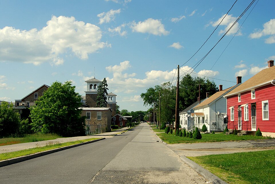
Listed on the National Register of Historic Places in 1979.
One of 82 National Register listings published here for Windham County · listed in 1979 · category: District.
Sources: the case file at the National Archives · the National Register database, National Park Service
The chapter on Plainfield Town in History of Windham County, Connecticut .., published 1889 names Plainfield. This is what it says, exactly as the scans read.
THE township of Plainfield lies in the southeastern part of the county, adjoining Griswold and Voluntown in the county of New London. It is about nine miles long from north to south and four to five miles wide. It has Canterbury on the west, also Brooklyn on the northwest, Killingly on the north, and Sterling on the east. The Quinebaug river forms, most of the way, the western boundary, and receives from this town the waters of branches, the Moosup and Mill rivers, which afford sites for a number of manufacturing establishments. The town is traversed by about twenty miles of railroad, the Norwich & Worcester line running through it lengthwise, and the Providence Division of the New York & New England railroad running diagonally across it. Beautiful fertile plains stretching northeast and southwest between the rugged hills, early attracted the attention of settlers andland speculators, and these fertile plains gave name to the locality and to the town. Some attention is given to agriculture, but the great industrial interest of the town is manufacturing. Several factory villages have grown up within its borders.
Passage source: History of Windham County, Connecticut .., published 1889.
The division of Plainfield territory into equal and regular allotments, and its distribution among such inhabitants as fulfilled the required conditions, were accomplished in 1704 ; the recipients throwing up their previous purchases into the common stock and each receiving an allotment with rights in future divisions proportionate to his interest in the common proprietorship. A broad strip of land adjoining the Quinebaug, extending from the north side of Moosup river to the Cedar swamp, was ^reserved as a general field, the great plain for corn planting, for the use of all the inhabitants. Twenty-four proprietors received -shares in this allotment, of one hundred acres each, which was completed in February, 1804. These proprietors were : Samuel Shepard, John Smith, Benjamin Smith, John Fellows, Ebenezer Harris, William Douglas, Thomas Stevens, Sr., Thomas Pierce, James Kingsbury, Edward Yeomans, Joshua Whitney, Stephen Hall, John Spalding, Edward Spalding, Benjamin Palmer, Nathaniel Jewell, Thomas Stevens, Jr., Matthias Button, Jacob Warren, Timothy Pierce, Joseph Parkhurst, Thomas Williams, James Deane and Joseph Spalding. To these twenty-four proprietors others were soon added, the town having ordered forty lots of the same size, so as to meet the probable demand. A number of the inhabitants were at first reluctant to resign their lands, but afterward came into the arrangement. Two or three individuals never did relinquish their individual ownership, and <;onsequently had no share in the common proprietorship. New inhabitants who joined the settlement were granted an allotment on payment of three pounds into the town treasury.
Passage source: History of Windham County, Connecticut .., published 1889.
Machine-read from a century-old scan, so expect the errors a machine makes: misspelled names, dropped words, stray characters.
Read the whole chapter on Plainfield Town - 31,302 words on its settlement, mills, schools and churches.
Regional context, not property-specific evidence. The federal wildfire occurrence database lists 204 fires within 5 miles of Wauregan Historic District between 1993 and 2020, burning about 208 acres in total. 1 started naturally. 10 were recorded as arson. Distance is straight-line from the map coordinates, so a fire counted here may appear on a neighbouring settlement's page as well.
| Reported cause | Fires |
|---|---|
| Missing data/not specified/undetermined | 133 |
| Recreation and ceremony | 20 |
| Debris and open burning | 16 |
| Arson/incendiarism | 10 |
| Smoking | 9 |
| Misuse of fire by a minor | 9 |
| Equipment and vehicle use | 3 |
| Power generation/transmission/distribution | 2 |
| Natural | 1 |
| Railroad operations and maintenance | 1 |
The most recent of them, most recent first, with the day each was reported and the service that recorded it.
| Date | Cause | Size | Reported by | Name on the report |
|---|---|---|---|---|
| 28 September 2011 | Missing data/not specified/undetermined | under an acre | Connecticut Division of Forestry | PLAINFIELD |
| 19 September 2020 | Missing data/not specified/undetermined | under an acre | Connecticut Division of Forestry | 1 CAPRON STREET |
| 16 September 2020 | Recreation and ceremony | under an acre | Connecticut Division of Forestry | ALAN HILL ROAD* |
| 7 August 2010 | Missing data/not specified/undetermined | under an acre | Connecticut Division of Forestry | not named |
| 6 August 2020 | Power generation/transmission/distribution | 2.0 acres | Connecticut Division of Forestry | not named |
| 5 August 2020 | Missing data/not specified/undetermined | 1.0 acres | Connecticut Division of Forestry | 289 STERLING ROAD |
| 2 August 2020 | Missing data/not specified/undetermined | under an acre | Connecticut Division of Forestry | OLD FURNACE STATE PARK |
| 2 August 2020 | Missing data/not specified/undetermined | under an acre | Connecticut Division of Forestry | 81 ROSS ROAD |
Regional context, not property-specific evidence. The federal mineral resources record lists 10 workings within 5 miles of Wauregan Historic District: 5 past producers, 4 producers, 1 unknown. 4 still produce. What was taken out: Sand and Gravel, Construction, Stone, Crushed/Broken, Granite, Flagstone. Distance is straight-line from the map coordinates, so a quarry counted here may appear on a neighbouring settlement's page as well.
| Where | Site | Commodity | Status | Recorded |
|---|---|---|---|---|
| Connecticut Flatstone Quarry | Stone, Dimension | Producer | ||
| Strouse Brothers Quarry | Flagstone | Past Producer | ||
| Granite Quarries | Granite | Past Producer | ||
| Wauregan Quarry | Granite | Past Producer | Granite | |
| Connecticut Flat | Stone, Crushed/Broken | Past Producer | ||
| Strouse Brothers Quarry | Stone, Crushed/Broken | Past Producer | Sedimentary | |
| Wauregan Pit and Quarry | Stone, Crushed/Broken, Sand and Gravel, Construction | Producer | ||
| Danielson Mine | Sand and Gravel, Construction | Producer | ||
| Danielson Pit | Sand and Gravel, Construction | Unknown | ||
| Route 205 Pit | Sand and Gravel, Construction | Producer |
Regional context, not property-specific evidence. The National Weather Service names Plainfield, the town this property stands in, in 10 storm reports between 1995 and 2024: 6 thunderstorm wind, 2 lightning, 2 hail. No death or injury is recorded in these reports. Each account below is quoted exactly as the forecast office filed it, from the NOAA Storm Events Database, and each date opens the federal record of that event.
| When | Event | Place named | Harm | What the report says |
|---|---|---|---|---|
| June 2010 | Thunderstorm Wind | Plainfield | $15,000 | Trees on Major Drive, Forest Street, and Gendron Road were downed by thunderstorm winds. |
| May 2018 | Thunderstorm Wind | Plainfield | $5,000 | At 4:55 PM EST trees were reported blocking Greene Avenue at the intersection with Butterworth Avenue in Plainfield. |
| May 2010 | Thunderstorm Wind | Plainfield | $5,000 | Two trees on Lake Street were downed by thunderstorm winds. |
| July 2017 | Lightning | Plainfield | $4,000 | At 550 PM EST, an amateur radio operator reported trees down due to lightning on Packerville Road in Plainfield. Wires were also brought down on a car on Packerville Road. |
| June 2024 | Thunderstorm Wind | Plainfield | $2,000 | In Plainfield, trees, wires, and transformers were downed on a few roads. |
| July 2006 | Hail | Plainfield | - | no account filed |
| July 2004 | Hail | Plainfield | - | no account filed |
| August 2001 | Thunderstorm Wind | Plainfield | - | no account filed |
| July 1999 | Lightning | Plainfield | - | no account filed |
| August 1995 | Thunderstorm Wind | Plainfield | - | no account filed |
No historic map-sheet match is published for this property yet. That does not mean no map exists. This record needs a coordinate-quality review before it can be joined to a sheet boundary. Browse the county's mapped places while that work is pending.
Other National Register properties close enough to walk or drive between, ordered by distance from this one. Both positions come from the same geocoding pass that matched these properties to their map sheets.
| Photograph | Property | Distance | Listed |
|---|---|---|---|
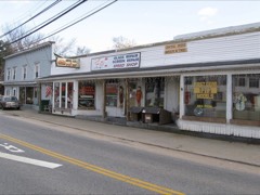 | Central Village Historic District | 1.4 miles | 1991 |
 | Plainfield Woolen Company Mill | 1.7 miles | 1985 |
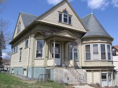 | Aldrich Free Public Library | 2.5 miles | 1994 |
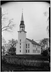 | Unitarian Meetinghouse | 3.1 miles | 1972 |
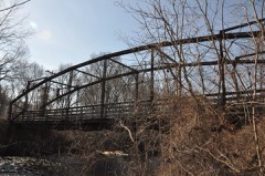 | Glen Falls Bridge | 3.1 miles | 1999 |
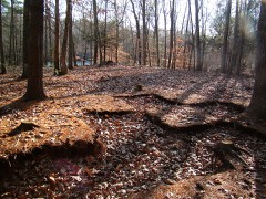 | Quinebaug River Prehistoric Archeological District | 3.4 miles | 2009 |
| National Archives record | The nomination case file for reference 79003789 in Record Group 79. |
| Windham County | All 82 listed properties in this county. |