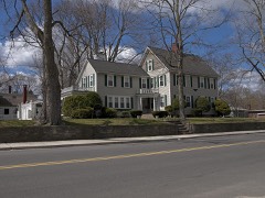
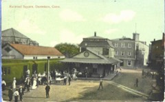
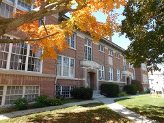
Listed on the National Register of Historic Places in 1982.
From the record
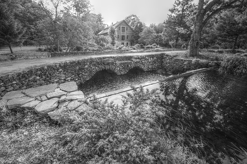
“The Elliottville Lower Mill, also known historically as the Peep Toad Mill, is an historic cotton mill in the East Killingly section of Killingly, Connecticut. Built about 1850, it is a well-preserved example of an early wood-frame textile mill.”
Wikipedia article Elliottville Lower Mill, CC BY-SA 4.0.
One of 82 National Register listings published here for Windham County · listed in 1982 · category: Building.
National Register reference number.82004406- the number the National Park Service assigned this property when it was listed, and the key its nomination file is catalogued under at the National Archives.
Growth and business expansion in this town are not confined to Danielsonville. Dayville is a lively and thrifty village with various mills aud interests. Mr. Ezekiel Webster followed the railroad track, building a hotel and many private dwellings. He engaged largely in lumber trade, introducing a steam mill and lumber- working machinery. In 1846, Mr. John Day put up a new brick factory and carried on manufacturing till the destruction of the building in 1858, when privilege and accommodations were purchased by Messrs. S. and II. Sayles, who built up extensive woolen manufacturing establishments. Other industries were developed, stores opened, churches built up. The Dayville Congregational church was organized May 23, 1849. Its constittitent members were mostly dismissed from the three Killingly churches. Rev. Uoswell Whitmore* officiated as pastor till 1857, thus ministering to a pait of his former flock. Suitable houses of worship were provided for Congregational and Catholic churches. Schools received needful attention, and are accommodated by ^^a nice house with ample play-ground around it." The neighboring Williamsville Factory has been re|>eatedly enlarged. In 1849 the company was reorganized, and after refitting the mill with new machinery of the best workmanship, turned out the '* Williamsville fine sheetings," so favorably known to connoisseui*s in cotton fabrics. Williamsville like Wauregan is '' a close corporation," owned and controlled by a single company and interest - a pleasant, isolated working village, wellmanaged and orderly. Enlightened self-interest as well as public spirit and philanthropy have eflected great improvement in the administration of factory villages. Sanitary conditions are studie<l and observed. Evil influences are kept in abeyance. Compelled by the State to educate tlie children, they voluntarily in many cases jMovide for tlie instruction and innocent entertainment of adults by libraries, reading-rooms, lectures, <fec. A fine ball has been built by the Williarasville Company for religious purposes and lectures. Attawaugan and some of the smaller factories are maintained on former sites. Rist Killingly has been aided by increasing centralization and the construction of a capacious reservoir which enables the enterprising little Whetstone to run its mills throughout the year. Messrs. Thomas Pray and Henry Westcott were among the many owners who have helped build up Chestnut Hill villages. Lemuel Elliott, Esq., of Providence, improveil another privilege and had a pleasant country seat at the foot of Breakneck. The mineral treasures of Mashentuck and Breakneck are as yet neatly undeveloped, waiting for the construction of the '* Ponoganset Railroad ** or some kindred enterprise. The well of " porcelain clay " formerly so vaunted has been tested and found lacking in quantity. The East Killingly and Free-Will Baptist churches have maintained their standing under a succession of pastors. lievs. Austin Robbins and David Williams, formerly laborers in both these churches, died on successive days at their homes in East Killingly. Uev. Hubbel Loomis, well-known in the Baptist ministry, compile<] an historical sketch while pastor of the former church. The church in South Killingly after reaching the verge of dissolution, was hn))pily revived, and under an efficient ministry has quite renewed its youth. Its house of worship has been remodeled and much pains ex[)ended upon Sabbath school and temperance training. The village has recently Bufiered the loss of its much respected physician. Dr. Daniel L. Ilovey, who had pursued his calling there for nearly half a century. He was the oldest member of the County Medical Society at the time of his decease. Having no manufacturing interests, this village is gradually wasting. Killingly's strength lies in her rocks and rivers. Extensive Brick Works have been carried on near Dayville for many years by Colonel L. D. Alexander. The " Nashawaug Farm " and privilege of Hon. Elisha Dyer, promises to bring new business and prosperity to the south of the town.
THE town of Killingly lies in the eastern central part of Windham county, on the Rhode Island border. In territory, population and business importance it is one of the largest towns of the county. Its territory, which originally embraced the whole northeast corner of Connecticut east of tbe Quinebaug and north of Plainfield, has been diminished by the formation of Thompson and Putnam in part from its territory. It is bounded by Putnam on the north, Rhode Island on the east. Sterling and Plainfield on the south, and Brooklyn and Pomfret on the west. Much of its surface is hilly and but moderately adapted to agriculture. It is well drained by the Assawaga or Five Mile river and its tributary, the Whetstone branch, and the Quinebaug, into which the former empties. The last named stream forms its entire western boundary. These waters afford power for a number of mills and manufacturing concerns, this town being one of the large manufacturing towns of the county. Alexander's Lake, a handsome sheet of water a mile in length by a half mile in breadth, lies in the northwest part, and Chaubamaug pond, a narrow body a mile and a half long, lies near the eastern border. The town is about nine miles long from north to south, and an average width of six miles from east to west. Thus it has an area of about fifty-foursquare miles. The Norwich & Worcester railroad runs along its western border the length of the town. The post offices of Danielsonville, Ballouville, Killingly, East Killingly and South Killingly are in this town. A small part of the borough of Danielsonville extends
Regional context, not property-specific
evidence. The
federal wildfire occurrence database
lists 155 fires within 5 miles of Elliottville Lower Mill
between 1992 and 2020, burning about 209 acres in total. None started naturally. 25 were recorded as arson.
Distance is straight-line from the map coordinates, so a fire counted
here may appear on a neighbouring settlement's page as well.
Reported cause
Fires
Missing data/not specified/undetermined
89
Arson/incendiarism
25
Recreation and ceremony
15
Debris and open burning
10
Misuse of fire by a minor
8
Smoking
5
Railroad operations and maintenance
2
Equipment and vehicle use
1
The most recent of
them, most recent first, with the day each was reported and the service
that recorded it.
Regional context, not property-specific
evidence. The federal mineral resources record lists
8 workings within 5 miles of Elliottville Lower Mill: 4 past producers, 3 producers, 1 unknown.
3 still produce. What was taken out: Stone, Dimension, Sand and Gravel, Construction, Stone, Crushed/Broken. Distance is straight-line from the
map coordinates, so a quarry counted here may appear on a neighbouring
settlement's page as well.
Regional context, not property-specific
evidence. The National Weather Service names
East Killingly, the town this property stands in, in 1 storm report in 2021: 1 thunderstorm wind.
No death or injury is recorded in these reports. Each account below is quoted exactly as the forecast office
filed it, from the NOAA Storm Events Database, and each date
opens the federal record of that event.
No historic map-sheet match is published
for this property yet. That does not mean no map exists. This record needs
a coordinate-quality review before it can be joined to a sheet boundary.
Browse the county's mapped places while that work is
pending.
Listed places nearby
6 within 8 miles
Other National Register properties close
enough to walk or drive between, ordered by distance from this one. Both
positions come from the same geocoding pass that matched these properties
to their map sheets.
Listing record. National Park Service National Register of Historic Places, listed-properties dataset, current to 2026-05-22.
Map join. Address geocoded through the United States Census geocoder, then tested against the published boundary of every sheet in the USGS Historical Topographic Map Collection.
How this page is made. Listing fields come from federal records; map-sheet coverage is a labelled coordinate-to-boundary calculation, not a source-field claim.
Wildfire. Short, Karen C. 2022. Spatial wildfire occurrence data for the United States, 1992-2020 [FPA_FOD_20221014]. 6th Edition. Fort Collins, CO: Forest Service Research Data Archive. https://doi.org/10.2737/RDS-2013-0009.6 Collected with United States Government funding and usable without additional permissions or fees.
Mines and quarries. USGS Mineral Resources Data System (MRDS) https://mrdata.usgs.gov/mrds/ A work of the United States government, no copyright under 17 U.S.C. 105.
Storms. NOAA National Centers for Environmental Information, Storm Events Database https://www.ncei.noaa.gov/stormevents/ A work of the United States government, no copyright under 17 U.S.C. 105. Narratives are quoted verbatim from the National Weather Service report and are not edited or summarised.
 Block