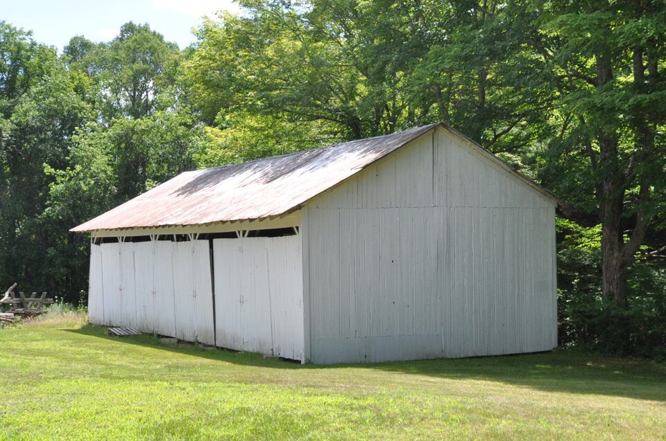
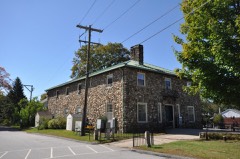
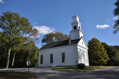
Listed on the National Register of Historic Places in 1986.
From the record
“The Natchaug Forest Lumber Shed is a historic utility building in Natchaug State Forest in Eastford, Connecticut, United States. It was built in the 1930s, and is one of the only surviving buildings built by the Civilian Conservation Corps in the forest.”
Wikipedia article Natchaug Forest Lumber Shed, CC BY-SA 4.0.
One of 82 National Register listings published here for Windham County · listed in 1986 · category: Building.
Also known as. Connecticut State Park and Forest Depression-Era Federal Work Relief Programs Structures TR
Town. Eastford town
National Register reference number.86001732- the number the National Park Service assigned this property when it was listed, and the key its nomination file is catalogued under at the National Archives.
THE town of Eastford, lying in the northwest part of Windham county, is about nine miles in length from north to south, and has an average width of about three miles. Its area would thus approximate twenty-seven square miles. It is a well watered town, the Natchaug river running through the length of it, and receiving within its bounds several tributaries, the largest of which are Bigelow river from the west and Bungee brook from the east. It has no railroad track within its borders. Farming and manufacturing are the chief occupations of the people. The town was formerly included in the territory of Ashford, which joins it on the west. Other boundaries of the town are Union on the north, Woodstock on the north and east, making an offset of about three miles square upon the northeast corner, Pomfret on the east and Hampton and Chaplin on the south. The population in 1870 was 984, and in 1880, 886.
In March, 1764, the inhabitants of the town of Ashford voted to divide the town into three ecclesiastical societies, as nearly of equal size as possible, for the better accommodation of the people in their religious privileges. When religious worship was maintained in the Eastford and Westford societies, they were to be relieved from the tax in support of the minister in the center. A bill passed the general assembly to this effect. Eastford did not use this privilege until October, 1777, when arrangements were made to have a settled ministry and a church in said society. In almost every interest, except holding town meetings, all proceeded much as though it was a separate town. In sharing town offices and sending representatives to the general assembly it was expected that Eastford would have her due proportion. The management of the schools, the appointment of school visitors and most of the local interests were under her supervision as much as desired. Ephraim Lyon, David BoUes, Stephen Keyes, John Paine, Anthony Stoddard, Captain John Stevens and many other prominent inhabitants of Eastford were among the early settlers in the town of Ashford.
Regional context, not property-specific
evidence. The
federal wildfire occurrence database
lists 73 fires within 5 miles of Natchaug Forest Lumber Shed
between 1999 and 2020, burning about 150 acres in total. None started naturally. 3 were recorded as arson.
Distance is straight-line from the map coordinates, so a fire counted
here may appear on a neighbouring settlement's page as well.
Reported cause
Fires
Missing data/not specified/undetermined
45
Debris and open burning
14
Recreation and ceremony
6
Arson/incendiarism
3
Smoking
3
Misuse of fire by a minor
1
Equipment and vehicle use
1
The most recent of
them, most recent first, with the day each was reported and the service
that recorded it.
Regional context, not property-specific
evidence. The federal mineral resources record lists
1 working within 5 miles of Natchaug Forest Lumber Shed: 1 past producer.
None of them still produces. What was taken out: Sand and Gravel, Construction. Distance is straight-line from the
map coordinates, so a quarry counted here may appear on a neighbouring
settlement's page as well.
Regional context, not property-specific
evidence. The National Weather Service names
Eastford, the town this property stands in, in 11 storm reports between 1995 and 2021: 6 thunderstorm wind, 3 hail, 2 flood.
No death or injury is recorded in these reports. Each account below is quoted exactly as the forecast office
filed it, from the NOAA Storm Events Database, and each date
opens the federal record of that event.
Two to three inches of rain fell within a few hours time and produced significant urban flooding in parts of Windham County. In Woodstock, the basement of Woodstock Elementary School was flooded with about a foot of water. In Plainfield, Railroad Avenue at Church Street was flooded and impassable. Sections of Cemetery Road and South Street were closed due to flooding.
A bow echo downed numerous trees across Windham County. The most pronounced damage occurred in Pomfret where a microburst occurred. Hundreds of trees were downed in the vicinity of Taft Pond Road and Route 97. Some of the trees were sheared off well above ground level. Winds were estimated in this area to be between 60 and 80 mph. Tree Damage also occurred in Ashford, Putnam, and Killingly.
No historic map-sheet match is published
for this property yet. That does not mean no map exists. This record needs
a coordinate-quality review before it can be joined to a sheet boundary.
Browse the county's mapped places while that work is
pending.
Listed places nearby
6 within 8 miles
Other National Register properties close
enough to walk or drive between, ordered by distance from this one. Both
positions come from the same geocoding pass that matched these properties
to their map sheets.
Listing record. National Park Service National Register of Historic Places, listed-properties dataset, current to 2026-05-22.
Map join. Address geocoded through the United States Census geocoder, then tested against the published boundary of every sheet in the USGS Historical Topographic Map Collection.
How this page is made. Listing fields come from federal records; map-sheet coverage is a labelled coordinate-to-boundary calculation, not a source-field claim.
Wildfire. Short, Karen C. 2022. Spatial wildfire occurrence data for the United States, 1992-2020 [FPA_FOD_20221014]. 6th Edition. Fort Collins, CO: Forest Service Research Data Archive. https://doi.org/10.2737/RDS-2013-0009.6 Collected with United States Government funding and usable without additional permissions or fees.
Mines and quarries. USGS Mineral Resources Data System (MRDS) https://mrdata.usgs.gov/mrds/ A work of the United States government, no copyright under 17 U.S.C. 105.
Storms. NOAA National Centers for Environmental Information, Storm Events Database https://www.ncei.noaa.gov/stormevents/ A work of the United States government, no copyright under 17 U.S.C. 105. Narratives are quoted verbatim from the National Weather Service report and are not edited or summarised.
 Block