 Block
From the record
One of 298 National Register listings published here for Fairfield County · listed in 1991 · category: District.
Sources: the case file at the National Archives · the National Register database, National Park Service
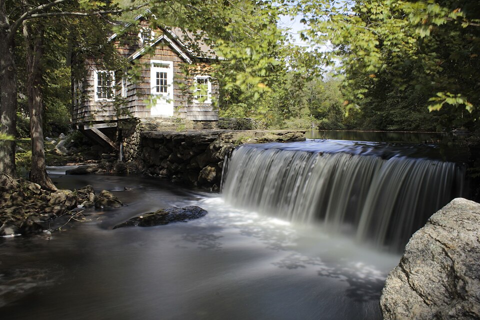
Listed on the National Register of Historic Places in 1991.
One of 298 National Register listings published here for Fairfield County · listed in 1991 · category: District.
Sources: the case file at the National Archives · the National Register database, National Park Service
The chapter on Easton Town in History of Fairfield County, Connecticut : with Illustrations and Biographical Sketches of Its Prominent Men and Pioneers, published 1881 names Easton. This is what it says, exactly as the scans read.
Hon. Isaac Toucey, Governor and United States senator, received the rudiments of lus education at the free academy in Easton, and offered to give five hundred dollars toward erecting a suitable monument to the memory of Mr. Staples.
Passage source: History of Fairfield County, Connecticut : with Illustrations and Biographical Sketches of Its Prominent Men and Pioneers, published 1881.
At this time the parish received from the Legislature the corporate name of Christ Church, Easton; up to this time it was known as the Episcopal Society of North Fairfield. Since that time the rectors have been Rev. Alfred Louderback, 1861-62 ; Rev. Henry Zell, from February to November, 1863, when death closed his ministry ; Rev. William L. Bostwick, 1864 -65; Rev. John N. Marvin, 1865-71 ; Rev. Charles W. Kelley, 1873-75; Rev. David M. Elwood, 1876-79; Rev. William H. Bulkley, 1880. Present officers : Eli
Passage source: History of Fairfield County, Connecticut : with Illustrations and Biographical Sketches of Its Prominent Men and Pioneers, published 1881.
Machine-read from a century-old scan, so expect the errors a machine makes: misspelled names, dropped words, stray characters.
Read the whole chapter on Easton Town - 1,910 words on its settlement, mills, schools and churches.
Regional context, not property-specific evidence. The federal wildfire occurrence database lists 34 fires within 5 miles of Aspetuck Historic District between 1994 and 2020, burning about 35 acres in total. None started naturally. 1 was recorded as arson. Distance is straight-line from the map coordinates, so a fire counted here may appear on a neighbouring settlement's page as well.
| Reported cause | Fires |
|---|---|
| Missing data/not specified/undetermined | 24 |
| Debris and open burning | 6 |
| Smoking | 3 |
| Arson/incendiarism | 1 |
The most recent of them, most recent first, with the day each was reported and the service that recorded it.
| Date | Cause | Size | Reported by | Name on the report |
|---|---|---|---|---|
| 9 September 2015 | Missing data/not specified/undetermined | under an acre | Connecticut Division of Forestry | not named |
| 5 September 2015 | Missing data/not specified/undetermined | under an acre | Connecticut Division of Forestry | not named |
| 11 September 2000 | Debris and open burning | under an acre | Connecticut Division of Forestry | not named |
| 4 July 2016 | Smoking | under an acre | Connecticut Division of Forestry | 5065 MAIN STREET TRUMULL |
| 21 June 2020 | Missing data/not specified/undetermined | under an acre | Connecticut Division of Forestry | 4 FLORIAN CT |
| 21 June 2016 | Missing data/not specified/undetermined | under an acre | Connecticut Division of Forestry | COLEYTOWN ROAD @ NORTH AVE |
| 7 May 2015 | Missing data/not specified/undetermined | under an acre | Connecticut Division of Forestry | not named |
| 5 May 2006 | Missing data/not specified/undetermined | under an acre | Connecticut Division of Forestry | not named |
Regional context, not property-specific evidence. The federal mineral resources record lists 2 workings within 5 miles of Aspetuck Historic District: 1 producer, 1 past producer. 1 still produces. What was taken out: Sand and Gravel, Construction, Quartz. Distance is straight-line from the map coordinates, so a quarry counted here may appear on a neighbouring settlement's page as well.
| Where | Site | Commodity | Status | Recorded |
|---|---|---|---|---|
| Quartz Mine | Quartz | Past Producer | ||
| Weston Pit & Dredge | Sand and Gravel, Construction | Producer |
Regional context, not property-specific evidence. The National Weather Service names Easton, the town this property stands in, in 6 storm reports between 1997 and 2024: 6 thunderstorm wind. No death or injury is recorded in these reports. Each account below is quoted exactly as the forecast office filed it, from the NOAA Storm Events Database, and each date opens the federal record of that event.
| When | Event | Place named | Harm | What the report says |
|---|---|---|---|---|
| June 2010 | Thunderstorm Wind | Easton | $30,000 | Significant tree damage was reported throughout the Town of Easton, with some falling on houses. |
| August 2024 | Thunderstorm Wind | Easton | $5,000 | Multiple trees and wires down across the town of Easton. |
| May 2007 | Thunderstorm Wind | Easton | - | Numerous trees down. |
| July 2002 | Thunderstorm Wind | Easton | - | A spotter reported that severe thunderstorm winds knocked over a 12 inch diameter tree. |
| July 1997 | Thunderstorm Wind | Easton | - | no account filed |
| May 1997 | Thunderstorm Wind | Easton | - | no account filed |
No historic map-sheet match is published for this property yet. That does not mean no map exists. This record needs a coordinate-quality review before it can be joined to a sheet boundary. Browse the county's mapped places while that work is pending.
Other National Register properties close enough to walk or drive between, ordered by distance from this one. Both positions come from the same geocoding pass that matched these properties to their map sheets.
| Photograph | Property | Distance | Listed |
|---|---|---|---|
 | Bradley-Hubbell House | 1.4 miles | 2003 |
 | Bradley Edge Tool Company Historic District | 2.3 miles | 1995 |
 | Greenfield Hill Grange #133 | 3.2 miles | 2008 |
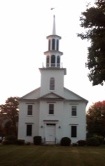 | Norfield Historic District | 3.3 miles | 1991 |
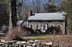 | Kettle Creek Historic District | 3.6 miles | 1995 |
| Dr. Harvey and Rhoda Wasserman House | 3.6 miles | 2024 |
| National Archives record | The nomination case file for reference 91000437 in Record Group 79. |
| Fairfield County | All 298 listed properties in this county. |