BlockBefore
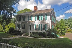
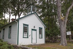
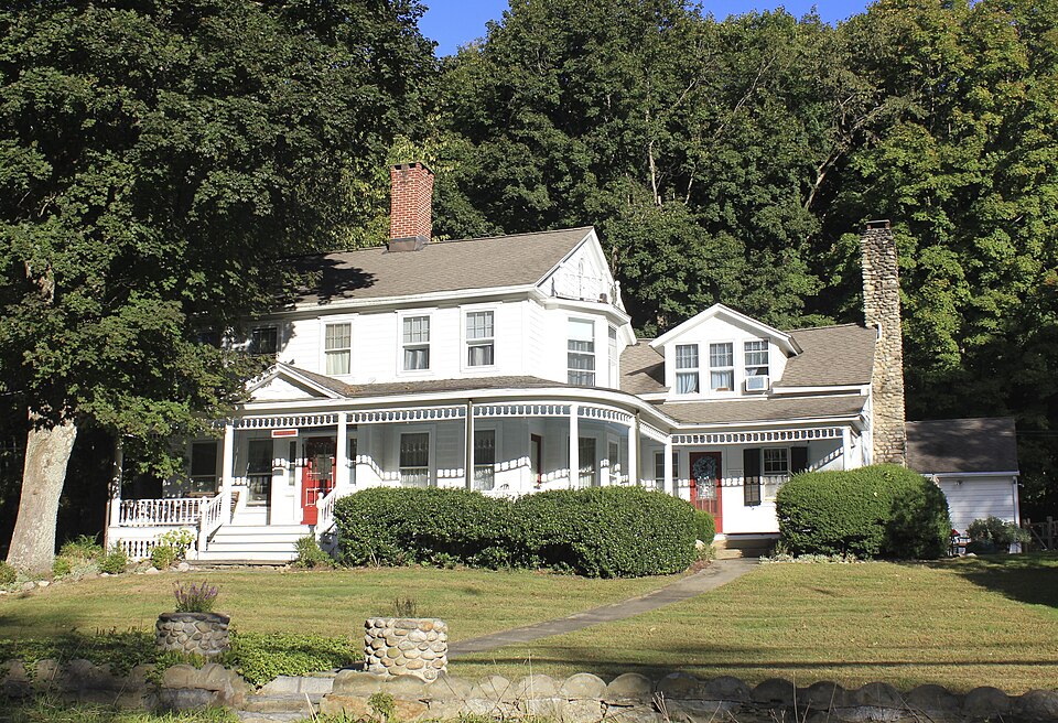
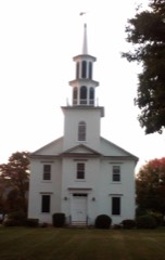
Photograph of Bradley Edge Tool Company Historic District
Photograph by Swroche, CC BY-SA 3.0. Via Wikimedia Commons.

Bradley Edge Tool Company Historic District

Listed on the National Register of Historic Places in 1995.

From the record

“The Bradley Edge Tool Company Historic District encompasses the surviving remnants of a historic 19th-century industrial village in Weston, Connecticut. Extending along Lyons Plain Road near White Birch Road and the Saugatuck River, the area was home to the Bradley Edge Tool Company, which flourished here between 1834 and 1870.”

Wikipedia article Bradley Edge Tool Company Historic District, CC BY-SA 4.0.

One of 298 National Register listings published here for Fairfield County · listed in 1995 · category: District.

Sources: the Wikipedia article · the case file at the National Archives · the National Register database, National Park Service
The listing

  • Address. Roughly, Lyons Plains Rd. N and S of jct. with White Birch Rd., Weston, 06883
  • When was it listed? November 1995
  • Category. district
  • Town. Weston town
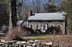
  • Architectural style. Greek Revival architecture, Renaissance Revival architecture
  • National Register reference number. 95001347 - the number the National Park Service assigned this property when it was listed, and the key its nomination file is catalogued under at the National Archives.

The ground it stands on

3,670 words

The chapter on Weston Town in History of Fairfield County, Connecticut, published 1881 names Weston. This is what it says, exactly as the scans read.

The Coleys are numerous. They also arc in 'Westjiort, so that not far from the boundary-line between that town and Weston a [lart of the town is called Colevville. Among tlii' leading ones are David and Lewis Coley ; they own large, commodious farmhouses built alter the style of architecture of the |icriod, and own good farms. On one of them is the h(dd wliere Weston was accustomed to assemble its men to obey the laws regulating the militia, which met the first Monday in May to drill, from which the old couplet originated, another town was si'vered from it and called Easton, thcridbre there sci'ins to hi' some confusion in tracing families and property. ^Fany of the dead arc recorded on that account in Weston, but on looking for them to-day, one must go in many cases to Easton ; the same fact apjilies to ]iroperty. The graveyard of lies not far from this parade-ground, and contains the bodies of some of the stauiudiest of the

Passage source: History of Fairfield County, Connecticut, published 1881.

Weston being an inland town, with a very limited transient foreign population, it has not had occasion to notice the inroads of eonimunism, socialism, party intrigues, illegal government appropriations, and the inroads of the Church inconsistent with the Constitution of the land, therefore it holds to the faith, integrity, and politics of its anccstoi-s, and is, in consequence. Democratic.

Passage source: History of Fairfield County, Connecticut, published 1881.

Machine-read from a century-old scan, so expect the errors a machine makes: misspelled names, dropped words, stray characters.

Read the whole chapter on Weston Town - 3,670 words on its settlement, mills, schools and churches.

Fires near this property

71 since 1994

Regional context, not property-specific evidence. The federal wildfire occurrence database lists 71 fires within 5 miles of Bradley Edge Tool Company Historic District between 1994 and 2020, burning about 46 acres in total. None started naturally. 1 was recorded as arson. Distance is straight-line from the map coordinates, so a fire counted here may appear on a neighbouring settlement's page as well.

Reported cause Fires
Missing data/not specified/undetermined45
Smoking13
Debris and open burning8
Railroad operations and maintenance2
Recreation and ceremony2
Arson/incendiarism1

The most recent of them, most recent first, with the day each was reported and the service that recorded it.

DateCause SizeReported by Name on the report
9 September 2015Missing data/not specified/undeterminedunder an acreConnecticut Division of Forestrynot named
8 September 2007Smokingunder an acreConnecticut Division of Forestrynot named
6 September 2007Missing data/not specified/undeterminedunder an acreConnecticut Division of Forestrynot named
5 September 2015Missing data/not specified/undeterminedunder an acreConnecticut Division of Forestrynot named
24 September 2007Smokingunder an acreConnecticut Division of Forestrynot named
11 September 2000Debris and open burningunder an acreConnecticut Division of Forestrynot named
5 August 2007Missing data/not specified/undeterminedunder an acreConnecticut Division of Forestrynot named
3 August 2015Smokingunder an acreConnecticut Division of Forestrynot named

Every fire recorded in Fairfield County

Mines and quarries near this property

6 within 5 miles

Regional context, not property-specific evidence. The federal mineral resources record lists 6 workings within 5 miles of Bradley Edge Tool Company Historic District: 3 producers, 3 past producers. 3 still produce. What was taken out: Sand and Gravel, Construction, Granite, Quartz, Silver. Distance is straight-line from the map coordinates, so a quarry counted here may appear on a neighbouring settlement's page as well.

Where SiteCommodity StatusRecorded
Hall QuarryGranitePast Producer
Quartz MineQuartzPast Producer
Wilton Silver and Galena Chalcopyrite MineSilverPast ProducerMetamorphosed Sedimentary
Gaults Gravel BankSand and Gravel, ConstructionProducer
Jayne Brothers PitSand and Gravel, ConstructionProducer
Weston Pit & DredgeSand and Gravel, ConstructionProducer

Every working recorded in Fairfield County

Storms near this property

12 since 1994

Regional context, not property-specific evidence. The National Weather Service names Weston, the town this property stands in, in 12 storm reports between 1994 and 2024: 5 thunderstorm wind, 3 hail, 3 flash flood, 1 lightning. No death or injury is recorded in these reports. Each account below is quoted exactly as the forecast office filed it, from the NOAA Storm Events Database, and each date opens the federal record of that event.

WhenEvent Place namedHarm What the report says
May 2018Thunderstorm WindWeston$5,000Tree on car with people trapped on Route 300 near New Windsor.
July 2017Thunderstorm WindWeston$5,000Multiple trees and wires were reported down throughout the town of Weston.
November 2020Thunderstorm WindWeston$2,000Large branches greater than 2 inches in diameter down.
August 2018Thunderstorm WindWeston$2,000Trees and wires down on Godfrey Road West just west of Pinefield Lane.
August 2024Flash FloodWeston-Route 53 closed between Weston Road and Newtown Turnpike because of washout.
August 2009Flash FloodWeston-In Wilton, 1 to 1.5 ft. of running water accumulated at the intersection of Newtown Tpke. and Weston Road.
March 2007Flash FloodWeston-Multiple Road closures.
June 2007HailWeston-Hail accumulated up to 1 inch in depth.
May 1994HailWeston-Local police reported large hail.
April 2005Thunderstorm WindWeston-no account filed
May 2004HailWeston-no account filed
May 1998LightningWeston-no account filed

Every storm recorded in Fairfield County

Map coverage status

No historic map-sheet match is published for this property yet. That does not mean no map exists. This record needs a coordinate-quality review before it can be joined to a sheet boundary. Browse the county's mapped places while that work is pending.

Listed places nearby

6 within 8 miles

Other National Register properties close enough to walk or drive between, ordered by distance from this one. Both positions come from the same geocoding pass that matched these properties to their map sheets.

Photograph PropertyDistance Listed
Kettle Creek Historic District1.3 miles1995
Dr. Harvey and Rhoda Wasserman House1.3 miles2024
Norfield Historic District1.4 miles1991
Aspetuck Historic District2.3 miles1991
Sturges-Wright House2.6 miles2015
Hurlbutt Street School2.9 miles1996

Sources for this property

National Archives recordThe nomination case file for reference 95001347 in Record Group 79.
Wikipedia articleCommunity-written account of this property, licensed CC BY-SA.
Fairfield CountyAll 298 listed properties in this county.

Provenance

  • Listing record. National Park Service National Register of Historic Places, listed-properties dataset, current to 2026-05-22.
  • Map join. Address geocoded through the United States Census geocoder, then tested against the published boundary of every sheet in the USGS Historical Topographic Map Collection.
  • How this page is made. Listing fields come from federal records; map-sheet coverage is a labelled coordinate-to-boundary calculation, not a source-field claim.
  • Wildfire. Short, Karen C. 2022. Spatial wildfire occurrence data for the United States, 1992-2020 [FPA_FOD_20221014]. 6th Edition. Fort Collins, CO: Forest Service Research Data Archive. https://doi.org/10.2737/RDS-2013-0009.6 Collected with United States Government funding and usable without additional permissions or fees.
  • Mines and quarries. USGS Mineral Resources Data System (MRDS) https://mrdata.usgs.gov/mrds/ A work of the United States government, no copyright under 17 U.S.C. 105.
  • Storms. NOAA National Centers for Environmental Information, Storm Events Database https://www.ncei.noaa.gov/stormevents/ A work of the United States government, no copyright under 17 U.S.C. 105. Narratives are quoted verbatim from the National Weather Service report and are not edited or summarised.