BlockBefore
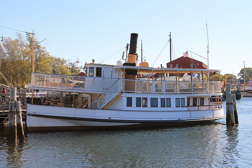
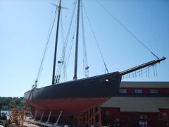
Photograph of Sabino
Photograph by Godsfriendchuck, CC BY-SA 4.0. Via Wikimedia Commons.

SABINO (steamer)

A National Historic Landmark. Built in 1908. Listed on the National Register of Historic Places in 1992.

From the record

“Sabino is a small wooden, coal-fired steamboat built in 1908 and located at the Mystic Seaport Museum in Mystic, Connecticut. It is one of only two surviving members of the American mosquito fleet, and it was declared a National Historic Landmark in 1992.”

Wikipedia article Sabino (steamer), CC BY-SA 4.0.

One of 197 National Register listings published here for New London County · listed in 1992 · category: Structure · built in 1908 · a National Historic Landmark.

Sources: the Wikipedia article · the case file at the National Archives · the National Register database, National Park Service
The listing

  • National Historic Landmark. The highest federal designation, held by about 2,600 places in the country against roughly 100,000 Register listings.
  • What is counted as historic. The nomination lists 1 structure as contributing to the listing.
  • Still standing. The Park Service records this property as extant.
  • Address. Mystic Seaport Museum, Mystic, 06355
  • When was it listed? October 1992
  • Category. structure
  • Town. Stonington town
  • When was it built? 1908
  • National Register reference number. 92001887 - the number the National Park Service assigned this property when it was listed, and the key its nomination file is catalogued under at the National Archives.

The ground it stands on

44,106 words

The chapter on Stonington Town in History of New London County, Connecticut, with Biographical Sketches of Many of Its Pioneers and Prominent Men, published 1882 names Mystic. This is what it says, exactly as the scans read.

The determination of the British government to impress American seamen into their service, and other belligerent acts on her part, led to several armed collisions, and finally culminated in a declaration of war by the United States government against Great Britain, June 18, 1812. Very little had ever been done by the general government for the defense of our sea-coast. Long Point, since the close of the Revolution, had materially increased in population and wealth. The General Assembly had incorporated the place into a borough in 1801. Mystic was but a small village at the time, composed .largely of enterprising seafaring men. Before the embargo the foreign trade of the town of Stonington was almost entirely with the West Indies, and generally productive of large gains. During the war, and especially after the spring of 1813, our sea-coast was blockaded by a British squadron, which at first wellnigh annihilated all our commerce, but a few brave, resolute, enterprising men ran the blockade and carried on business with New York. Privateers were fitted out, and were successful in most cases in capturing English vessels. We lost the sloop " Fox" in 1813, which was retaken by the privateer " Hero," fitted out at Mystic and manned by Stonington and Groton men. Other feats of heroism and successful daring, by Groton and Stonington men combined, took place on the ocean before the close of the war. During its first year England had her hands full with European conflicts, but in the spring of 1813 she managed to send a formidable fleet to our shores and blockaded Long Island Sound. Stonington borough had received two eighteen-pounders from the general government for the defense of the place. A battery had been erected there during the Revolution which had almost disappeared. But the inhabitants, with the guards stationed there, drafted from the militia of the State, had erected another battery, the north end of which terminated at the southeast corner of the Messrs. Atwood's silk-machinery establishment. So apprehensive were the people of Stonington borough that their village would be attacked and burned by the British fleet that they sought the aid of the State, the Governor of which ordered detachments from the militia to be drafted and stationed there. There were six of these military drafts and detachments, - three in 1813, and three in 1814-15, - four of which were commanded by Lieut. Horatio G. Lewis, one by Lieut. Samuel Hough, and one by Sergt. Peleg Hancox.

Passage source: History of New London County, Connecticut, with Biographical Sketches of Many of Its Pioneers and Prominent Men, published 1882.

The Mystic Bridge men were Capt. Jeremiah Holmes, Capt. Nathaniel Clift, Capt. Simon Haley, Capt. Jeremiah Haley, Frederick Denison, Ebenezer Denison, Isaac Denison, and Frederick Haley. From the rural districts in Stonington were John Miner Jesse Dean, John Dean Gallup, Charles T. Stanton, Charles P. Wheeler, and Jonathan Denison, who refused to enter the battery, but fought the enemy from the shore with his musket at long range. The Groton men were Ebenezer Morgan, Stanton Gallup, Alfred White, Frank Daniels, Giles Moran ; the New London men were Maj. Simeon Smith, Capt. Noah Lester, Maj. N. Frink, and Lambert Williams ; the Massachusetts men were Capt. Leonard, Wm. G. Bush, and Mr. Dunham, and no doubt others. The fire from the battery on the 9th was under the command of Capt. George Fellows, and under the command of Capt. Jeremiah Holmes on the 10th of August Both were brave men and true. Capt. Holmes' three years' service on board of a British man-of-war, the greater part of which he served as captain of a gun, enabled him to direct the guns in the battery with great precision. He double-shotted the eighteen-pounders, and sent the shot plunging through the brig below her water-lines.

Passage source: History of New London County, Connecticut, with Biographical Sketches of Many of Its Pioneers and Prominent Men, published 1882.

Machine-read from a century-old scan, so expect the errors a machine makes: misspelled names, dropped words, stray characters.

Read the whole chapter on Stonington Town - 44,106 words on its settlement, mills, schools and churches.

Mines and quarries near this property

10 of 22 shown

Regional context, not property-specific evidence. The federal mineral resources record lists 22 workings within 5 miles of SABINO (steamer): 18 past producers, 4 producers. 4 still produce. What was taken out: Sand and Gravel, Construction, Stone, Dimension, Granite, Stone. Distance is straight-line from the map coordinates, so a quarry counted here may appear on a neighbouring settlement's page as well.

Where SiteCommodity StatusRecorded
Granite Rock Quarry No. Ak-016StonePast ProducerGranite
Quartzite and Gneiss Rock Quarry No. Ak-007StonePast ProducerGneiss
Eckerlein QuarriesGranitePast Producer
Granite Dike Rock Quarry #Ak-015GranitePast Producer
Granite QuarriesGranitePast Producer
Kapp QuarriesGranitePast Producer
Mcgaughey QuarryGranitePast Producer
Eckerlein Quartz Monzonite Rock QuarriesStone, DimensionPast Producer1855
Granite Dike Rock Quarry No. Ak-012Stone, DimensionPast ProducerGranite
Granite Dike Rock Quarry No. Ak-015Stone, DimensionPast ProducerGranite

Every working recorded in New London County

Storms near this property

5 since 2006

Regional context, not property-specific evidence. The National Weather Service names Mystic, the town this property stands in, in 5 storm reports between 2006 and 2015: 2 flash flood, 2 thunderstorm wind, 1 hail. The reports record 1 death. Each account below is quoted exactly as the forecast office filed it, from the NOAA Storm Events Database, and each date opens the federal record of that event.

WhenEvent Place namedHarm What the report says
August 2015Thunderstorm WindWest Mystic1 killed, $10,000A tree fell on a car along Flanders Road, near U. S. Route 1. The driver, and sole occupant of the vehicle, was killed.
July 2009Flash FloodWest Mystic$50,000A river bridge on Collins Rd. in North Stonington was flooded, which resulted in damage to the bridge and the road being closed. Noank Rd. in Mystic was closed due to flooding. A river bridge on North Stonington Rd. near Shewville Rd. in North Stonington was flooded and resulted in the road being closed. Approximately 50-60 cars were inundated with water and trapped in the Mystic Aquarium parking lot. Several vehicles were also stuck in high water on Coogan Blvd. near the Mystic Aquarium. A portion of Rt. 1 in Mystic was closed due to flooding. Emergency responders in Stonington pulled an occupied vehicle out of the water in the area of Washington St. and Broadway Ave.
July 2015Thunderstorm WindWest Mystic$1,500A large branch fell on wires along Flanders Road.
October 2006Flash FloodOld Mystic-Fire Department responded to flooded basements.
June 2011HailMystic-no account filed

Every storm recorded in New London County

Map coverage status

No historic map-sheet match is published for this property yet. That does not mean no map exists. This record needs a coordinate-quality review before it can be joined to a sheet boundary. Browse the county's mapped places while that work is pending.

Listed places nearby

6 within 8 miles

Other National Register properties close enough to walk or drive between, ordered by distance from this one. Both positions come from the same geocoding pass that matched these properties to their map sheets.

Photograph PropertyDistance Listed
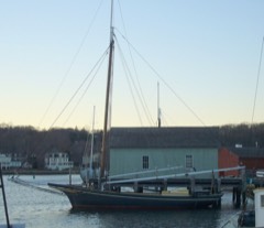
L. A. DUNTONunder 500 feet1993
EMMA C. BERRY (Fishing Sloop)under 500 feet1994
CHARLES W. MORGAN0.1 miles1966
Mystic Bridge Historic District0.4 miles1979
Mystic River Historic District0.6 miles1979
Pequotsepos Manor0.9 miles1979

Sources for this property

National Archives recordThe nomination case file for reference 92001887 in Record Group 79.
Wikipedia articleCommunity-written account of this property, licensed CC BY-SA.
New London CountyAll 197 listed properties in this county.

Provenance

  • Listing record. National Park Service National Register of Historic Places, listed-properties dataset, current to 2026-05-22.
  • Map join. Address geocoded through the United States Census geocoder, then tested against the published boundary of every sheet in the USGS Historical Topographic Map Collection.
  • How this page is made. Listing fields come from federal records; map-sheet coverage is a labelled coordinate-to-boundary calculation, not a source-field claim.
  • Mines and quarries. USGS Mineral Resources Data System (MRDS) https://mrdata.usgs.gov/mrds/ A work of the United States government, no copyright under 17 U.S.C. 105.
  • Storms. NOAA National Centers for Environmental Information, Storm Events Database https://www.ncei.noaa.gov/stormevents/ A work of the United States government, no copyright under 17 U.S.C. 105. Narratives are quoted verbatim from the National Weather Service report and are not edited or summarised.