 Block
From the record
One of 82 National Register listings published here for Windham County · listed in 1993 · category: District.
Sources: the case file at the National Archives · the National Register database, National Park Service
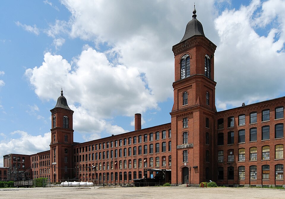
Listed on the National Register of Historic Places in 1993.
One of 82 National Register listings published here for Windham County · listed in 1993 · category: District.
Sources: the case file at the National Archives · the National Register database, National Park Service
The chapter on Thompson Town in History of Windham County, Connecticut .., published 1889 names Thompson. This is what it says, exactly as the scans read.
The territory now included in Thompson was, prior to white settlement, a part of the Nipmuck country, though also claimed by the Narragansetts. The Great Pond, Chaubunakongkomuk, just beyond its present northern boundary, was the "bound mark " between the Nipmucks and Narragansetts. An Indian captain named Allum or Hyems gave his name to the little Allum pond, near its northeast corner. In the days of John Eliot's missionary labors, 1670-1674, the Nipmucks were in ascendency, occupying a fort on the hill east of what is now Thompson hill. This latter hill and the surrounding country was known as Quinnatisset, and the little brook circuiting from " the meadow " into the French river was called Quinnatisset brook. Through the faithful labors of Eliot's Indian missionaries the Quinnatisset residents were persuaded to gather into a village on the hill, where a large wigwam was constructed, visible as late as 1730. Twenty families, containing about a hundred souls, were reported to Eliot, partly civilized and inclined to religious worship, to whom was sent in 1674 " a sober and pious young man of Natick, called Daniel, to be their minister, whom they accepted in the Lord." The breaking out of King Philip's war quickly obliterated the results of missionary labor. The Quinnatisset Nipmucks joined the Narragansetts and were mostly destroyed. The fort in Quinnatisset, known as " Fort No. 1 in the Nipmuck Country," was assaulted and demolished, but the aboriginal cellar on Fort hill, described by surveyors in 1684 as "the ruins of an old Indian fort," is visible until this day, one of the oldest and best authenticated Indian relics in Windham county. Many Indian utensils and arrows, found in this vicinity and the adjacent Pattaquatic (now Quadic), show that this Assawaga valley was once a favorite resort. The remains of corn rows were distinctly seen upon Fort hill within the memory of older inhabitants.
Passage source: History of Windham County, Connecticut .., published 1889.
Indians. This land was immediately made over to the Massachusetts agents, Messrs Stoughton and Dudley, and soon after sold to non-resident English gentlemen. June 18th, 1683, two thousand acres of " forest land in the Nipmuck Country," including the present Thompson hill and surrounding land, was conveyed to Thomas Freak, Hamington, Wells county, England, and a two thousand acre tract, east of the above, was soon after sold to vSir Robert Thompson, North Newington, Middlesex, England - the initial bound between the tracts running through the cellar of the old fort. Another large slice of the Indian reservation, east of the Quinebaug or Myanexet, now occupied by New Boston village, was secured by Joseph Dudley, and smaller farms by other non-residents. These farms were all laid out in 1684, the earliest of any in Windham county, but owing to the uncertain tenure of the land, they were not improved for many years. The survey under which Massachusetts claimed Quinnatisset and the adjacent Senexet (now Woodstock) was clearly erroneous. Woodward and Saffery's line, dividing Massachusetts and Connecticut colonies, deflected southward six or eight miles, striking the Connecticut river at Windsor. The protracted boundary quarrel greatly discouraged settlement, and it was not till after 1713, when Massachusetts consented to rectify the line provided she could keep all the towns she had settled, that much progress was made. The township of Killingly had meanwhile been settled and organized, and as it was certain that Connecticut's claim would ultimately prevail, a few settlers had straggled in north of that town.
Passage source: History of Windham County, Connecticut .., published 1889.
Machine-read from a century-old scan, so expect the errors a machine makes: misspelled names, dropped words, stray characters.
Read the whole chapter on Thompson Town - 62,001 words on its settlement, mills, schools and churches.
Regional context, not property-specific evidence. The federal wildfire occurrence database lists 167 fires within 5 miles of North Grosvenordale Mill Historic Disrict between 1992 and 2020, burning about 355 acres in total. 2 started naturally. 8 were recorded as arson. Distance is straight-line from the map coordinates, so a fire counted here may appear on a neighbouring settlement's page as well.
| Reported cause | Fires |
|---|---|
| Missing data/not specified/undetermined | 106 |
| Debris and open burning | 18 |
| Recreation and ceremony | 14 |
| Misuse of fire by a minor | 11 |
| Arson/incendiarism | 8 |
| Smoking | 4 |
| Natural | 2 |
| Equipment and vehicle use | 2 |
| Railroad operations and maintenance | 1 |
| Power generation/transmission/distribution | 1 |
The most recent of them, most recent first, with the day each was reported and the service that recorded it.
| Date | Cause | Size | Reported by | Name on the report |
|---|---|---|---|---|
| 7 September 2020 | Arson/incendiarism | under an acre | Connecticut Division of Forestry | BAKER RD/QUADDICK TOWN FARM ROAD |
| 22 September 2020 | Missing data/not specified/undetermined | under an acre | Connecticut Division of Forestry | 11 HOLMES STREET |
| 20 September 2020 | Missing data/not specified/undetermined | 3.5 acres | Connecticut Division of Forestry | 78 ROCK AVE |
| 19 September 2020 | Missing data/not specified/undetermined | 2.0 acres | Connecticut Division of Forestry | 1017 RIVERSIDE DRIVE |
| 19 September 2020 | Missing data/not specified/undetermined | 1.0 acres | Connecticut Division of Forestry | 1175 RIVERSIDE DRIVE |
| 8 August 2015 | Recreation and ceremony | under an acre | Massachusetts Bureau of Forest Fire Control | not named |
| 6 August 2015 | Recreation and ceremony | under an acre | Massachusetts Bureau of Forest Fire Control | not named |
| 4 August 1993 | Equipment and vehicle use | 5.0 acres | Connecticut Division of Forestry | not named |
Regional context, not property-specific evidence. The federal mineral resources record lists 13 workings within 5 miles of North Grosvenordale Mill Historic Disrict: 12 past producers, 1 producer. 1 still produces. What was taken out: Sand and Gravel, Construction, Stone, Crushed/Broken. Distance is straight-line from the map coordinates, so a quarry counted here may appear on a neighbouring settlement's page as well.
| Where | Site | Commodity | Status | Recorded |
|---|---|---|---|---|
| New Haven Traprock Co. Quarry | Stone, Crushed/Broken | Past Producer | ||
| Janeczek Pit | Sand and Gravel, Construction | Past Producer | Sedimentary | |
| Janeczek Pit | Sand and Gravel, Construction | Past Producer | ||
| Kappys Gravel Pit | Sand and Gravel, Construction | Past Producer | ||
| Kaprys Gravel Pit | Sand and Gravel, Construction | Past Producer | Sedimentary | |
| Leo Construction Co | Sand and Gravel, Construction | Past Producer | Sedimentary | |
| Minarik Pit | Sand and Gravel, Construction | Past Producer | Sedimentary | |
| Minarik Pit | Sand and Gravel, Construction | Past Producer | ||
| Sunny Shores, Inc. Pit | Sand and Gravel, Construction | Past Producer | ||
| Thompson Pit | Sand and Gravel, Construction | Past Producer | Sedimentary |
Regional context, not property-specific evidence. The National Weather Service names Thompson, the town this property stands in, in 8 storm reports between 2001 and 2020: 6 thunderstorm wind, 2 hail. No death or injury is recorded in these reports. Each account below is quoted exactly as the forecast office filed it, from the NOAA Storm Events Database, and each date opens the federal record of that event.
| When | Event | Place named | Harm | What the report says |
|---|---|---|---|---|
| September 2008 | Thunderstorm Wind | Thompson | $7,000 | Numerous trees were downed by thunderstorm winds. |
| July 2008 | Thunderstorm Wind | Thompson | $5,000 | Trees and Wires on Bolton Hill Road were downed by thunderstorm winds. |
| June 2020 | Thunderstorm Wind | West Thompson | $4,000 | In Putnam, a tree was down on a house on Viens Street. Also, wires were downed by wind on Grove Street. |
| August 2006 | Thunderstorm Wind | Thompson | $2,000 | no account filed |
| July 2012 | Hail | Thompson | - | no account filed |
| July 2012 | Hail | Thompson | - | no account filed |
| July 2001 | Thunderstorm Wind | Thompson | - | no account filed |
| August 2001 | Thunderstorm Wind | Thompson | - | no account filed |
No historic map-sheet match is published for this property yet. That does not mean no map exists. This record needs a coordinate-quality review before it can be joined to a sheet boundary. Browse the county's mapped places while that work is pending.
Other National Register properties close enough to walk or drive between, ordered by distance from this one. Both positions come from the same geocoding pass that matched these properties to their map sheets.
| Photograph | Property | Distance | Listed |
|---|---|---|---|
 | Thompson Hill Historic District | 2.4 miles | 1987 |
 | George Pickering Nichols House | 2.8 miles | 1991 |
 | Capt. Seth Chandler House | 4.1 miles | 1993 |
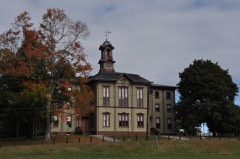 | Woodstock Academy Classroom Building | 4.7 miles | 1984 |
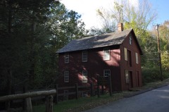 | Brayton Grist Mill | 4.7 miles | 1986 |
 | Putnam High School | 4.8 miles | 1993 |
| National Archives record | The nomination case file for reference 93000288 in Record Group 79. |
| Windham County | All 82 listed properties in this county. |