Listed on the National Register of Historic Places in 1993.
From the record
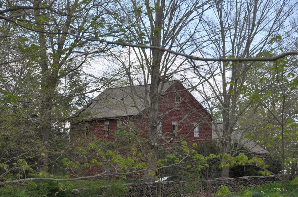
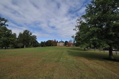
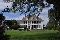
“The Captain Seth Chandler House is a historic house in the East Woodstock section of Woodstock, Connecticut. With a construction history dating to 1760, it has a number of unusual features and form for a rurally sited house of that period, including unusually fine stonework in the chimney and stencilled plaster.”
Wikipedia article Capt. Seth Chandler House, CC BY-SA 4.0.
One of 82 National Register listings published here for Windham County · listed in 1993 · category: Building.
Architectural style. American colonial architecture
National Register reference number.93001380- the number the National Park Service assigned this property when it was listed, and the key its nomination file is catalogued under at the National Archives.
The old " Child House " with its Centennial Elm, and the " old May House," (now Lippitt's) stand upon or near the sites of the first rude houses built by Ephraim Child and John May. The homestead of Benjamin Child was on the brook in the heart of the present East Woodstock village. " Old Mr. Maturin Allard," Thomas Gou.ld, tanner, and Deacon Joseph Lyon, were also among the early inhabitants of the north half. Their first recognition in town meeting was in 1715, when theY had liberty to mend their own highways. :Maturin AUard was the first man chosen to hold town office. Wolf hunting was apparently greatly stimulated by settlement in this previously waste country, as the town was called to pay many wolf bounties, at twenty shillings a head. Thomas Lyon, Jr., and Jonathan Payson were very active in this service. John ]May showed much versatility, helping build chimnej-s and houses, having charge of the Cedar Swamp, and assisting Lieutenant Samuel :\Iorris in placing the first bridge over the Quinebaug river.
Parish divisions in Woodstock are unusually pronounced and definite. After a serious contest the west half of the town was set off as a distinct parish or religious society in 1743, and still remains nearly or quite intact, as the Second or West parish. The First or East parish was again divided after the church controversy of 1850-60. The villages of Woodstock hill, South Woodstock and Quasset are included in the First society. West Woodstock parish includes the villages of West AVoodstock and Woodstock Valley. The Third or Northeast society includes East Woodstock village, formerly called Muddy Brook, and North Woodstock village, first known as Village Corners. Town meetings are held alternately in each of the three parishes, and representatives are sent alternately, each sending a representative for two successive years, while one is without a representative every year.
Regional context, not property-specific
evidence. The
federal wildfire occurrence database
lists 105 fires within 5 miles of Capt. Seth Chandler House
between 1992 and 2020, burning about 102 acres in total. 1 started naturally. 3 were recorded as arson.
Distance is straight-line from the map coordinates, so a fire counted
here may appear on a neighbouring settlement's page as well.
Reported cause
Fires
Missing data/not specified/undetermined
59
Debris and open burning
18
Recreation and ceremony
17
Arson/incendiarism
3
Smoking
3
Power generation/transmission/distribution
2
Misuse of fire by a minor
1
Natural
1
Railroad operations and maintenance
1
The most recent of
them, most recent first, with the day each was reported and the service
that recorded it.
Regional context, not property-specific
evidence. The federal mineral resources record lists
5 workings within 5 miles of Capt. Seth Chandler House: 5 past producers.
None of them still produces. What was taken out: Sand and Gravel, Construction, Stone, Crushed/Broken. Distance is straight-line from the
map coordinates, so a quarry counted here may appear on a neighbouring
settlement's page as well.
Regional context, not property-specific
evidence. The National Weather Service names
East Woodstock, the town this property stands in, in 1 storm report in 2023: 1 thunderstorm wind.
No death or injury is recorded in these reports. Each account below is quoted exactly as the forecast office
filed it, from the NOAA Storm Events Database, and each date
opens the federal record of that event.
No historic map-sheet match is published
for this property yet. That does not mean no map exists. This record needs
a coordinate-quality review before it can be joined to a sheet boundary.
Browse the county's mapped places while that work is
pending.
Listed places nearby
6 within 8 miles
Other National Register properties close
enough to walk or drive between, ordered by distance from this one. Both
positions come from the same geocoding pass that matched these properties
to their map sheets.
Listing record. National Park Service National Register of Historic Places, listed-properties dataset, current to 2026-05-22.
Map join. Address geocoded through the United States Census geocoder, then tested against the published boundary of every sheet in the USGS Historical Topographic Map Collection.
How this page is made. Listing fields come from federal records; map-sheet coverage is a labelled coordinate-to-boundary calculation, not a source-field claim.
Wildfire. Short, Karen C. 2022. Spatial wildfire occurrence data for the United States, 1992-2020 [FPA_FOD_20221014]. 6th Edition. Fort Collins, CO: Forest Service Research Data Archive. https://doi.org/10.2737/RDS-2013-0009.6 Collected with United States Government funding and usable without additional permissions or fees.
Mines and quarries. USGS Mineral Resources Data System (MRDS) https://mrdata.usgs.gov/mrds/ A work of the United States government, no copyright under 17 U.S.C. 105.
Storms. NOAA National Centers for Environmental Information, Storm Events Database https://www.ncei.noaa.gov/stormevents/ A work of the United States government, no copyright under 17 U.S.C. 105. Narratives are quoted verbatim from the National Weather Service report and are not edited or summarised.
 Block