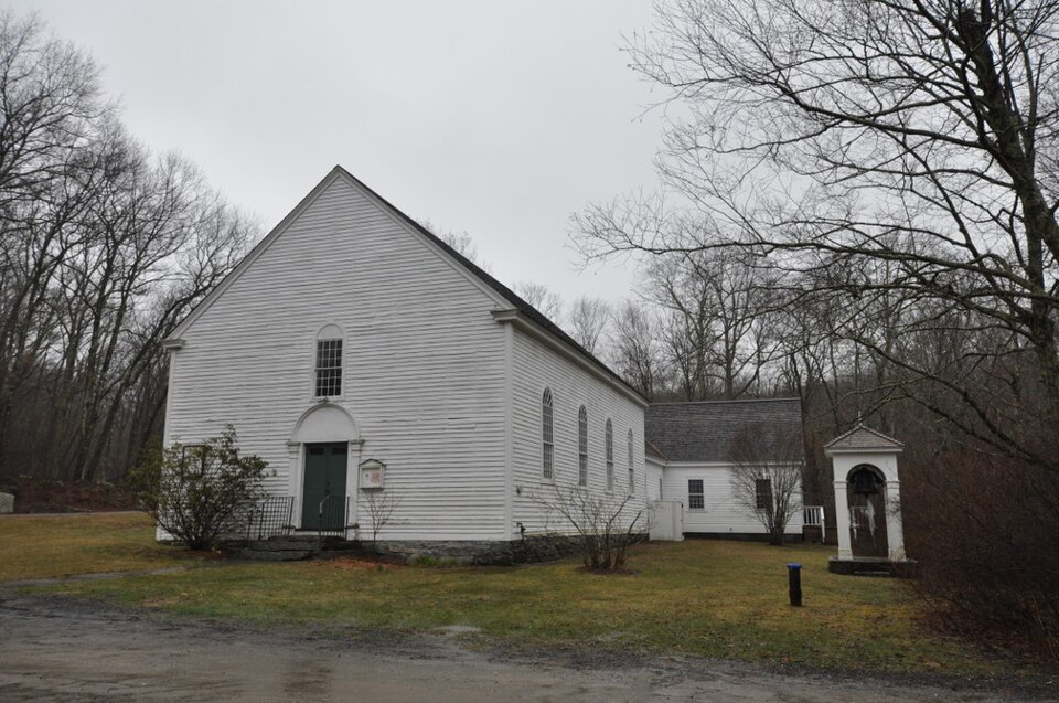
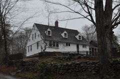
National Register reference number.99000924- the number the National Park Service assigned this property when it was listed, and the key its nomination file is catalogued under at the National Archives.
The settlers were constantly beset with trouble as to boundaries. Guilford was originally bounded on the east by the west]bank of Hammonassett River, but when the General Court ordered a bridge to be built across the river, Guilford was ordered to build one-half of the bridge and the middle of the river was made the line of division. Another source of affliction was, Saybrook claimed to own the territory, and finally several, if not all, owners of real estate in Killingworth paid to Saybrook a sort of hush money to keep matters quiet.
The present Clinton was the original Killingworth. Main street was the identical ground where the first settlers took their home lots. These were surveyed in 1663, and were alloted to them by some method analogous to " drawing cuts." It may have been by drawing numbers from a hat or box. Lot No. i was on the south side of Main street, east of Indian River, and is now owned and occupied by George E. Elliot, Esq. It was owned and occupied by Rev. Jared Eliot in his day, and has ever since remained in the possession of the Eliot family. Killingworth was originally a piece of ground "left out " as not worth settling. Guilford had been settled as a part of New Haven colony as early as 1640. Saybrook had been settled as early as 1635, an independent colony. Guilford was settled east of its center, on the beautiful lands of Hammonassett, on the west bank of that river. Saybrook settlers had reached west from their center to the equally rich lands east of Westbrook meeting house, and south of Main street. But the passage from Saybrook to Guilford was, at that time, almost an impossibility, even for a daring hunter. To travel with wheels was an impossibility. A river on the east was unfordable' for two miles, except at low tide at the mouth, called the "riding way" as early as 1663. There was another "riding way" on the Menunketesuc, about two miles north, at Chapman's Mills. The dividing line between Clinton and Westbrook runs through the mill building. On the west was no ford on the Hammonassett River, except about two miles north of Main street, Clinton, just below Hammonassett Mills. Tradition says that footmen between Saybrook and Guilford kept along the seabeach of Long Island Sound. But there was a delightful spot at the head of a beautiful harbor, where the first settlers located Main street. This street runs a little north of west and south of east about a half mile north of the head of the harbor. An abundance of oysters, fish, and clams were to be found in the harbor and in the rivers as far up as salt water flowed.
Regional context, not property-specific
evidence. The
federal wildfire occurrence database
lists 71 fires within 5 miles of Emmanuel Church
between 1994 and 2020, burning about 101 acres in total. 1 started naturally. 1 was recorded as arson.
Distance is straight-line from the map coordinates, so a fire counted
here may appear on a neighbouring settlement's page as well.
Reported cause
Fires
Missing data/not specified/undetermined
31
Debris and open burning
21
Recreation and ceremony
13
Misuse of fire by a minor
2
Arson/incendiarism
1
Smoking
1
Natural
1
Power generation/transmission/distribution
1
The most recent of
them, most recent first, with the day each was reported and the service
that recorded it.
Regional context, not property-specific
evidence. The federal mineral resources record lists
4 workings within 5 miles of Emmanuel Church: 4 past producers.
None of them still produces. What was taken out: Stone, Crushed/Broken, Limestone, General, Stone, Stone, Dimension. Distance is straight-line from the
map coordinates, so a quarry counted here may appear on a neighbouring
settlement's page as well.
Regional context, not property-specific
evidence. The National Weather Service names
Killingworth, the town this property stands in, in 10 storm reports between 1997 and 2025: 7 thunderstorm wind, 2 hail, 1 tornado.
No death or injury is recorded in these reports. Each account below is quoted exactly as the forecast office
filed it, from the NOAA Storm Events Database, and each date
opens the federal record of that event.
No historic map-sheet match is published
for this property yet. That does not mean no map exists. This record needs
a coordinate-quality review before it can be joined to a sheet boundary.
Browse the county's mapped places while that work is
pending.
Listed places nearby
6 within 8 miles
Other National Register properties close
enough to walk or drive between, ordered by distance from this one. Both
positions come from the same geocoding pass that matched these properties
to their map sheets.
Listing record. National Park Service National Register of Historic Places, listed-properties dataset, current to 2026-05-22.
Map join. Address geocoded through the United States Census geocoder, then tested against the published boundary of every sheet in the USGS Historical Topographic Map Collection.
How this page is made. Listing fields come from federal records; map-sheet coverage is a labelled coordinate-to-boundary calculation, not a source-field claim.
Wildfire. Short, Karen C. 2022. Spatial wildfire occurrence data for the United States, 1992-2020 [FPA_FOD_20221014]. 6th Edition. Fort Collins, CO: Forest Service Research Data Archive. https://doi.org/10.2737/RDS-2013-0009.6 Collected with United States Government funding and usable without additional permissions or fees.
Mines and quarries. USGS Mineral Resources Data System (MRDS) https://mrdata.usgs.gov/mrds/ A work of the United States government, no copyright under 17 U.S.C. 105.
Storms. NOAA National Centers for Environmental Information, Storm Events Database https://www.ncei.noaa.gov/stormevents/ A work of the United States government, no copyright under 17 U.S.C. 105. Narratives are quoted verbatim from the National Weather Service report and are not edited or summarised.
 Block