 Block
BlockBig Pine, Florida
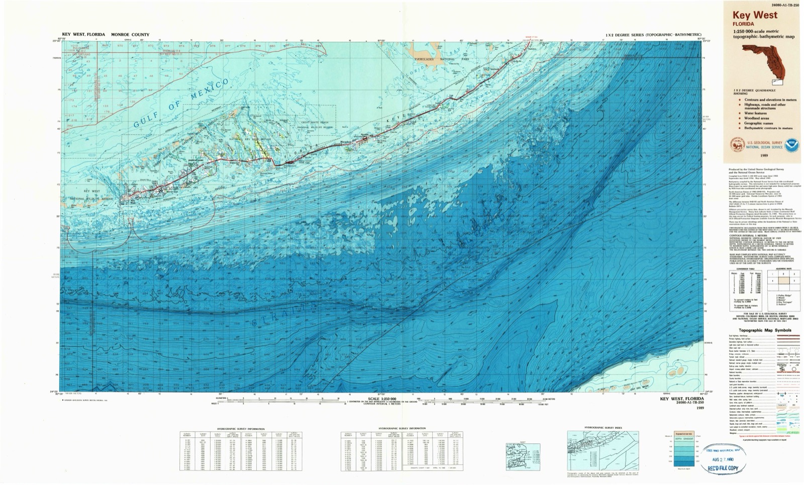
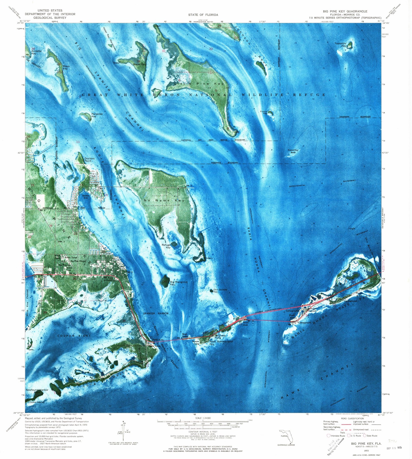
4 topographic sheets cover this place, the earliest surveyed in 1972 and the latest in 1989. It stands in the Lower Keys census division. It lies in ZIP code area 33043. It lies near Big Mangrove Key. The Survey maps it on the Big Pine Key quadrangle.
Then and now
1972 to 1989The same ground, surveyed 17 years apart. Drag the handle to wipe between them. Both sheets are United States Geological Survey originals; neither has been altered.
Topographic sheets covering this place
3 surveys from 4 printed sheetsMatched by testing this settlement's coordinate against the published boundary of every sheet in the United States Geological Survey's historical collection. Each opens the scanned sheet at the Survey.
- 1972 USGS Big Pine Key quadrangle1:24000
- 1983 USGS Key West quadrangle1:100000, 2 printings
- 1989 USGS Key West quadrangle1:250000
Fires near this place
252 since 1992Regional context, not property-specific evidence. The federal wildfire occurrence database lists 252 fires within 5 miles of Big Pine between 1992 and 2019, burning about 340 acres in total. 6 started naturally. 29 were recorded as arson. Distance is straight-line from the map coordinates, so a fire counted here may appear on a neighbouring settlement's page as well.
| Reported cause | Fires |
|---|---|
| Missing data/not specified/undetermined | 59 |
| Misuse of fire by a minor | 45 |
| Railroad operations and maintenance | 33 |
| Arson/incendiarism | 29 |
| Debris and open burning | 28 |
| Smoking | 22 |
| Recreation and ceremony | 14 |
| Equipment and vehicle use | 9 |
| Power generation/transmission/distribution | 6 |
| Natural | 6 |
| Fireworks | 1 |
The most recent of them, most recent first, with the day each was reported and the service that recorded it.
| Date | Cause | Size | Reported by | Name on the report |
|---|---|---|---|---|
| 9 September 1998 | Arson/incendiarism | under an acre | Florida Forest Service | not named |
| 8 September 1998 | Misuse of fire by a minor | 2.0 acres | Florida Forest Service | not named |
| 7 September 1998 | Smoking | under an acre | Florida Forest Service | not named |
| 30 September 1998 | Debris and open burning | under an acre | Florida Forest Service | not named |
| 30 September 1998 | Debris and open burning | under an acre | Florida Forest Service | not named |
| 3 September 2013 | Natural | under an acre | Florida Forest Service | WASHINGTONIAN TREE (44) |
| 3 September 1996 | Misuse of fire by a minor | under an acre | Florida Forest Service | not named |
| 25 September 2006 | Misuse of fire by a minor | under an acre | Florida Forest Service | FATHER TONY FIRE |
Settlements close enough to share some of these fires:
Mines and quarries near this place
5 within 5 milesRegional context, not property-specific evidence. The federal mineral resources record lists 5 workings within 5 miles of Big Pine: 4 producers, 1 past producer. 4 still produce. What was taken out: Stone, Crushed/Broken, Limestone, General. Distance is straight-line from the map coordinates, so a quarry counted here may appear on a neighbouring settlement's page as well.
| Where | Site | Commodity | Status | Recorded |
|---|---|---|---|---|
| Pinewood Materials - No Name Key | Limestone, General | Producer | Limestone | |
| Tarmac-Florida - Big Pine Key | Limestone, General | Producer | Limestone | |
| Big Pine Key Quarry | Stone, Crushed/Broken | Past Producer | ||
| Big Pine Quarry | Stone, Crushed/Broken | Producer | ||
| No Name Lake Pit | Stone, Crushed/Broken | Producer |
Storms near this place
4 since 1998Regional context, not property-specific evidence. The National Weather Service names Big Pine in 4 storm reports between 1998 and 2014: 1 thunderstorm wind, 1 lightning, 1 tornado, 1 flood. No death or injury is recorded in these reports. Each account below is quoted exactly as the forecast office filed it, from the NOAA Storm Events Database, and each date opens the federal record of that event.
| When | Event | Place named | Harm | What the report says |
|---|---|---|---|---|
| April 2013 | Tornado (EF0) | Big Pine | $30,000 | A waterspout was observed by the public, backlit by frequent lightning strikes approaching long beach estates from the west-southwest, passing to the south of the Newfound Harbor Keys. The waterspout moved ashore along the oceanside of Long Beach Drive and passed over the public observer's property, a bed-and-breakfast inn. It was at this landfall location that the tornado was at its maximum intensity and width of about 80 yards. Widespread damage to large limbs of native hardwood trees occurred, and one royal palm snapped at a level above 15 feet. A ground deck with four kayaks became airborne with the dock dropped within mangroves beyond 30 yards from the original location. A large unmounted above-ground cistern containing nearly 200 gallons of water slide just over 15 yards, knocking a large camping trailer off its front mount. Bolts securing a large grill to wood ground decking were sheared off. While numerous tables and lounge chairs were carried to the leeward side of the property, one 40-lb steel lounge chair was lifted to the edge of the roof line of the two-story residence, crushing the rain gutter, before settling in the lee of the structure. Small gravel and pea rock along the waterfront caused moderate to severe paint chipping on the oceanside of several homes. Screens including their wood frames were torn off several residences' oceanside porches, with one home losing about 40 percent of its oceanside vinyl siding. A phone line was downed along Long Beach Drive. ||The tornado continued across mud flats along the southeast edge of Coupon Bight, where only isolated damage to mangrove branches was observed. Small limbs were observed downed across Long Beach Drive between Southeast Point and U.S. Highway 1, eventually crossed through a campground just south of the Spanish Harbor Channel Bridge. Several tents including one large aluminum-framed dome tent strucutre were overturned before the tornado likely passed into Spanish Harbor Channel. The intensity of the tornado at Spanish Harbor Channel had decreased since its original landfall with estimated winds near 60 mph. |
| June 2010 | Lightning | Big Pine | $1,000 | Lightning struck a tiki hut at the Big Pine Fishing Lodge on Big Pine Key. |
| October 2014 | Flood | Big Pine | - | Initial reports of widespread minor street flooding came in to the NWS, Key West office via Facebook around 345 pm. Later reports were verified via phone calls to local businesses, including the Winn-Dixie on Big Pine Key. The Deepest reports of flood waters came from Key Deer Blvd, where approximately 18 inches of water covered extensive areas of the roadway. |
| February 1998 | Thunderstorm Wind | Big Pine | - | Two trees fell into house. |
Nearest settlements
The eight closest, with where each one stands in the county. Distances are straight-line, computed from the Geographic Names Information System coordinates.
| Map | Place | Distance | Sheets |
|---|---|---|---|
| Big Pine Key | 0.3 miles | 4 | |
| Summerland Key | 5.0 miles | 5 | |
| Cudjoe Key | 7.9 miles | 5 | |
| Pirates Cove | 8.9 miles | 9 | |
| Sugarloaf Shores | 11.4 miles | 9 | |
| Perky | 11.9 miles | 9 | |
| Bay Point | 13.3 miles | 9 | |
| Marathon | 14.0 miles | 5 |
Provenance
This settlement is recorded in the Geographic Names Information System as feature 299984. The sheet list is computed by point-in-boundary test against the United States Geological Survey's historical topographic inventory. Both are works of the United States government and carry no copyright under 17 U.S.C. 105.
Wildfire. Short, Karen C. 2022. Spatial wildfire occurrence data for the United States, 1992-2020 [FPA_FOD_20221014]. 6th Edition. Fort Collins, CO: Forest Service Research Data Archive. https://doi.org/10.2737/RDS-2013-0009.6 Collected with United States Government funding and usable without additional permissions or fees.
Mines and quarries. USGS Mineral Resources Data System (MRDS) https://mrdata.usgs.gov/mrds/ A work of the United States government, no copyright under 17 U.S.C. 105.
Storms. NOAA National Centers for Environmental Information, Storm Events Database https://www.ncei.noaa.gov/stormevents/ A work of the United States government, no copyright under 17 U.S.C. 105. Narratives are quoted verbatim from the National Weather Service report and are not edited or summarised.