 Block
BlockSummerland Key, Florida
5 topographic sheets cover this place, the earliest surveyed in 1972 and the latest in 1989. It stands in the Lower Keys census division. It lies in ZIP code area 33042. It stands on Summerland Key. The Survey maps it on the Summerland Key quadrangle. It stands 13 feet above sea level.
Then and now
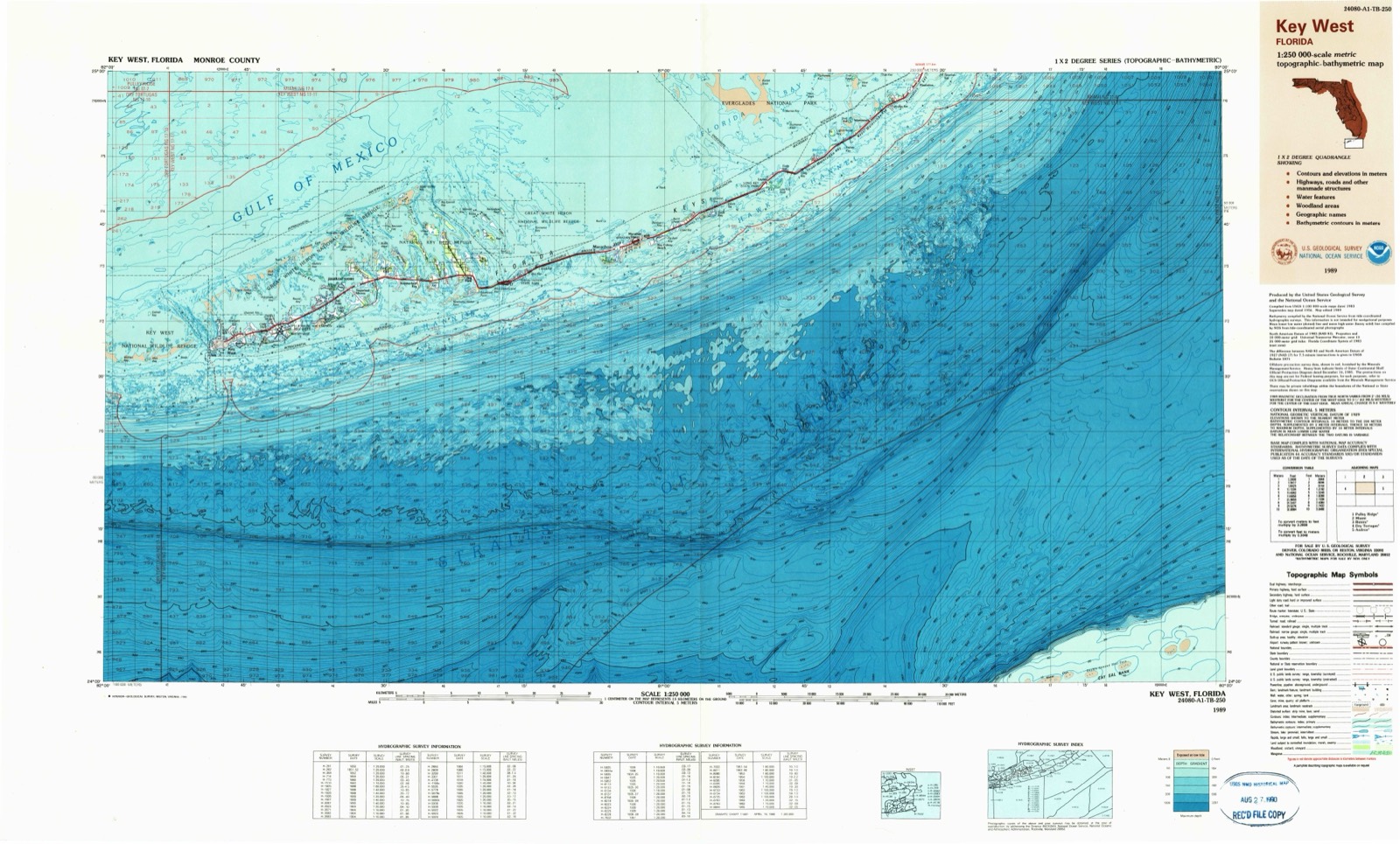
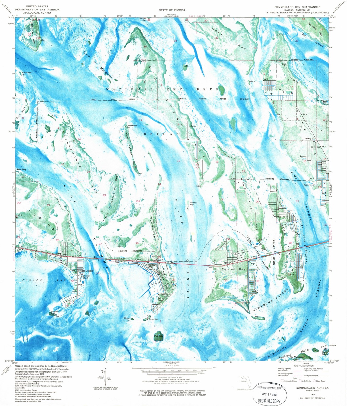
1972 to 1989The same ground, surveyed 17 years apart. Drag the handle to wipe between them. Both sheets are United States Geological Survey originals; neither has been altered.
On record in Summerland Key
Buildings and businesses the archive holds for this place. Each opens its own page, with the source record it came from.
On the National Register 1 record
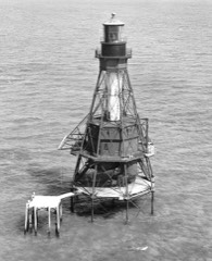 American Shoal Lightlisted 2011
Topographic sheets covering this place
3 surveys from 5 printed sheetsMatched by testing this settlement's coordinate against the published boundary of every sheet in the United States Geological Survey's historical collection. Each opens the scanned sheet at the Survey.
- 1972 USGS Summerland Key quadrangle1:24000, 2 printings
- 1983 USGS Key West quadrangle1:100000, 2 printings
- 1989 USGS Key West quadrangle1:250000
Fires near this place
102 since 1992Regional context, not property-specific evidence. The federal wildfire occurrence database lists 102 fires within 5 miles of Summerland Key between 1992 and 2018, burning about 158 acres in total. 3 started naturally. 15 were recorded as arson. Distance is straight-line from the map coordinates, so a fire counted here may appear on a neighbouring settlement's page as well.
| Reported cause | Fires |
|---|---|
| Missing data/not specified/undetermined | 23 |
| Debris and open burning | 19 |
| Railroad operations and maintenance | 16 |
| Arson/incendiarism | 15 |
| Misuse of fire by a minor | 11 |
| Smoking | 4 |
| Power generation/transmission/distribution | 4 |
| Recreation and ceremony | 4 |
| Equipment and vehicle use | 3 |
| Natural | 3 |
The most recent of them, most recent first, with the day each was reported and the service that recorded it.
| Date | Cause | Size | Reported by | Name on the report |
|---|---|---|---|---|
| 9 September 1998 | Arson/incendiarism | under an acre | Florida Forest Service | not named |
| 7 September 2011 | Missing data/not specified/undetermined | under an acre | National Key Deer Refuge | TRAILER FIRE |
| 3 September 1996 | Misuse of fire by a minor | under an acre | Florida Forest Service | not named |
| 24 September 2013 | Natural | under an acre | National Key Deer Refuge | NATURAL OUT |
| 23 September 2009 | Missing data/not specified/undetermined | under an acre | Florida Forest Service | 2009-18-0234 |
| 19 September 2002 | Missing data/not specified/undetermined | under an acre | Florida Forest Service | not named |
| 18 September 1995 | Railroad operations and maintenance | under an acre | Florida Forest Service | not named |
| 17 September 2011 | Arson/incendiarism | under an acre | National Key Deer Refuge | KIOSK |
Settlements close enough to share some of these fires:
Mines and quarries near this place
2 within 5 milesRegional context, not property-specific evidence. The federal mineral resources record lists 2 workings within 5 miles of Summerland Key: 2 producers. All of them still produce. What was taken out: Limestone, General. Distance is straight-line from the map coordinates, so a quarry counted here may appear on a neighbouring settlement's page as well.
| Where | Site | Commodity | Status | Recorded |
|---|---|---|---|---|
| Frank Keevan and Sons - Summerland Key Mine | Limestone, General | Producer | Limestone | |
| Tarmac-Florida - Cudjoe Key | Limestone, General | Producer | Limestone |
Storms near this place
15 since 1999Regional context, not property-specific evidence. The National Weather Service names Summerland Key in 15 storm reports between 1999 and 2024: 11 waterspout, 3 tornado, 1 funnel cloud. No death or injury is recorded in these reports. Each account below is quoted exactly as the forecast office filed it, from the NOAA Storm Events Database, and each date opens the federal record of that event.
| When | Event | Place named | Harm | What the report says |
|---|---|---|---|---|
| February 2024 | Tornado (EF0) | Summerland Key | $75,000 | A waterspout was observed by resident video of a |mature waterspout passing just to the north of the southern end of |Cudjoe Key, entering Cudjoe Bay on a northeast path. The waterspout |made landfall in a residential section along Cudjoe Bay near Spanish |Main Drive and moved through the Venture Out residential community of mixed single |family and manufactured residences. The EF0 rating is based on tree |damage including snapped hardwood branches and a healthy palm trunk |roughly 15 feet above the ground. The top portion of the tree fell |onto a manufactured residence with major wall damage and release of |numerous roofing panels deposited as far as 300 yards to the |northeast. Siding was removed from several residences. The tornado |exited the northeast portion of the community and traveled over the |western portion of Kemp Channel, before crossing U.S. Highway One |just west of the Kemp Channel Bridge. A small hardwood tree and |several large hardwood limbs were downed to the north just west of |the western bridge abutment. Maximum winds near 85 mph were estimated at the Venture Out community with a patch width near 120 yards. ||The continuing waterspout observed by resident video of a |mature waterspout approaching the western shore of Big Torch Key |from Niles Channel approximately 2.5 miles north of the Niles |Channel Bridge. The waterspout made landfall as a tornado north of |Osprey Lane and moved northeast, crossing Dorn Road about three |miles north of U.S. Highway 1. Numerous large hardwood branches |were broken off from area trees with a lightweight residential |amenities deposited along a narrow path about 125 yards to the |northeast. No assessment could be made further northeast due to |dense mangrove marshland as the tornado moved toward the northern |portion of Pine Channel. Maximum winds were estimated near 75 mph with a path width of about 80 yards on Big Torch Key. |
| August 2008 | Tornado (EF0) | Summerland Key | $1,000 | A waterspout was observed southeast of Ramrod Key. The waterspout moved northwest and made landfall in the 400 block of West Indies Drive as an EF0 tornado. The tornado dissipated after crossing West Indies Drive almost immediately after landfall. No structural damage occurred, however a 4x4 post was sheared off at dock level. The tornado also broke several large tree limbs, and removed a television cable service line from one residence. Estimated wind speed 60 to 70 mph per wind measurement of 62 mph coincident with no observed damage one half hour prior to the arrival of the tornado. |
| August 2019 | Tornado (EF0) | Summerland Key | - | A waterspout over Cudjoe Bay moved east-southeast and onshore as a tornado over the south end of Cudjoe Key. Maximum wind speeds were estimated at 50 to 60 mph with only a few palm fronds downed and a small piece of vinyl siding from one waterfront home. The tornado dissipated immediately over a narrow peninsula before reaching the oceanside shoreline. |
| August 2001 | Funnel Cloud | Summerland Key | - | Funnel cloud observed 2 miles north of Sugarloaf Key, mile marker 17. |
| March 2000 | Waterspout | Summerland Key | - | Waterspout reported 1 miles south of Cudjoe Key |
| July 2000 | Waterspout | Summerland Key | - | Waterspout observed 2 miles north of upper Sugarloaf Key. |
| October 2000 | Waterspout | Summerland Key | - | Waterspout observed 1 mile north of Cudjoe Key. |
| August 2000 | Waterspout | Summerland Key | - | Waterspout observed 100 yards south of Cudjoe Key, moving north. Dissipated before hitting land. |
| September 2000 | Waterspout | Summerland Key | - | 3 waterspouts observed 1 mile northeast of summerland Key. |
| June 1999 | Waterspout | Summerland Key | - | 6 miles south of Sugarloaf Key |
| May 1999 | Waterspout | Summerland Key | - | 2 waterspouts 1/2 mile south, did not affect land |
| June 1999 | Waterspout | Summerland Key | - | 1 mile south of Sugarloaf Key |
| June 1999 | Waterspout | Summerland Key | - | Waterspout 1 mile north of Sugarloaf Key |
| May 1999 | Waterspout | Summerland Key | - | 2 waterspouts 1/2 mile south |
| April 1999 | Waterspout | Summerland Key | - | no account filed |
Nearest settlements
The eight closest, with where each one stands in the county. Distances are straight-line, computed from the Geographic Names Information System coordinates.
| Map | Place | Distance | Sheets |
|---|---|---|---|
| Cudjoe Key | 3.0 miles | 5 | |
| Pirates Cove | 4.0 miles | 9 | |
| Big Pine Key | 4.7 miles | 4 | |
| Big Pine | 5.0 miles | 4 | |
| Sugarloaf Shores | 6.5 miles | 9 | |
| Perky | 7.0 miles | 9 | |
| Bay Point | 8.4 miles | 9 | |
| El Chico | 12.5 miles | 7 |
Elsewhere
Matched on this settlement's Geographic Names Information System number rather than its name, so it cannot be a different place of the same name in another state.
| Wikipedia article on Summerland Key | An encyclopaedic summary. Its text is share-alike, so it is linked here rather than copied. |
| Wikidata item Q7637610 | The structured record the population and elevation above come from. Public domain (CC0). |
Provenance
This settlement is recorded in the Geographic Names Information System as feature 1802951. The sheet list is computed by point-in-boundary test against the United States Geological Survey's historical topographic inventory. Both are works of the United States government and carry no copyright under 17 U.S.C. 105.
Wildfire. Short, Karen C. 2022. Spatial wildfire occurrence data for the United States, 1992-2020 [FPA_FOD_20221014]. 6th Edition. Fort Collins, CO: Forest Service Research Data Archive. https://doi.org/10.2737/RDS-2013-0009.6 Collected with United States Government funding and usable without additional permissions or fees.
Mines and quarries. USGS Mineral Resources Data System (MRDS) https://mrdata.usgs.gov/mrds/ A work of the United States government, no copyright under 17 U.S.C. 105.
Storms. NOAA National Centers for Environmental Information, Storm Events Database https://www.ncei.noaa.gov/stormevents/ A work of the United States government, no copyright under 17 U.S.C. 105. Narratives are quoted verbatim from the National Weather Service report and are not edited or summarised.