 Block
BlockBrooksville, Florida
16 topographic sheets cover this place, the earliest surveyed in 1954 and the latest in 1998. It stands in the Brooksville census division. It lies in ZIP code area 34601. The Survey maps it on the Brooksville quadrangle. 8,890 people lived here at the 2020 count. It stands 194 feet above sea level.
Research this city
Then and now
1954 to 1998The same ground, surveyed 44 years apart. Drag the handle to wipe between them. Both sheets are United States Geological Survey originals; neither has been altered.
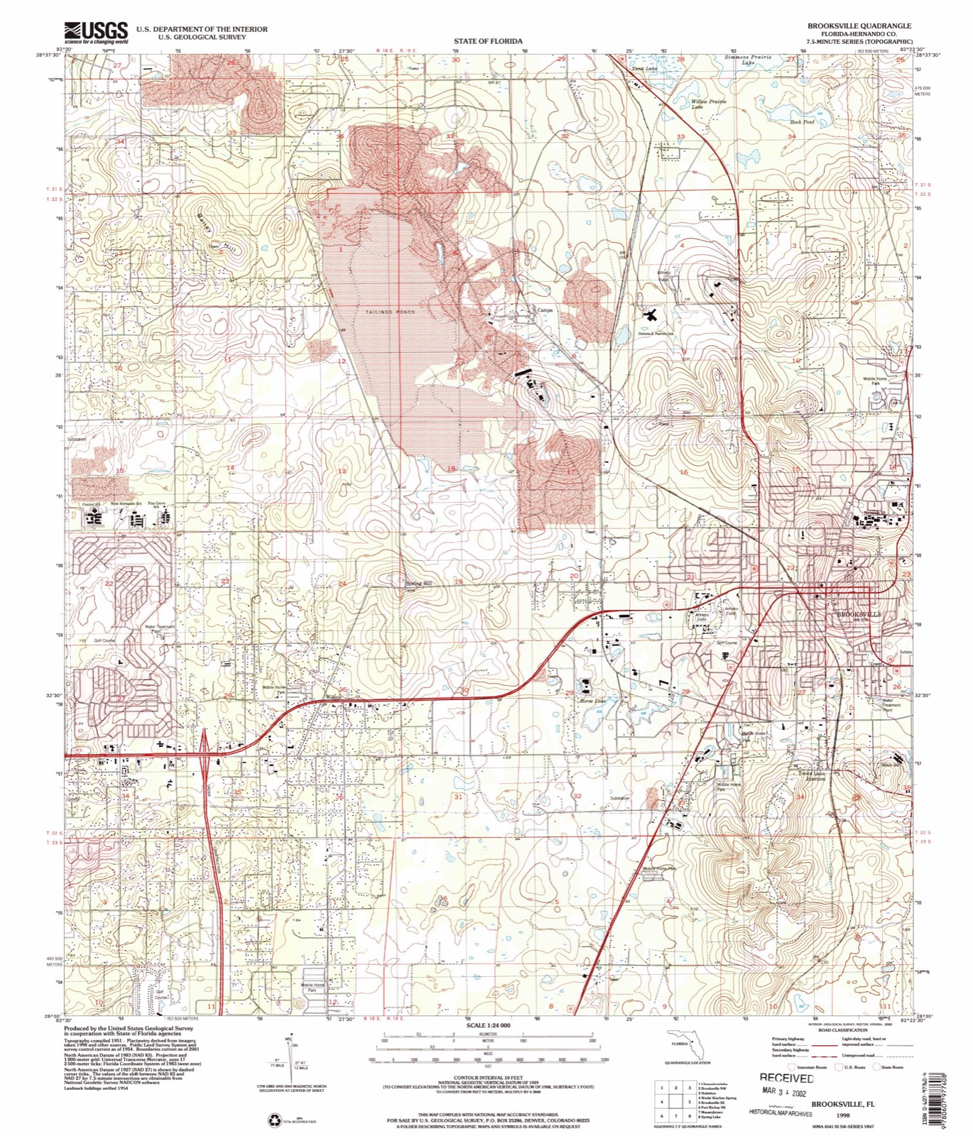
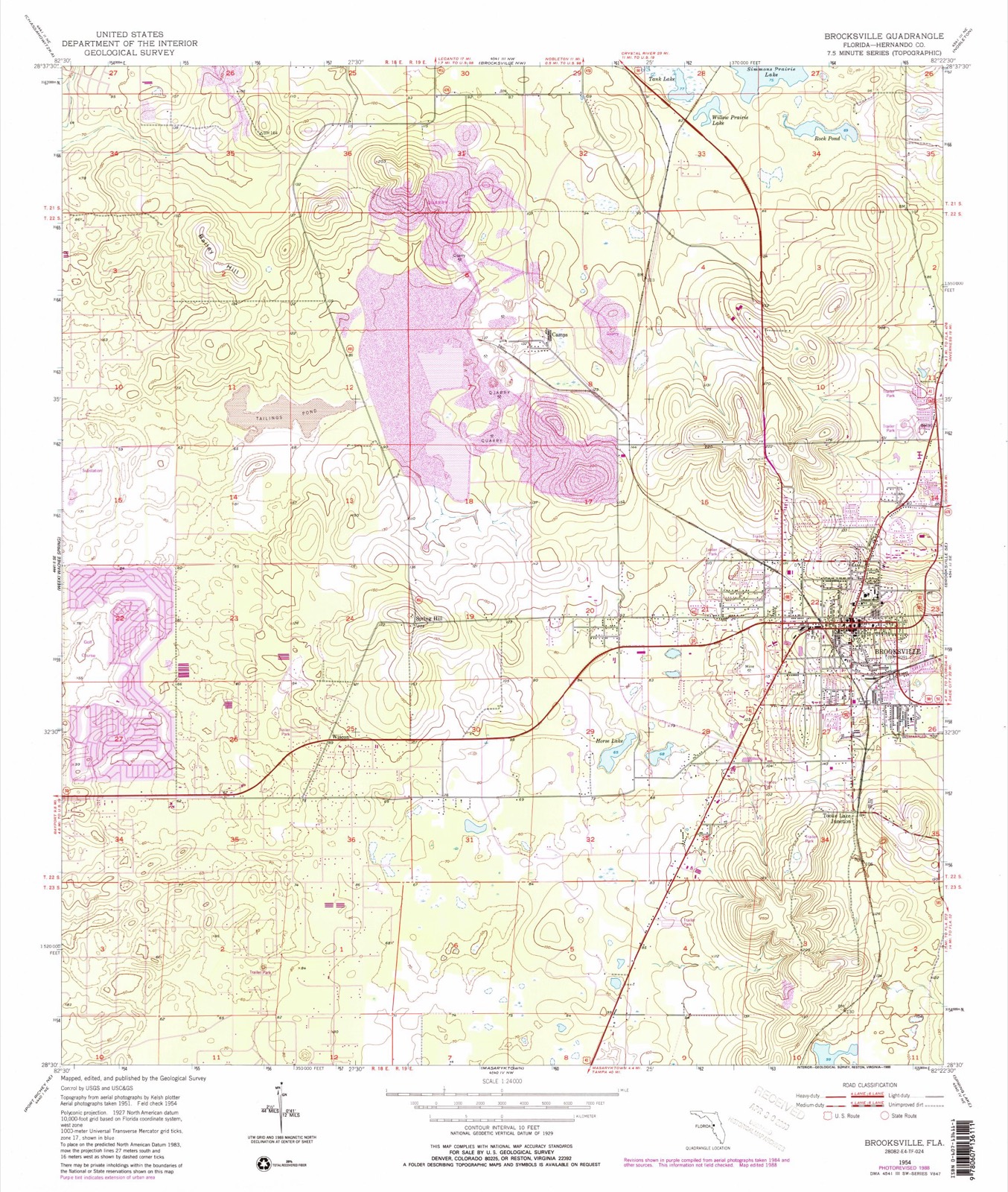
Compare 1954 against another survey:
On record in Brooksville
Buildings and businesses the archive holds for this place. Each opens its own page, with the source record it came from.
On the National Register 7 records
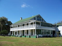 Chinsegut Hill Manor Houselisted 2003
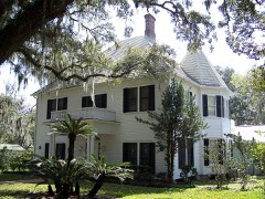 William Sherman Jennings Houselisted 1998
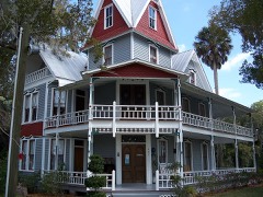 May-Stringer Houselisted 1997
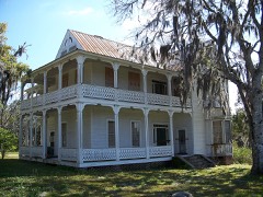 Frank Saxon Houselisted 1998
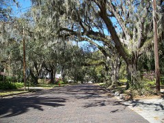 South Brooksville Avenue Historic Districtlisted 1998
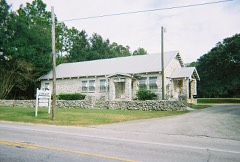 Spring Lake Community Centerlisted 2009
- Judge Willis Russell Houselisted 1999
Population over time
3 figuresBrooksville fell from 20,264 to 8,890 between 2000 and 2020. These are the recorded population figures Wikidata holds for this place, reached through the Geographic Names Information System number this page is keyed on rather than by name, so they belong to this place and not to another of the same name. Most are census counts, but not all are: an early figure may be a founding or settlement estimate, and an estimate published within five years of a census is left out. The change column is computed, and is left blank where more than 20 years separate a figure from the one before it, because a gap that long is not a change between two counts.
| Year | People | Change |
|---|---|---|
| 2000 | 20,264 | |
| 2010 | 7,719 | -12,545 (-62%) |
| 2020 | 8,890 | +1,171 (+15%) |
Topographic sheets covering this place
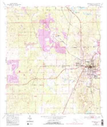
8 surveys from 16 printed sheetsMatched by testing this settlement's coordinate against the published boundary of every sheet in the United States Geological Survey's historical collection. Each opens the scanned sheet at the Survey.
- 1954 USGS Brooksville quadrangle1:24000, 4 printings
- 1955 USGS Plant City quadrangle1:250000, 3 printings
- 1955 USGS Tarpon Springs quadrangle1:250000, 3 printings
- 1958 USGS Plant City quadrangle1:250000
- 1959 USGS Plant City quadrangle1:250000
- 1964 USGS Plant City quadrangle1:250000
- 1979 USGS Inverness quadrangle1:100000, 2 printings
- 1998 USGS Brooksville quadrangle1:24000
Fires near this place
141 since 1992Regional context, not property-specific evidence. The federal wildfire occurrence database lists 141 fires within 5 miles of Brooksville between 1992 and 2020, burning about 2,613 acres in total. 6 started naturally. 13 were recorded as arson. Distance is straight-line from the map coordinates, so a fire counted here may appear on a neighbouring settlement's page as well.
| Reported cause | Fires |
|---|---|
| Railroad operations and maintenance | 44 |
| Equipment and vehicle use | 21 |
| Debris and open burning | 20 |
| Arson/incendiarism | 13 |
| Missing data/not specified/undetermined | 13 |
| Misuse of fire by a minor | 10 |
| Power generation/transmission/distribution | 8 |
| Natural | 6 |
| Recreation and ceremony | 3 |
| Other causes | 2 |
| Smoking | 1 |
The most recent of them, most recent first, with the day each was reported and the service that recorded it.
| Date | Cause | Size | Reported by | Name on the report |
|---|---|---|---|---|
| 11 September 1997 | Railroad operations and maintenance | under an acre | Florida Forest Service | not named |
| 16 August 2018 | Power generation/transmission/distribution | 6.0 acres | Florida Forest Service | PEACH ORCHARD (27) |
| 8 July 2017 | Natural | 100 acres | Florida Forest Service | CAMPMINE RD(27) |
| 30 July 1999 | Natural | under an acre | Florida Forest Service | not named |
| 28 July 1996 | Railroad operations and maintenance | 1.0 acres | Florida Forest Service | not named |
| 21 July 1999 | Railroad operations and maintenance | 1.0 acres | Florida Forest Service | not named |
| 1 July 2007 | Natural | 20 acres | Florida Forest Service | 27/FOXFIRE/0807 |
| 8 June 1997 | Equipment and vehicle use | under an acre | Florida Forest Service | not named |
Settlements close enough to share some of these fires:
Mines and quarries near this place
4 within 5 milesRegional context, not property-specific evidence. The federal mineral resources record lists 4 workings within 5 miles of Brooksville: 1 plant, 1 producer, 1 past producer, 1 unknown. 2 still produce. What was taken out: Calcium, Stone, Crushed/Broken, Clay, Limestone, General. Distance is straight-line from the map coordinates, so a quarry counted here may appear on a neighbouring settlement's page as well.
| Where | Site | Commodity | Status | Recorded |
|---|---|---|---|---|
| Brooksville Gay Quarry | Stone, Crushed/Broken | Producer | ||
| Brooksville Lime Kiln | Calcium | Plant | ||
| Dot Dade City - Mason-Smith Mine | Limestone, General | Unknown | Limestone | |
| Wayne Thomas Pit | Clay | Past Producer |
Storms near this place
60 of 76 shownRegional context, not property-specific evidence. The National Weather Service names Brooksville in 76 storm reports between 1993 and 2024: 34 thunderstorm wind, 11 lightning, 10 hail, 8 flood. The reports record 2 injuries. Each account below is quoted exactly as the forecast office filed it, from the NOAA Storm Events Database, and each date opens the federal record of that event.
| When | Event | Place named | Harm | What the report says |
|---|---|---|---|---|
| June 2000 | Lightning | Brooksville | 1 hurt | A 28 year old man was injured while using a power tool when lightning struck the electrical system of his home on the 15000 block of Woodcrest Road southwest of Brooksville. The man was thrown six to eight feet into the air by the force of the lightning charge. |
| August 1998 | Lightning | Brooksville | 1 hurt | The Hernando County Sheriffs Department reported that an adult male was struck and injured by lightning. |
| December 1997 | Flood | Brooksville | $1,500,000 | The Withlacoochee River at Croom crested at 10.9 feet, nearly two feet above the flood stage of nine feet on the 31st. Several homes along Hernando-Pasco county line, from Croom south to Ridge Manor, were damaged by floodwaters. The most heavily damaged areas were near County Road 575 and U.S. Highway 301 at the Talisman Estates along the eastern Pasco-Hernando county line. Fifty-four homes were damaged by floodwaters of which ten were destroyed and another 27 incurred major damage. |
| April 1997 | Tornado (F0) | Brooksville | $500,000 | A tornado sporatically touched down along a 16 mile path and damaged up to 50 homes from near U.S. HIghway 41, four miles southwest of Brooksville, east to the Ridge Manor area. Several trees and power lines were also downed from the tornado before it lifted and dissipated. Most damage to homes in the path of the tornado consisted of minor to moderate roof damage, destroyed porch and pool enclosures and downed trees. |
| September 1998 | Lightning | Brooksville | $284,000 | Lightning struck and burned a 5,500 square foot home off Croom Road northeast of Brooksville. |
| September 2000 | Lightning | Brooksville | $250,000 | Lightning struck and caused $250,000 dollars in damage to the Hernando county governments telephone and computer system in Brooksville. |
| July 2001 | Thunderstorm Wind | Brooksville | $150,000 | National Weather Service damage survey concluded that thunderstorm winds downed sixteen utility poles, two commercial signs and a few trees along State Road 50, one half mile west of County Road 587 (Mariner Blvd). Twelve of the downed power poles on the north side of State Road 50 were also toppled northward by the straight-line thunderstorm winds west of State Road 50 and Weeping Willow Road. Four of the power poles downed on the south side of State Road 50 were also toppled in a northward direction.Also, an electrical fire, caused by downed power lines from the straight-line winds, severely damaged a parked vehicle. |
| February 1998 | Tornado (F0) | Brooksville | $125,000 | A tornado touched down and destroyed a large metal building near the Hernando County Airport. The tornado also caused significant structural damage to a building at a plant nursery and snapped several pine trees along Powell Road before it lifted and dissipated. |
| January 1998 | Flood | Brooksville | $100,000 | The Withlacoochee River at Croom crested at 10.9 feet, nearly two feet above the flood stage of nine feet on the 5th. Several homes along the Hernando-Pasco county line from Croom south to Ridge Manor were damaged by floodwaters. |
| June 1997 | Lightning | Brooksville | $80,000 | Lightning struck and burned to the ground a pole barn worth $50,000 dollars on Sam C. Road in Brooksville. Lightning also struck a tree on Sims Road in Brooksville which ignited and destroyed a nearby garage worth $30,000 dollars. |
| June 2003 | Flash Flood | Brooksville | $50,000 | A mobile home park near Highway 41 and Croom Road in Brooksville experienced a water rise of six feet in a few hours. This resulted in flooded homes and vehicles. One indirect fatality was attributed to the heavy rain as a car hydroplaned and crashed near Highway 19 and Northcliffe in Spring Hill. Masaryktown received 5.05 inches of rain during the day, 3 miles northeast of Spring Hill received 4.30 inches, and Brooksville received 4.09 inches. |
| June 1994 | Thunderstorm Wind | Brooksville | $50,000 | Trees were downed onto a road and a large utility shed worth $30,000 was destroyed by thunderstorm winds just north of Brooksville. |
| August 1994 | Thunderstorm Wind | Brooksville | $50,000 | Severe thunderstorms produced dime-size hail and wind gusts that damaged a house roof, and blew down power lines and large tree limbs in Brooksville. |
| June 2000 | Thunderstorm Wind | Brooksville | $25,000 | The public reported, through WFTS-TV (ABC) of Tampa, that thunderstorm winds downed several large trees, one atop a house, in Brooksville. |
| September 1998 | Tornado (F1) | Brooksville | $25,000 | A tornado, associated with an outer band of Hurricane Earl, touched down and caused minor to moderate roof and shingle damage to three single family homes, two additional homes under construction, and snapped several large branches near the intersection of County Roads 572 and 581 south of Brooksville. The tornado continued to down a few large trees and power lines across semi-wooded rural eastern Hernando county before it lifted and dissipated. |
| September 1997 | Flood | Brooksville | $25,000 | no account filed |
| July 1996 | Lightning | Brooksville | $25,000 | no account filed |
| November 2005 | Thunderstorm Wind | Brooksville | $20,000 | Thunderstorms moved through Brooksville and caused minor damage to several mobile homes along Grant Street and Country Club Drive. The roof of one older mobile home was peeled back. |
| July 2002 | Lightning | Brooksville | $20,000 | Lightning started a business on fire. |
| June 2001 | Thunderstorm Wind | Brooksville | $20,000 | Hernando county emergency management reported that thunderstorm winds downed several large trees, branches and power lines along Citrus Way and Lake Lindsey Road, three miles west of Brooksville. |
| July 2000 | Thunderstorm Wind | Brooksville | $20,000 | Thunderstorm wind gusts of 64 mph were measured by Automated Surface Observing Equipment (ASOS) at the Hernando County Airport. Hernando Emergency Management reported that thunderstorm winds damaged the roof of a chickan farm, downed several large trees, branches and power lines from the Hernando County Airport northeast to near the intersection of U.S. Highway 41 and Powell Road. |
| September 2000 | Lightning | Brooksville | $20,000 | Lightning struck and ignited a fire in bedroom of a home on the 11300 block of Furley Avenue in Royal Highlands of northwest Hernando county. |
| June 1998 | Thunderstorm Wind | Brooksville | $20,000 | Thunderstorm wind downed several large trees along the U.S. Highway 41 corridor between U.S. Highway 98 and County Road 476. A home and a truck were damaged by wind toppled trees in Brooksville. |
| June 1997 | Thunderstorm Wind | Brooksville | $20,000 | Thunderstorm winds rolled a mobile home fifteen feet into a metal barn which caused severe damage to both the mobile home and barn. Several large oak trees were also uprooted at the damage site. |
| March 1996 | Tornado (F0) | Brooksville | $20,000 | no account filed |
| March 2003 | Thunderstorm Wind | Brooksville | $15,000 | Trees and power lines were down along the north side of Brooksville. |
| July 2001 | Thunderstorm Wind | Brooksville | $15,000 | National Weather Service damage survey concluded that straight-line thunderstorm winds caused minor roof damage, downed a few trees and several large branches over a four square mile area of rural southern Hernando county. Most of the thunderstorm wind damage occurred near the intersections of Baseball Pond and Old Trilby Roads, Powell and Olympic Roads and the Spring Lake area of rural southern Hernando county. |
| December 2020 | Thunderstorm Wind | North Brooksville | $10,000 | Citizen reported numerous downed trees on their property and neighbor's property along Marguerite Rd. near Brooksville. |
| May 2016 | Thunderstorm Wind | Brooksville | $10,000 | Hernando County Emergency Management reported numerous trees and power lines down to the south and southeast of Brooksville. The damage was reported to have occurred between 4:45 and 5AM. |
| October 2003 | Thunderstorm Wind | Brooksville | $10,000 | Thunderstorm winds created minor damage to two homes, two barns, and downed trees and power lines. |
| February 1998 | Flood | Brooksville | $10,000 | The Withlacoochee at Croom crested at 9.7 feet, less than a foot above the flood stage of nine feet, on the 28th. Crops were also damaged by the floodwaters. |
| June 1997 | Lightning | Brooksville | $10,000 | Lightning struck and killed seventeen cows that were clumped in a circle under a tree on a pasture near Powell Road and Spring Hill Drive. |
| September 1996 | Thunderstorm Wind | Brooksville | $10,000 | no account filed |
| March 1996 | Thunderstorm Wind | Brooksville | $10,000 | no account filed |
| August 1996 | Thunderstorm Wind | Brooksville | $8,000 | no account filed |
| July 1999 | Thunderstorm Wind | Brooksville | $5,000 | The Hernando Sheriffs Department reported that thunderstorm winds downed a few large trees and power lines near the intersection of County Road 493 (Sunshine Grove Road) and State Road 50. |
| July 1997 | Thunderstorm Wind | Brooksville | $5,000 | Several large trees were downed by thunderstorm winds near U.S. Highway 98 and Olympia Road. |
| August 1993 | Thunderstorm Wind | Brooksville | $5,000 | Strong downburst winds caused light to moderate damage to two mobile homes and one vehicle. Several trees and power lines were downed. |
| August 1996 | Flood | Brooksville | $5,000 | no account filed |
| July 1996 | Thunderstorm Wind | Brooksville | $5,000 | no account filed |
| July 2003 | Lightning | Brooksville | $2,000 | Lightning entered a home through the cable TV or phone line and destroyed the entertainment center and phone. An energy surge also tripped every circuit breaker and damaged the water heater. |
| July 1999 | Thunderstorm Wind | Brooksville | $2,000 | The Hernando County Sheriffs Department reported that thunderstorm winds downed a few large trees and branches near the intersection of Croom and Weatherly Roads. |
| July 1995 | Tornado (F0) | Brooksville | $2,000 | A waterspout moved onshore and downed several large trees along Amberjack Drive in Hernando Beach before it lifted and dissipated. |
| June 1996 | Thunderstorm Wind | Brooksville | $2,000 | no account filed |
| October 1996 | Tornado (F0) | Brooksville | $2,000 | no account filed |
| July 2024 | Thunderstorm Wind | Brooksville | $1,000 | Social media pictures depict a few pockets of damage across parts of Brooksville consisting of mainly medium to large downed tree limbs. |
| January 2011 | Lightning | Brooksville | $1,000 | Lightning struck a tree and blew pieces of the tree in all directions. No other trees or structures in the vicinity were affected. |
| June 2008 | Thunderstorm Wind | Brooksville | $1,000 | A spotter reported the roof blown off of his carport, an iron fence blown over, and several trees and powerlines down in the road. |
| October 1997 | Flood | Brooksville | $1,000 | no account filed |
| March 1996 | Thunderstorm Wind | Brooksville | $1,000 | no account filed |
| September 2013 | Heavy Rain | Brooksville | - | Hernando County Emergency Management reported that heavy rain caused several road closures due to street flooding around Brooksville. Additionally, Sparkman Lake overflowed its banks and flooded Campers Holiday RV Park. |
| March 2011 | Thunderstorm Wind | Brooksville | - | There were numerous reports of tree damage and power lines down in and around the Brooksville area. |
| June 2009 | Hail | Brooksville | - | Quarter sized hail was reported near the intersection of East Summit Road and East Jefferson Street. |
| February 2008 | Thunderstorm Wind | Brooksville | - | Law Enforcement reported trees down on powerlines causing the powerlines to be downed. |
| August 2008 | Heavy Rain | Brooksville | - | A Southwest Florida Water Management District gauge recorded 5.03 inches of rain. |
| July 2006 | Thunderstorm Wind | Brooksville | - | Trained spotters measured 60 MPH winds with their home weather stations. |
| July 2006 | Hail | Brooksville | - | Trained spotters reported a path of penny sized hail from west of Brooksville to Spring Hill. |
| April 2005 | Hail | Brooksville | - | Dime to penny size hail was reported by law enforcement. |
| June 2004 | Thunderstorm Wind | Brooksville | - | Several trees and numerous branches were downed by thunderstorm winds. Several power lines were downed at the intersection of Powell and Culbreath and a large tree blocked the intersection of Endsly Road and Moore Road. |
| September 2004 | Heavy Rain | Brooksville | - | A National Weather Service observer in Brooksville recorded 10.82". |
Nearest settlements
The eight closest, with where each one stands in the county. Distances are straight-line, computed from the Geographic Names Information System coordinates.
| Map | Place | Distance | Sheets |
|---|---|---|---|
| Tooke Lake Junction | 1.6 miles | 16 | |
| North Brooksville | 1.6 miles | 16 | |
| South Brooksville | 1.8 miles | 16 | |
| Conrock | 2.5 miles | 14 | |
| Camps | 3.4 miles | 16 | |
| Wiscon | 4.1 miles | 16 | |
| Powell | 4.8 miles | 13 | |
| Norman | 5.2 miles | 16 |
Elsewhere
Matched on this settlement's Geographic Names Information System number rather than its name, so it cannot be a different place of the same name in another state.
| Wikipedia article on Brooksville | An encyclopaedic summary. Its text is share-alike, so it is linked here rather than copied. |
| Wikidata item Q587435 | The structured record the population and elevation above come from. Public domain (CC0). |
Provenance
This settlement is recorded in the Geographic Names Information System as feature 279446. The sheet list is computed by point-in-boundary test against the United States Geological Survey's historical topographic inventory. Both are works of the United States government and carry no copyright under 17 U.S.C. 105.
Wildfire. Short, Karen C. 2022. Spatial wildfire occurrence data for the United States, 1992-2020 [FPA_FOD_20221014]. 6th Edition. Fort Collins, CO: Forest Service Research Data Archive. https://doi.org/10.2737/RDS-2013-0009.6 Collected with United States Government funding and usable without additional permissions or fees.
Mines and quarries. USGS Mineral Resources Data System (MRDS) https://mrdata.usgs.gov/mrds/ A work of the United States government, no copyright under 17 U.S.C. 105.
Storms. NOAA National Centers for Environmental Information, Storm Events Database https://www.ncei.noaa.gov/stormevents/ A work of the United States government, no copyright under 17 U.S.C. 105. Narratives are quoted verbatim from the National Weather Service report and are not edited or summarised.