 Block
BlockDestin, Florida
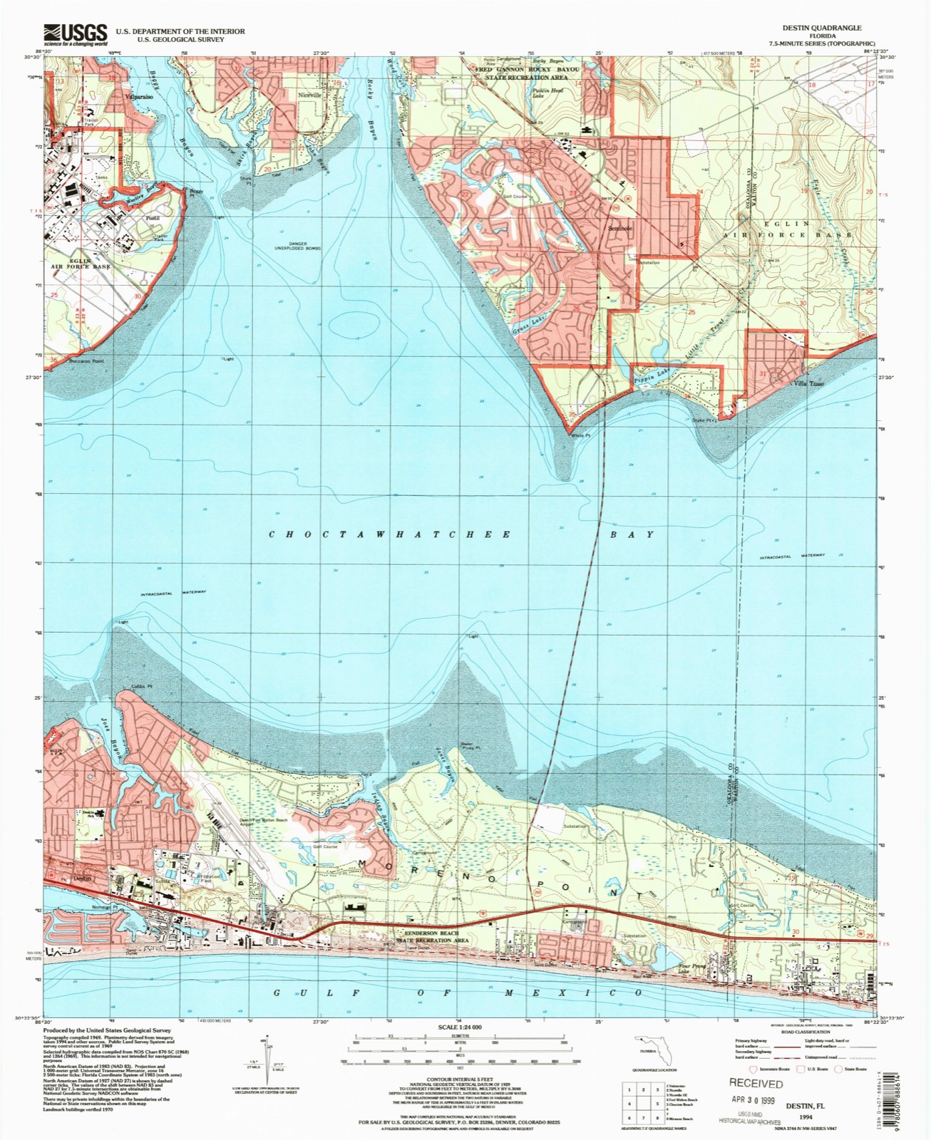
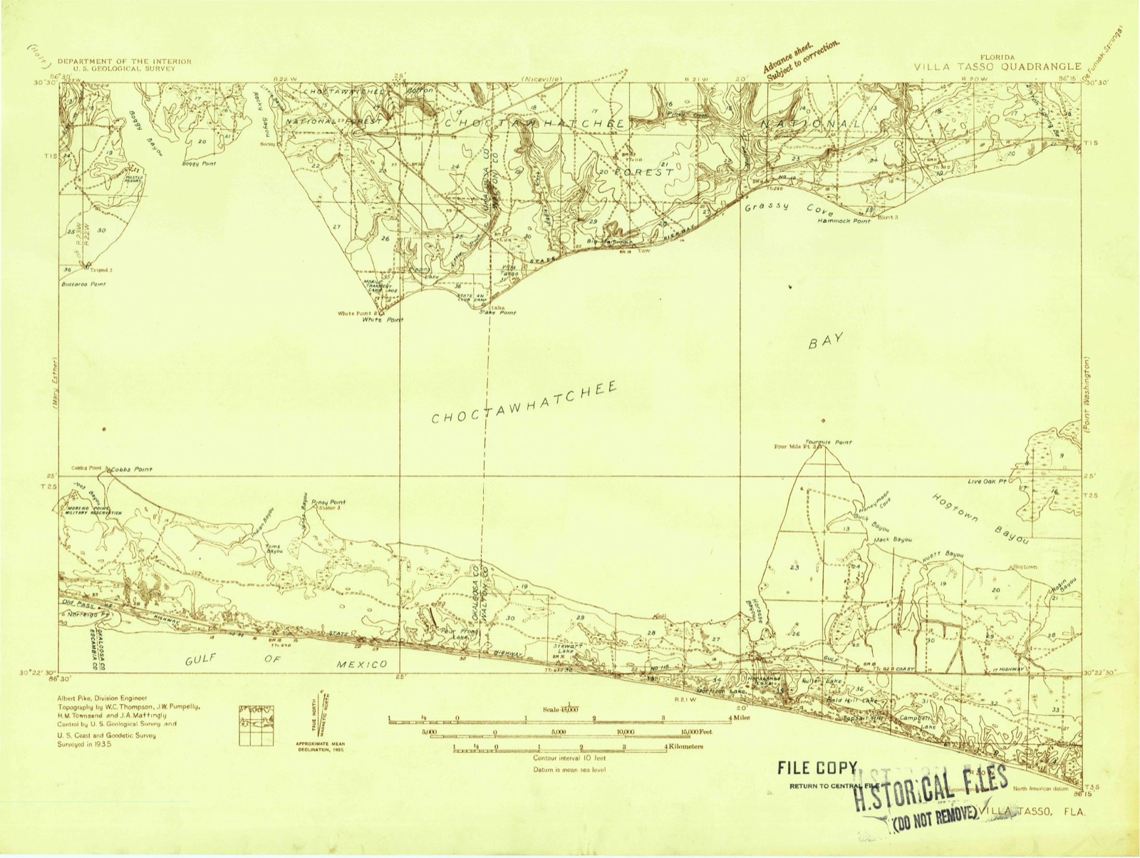
18 topographic sheets cover this place, the earliest surveyed in 1935 and the latest in 1994. It stands in the Fort Walton Beach census division. It lies in ZIP code area 32541. The Survey maps it on the Destin quadrangle. 13,931 people lived here at the 2020 count. It stands 26 feet above sea level.
Then and now
1935 to 1994The same ground, surveyed 59 years apart. Drag the handle to wipe between them. Both sheets are United States Geological Survey originals; neither has been altered.
Population over time
2 figuresDestin grew from 12,305 to 13,931 between 2010 and 2020. These are the recorded population figures Wikidata holds for this place, reached through the Geographic Names Information System number this page is keyed on rather than by name, so they belong to this place and not to another of the same name. Most are census counts, but not all are: an early figure may be a founding or settlement estimate, and an estimate published within five years of a census is left out. The change column is computed, and is left blank where more than 20 years separate a figure from the one before it, because a gap that long is not a change between two counts.
| Year | People | Change |
|---|---|---|
| 2010 | 12,305 | |
| 2020 | 13,931 | +1,626 (+13%) |
Topographic sheets covering this place
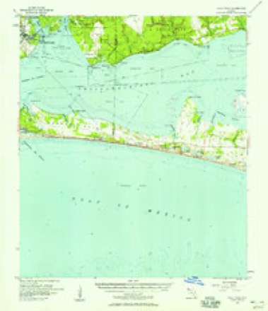
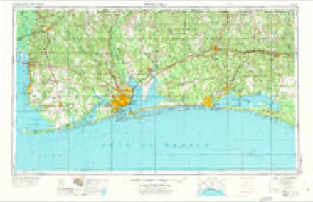
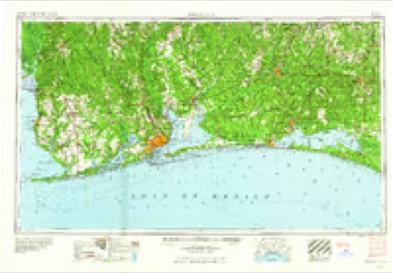
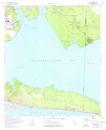
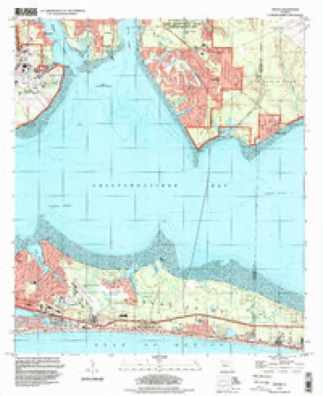
9 surveys from 18 printed sheetsMatched by testing this settlement's coordinate against the published boundary of every sheet in the United States Geological Survey's historical collection. Each opens the scanned sheet at the Survey.
- 1935 USGS Villa Tasso quadrangle1:48000
- 1938 USGS Villa Tasso quadrangle1:62500, 4 printings
- 1956 USGS Villa Tasso quadrangle1:62500, 2 printings
- 1957 USGS Pensacola quadrangle1:250000, 3 printings
- 1959 USGS Pensacola quadrangle1:250000
- 1960 USGS Pensacola quadrangle1:250000
- 1970 USGS Destin quadrangle1:24000, 3 printings
- 1978 USGS Fort Walton Beach quadrangle1:100000, 2 printings
- 1994 USGS Destin quadrangle1:24000
Fires near this place
3 since 2004Regional context, not property-specific evidence. The federal wildfire occurrence database lists 3 fires within 5 miles of Destin between 2004 and 2008, burning about 13 acres in total. 1 started naturally. None was recorded as arson. Distance is straight-line from the map coordinates, so a fire counted here may appear on a neighbouring settlement's page as well.
| Reported cause | Fires |
|---|---|
| Missing data/not specified/undetermined | 2 |
| Natural | 1 |
The most recent of them, most recent first, with the day each was reported and the service that recorded it.
| Date | Cause | Size | Reported by | Name on the report |
|---|---|---|---|---|
| 30 September 2007 | Missing data/not specified/undetermined | 5.0 acres | Florida Forest Service | KELLY PLANTATION FIRE 46-1552 |
| 20 June 2004 | Natural | 8.0 acres | Florida Forest Service | KELLY PLANTATION FIRE-0860 |
| 29 May 2008 | Missing data/not specified/undetermined | under an acre | Florida Forest Service | 46-KELLY PLANTATION FIRE-0655 |
Storms near this place
30 since 1995Regional context, not property-specific evidence. The National Weather Service names Destin in 30 storm reports between 1995 and 2023: 12 thunderstorm wind, 5 lightning, 5 rip current, 3 hail. The reports record 5 deaths and 15 injuries. Each account below is quoted exactly as the forecast office filed it, from the NOAA Storm Events Database, and each date opens the federal record of that event.
| When | Event | Place named | Harm | What the report says |
|---|---|---|---|---|
| June 2003 | Rip Current | Destin | 1 killed, 10 hurt | A thirty one year old female from Indiana jumped into the gulf to rescue her son who was having trouble swimming in the rough surf. Both of them were pulled out of the rough water and transported to a local hospital. She was pronounced dead and her son was treated and released. The drowning occurred around James Lee Park where red flags warning of dangerous surf were flying. The drownings in Okaloosa county were part of a rash of drownings that occurred along the beaches of Walton and Okaloosa counties on this date. Six people drowned in Walton county that day. The rough water was the result of swells of four to six feet moving ashore. Ten people along the Okaloosa county beaches had to be transported to local hospitals where they were treated and released. Many others had to be pulled from the rough surf where they were treated on the beach . Officials were flying and driving along the beaches to warn people of the dangerous surf. People would exit the water and then go back in after the officials had left. |
| June 2003 | Rip Current | Destin | 1 killed | A fifty seven year old Missouri man was swimming in rough surf near James Lee Park when he started having trouble staying afloat. He was pulled out of the water but later died at a local hospital. Red flags were flying at the time of the drowning. |
| October 2003 | Lightning | Destin | 1 killed | A 49 year old male, from the local area, was surfing in the waters of the Gulf of Mexico in front of the Eglin Community Beach Club near Destin when he was struck by a bolt of lightning. Other surfers pulled the man out of the water, and emergency personnel transported him to a local hospital, where he later died. Thunderstorms had moved through the area earlier in the morning. The overcast sky, after most of the storms had moved out of the area, produced the isolated, but deadly, lightning bolt. |
| June 2001 | Rip Current | Destin | 1 killed | A forty-eight year old male from New Mexico drowned in rough surf near Henderson State Park. The man was swimming with his son when they were caught in a strong rip current. Bystanders were able to pull the two out of the water. The boy was unharmed but the father was unconscious and could not be revived. Tropical Storm Allison had moved North out of the western Gulf of Mexico into eastern Texas the day before. At the same time, strong High pressure was centered off the southeast Atlantic coast. The gradient between the low pressure to the west and the high pressure to the east, produced a persistent strong southerly wind flow over the coastal waters of the western Florida panhandle. This, combined with larger than normal swells which were propagated off Tropical Storm Allison, produced deadly rip currents along the Florida Panhandle beaches. The National Weather Service in Mobile had forecasted a moderate threat of rip tides for the day, and red flags were flying along the beaches to alert swimmers to the potential rip current threat. The rip current situation became so bad during the afternoon, that sirens, normally used as storm warnings, were activated at Pensacola Beach. |
| April 1999 | Rip Current | Destin | 1 killed | A male visiting Destin from out of state was caught in a strong rip current and drowned. He was brought to shore and died before reaching a local hospital. |
| March 2003 | Rip Current | Destin | 2 hurt | Several people had to be rescued from the waters between Fort Walton Beach to east of Destin because of high surf and rip currents. Nine people had to be pulled from the water. Two required medical treatment and were transported to a local hospital. They were kept for several hours and later released. The rescues were not confined to one spot but were scattered at different locations along the beach. |
| January 1998 | Tornado (F0) | Destin | 1 hurt, $7,000 | A waterspout moved onshore on Okaloosa Island and damaged a home under construction. The waterspout/tornado quickly dissipated as it moved onshore. The tornado track on the island was less than a block long. A male working on the house was injured and was briefly hospitalised. |
| June 2003 | Lightning | Destin | 1 hurt | A Georgia man was on a personal watercraft when he was struck by lightning. He was on his way to shore to beat approaching thunderstorms when he was struck. He was transported and treated at the hospital and was released after a couple of hours. |
| March 2009 | Lightning | Destin | 1 hurt | no account filed |
| October 2002 | Tornado (F0) | Destin | $50,000 | A weak tornado moved ashore near Destin. The tornado downed some trees and caused roof damage to a condo. A screen room was also damaged at a home. No injuries were reported. |
| January 2016 | Thunderstorm Wind | Destin | $25,000 | Winds estimated at 70 mph peeled a gas station awning off and caused damage to a roof at Harborwalk Village. |
| April 1997 | Lightning | Destin | $20,000 | Lightning struck a home in Destin. The resulting fire caused twenty thousand dollars in damage. |
| February 2018 | Thunderstorm Wind | Destin | $5,000 | Winds estimated at 60 mph downed a few trees and power lines. Also damage to a roof and fence along Stahlman Ave. |
| July 2012 | Thunderstorm Wind | Destin | $5,000 | Winds estimated at 60 mph downed trees. |
| December 2004 | Tornado (F0) | Destin | $5,000 | A tornado briefly touched down at a construction site along the coast in Destin. The tornado did minor damage to some construction equipment. |
| March 1997 | Lightning | Destin | $5,000 | no account filed |
| May 2016 | Thunderstorm Wind | Destin | $3,000 | Severe thunderstorm wind gusts downed trees across Calhoun and Sibert Avenues. |
| November 2015 | Thunderstorm Wind | Destin | $3,000 | Winds estimated at 60 mph downed a power pole blocking one lane of US 98 between Destin and Miramar Beach. |
| July 1995 | Thunderstorm Wind | Destin | $500 | Winds estimated at 60 MPH overturned several small boats around Destin. No one was injured. |
| May 2022 | Hail | Destin | - | In addition to quarter size hail, three trees were snapped at the Destin Fire Department due to high winds. |
| January 2020 | Thunderstorm Wind | Destin | - | Power lines down on Legendary Drive in the Destin area. |
| February 2020 | Thunderstorm Wind | Destin | - | High winds from a thunderstorms caused roof damage to a home on Gulf Shore Drive. |
| February 2017 | Thunderstorm Wind | Destin | - | Measured from a weatherflow station. |
| March 2001 | Waterspout | Destin | - | Several people reported a waterspout over Choctawhatchee Bay near the Mid Bay Bridge. The waterspout lasted for several minutes and eventually dissipated over the bay. |
| October 2000 | Waterspout | Destin | - | A waterspout was sighted over Choctawhatchee Bay north of Destin. The waterspout dissipated over the bay. |
| January 1999 | Thunderstorm Wind | Destin | - | Destin Middle School reported a wind gust of 56 mph from a thunderstorm. |
| June 2023 | Thunderstorm Wind | Destin | - | no account filed |
| June 2023 | Thunderstorm Wind | Destin | - | no account filed |
| July 2002 | Hail | Destin | - | no account filed |
| January 1997 | Hail | Destin | - | no account filed |
Nearest settlements
The eight closest, with where each one stands in the county. Distances are straight-line, computed from the Geographic Names Information System coordinates.
| Map | Place | Distance | Sheets |
|---|---|---|---|
| Lake Lorraine | 5.0 miles | 18 | |
| Eglin Village | 5.3 miles | 18 | |
| Shalimar | 5.7 miles | 18 | |
| Postil | 5.9 miles | 18 | |
| Cinco Bayou | 6.3 miles | 18 | |
| Fort Walton Beach | 6.6 miles | 18 | |
| Dana Point | 6.6 miles | 18 | |
| Longwood | 6.8 miles | 18 |
Elsewhere
Matched on this settlement's Geographic Names Information System number rather than its name, so it cannot be a different place of the same name in another state.
| Wikipedia article on Destin | An encyclopaedic summary. Its text is share-alike, so it is linked here rather than copied. |
| Wikidata item Q2156427 | The structured record the population and elevation above come from. Public domain (CC0). |
Provenance
This settlement is recorded in the Geographic Names Information System as feature 281516. The sheet list is computed by point-in-boundary test against the United States Geological Survey's historical topographic inventory. Both are works of the United States government and carry no copyright under 17 U.S.C. 105.
Wildfire. Short, Karen C. 2022. Spatial wildfire occurrence data for the United States, 1992-2020 [FPA_FOD_20221014]. 6th Edition. Fort Collins, CO: Forest Service Research Data Archive. https://doi.org/10.2737/RDS-2013-0009.6 Collected with United States Government funding and usable without additional permissions or fees.
Storms. NOAA National Centers for Environmental Information, Storm Events Database https://www.ncei.noaa.gov/stormevents/ A work of the United States government, no copyright under 17 U.S.C. 105. Narratives are quoted verbatim from the National Weather Service report and are not edited or summarised.