 Block
BlockEast Naples, Florida
15 topographic sheets cover this place, the earliest surveyed in 1956 and the latest in 1987. It stands in the Naples census division. It lies in ZIP code area 34104. It stands on Rock Creek. The Survey maps it on the Naples North quadrangle. 25,000 people lived here at the 2000 count. It stands 7 feet above sea level.
Then and now
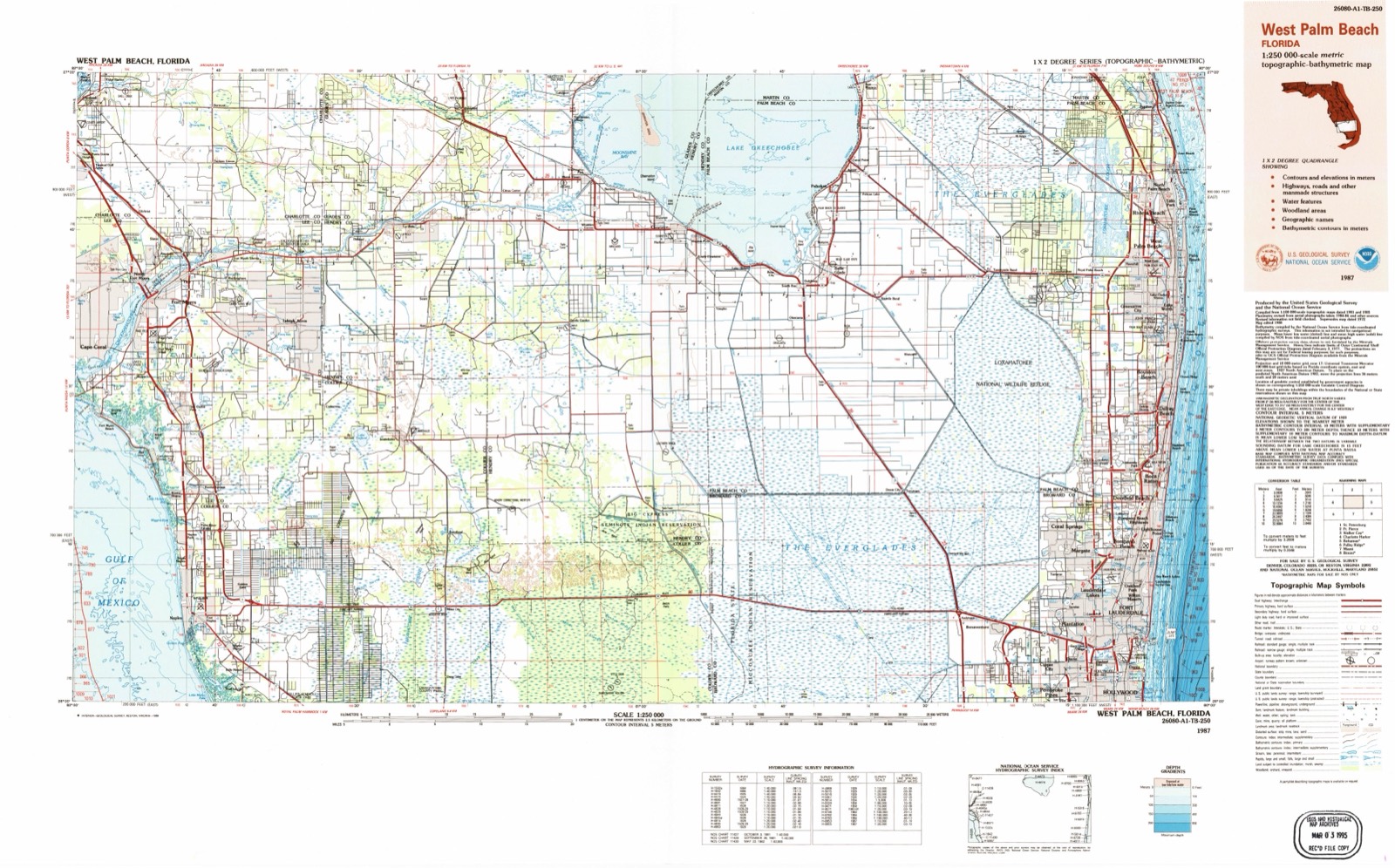
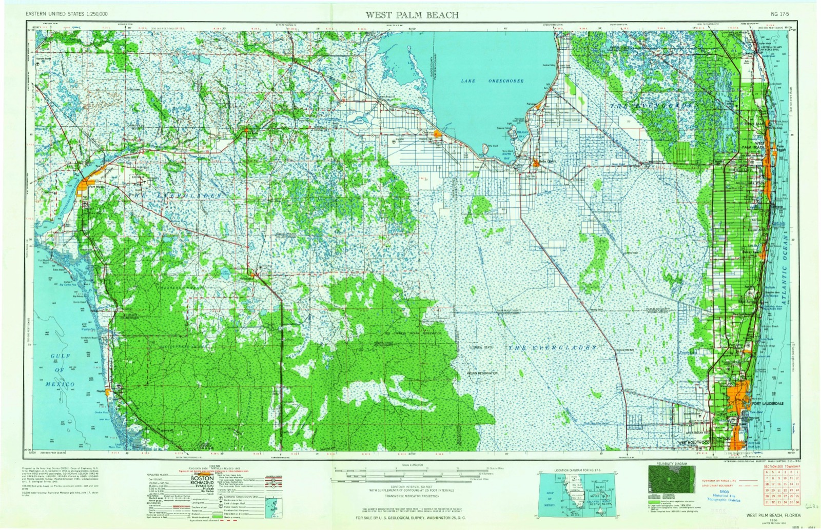
1956 to 1987The same ground, surveyed 31 years apart. Drag the handle to wipe between them. Both sheets are United States Geological Survey originals; neither has been altered.
Population over time
2 figuresEast Naples grew from 6,155 to 25,000 between 1970 and 2000. These are the recorded population figures Wikidata holds for this place, reached through the Geographic Names Information System number this page is keyed on rather than by name, so they belong to this place and not to another of the same name. Most are census counts, but not all are: an early figure may be a founding or settlement estimate, and an estimate published within five years of a census is left out. The change column is computed, and is left blank where more than 20 years separate a figure from the one before it, because a gap that long is not a change between two counts.
| Year | People | Change |
|---|---|---|
| 1970 | 6,155 | |
| 2000 | 25,000 |
Topographic sheets covering this place
6 surveys from 15 printed sheetsMatched by testing this settlement's coordinate against the published boundary of every sheet in the United States Geological Survey's historical collection. Each opens the scanned sheet at the Survey.
- 1956 USGS West Palm Beach quadrangle1:250000, 2 printings
- 1957 USGS West Palm Beach quadrangle1:250000
- 1958 USGS Naples North quadrangle1:24000, 6 printings
- 1958 USGS West Palm Beach quadrangle1:250000, 2 printings
- 1985 USGS Naples quadrangle1:100000, 2 printings
- 1987 USGS West Palm Beach quadrangle1:250000, 2 printings




Fires near this place
183 since 1992Regional context, not property-specific evidence. The federal wildfire occurrence database lists 183 fires within 5 miles of East Naples between 1992 and 2019, burning about 1,114 acres in total. 25 started naturally. 27 were recorded as arson. Distance is straight-line from the map coordinates, so a fire counted here may appear on a neighbouring settlement's page as well.
| Reported cause | Fires |
|---|---|
| Railroad operations and maintenance | 44 |
| Missing data/not specified/undetermined | 28 |
| Arson/incendiarism | 27 |
| Natural | 25 |
| Misuse of fire by a minor | 22 |
| Equipment and vehicle use | 19 |
| Recreation and ceremony | 7 |
| Debris and open burning | 6 |
| Smoking | 3 |
| Power generation/transmission/distribution | 1 |
| Fireworks | 1 |
The most recent of them, most recent first, with the day each was reported and the service that recorded it.
| Date | Cause | Size | Reported by | Name on the report |
|---|---|---|---|---|
| 28 September 1993 | Natural | under an acre | Florida Forest Service | not named |
| 21 September 1997 | Equipment and vehicle use | 1.0 acres | Florida Forest Service | not named |
| 2 September 1996 | Railroad operations and maintenance | 1.0 acres | Florida Forest Service | not named |
| 21 August 1995 | Natural | under an acre | Florida Forest Service | not named |
| 18 August 2007 | Natural | 1.5 acres | Florida Forest Service | 11/OAK WILLOW FIRE |
| 12 August 2007 | Natural | under an acre | Florida Forest Service | 11/STUCK IN THE MUD |
| 8 July 1992 | Natural | 3.0 acres | Florida Forest Service | not named |
| 5 July 1992 | Natural | 25 acres | Florida Forest Service | not named |
Settlements close enough to share some of these fires:
Mines and quarries near this place
5 within 5 milesRegional context, not property-specific evidence. The federal mineral resources record lists 5 workings within 5 miles of East Naples: 4 producers, 1 past producer. 4 still produce. What was taken out: Limestone, General, Stone, Crushed/Broken. Distance is straight-line from the map coordinates, so a quarry counted here may appear on a neighbouring settlement's page as well.
| Where | Site | Commodity | Status | Recorded |
|---|---|---|---|---|
| Golden Gate Quarry | Stone, Crushed/Broken | Past Producer | ||
| Berkshire Lake | Limestone, General | Producer | Limestone | |
| Harper Brothers - Berkshire Lk. Quarry | Limestone, General | Producer | Limestone | |
| Macasphalt - Golden Gate Quarry | Limestone, General | Producer | Limestone | |
| Southern Sand and Stone - Willow Run | Limestone, General | Producer | Limestone |
Storms near this place
26 since 1995Regional context, not property-specific evidence. The National Weather Service names East Naples in 26 storm reports between 1995 and 2024: 7 thunderstorm wind, 6 tornado, 4 lightning, 4 funnel cloud. The reports record 1 injury. Each account below is quoted exactly as the forecast office filed it, from the NOAA Storm Events Database, and each date opens the federal record of that event.
| When | Event | Place named | Harm | What the report says |
|---|---|---|---|---|
| August 2015 | Lightning | East Naples | 1 hurt | Tour boat captain was struck by lightning on deck of vessel while returning back from Gulf of Mexico through Gordon Pass during stormy weather. Boat captain sustained minor injuries and was held overnight at hospital for monitoring. |
| February 1995 | Tornado | East Naples | $300,000 | A brief tornado touched down in the Hitching Post RV Travel resort in East Naples, heavily damaging eight mobile homes, motor homes, and recreational vehicles. |
| September 1998 | Tornado (F0) | East Naples | $250,000 | The f0 tornado touched down near Quail Hollow along Rattlesnake Hammock Road and moved to the west northwest to the Riviera Golf Course. Storefront glass was shattered. Signs...tree limbs and street lights were blown down. Roofs...carports and patios were destroyed at mobile home park. |
| September 2004 | Tornado (F1) | East Naples | $75,000 | A tornado touched down in a vacant construction site just south of the Imperial Wilderness Mobile Home Park then moved northwest through the MHP. Damage was sustained to twenty homes with six suffering major damage. |
| August 2006 | Thunderstorm Wind | East Naples | $50,000 | Four mobile homes suffered minor damage from strong downburst winds during a thunderstorm at Naples Mobile Home Estates in East Naples. Most of the damage was done to carports, windows and screens. Damage survey done by Collier County Emergency Management Agency officials determined the source of the winds to be from a downburst and not tornado-related. |
| August 1996 | Lightning | East Naples | $40,000 | no account filed |
| June 2012 | Tornado (EF0) | East Naples | $35,000 | This tornado was first observed as a waterspout just of Isle of Capri and then tracked into the Naples area. Survey of damage revealed mostly broken tree branches, one which fell on and damaged a car, uprooted small trees and a palm tree split in half. A pool lanai was heavily damaged, but only minor roof damage was noted. Damage path indicated a low-end EF0 tornado with winds likely no more than 70-75 mph. Path length was discontinuous approximately 1.7 miles with width likely no more than 20 yards. |
| June 2022 | Flash Flood | East Naples | $20,000 | WINK-TV reported a home near Naples Manor west of Tamiami Trail with several inches of water inside the entire home. Rainfall in this area totaled 6-8 inches from Friday morning June 3rd through midday Saturday June 4th. ||This area has experienced flooding in the past, and the beginning time of the flooding is estimated. |
| September 2020 | Flash Flood | East Naples | $20,000 | A Collier County Emergency Manager relayed pictures of significant flooding at the Marco/Naples RV Park in East Naples of water encroaching on homes. Rainfall totals from September 12th through the 14th ranged from 6 inches to almost 8.7 inches across portions of western Collier County. |
| September 2017 | Flood | East Naples | $10,000 | The Collier County Sheriffs Office reported multiple intersections in the Lely area closed due to flooding. Two to three feet of standing water in the roadways with vehicles stranded was reported throughout the area, including the following locations: St. Andrews Boulevard at Warren Street, Rattlesnake Hammock Road from US 41 to Hawaii Boulevard, and Pebble Beach Boulevard and Big Springs Drive. |
| September 2004 | Tornado (F0) | East Naples | $10,000 | A tornado touched down 5 miles east of SR 951 south of U.S> 41 doing damage to trees and minor damage to a few mobile homes. |
| May 2020 | Thunderstorm Wind | East Naples | $6,000 | Reports via social media received of damage to a carport metal sheet covering along with a toppled medium sized palm tree at a Naples Estates off Rattlesnake Hammock Road. Winds in the general area gusted to as high as 51 mph. Damage totals are estimated. |
| May 2018 | Thunderstorm Wind | East Naples | $5,000 | Minor tree branch damage was reported by Naples Daily News at Eagle Key Circle in East Naples. The Lakewood Country Club also received minor tree damage, street signs were down and a plastic garden shed was blown across the street. Radar estimated wind was around 50 mph. |
| July 2014 | Lightning | East Naples | $5,000 | A house in the 3000 block of Andrews Ave. in East Naples was hit by lightning, causing a fire inside the home. The family members inside the house got out safely, however at least two pet birds died from the smoke. Fire Officials determined the house was inhabitable from the smoke damage. Time of event was estimated and based on archived lightning data from Earth Systems. |
| September 2013 | Lightning | East Naples | $2,000 | Lightning struck the exterior wall of an apartment building in East Naples, causing a fire which affected mainly the attic with moderate damage. Crews responded to the fire the following morning. Time of lightning strike estimated based on archived radar and lightning data. |
| June 2007 | Thunderstorm Wind | East Naples | $500 | Collier County Emergency Management relayed a report from a TV station of damage to an awning at the Club Naples RV resort on Beck Drive near I-75 in East Naples. The awning went flying about 800 feet, causing minor damage. |
| August 2024 | Flood | East Naples | - | Naples Police report Rum Row, between Bay Road and Ocean Drive, is impassable due to water on roadway. Rainfall estimates were in the 3-4 inch range, most of this falling in about 2 hours. |
| May 2020 | Thunderstorm Wind | East Naples | - | A wind gust of 58 mph (50 kt) was measured by the Earth Networks Mesonet site (NPLHH) at the Hamilton Harbor Yacht Club in Naples. |
| July 2017 | Flood | East Naples | - | Collier County Sheriff Office reported that Highway US 41 in Collier County at the intersection of Airport Pulling Road had been closed due to flooding. |
| August 2015 | Funnel Cloud | East Naples | - | Naples Airport (KAPF) observer reported funnel cloud near Gordon Pass. The funnel was visible for 5 minutes. |
| March 2014 | Thunderstorm Wind | East Naples | - | The Collier County Emergency Management reported a tree several feet in diameter was down near the Collier County Government Center. |
| June 2011 | Thunderstorm Wind | East Naples | - | A wind gust of 50 knots was measured at the Hamilton Harbor yacht club in Naples. |
| June 1998 | Funnel Cloud | East Naples | - | Observed at Everglades Blvd/16 TH Ave. Showers were moving to the southwest as funnel cloud came close to but did not touch ground. |
| July 1997 | Tornado (F0) | East Naples | - | several funnel clouds observed under storm cell . tornado lasted about 10 seconds sucking porch carpet off ground...shattered cypress trees...pool furniture observed 200 feet in the air. |
| June 1997 | Funnel Cloud | East Naples | - | three funnels sighted. no touchdown. |
| June 1997 | Funnel Cloud | East Naples | - | reported by naples p.d. near cooper drive. |
Nearest settlements
The eight closest, with where each one stands in the county. Distances are straight-line, computed from the Geographic Names Information System coordinates.
| Map | Place | Distance | Sheets |
|---|---|---|---|
| Naples | 1.5 miles | 15 | |
| Port Royal | 2.4 miles | 14 | |
| Berkshire Lakes | 2.6 miles | 15 | |
| Royal Harbor | 2.6 miles | 14 | |
| The Moorings | 2.8 miles | 15 | |
| Lely | 3.3 miles | 14 | |
| Naples Manor | 4.0 miles | 14 | |
| Golden Gate | 5.1 miles | 15 |
Elsewhere
Matched on this settlement's Geographic Names Information System number rather than its name, so it cannot be a different place of the same name in another state.
| Wikipedia article on East Naples | An encyclopaedic summary. Its text is share-alike, so it is linked here rather than copied. |
| Wikidata item Q3046528 | The structured record the population and elevation above come from. Public domain (CC0). |
Provenance
This settlement is recorded in the Geographic Names Information System as feature 282004. The sheet list is computed by point-in-boundary test against the United States Geological Survey's historical topographic inventory. Both are works of the United States government and carry no copyright under 17 U.S.C. 105.
Wildfire. Short, Karen C. 2022. Spatial wildfire occurrence data for the United States, 1992-2020 [FPA_FOD_20221014]. 6th Edition. Fort Collins, CO: Forest Service Research Data Archive. https://doi.org/10.2737/RDS-2013-0009.6 Collected with United States Government funding and usable without additional permissions or fees.
Mines and quarries. USGS Mineral Resources Data System (MRDS) https://mrdata.usgs.gov/mrds/ A work of the United States government, no copyright under 17 U.S.C. 105.
Storms. NOAA National Centers for Environmental Information, Storm Events Database https://www.ncei.noaa.gov/stormevents/ A work of the United States government, no copyright under 17 U.S.C. 105. Narratives are quoted verbatim from the National Weather Service report and are not edited or summarised.