 Block
BlockGolden Gate, Florida
15 topographic sheets cover this place, the earliest surveyed in 1956 and the latest in 1987. It stands in the Naples census division. It lies in ZIP code area 34116. The Survey maps it on the Belle Meade NW quadrangle. 25,321 people lived here at the 2020 count. It stands 10 feet above sea level.
Then and now
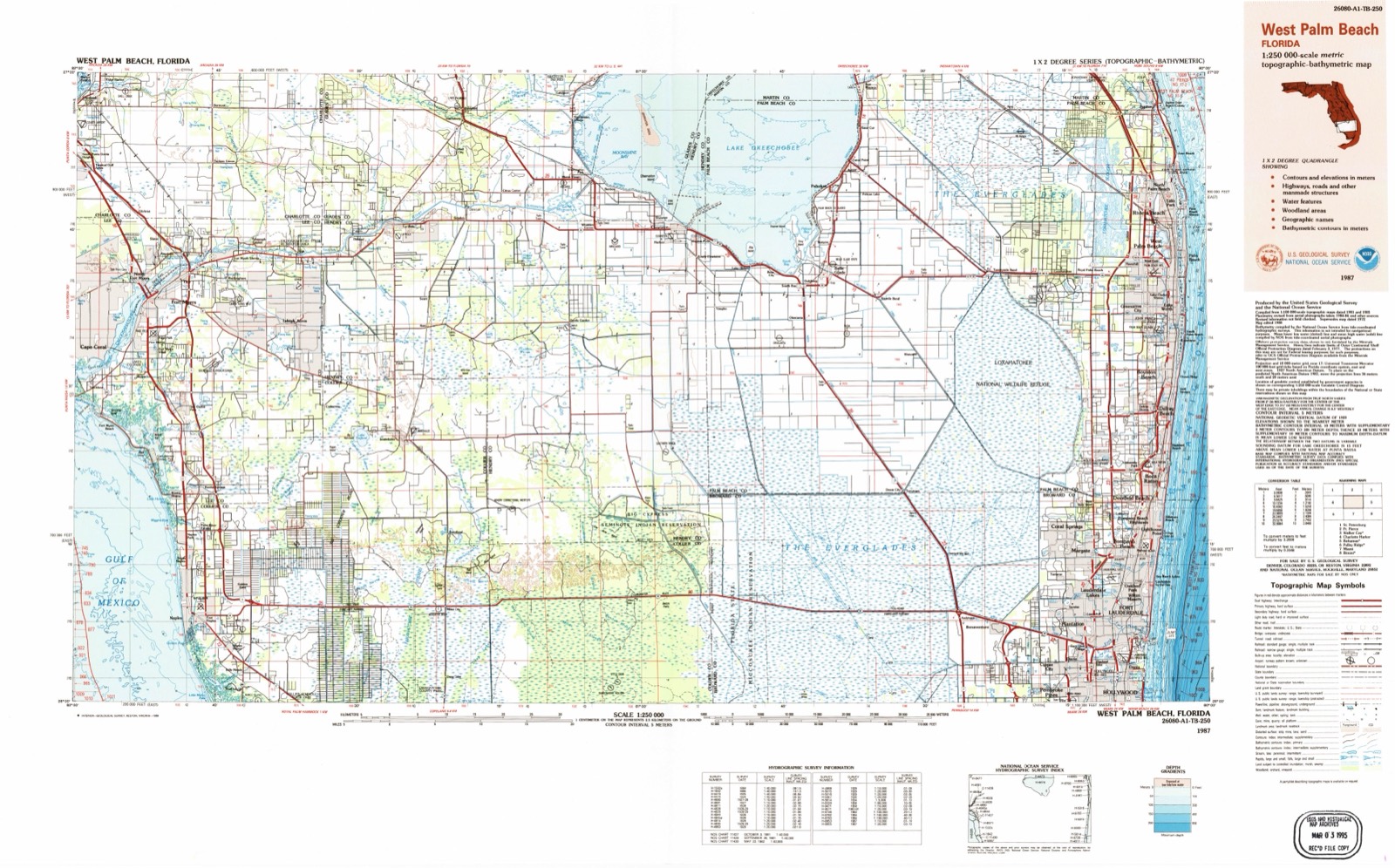
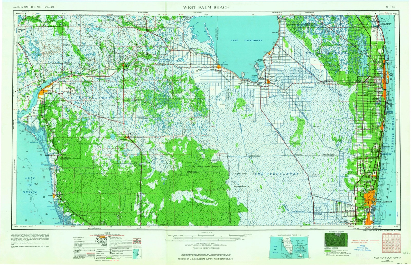
1956 to 1987The same ground, surveyed 31 years apart. Drag the handle to wipe between them. Both sheets are United States Geological Survey originals; neither has been altered.
Population over time
2 figuresGolden Gate grew from 23,961 to 25,321 between 2010 and 2020. These are the recorded population figures Wikidata holds for this place, reached through the Geographic Names Information System number this page is keyed on rather than by name, so they belong to this place and not to another of the same name. Most are census counts, but not all are: an early figure may be a founding or settlement estimate, and an estimate published within five years of a census is left out. The change column is computed, and is left blank where more than 20 years separate a figure from the one before it, because a gap that long is not a change between two counts.
| Year | People | Change |
|---|---|---|
| 2010 | 23,961 | |
| 2020 | 25,321 | +1,360 (+6%) |
Topographic sheets covering this place
6 surveys from 15 printed sheetsMatched by testing this settlement's coordinate against the published boundary of every sheet in the United States Geological Survey's historical collection. Each opens the scanned sheet at the Survey.
- 1956 USGS West Palm Beach quadrangle1:250000, 2 printings
- 1957 USGS West Palm Beach quadrangle1:250000
- 1958 USGS Belle Meade NW quadrangle1:24000, 6 printings
- 1958 USGS West Palm Beach quadrangle1:250000, 2 printings
- 1985 USGS Naples quadrangle1:100000, 2 printings
- 1987 USGS West Palm Beach quadrangle1:250000, 2 printings




Fires near this place
450 since 1992Regional context, not property-specific evidence. The federal wildfire occurrence database lists 450 fires within 5 miles of Golden Gate between 1992 and 2020, burning about 12,595 acres in total. 124 started naturally. 40 were recorded as arson. Distance is straight-line from the map coordinates, so a fire counted here may appear on a neighbouring settlement's page as well.
| Reported cause | Fires |
|---|---|
| Natural | 124 |
| Missing data/not specified/undetermined | 90 |
| Railroad operations and maintenance | 88 |
| Misuse of fire by a minor | 43 |
| Arson/incendiarism | 40 |
| Equipment and vehicle use | 30 |
| Debris and open burning | 22 |
| Power generation/transmission/distribution | 6 |
| Recreation and ceremony | 5 |
| Smoking | 1 |
| Fireworks | 1 |
The most recent of them, most recent first, with the day each was reported and the service that recorded it.
| Date | Cause | Size | Reported by | Name on the report |
|---|---|---|---|---|
| 7 September 1997 | Railroad operations and maintenance | 1.0 acres | Florida Forest Service | not named |
| 6 September 1999 | Natural | 25 acres | Florida Forest Service | not named |
| 6 September 1999 | Natural | 40 acres | Florida Forest Service | not named |
| 28 September 1993 | Natural | under an acre | Florida Forest Service | not named |
| 28 September 1993 | Natural | 5.0 acres | Florida Forest Service | not named |
| 26 September 2017 | Natural | 5.0 acres | Florida Forest Service | PAYTON PRESERVE (11) |
| 22 September 1997 | Railroad operations and maintenance | under an acre | Florida Forest Service | not named |
| 21 September 1997 | Equipment and vehicle use | 1.0 acres | Florida Forest Service | not named |
Settlements close enough to share some of these fires:
Mines and quarries near this place
8 within 5 milesRegional context, not property-specific evidence. The federal mineral resources record lists 8 workings within 5 miles of Golden Gate: 7 producers, 1 unknown. 7 still produce. What was taken out: Stone, Crushed/Broken, Limestone, General. Distance is straight-line from the map coordinates, so a quarry counted here may appear on a neighbouring settlement's page as well.
| Where | Site | Commodity | Status | Recorded |
|---|---|---|---|---|
| Berkshire Lake | Limestone, General | Producer | Limestone | |
| Golden Gate Quarry | Stone, Crushed/Broken | Producer | ||
| Golden Gate Quarry | Stone, Crushed/Broken | Producer | ||
| Harper Brothers - Berkshire Lk. Quarry | Limestone, General | Producer | Limestone | |
| Macasphalt - Golden Gate Quarry | Limestone, General | Producer | Limestone | |
| Naples Limerock North Quarry | Stone, Crushed/Broken | Producer | ||
| Southern Sand and Stone - Willow Run | Limestone, General | Producer | Limestone | |
| Virgil Marcom Pit | Stone, Crushed/Broken | Unknown |
Storms near this place
52 since 1997Regional context, not property-specific evidence. The National Weather Service names Golden Gate in 52 storm reports between 1997 and 2025: 15 hail, 13 thunderstorm wind, 8 funnel cloud, 5 tornado. The reports record 1 death and 4 injuries. Each account below is quoted exactly as the forecast office filed it, from the NOAA Storm Events Database, and each date opens the federal record of that event.
| When | Event | Place named | Harm | What the report says |
|---|---|---|---|---|
| May 2016 | Lightning | Golden Gate | 1 killed | OSHA reported a fatality due to a lightning strike to a construction worker who was struck while working on a roof. The date of death was reported to be the following day, May 29th, 2016. |
| March 1999 | Wildfire | Golden Gate | 3 hurt, $350,000 | no account filed |
| August 2006 | Lightning | Golden Gate | 1 hurt | The school principal at Golden Gate Elementary School was struck by lightning as he was dismissing students at the school. He was treated at the scene and released. It was raining heavily and the principal was holding an umbrella when struck. |
| April 2000 | Wildfire | Golden Gate | $200,000 | no account filed |
| April 2004 | Tornado (F1) | Golden Gate | $100,000 | A tornado associated with a squall line touched down near I-75 and Santa Barbara Boulevard. and lifted near the Golden Gate Parkway. The tornado caused minor roof damage to houses, destroyed sheds and uprooted trees. Minor damage was also reported at Naples Municipal Airport. |
| February 2006 | Heavy Rain | Golden Gate | $60,000 | Heavy rains caused roofs to collapse on 2 homes in Golden Gate. No injuries were reported. |
| April 2004 | Thunderstorm Wind | Golden Gate | $10,000 | A SKYWARN spotter reported wind damage to pool screening and the downing of two trees. Several construction walls were blown down. |
| July 1999 | Thunderstorm Wind | Golden Gate | $10,000 | no account filed |
| June 2011 | Thunderstorm Wind | Golden Gate | $2,000 | A high wind gust was measured on roof of collier county emergency operations center. The approximate height of instrument is 60 feet above ground. Surface winds were likely in 70-80 mph range.||Damage to the property at the EOC was limited to a light pole falling and crashing through a fence. |
| April 2010 | Thunderstorm Wind | Golden Gate | $2,000 | Damage to lanais and patio screens to a few homes in the Laurel Lakes subdivision just north of Golden Gate. |
| April 1999 | Wildfire | Golden Gate | $2,000 | no account filed |
| June 2007 | Thunderstorm Wind | Golden Gate | $1,000 | Strong winds blew down a 150-foot section of a fence in North Blocks of Golden Gate. |
| July 2005 | Thunderstorm Wind | Golden Gate | $1,000 | Utility lines were blown down at the intersection of Logan Blvd. and Teakwood St. |
| September 2011 | Lightning | Golden Gate | $600 | Lightning struck a home in Golden Gate Estates shortly before 6 PM. Damage was done to an outside electrical outlet and fire crews had to tear through part of the wall to make sure there wasn't any additional damage. |
| July 2025 | Thunderstorm Wind | Golden Gate | $500 | A home weather station near Orange Tree reported a 53 MPH wind gust with a severe thunderstorm located in the area. |
| July 2024 | Funnel Cloud | Golden Gate | - | A trained spotter reported a funnel cloud east of Naples associated with a thunderstorm moving through the area. |
| September 2024 | Tornado (EF0) | Golden Gate | - | The public reported outdoor items laying across DeSoto Blvd and 16th Avenue SE in Golden Gate Estates. Lawn furniture, boat cushions, tree damage was found. A tornadic cell likely moved over this area based on radar data, with time estimated. |
| September 2024 | Tornado (EF0) | Golden Gate | - | The public reported trees down on Randall Boulevard two blocks east of 16th Street NE. A tornadic cell likely moved over this area based on radar data, with time estimated. |
| September 2023 | Funnel Cloud | Golden Gate | - | Broadcast Media shared photos of a funnel cloud near Golden Gate Estates, associated with a shower moving over the area. |
| August 2022 | Flood | Golden Gate | - | Reports received via social media of flooding of yards and swales in the NE portion of Golden Gate. Rainfall measurements of up to 4 inches were noted, most of it falling in about an hour. |
| September 2022 | Funnel Cloud | Golden Gate | - | A trained spotter reported a funnel cloud in the Orangetree area near Immokalee Road and Wilson Boulevard. |
| May 2021 | Thunderstorm Wind | Golden Gate | - | A trained spotter estimated wind gusts to 60 mph and pea size hail at Rattlesnake Hammock Road and SR 951, just west of Collier Blvd. |
| May 2020 | Hail | Golden Gate | - | Pictures received via social media reported 3/4 inch hail near the intersection of Collier Blvd and Vanderbilt Beach Rd. |
| May 2019 | Hail | Golden Gate | - | Video on social media showed a driver driving along I-75 in Collier County reporting large quarter size hail associated with a severe thunderstorm. Hail fell in enough amounts to cover the roadway for a short time. |
| June 2018 | Hail | Golden Gate | - | NBC2 Fort Myers relayed a report of penny to dime sized hail associated with a thunderstorm in Golden Gate Estate. Time estimated via radar. |
| June 2018 | Hail | Golden Gate | - | A report received via Facebook from a member of the public reported dime sized hail at the toll booth on I-75 near Golden Gate. |
| September 2016 | Funnel Cloud | Golden Gate | - | Naples Airport observer reported a funnel cloud 4-5 miles northeast of the airport. The funnel cloud lasted from 213 PM EDT until 221 PM EDT and never touched the ground. |
| July 2016 | Hail | Golden Gate | - | Dime size hail was reported in Golden Gates Estates at the intersection of Golden Gate Boulevard and SW 17th Street via social media. |
| July 2016 | Hail | Golden Gate | - | A member of the public reported hail larger then quarters but smaller the golf ball size just north of the Hideout Golf Club. |
| June 2015 | Thunderstorm Wind | Golden Gate | - | Collier County EM relayed report of sabal palm tree down on house in the 2700 block of 8th Street NW near Orange Tree. |
| June 2015 | Thunderstorm Wind | Golden Gate | - | Large tree branch came down on the roof of a house. |
| June 2015 | Hail | Golden Gate | - | Penny size hail was reported at the intersection of Radio Rd. and Santa Barbara Blvd. via social media. |
| June 2014 | Thunderstorm Wind | Golden Gate | - | Law Enforcement reported a trailer was blown over along with powerlines down. |
| April 2014 | Lightning | Golden Gate | - | A house was struck by lightning causing a fire. The garage was completely destroyed with heavy smoke damage to the house. Two firefighters were treated at the local hospital with minor injuries sustained while fighting the fire. |
| June 2012 | Tornado (EF0) | Golden Gate | - | A trained spotter observed a tornado just north of Alligator Alley about 10 miles west of State Road 29. This tornado was likely spawned by the same storm that produced the earlier tornado in southern Collier County. |
| April 2012 | Hail | Golden Gate | - | A trained spotter reported nickel size hail near Brantley Blvd. |
| April 2012 | Hail | Golden Gate | - | Quarter sized hail was reported near Collier Boulevard 1 mile south of Immokalee Road. |
| April 2012 | Hail | Golden Gate | - | A trained spotter reported nickel to quarter sized hail. |
| April 2012 | Hail | Golden Gate | - | Reported near Golden Gate Boulevard about one mile east of Collier Blvd. |
| June 2011 | Thunderstorm Wind | Golden Gate | - | A wind gust of 51 knots was measured at Golden Gate fire station 71. |
| June 2011 | Thunderstorm Wind | Golden Gate | - | A wind gust of 52 knots was measured at Golden Gate fire station 70. |
| June 2008 | Hail | Golden Gate | - | A co-op observer at the Golden Gate Aquatic Complex reported hail the size of nickels with a passing severe thunderstorm. |
| July 2007 | Hail | Golden Gate | - | Nickel to quarter size hail at intersection of Wilson and Immokalee Roads near Golden Gate Estates reported by Division of Forestry. |
| June 2007 | Hail | Golden Gate | - | Quarter inch hail observed in North Blocks of Golden Gate Estates. |
| July 2005 | Funnel Cloud | Golden Gate | - | A SKYWARN spotter saw a funnel cloud. |
| June 2005 | Heavy Rain | Golden Gate | - | Rainfall amounts of one to three inches fell in one hour causing street flooding in Golden Gate and at Vanderbilt Beach. |
| May 2001 | Wildfire | Golden Gate | - | no account filed |
| May 1999 | Funnel Cloud | Golden Gate | - | no account filed |
| May 1999 | Hail | Golden Gate | - | no account filed |
| July 1999 | Tornado (F0) | Golden Gate | - | no account filed |
| July 1997 | Funnel Cloud | Golden Gate | - | no account filed |
| April 1997 | Funnel Cloud | Golden Gate | - | no account filed |
Nearest settlements
The eight closest, with where each one stands in the county. Distances are straight-line, computed from the Geographic Names Information System coordinates.
| Map | Place | Distance | Sheets |
|---|---|---|---|
| Berkshire Lakes | 2.6 miles | 15 | |
| Vineyards | 2.9 miles | 15 | |
| East Naples | 5.1 miles | 15 | |
| North Naples | 5.6 miles | 15 | |
| Pine Ridge | 6.1 miles | 15 | |
| Naples | 6.2 miles | 15 | |
| The Moorings | 6.2 miles | 15 | |
| Lely | 6.3 miles | 14 |
Elsewhere
Matched on this settlement's Geographic Names Information System number rather than its name, so it cannot be a different place of the same name in another state.
| Wikipedia article on Golden Gate | An encyclopaedic summary. Its text is share-alike, so it is linked here rather than copied. |
| Wikidata item Q578972 | The structured record the population and elevation above come from. Public domain (CC0). |
Provenance
This settlement is recorded in the Geographic Names Information System as feature 283146. The sheet list is computed by point-in-boundary test against the United States Geological Survey's historical topographic inventory. Both are works of the United States government and carry no copyright under 17 U.S.C. 105.
Wildfire. Short, Karen C. 2022. Spatial wildfire occurrence data for the United States, 1992-2020 [FPA_FOD_20221014]. 6th Edition. Fort Collins, CO: Forest Service Research Data Archive. https://doi.org/10.2737/RDS-2013-0009.6 Collected with United States Government funding and usable without additional permissions or fees.
Mines and quarries. USGS Mineral Resources Data System (MRDS) https://mrdata.usgs.gov/mrds/ A work of the United States government, no copyright under 17 U.S.C. 105.
Storms. NOAA National Centers for Environmental Information, Storm Events Database https://www.ncei.noaa.gov/stormevents/ A work of the United States government, no copyright under 17 U.S.C. 105. Narratives are quoted verbatim from the National Weather Service report and are not edited or summarised.