 Block
BlockHomosassa, Florida
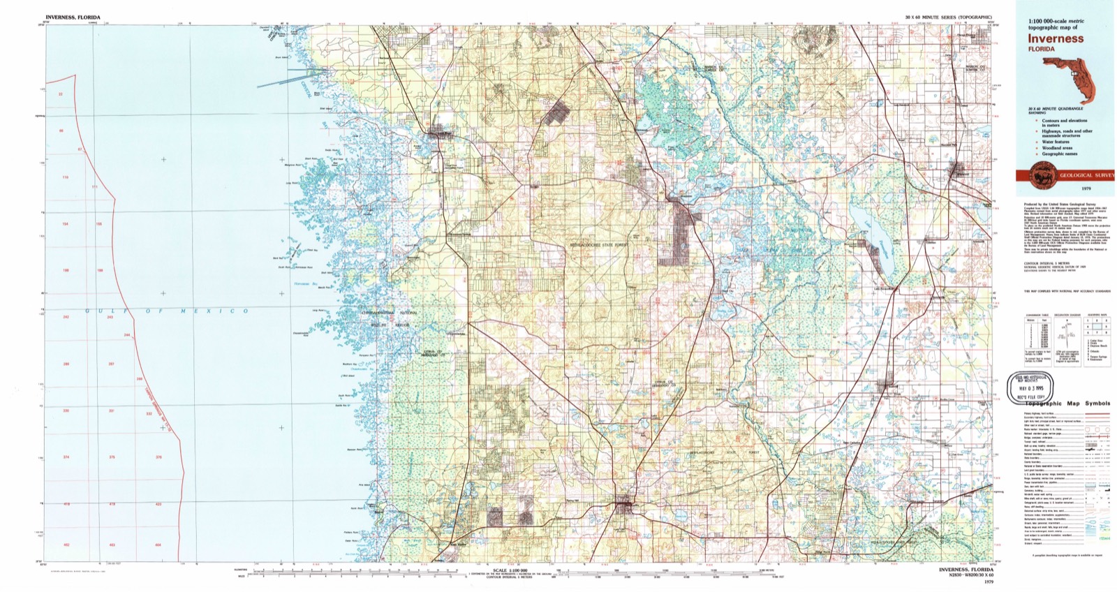
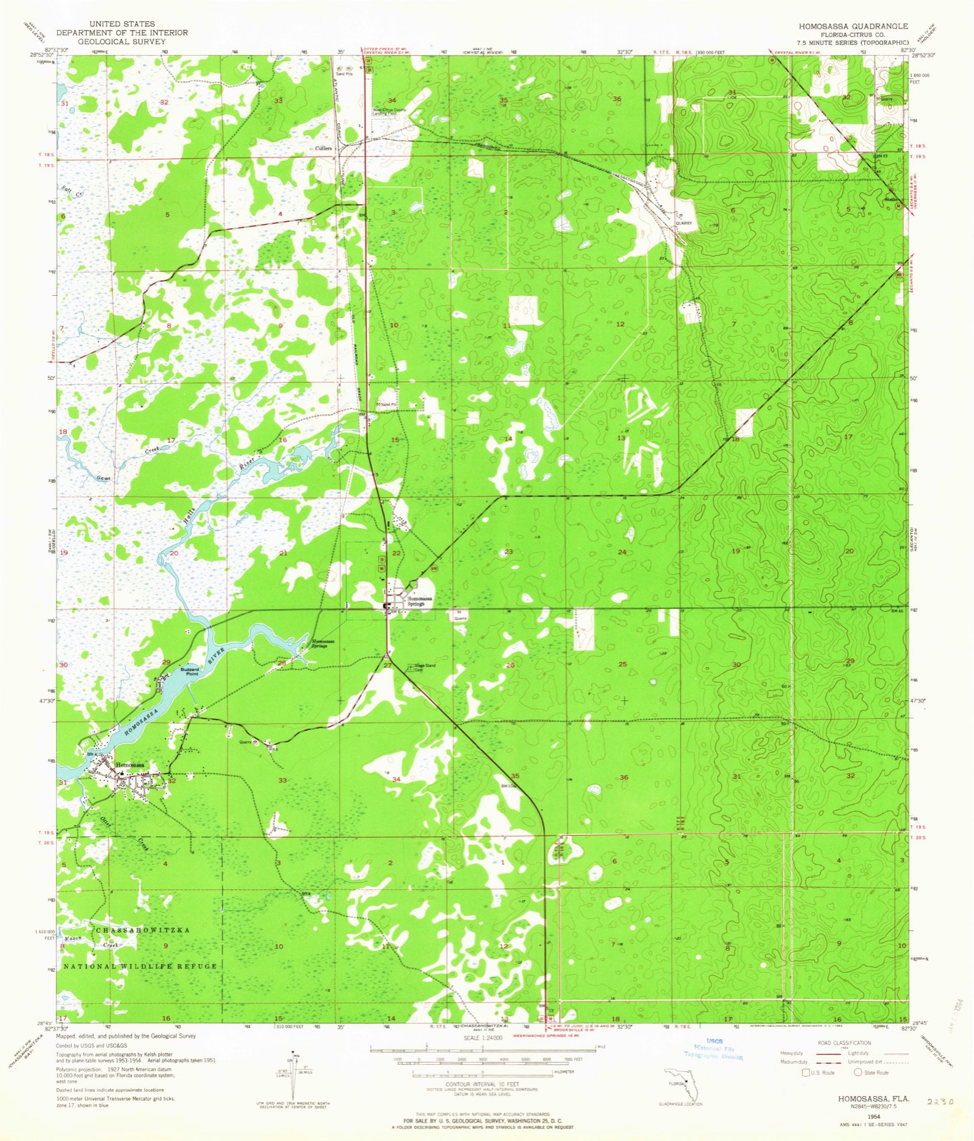
15 topographic sheets cover this place, the earliest surveyed in 1954 and the latest in 1979. It stands in the Crystal River census division. It lies in ZIP code area 34448. It stands on Otter Creek. The Survey maps it on the Homosassa quadrangle. 2,299 people lived here at the 2020 count.
Then and now
1954 to 1979The same ground, surveyed 25 years apart. Drag the handle to wipe between them. Both sheets are United States Geological Survey originals; neither has been altered.
On record in Homosassa
Buildings and businesses the archive holds for this place. Each opens its own page, with the source record it came from.
On the National Register 1 record
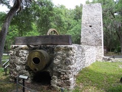 Yulee Sugar Mill Ruinslisted 1970
Population over time
2 figuresHomosassa fell from 2,578 to 2,299 between 2010 and 2020. These are the recorded population figures Wikidata holds for this place, reached through the Geographic Names Information System number this page is keyed on rather than by name, so they belong to this place and not to another of the same name. Most are census counts, but not all are: an early figure may be a founding or settlement estimate, and an estimate published within five years of a census is left out. The change column is computed, and is left blank where more than 20 years separate a figure from the one before it, because a gap that long is not a change between two counts.
| Year | People | Change |
|---|---|---|
| 2010 | 2,578 | |
| 2020 | 2,299 | -279 (-11%) |
Topographic sheets covering this place
7 surveys from 15 printed sheetsMatched by testing this settlement's coordinate against the published boundary of every sheet in the United States Geological Survey's historical collection. Each opens the scanned sheet at the Survey.
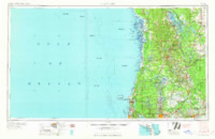
- 1954 USGS Homosassa quadrangle1:24000, 4 printings
- 1955 USGS Plant City quadrangle1:250000, 3 printings
- 1955 USGS Tarpon Springs quadrangle1:250000, 3 printings
- 1958 USGS Plant City quadrangle1:250000
- 1959 USGS Plant City quadrangle1:250000
- 1964 USGS Plant City quadrangle1:250000
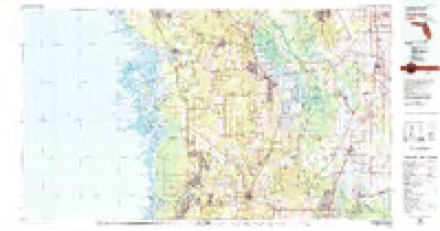
- 1979 USGS Inverness quadrangle1:100000, 2 printings
Fires near this place
111 since 1992Regional context, not property-specific evidence. The federal wildfire occurrence database lists 111 fires within 5 miles of Homosassa between 1992 and 2020, burning about 2,394 acres in total. 14 started naturally. 11 were recorded as arson. Distance is straight-line from the map coordinates, so a fire counted here may appear on a neighbouring settlement's page as well.
| Reported cause | Fires |
|---|---|
| Missing data/not specified/undetermined | 21 |
| Railroad operations and maintenance | 19 |
| Debris and open burning | 17 |
| Natural | 14 |
| Equipment and vehicle use | 11 |
| Misuse of fire by a minor | 11 |
| Arson/incendiarism | 11 |
| Recreation and ceremony | 4 |
| Power generation/transmission/distribution | 2 |
| Smoking | 1 |
The most recent of them, most recent first, with the day each was reported and the service that recorded it.
| Date | Cause | Size | Reported by | Name on the report |
|---|---|---|---|---|
| 9 September 2020 | Arson/incendiarism | 2.5 acres | Florida Forest Service | CHICKEN FIRE (09) |
| 28 September 2005 | Natural | 7.0 acres | Florida Forest Service | 09/ OAK RIDGE FIRE 0647 |
| 26 September 2010 | Debris and open burning | under an acre | Florida Forest Service | 09/SLASH PINE FIRE/1002 |
| 2 September 1999 | Railroad operations and maintenance | 1.0 acres | Florida Forest Service | not named |
| 17 September 1997 | Natural | 1,700 acres | Florida Forest Service | not named |
| 12 September 1997 | Natural | 2.0 acres | Florida Forest Service | not named |
| 12 September 1997 | Natural | 5.0 acres | Florida Forest Service | not named |
| 3 August 1993 | Natural | under an acre | Florida Forest Service | not named |
Settlements close enough to share some of these fires:
Storms near this place
15 since 1993Regional context, not property-specific evidence. The National Weather Service names Homosassa in 15 storm reports between 1993 and 2024: 6 hail, 5 thunderstorm wind, 2 lightning, 1 wildfire. No death or injury is recorded in these reports. Each account below is quoted exactly as the forecast office filed it, from the NOAA Storm Events Database, and each date opens the federal record of that event.
| When | Event | Place named | Harm | What the report says |
|---|---|---|---|---|
| April 1997 | Thunderstorm Wind | Homosassa | $250,000 | Thunderstorm winds caused minor to major roof damage to several mobile homes, downed numerous trees and power lines in Homosassa. A total of 33 buildings were damaged by thunderstorm winds in Homosassa with the most extensive damage near Cardinal Street in the southern portion of the city.Ten to fifteen electrical poles were snapped in half, several mobile home porches and roofs were severely damaged and signs were downed by thunderstorm winds on and along Cardinal Street. The roofs of a restaurant and furniture store in Homosassa were also severely damaged by thunderstorm winds and flying debris. |
| June 1999 | Lightning | Homosassa | $20,000 | Lightning struck and severely damaged a home on Woodbine Avenue in Homosassa. |
| August 1997 | Lightning | Homosassa | $5,000 | Lightning struck and melted a power meter which disabled the Riverhaven sewage treatment plant for approximately eight hours. |
| July 1994 | Thunderstorm Wind | Homosassa | $5,000 | Barn roof torn off on Oak Lane St. |
| May 2014 | Thunderstorm Wind | Homosassa | $3,000 | Reports were received of multiple trees knocked down near Homosassa. |
| February 2024 | Hail | Homosassa | - | Broadcast media relayed pictures from public of half-dollar size hail in Homosassa. |
| June 2007 | Heavy Rain | Homosassa | - | Three inches of rain fell in 45 minutes in the Sugar Mill area. |
| July 2002 | Thunderstorm Wind | Homosassa | - | Greater than 50 knot wind occurred for nine minutes and was measured by coastal marine station at the mouth of the Homosassa river. Peak wind was at 6:42 PM EST. |
| June 2001 | Hail | Homosassa | - | A Skywarn Spotter reported dime to moth ball sized hail briefly covered the ground in Homosassa. |
| May 2000 | Wildfire | Homosassa | - | A wildfire consumed nearly 120 acres of brush and trees in Homosassa over western Citrus county. |
| February 1998 | Hail | Homosassa | - | Dime sized hail was reported by a Skywarn Spotter. |
| March 1993 | Thunderstorm Wind | Homosassa | - | Thunderstorm winds blew down trees and power lines. |
| April 2005 | Hail | Homosassa | - | no account filed |
| October 2002 | Hail | Homosassa | - | no account filed |
| October 2002 | Hail | Homosassa | - | no account filed |
Nearest settlements
The eight closest, with where each one stands in the county. Distances are straight-line, computed from the Geographic Names Information System coordinates.
| Map | Place | Distance | Sheets |
|---|---|---|---|
| Homosassa Springs | 2.6 miles | 15 | |
| Ozello | 3.8 miles | 17 | |
| Chassahowitzka | 5.2 miles | 15 | |
| Cutlers | 5.9 miles | 15 | |
| Sugarmill Woods | 6.7 miles | 15 | |
| Paradise Point | 7.2 miles | 14 | |
| Lecanto | 8.3 miles | 25 | |
| Crystal River | 8.4 miles | 14 |
Elsewhere
Matched on this settlement's Geographic Names Information System number rather than its name, so it cannot be a different place of the same name in another state.
| Wikipedia article on Homosassa | An encyclopaedic summary. Its text is share-alike, so it is linked here rather than copied. |
| Wikidata item Q1626250 | The structured record the population and elevation above come from. Public domain (CC0). |
Provenance
This settlement is recorded in the Geographic Names Information System as feature 284219. The sheet list is computed by point-in-boundary test against the United States Geological Survey's historical topographic inventory. Both are works of the United States government and carry no copyright under 17 U.S.C. 105.
Wildfire. Short, Karen C. 2022. Spatial wildfire occurrence data for the United States, 1992-2020 [FPA_FOD_20221014]. 6th Edition. Fort Collins, CO: Forest Service Research Data Archive. https://doi.org/10.2737/RDS-2013-0009.6 Collected with United States Government funding and usable without additional permissions or fees.
Storms. NOAA National Centers for Environmental Information, Storm Events Database https://www.ncei.noaa.gov/stormevents/ A work of the United States government, no copyright under 17 U.S.C. 105. Narratives are quoted verbatim from the National Weather Service report and are not edited or summarised.