 Block
BlockHudson, Florida
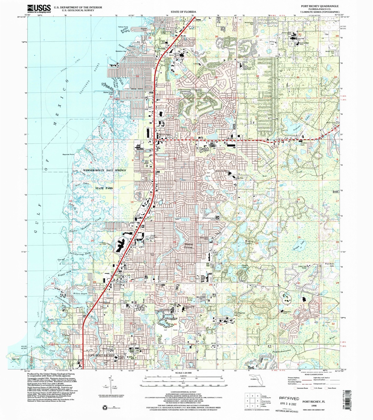
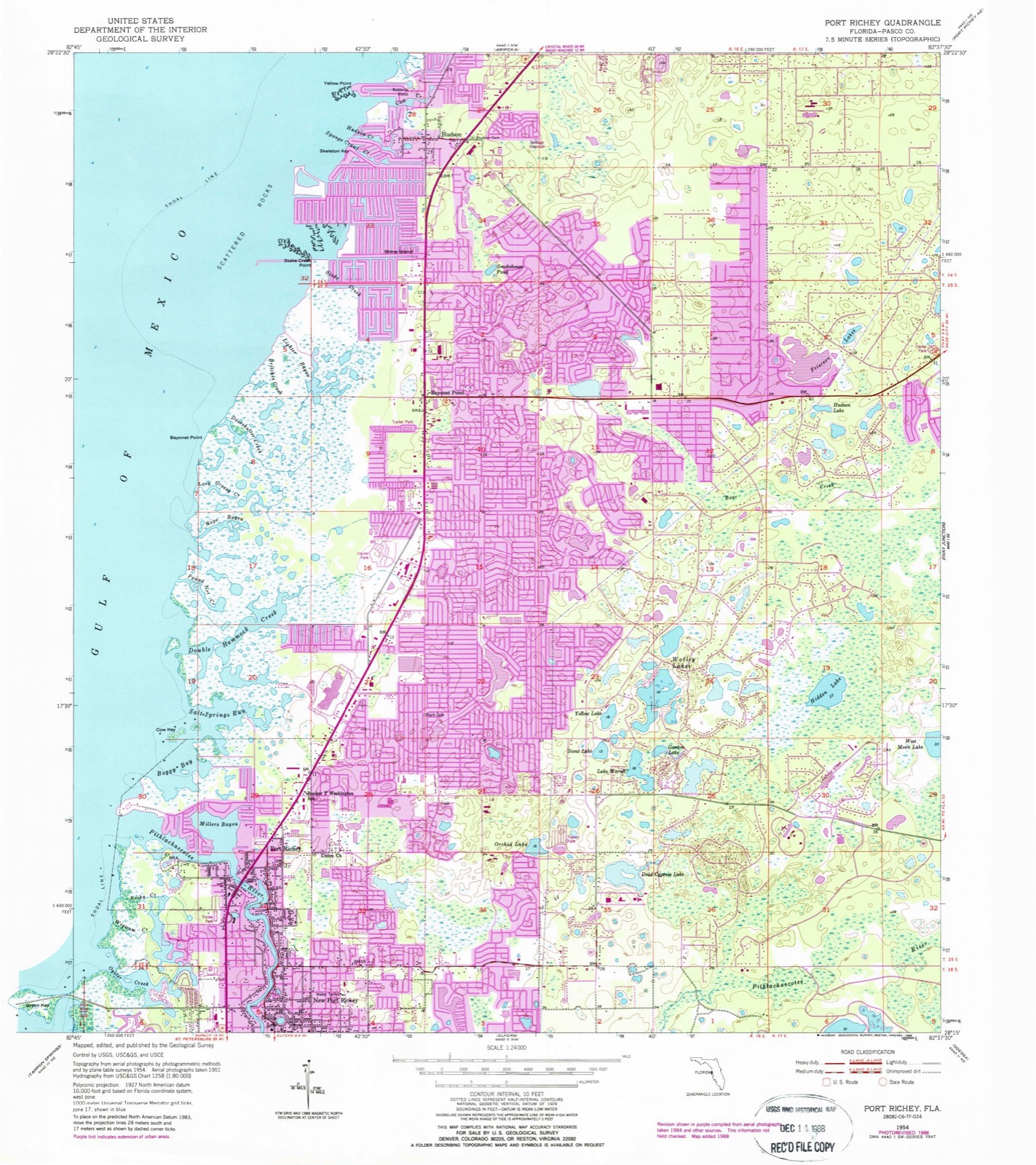
15 topographic sheets cover this place, the earliest surveyed in 1954 and the latest in 1998. It stands in the Port Richey census division. It lies in ZIP code area 34667. It lies near Buzzards Roost. The Survey maps it on the Port Richey quadrangle. 12,944 people lived here at the 2020 count. It stands 10 feet above sea level.
Then and now
1954 to 1998The same ground, surveyed 44 years apart. Drag the handle to wipe between them. Both sheets are United States Geological Survey originals; neither has been altered.
Compare 1954 against another survey:
Population over time
2 figuresHudson grew from 12,158 to 12,944 between 2010 and 2020. These are the recorded population figures Wikidata holds for this place, reached through the Geographic Names Information System number this page is keyed on rather than by name, so they belong to this place and not to another of the same name. Most are census counts, but not all are: an early figure may be a founding or settlement estimate, and an estimate published within five years of a census is left out. The change column is computed, and is left blank where more than 20 years separate a figure from the one before it, because a gap that long is not a change between two counts.
| Year | People | Change |
|---|---|---|
| 2010 | 12,158 | |
| 2020 | 12,944 | +786 (+6%) |
Topographic sheets covering this place
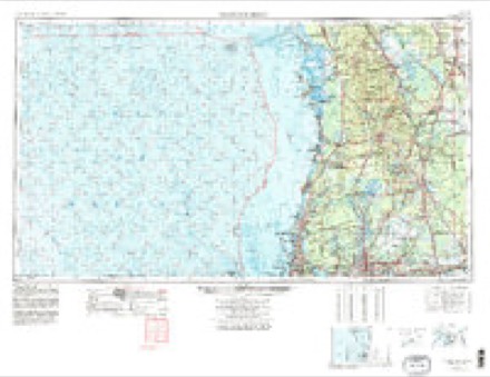
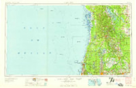
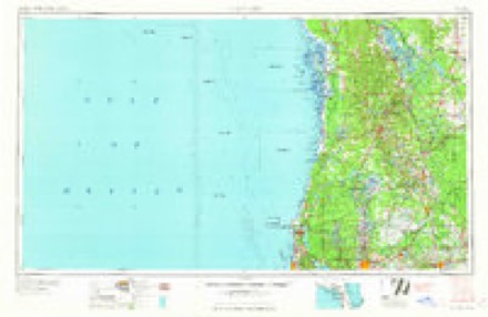
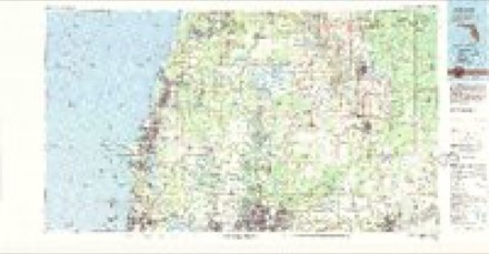
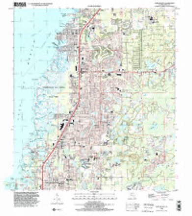
8 surveys from 15 printed sheetsMatched by testing this settlement's coordinate against the published boundary of every sheet in the United States Geological Survey's historical collection. Each opens the scanned sheet at the Survey.
- 1954 USGS Port Richey quadrangle1:24000, 4 printings
- 1955 USGS Plant City quadrangle1:250000, 3 printings
- 1955 USGS Tarpon Springs quadrangle1:250000, 3 printings
- 1958 USGS Plant City quadrangle1:250000
- 1959 USGS Plant City quadrangle1:250000
- 1964 USGS Plant City quadrangle1:250000
- 1978 USGS Tarpon Springs quadrangle1:100000
- 1998 USGS Port Richey quadrangle1:24000
Fires near this place
266 since 1992Regional context, not property-specific evidence. The federal wildfire occurrence database lists 266 fires within 5 miles of Hudson between 1992 and 2020, burning about 3,752 acres in total. 16 started naturally. 53 were recorded as arson. Distance is straight-line from the map coordinates, so a fire counted here may appear on a neighbouring settlement's page as well.
| Reported cause | Fires |
|---|---|
| Equipment and vehicle use | 92 |
| Arson/incendiarism | 53 |
| Railroad operations and maintenance | 34 |
| Misuse of fire by a minor | 19 |
| Missing data/not specified/undetermined | 18 |
| Recreation and ceremony | 17 |
| Natural | 16 |
| Debris and open burning | 14 |
| Fireworks | 2 |
| Power generation/transmission/distribution | 1 |
The most recent of them, most recent first, with the day each was reported and the service that recorded it.
| Date | Cause | Size | Reported by | Name on the report |
|---|---|---|---|---|
| 22 September 1996 | Railroad operations and maintenance | under an acre | Florida Forest Service | not named |
| 8 August 1993 | Equipment and vehicle use | 12 acres | Florida Forest Service | not named |
| 22 August 1997 | Natural | 4.0 acres | Florida Forest Service | not named |
| 14 August 2002 | Natural | 8.0 acres | Florida Forest Service | not named |
| 4 July 1992 | Equipment and vehicle use | 6.0 acres | Florida Forest Service | not named |
| 3 July 2000 | Missing data/not specified/undetermined | 10 acres | Florida Forest Service | not named |
| 3 July 1998 | Missing data/not specified/undetermined | 1.0 acres | Florida Forest Service | not named |
| 28 July 1997 | Natural | 1.0 acres | Florida Forest Service | not named |
Settlements close enough to share some of these fires:
Mines and quarries near this place
6 within 5 milesRegional context, not property-specific evidence. The federal mineral resources record lists 6 workings within 5 miles of Hudson: 4 producers, 2 unknowns. 4 still produce. What was taken out: Sand, Stone, Crushed/Broken, Limestone, General. Distance is straight-line from the map coordinates, so a quarry counted here may appear on a neighbouring settlement's page as well.
| Where | Site | Commodity | Status | Recorded |
|---|---|---|---|---|
| Sun West Mining - Sun West Mine | Limestone, General | Producer | Limestone | |
| Aripeka Quarry | Stone, Crushed/Broken | Producer | ||
| Belcher Mine | Stone, Crushed/Broken | Producer | ||
| Dot Dade City - Hudson Mine | Sand | Unknown | Sand | |
| Golden Crown Enterprises, Inc. - Bolton Ave. Sand Mine | Sand | Unknown | ||
| Sunset Sand Mine Inc. - Sunset Sand Mine | Sand | Producer |
Storms near this place
33 since 1993Regional context, not property-specific evidence. The National Weather Service names Hudson in 33 storm reports between 1993 and 2016: 11 thunderstorm wind, 7 hail, 4 heavy rain, 3 tornado. The reports record 1 injury. Each account below is quoted exactly as the forecast office filed it, from the NOAA Storm Events Database, and each date opens the federal record of that event.
| When | Event | Place named | Harm | What the report says |
|---|---|---|---|---|
| May 2005 | Lightning | Hudson | 1 hurt | A 45-year-old construction worker was inside a home under construction doing air conditioning work when he was indirectly struck by lightning. Another worker in the building said the man was sitting up against the wall shaking, his hands were twitching, and his speech was impaired after the strike. |
| August 2015 | Flood | Hudson | $7,000,000 | The Anclote River near Elfers, was just below flood stage at the onset of the heavy rain courtesy of 6-10 of rain across the basin at the end of July. The heavy rain and subsequent river flooding at the beginning of August produced millions in dollars of damage across Pasco County. The river crest at 25.4 feet which was well above major flood stage of 24.0 feet. ||In total, 46 single family dwellings were destroyed, 32 received major damage and 258 homes sustained minor damage from the flooding. 36 mobile homes were destroyed while 6 others sustained damage from flooding. |
| January 1999 | Storm Surge/Tide | Hudson | $1,800,000 | no account filed |
| January 1998 | Storm Surge/Tide | Hudson | $1,800,000 | no account filed |
| March 1998 | Flood | Hudson | $450,000 | Four to six inches of heavy rainfall caused localized flooding to dozens of homes and several streets near Frierson Lake. Most of the flood damage to homes occurred along West Road in Hudson. |
| June 2003 | Flash Flood | Hudson | $250,000 | Heavy rains caused flooding that impacted 125 properties and flooded 25 homes and businesses in the Hudson, Odessa, Wesley Chapel, and Zephyrhills area. Nine roads were damaged to a total of $150,000. The rainfall totals for the day were 8.01 inches 6 miles east northeast of Tarpon Springs, 6.36 inches in Gowers Corner, and 5.65 inches in Hudson. |
| March 2001 | Tornado (F0) | Hudson | $250,000 | National Weather Service damage survey indicated that a high end F0 tornado, that averaged 35 yards in width, initially touched down and uprooted two large pine trees which damaged the roof of a home on Willow Brook Court in a residential community of Hudson. The tornado continued on a tree-top level northeast trajectory where it caused additional sporadic tree and pool enclosure damage on Ashbury Drive. The tornado then began a east-northeast trajectory and removed a poorly fastened aluminum roof from a mobile home on Bud Street. As the path direction became northeast, the next sporadic touchdown occurred at the Hudson High School where a portion of the gynasium roof was lifted, buckled and removed, while the nearby ballfield bleachers were flipped over by the tornado.The tornado continued over rural semi-wooded western Pasco county where it snapped two pine trees along Coyote Road before it lifted and dissipated. |
| March 2001 | Thunderstorm Wind | Hudson | $100,000 | National Weather Service damage survey indicated that thunderstorm winds caused a sporadic path of damage from downtown Hudson to three miles northeast of Hudson. The straight-line thunderstorm winds damaged vehicles, signs and building awnings at an automobile dealership on U.S. Highway 19 near Hudson Avenue in Hudson. Also, thunderstorm winds downed trees, branches and power lines on Kitten Trail, three miles northeast of Hudson. |
| August 2015 | Heavy Rain | Hudson | $75,000 | A trained spotter near Hudson reported receiving 7.5 inches of rain since midnight. The rain soaked ground caused trees and power lines to fall in the area. |
| January 1999 | Thunderstorm Wind | Hudson | $50,000 | Thunderstorm winds caused minor roof and carport damage to several homes in Hudson. Also, a few large trees were uprooted and several large branches downed by thunderstorm winds in Hudson. |
| April 1997 | Thunderstorm Wind | Hudson | $40,000 | Thunderstorm winds caused roof damage to a few homes and downed several power lines in Hudson. |
| March 2011 | Thunderstorm Wind | Hudson | $25,000 | Trees were uprooted in the Beacon Woods subdivision. One large tree was pushed over onto three vehicles. |
| July 2001 | Thunderstorm Wind | Hudson | $25,000 | National Weather Service damage survey concluded that straight-line thunderstorm winds, estimated at 55 to 60 mph, caused damage to the tin roof of a home, downed a few large trees and several large branches on Lynway Road. Survey indicated that most of the thunderstorm wind damage occurred along a one half mile wide by 100 yard long path over rural northwest Pasco county. |
| August 2000 | Thunderstorm Wind | Hudson | $25,000 | The Pasco County Emergency Management reported that thunderstorm winds downed a few trees, several large branches and few power lines near the intersection of U.S. Highway 19 and Flounder Road in Hudson. |
| February 1998 | Thunderstorm Wind | Hudson | $25,000 | A Skywarn Spotter reported a wind gust of 64 mph and several downed large branches. |
| June 1996 | Thunderstorm Wind | Hudson | $20,000 | no account filed |
| July 1994 | Thunderstorm Wind | Hudson | $5,000 | Thunderstorm winds blew a tree onto a house and downed power lines in Hudson. A lightning initiated fire destroyed a garage and its contents causing $20,000 damage. |
| March 1995 | Thunderstorm Wind | Hudson | $3,000 | Severe thunderstorm winds destroyed a porch roof on a home in Hudson. |
| September 1998 | Tornado (F0) | Hudson | $1,000 | A Pasco County Sheriffs Deputy observed a tornado, associated with an outer band of Hurricane Georges, briefly touch down and topple a few large trees near U.S. Highway 19 in Hudson. |
| August 2016 | Lightning | Hudson | - | A lightning strike to Bayonet Point Medical Center caused a fire on the roof and damaged the electrical system. The backup generators came on but the electricity traveled through damage electrical lines and was immediately turned off leaving the entire hospital in the dark. All 224 patients had to be evacuated while power was out. Mutual aide was received from neighboring communities with 70 ambulances taking patients to areas hospitals. The hospital reopened 5 days after the incident forgoing $2.6 million in net operating revenue. Damage due to the lightning strike and resulting fire was unknown. There was one burn injury from the fire. |
| August 2015 | Heavy Rain | Hudson | - | A trained spotter had reported receiving 6.5 inches of rain in the six hours since midnight. |
| September 2014 | Heavy Rain | Hudson | - | A CoCoRaHS observer near Hudson measured 5.67 inches of rain during the 4 day period. |
| March 2013 | Hail | Hudson | - | A SKYWARN spotter reported quarter sized hail in Hudson. |
| December 2009 | Thunderstorm Wind | Hudson | - | A trained SKYWARN Spotter measured a wind gust of 60mph with an anemometer. |
| July 2008 | Heavy Rain | Hudson | - | The public reported nine inches of standing water and street flooding near Gulf Way and Sea Pines Drive in Hudson. |
| July 2001 | Waterspout | Hudson | - | The public reported, through the Pasco county emergency management, a waterspout off Hudson Beach, Florida. |
| July 2000 | Tornado (F0) | Hudson | - | An amateur radio operator reported that a tornado briefly touched down without damage near the intersection of State Road 52 and Hayes Road. |
| June 1999 | Hail | Hudson | - | Dime sized hail was reported by the public in Hudson. |
| February 1993 | Hail | Hudson | - | Golf ball-size hail fell. |
| March 1993 | Hail | Hudson | - | Dime-size hail fell. |
| September 2003 | Hail | Hudson | - | no account filed |
| July 2002 | Hail | Hudson | - | no account filed |
| August 1996 | Hail | Hudson | - | no account filed |
Nearest settlements
The eight closest, with where each one stands in the county. Distances are straight-line, computed from the Geographic Names Information System coordinates.
| Map | Place | Distance | Sheets |
|---|---|---|---|
| Bayonet Point | 2.7 miles | 15 | |
| Aripeka | 4.9 miles | 14 | |
| Jasmine Estates | 4.9 miles | 15 | |
| Port Richey | 6.5 miles | 15 | |
| New Port Richey | 8.4 miles | 17 | |
| Shady Hills | 8.6 miles | 15 | |
| Gulf Harbors | 9.6 miles | 18 | |
| Fivay Junction | 9.7 miles | 14 |
Elsewhere
Matched on this settlement's Geographic Names Information System number rather than its name, so it cannot be a different place of the same name in another state.
| Wikipedia article on Hudson | An encyclopaedic summary. Its text is share-alike, so it is linked here rather than copied. |
| Wikidata item Q768903 | The structured record the population and elevation above come from. Public domain (CC0). |
Provenance
This settlement is recorded in the Geographic Names Information System as feature 284369. The sheet list is computed by point-in-boundary test against the United States Geological Survey's historical topographic inventory. Both are works of the United States government and carry no copyright under 17 U.S.C. 105.
Wildfire. Short, Karen C. 2022. Spatial wildfire occurrence data for the United States, 1992-2020 [FPA_FOD_20221014]. 6th Edition. Fort Collins, CO: Forest Service Research Data Archive. https://doi.org/10.2737/RDS-2013-0009.6 Collected with United States Government funding and usable without additional permissions or fees.
Mines and quarries. USGS Mineral Resources Data System (MRDS) https://mrdata.usgs.gov/mrds/ A work of the United States government, no copyright under 17 U.S.C. 105.
Storms. NOAA National Centers for Environmental Information, Storm Events Database https://www.ncei.noaa.gov/stormevents/ A work of the United States government, no copyright under 17 U.S.C. 105. Narratives are quoted verbatim from the National Weather Service report and are not edited or summarised.