 Block
BlockPort Richey, Florida
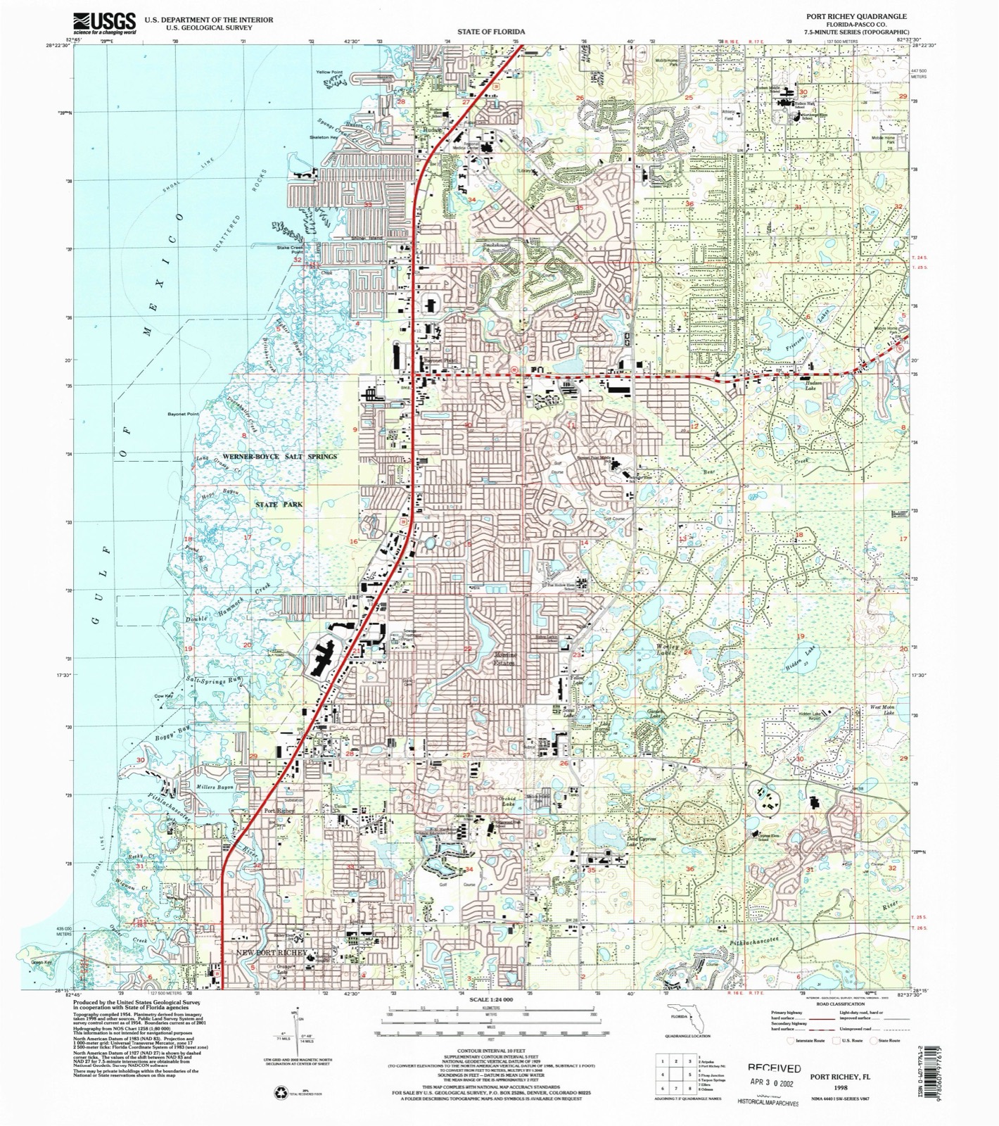
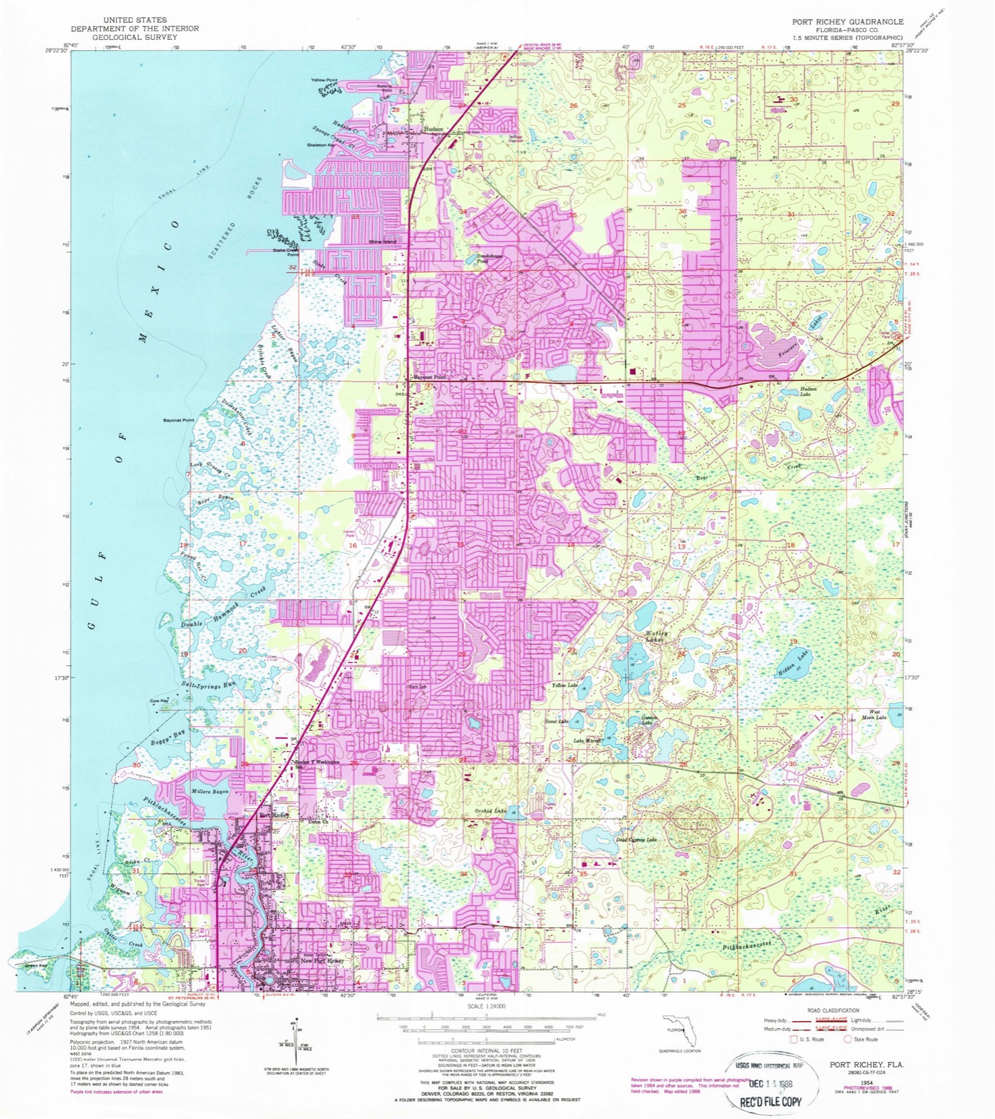
15 topographic sheets cover this place, the earliest surveyed in 1954 and the latest in 1998. It stands in the New Port Richey census division. It lies in ZIP code area 34668. It stands on Pithlachascotee River. The Survey maps it on the Port Richey quadrangle. 3,052 people lived here at the 2020 count. It stands 10 feet above sea level.
Then and now
1954 to 1998The same ground, surveyed 44 years apart. Drag the handle to wipe between them. Both sheets are United States Geological Survey originals; neither has been altered.
Compare 1954 against another survey:
Population over time
2 figuresPort Richey grew from 2,671 to 3,052 between 2010 and 2020. These are the recorded population figures Wikidata holds for this place, reached through the Geographic Names Information System number this page is keyed on rather than by name, so they belong to this place and not to another of the same name. Most are census counts, but not all are: an early figure may be a founding or settlement estimate, and an estimate published within five years of a census is left out. The change column is computed, and is left blank where more than 20 years separate a figure from the one before it, because a gap that long is not a change between two counts.
| Year | People | Change |
|---|---|---|
| 2010 | 2,671 | |
| 2020 | 3,052 | +381 (+14%) |
Topographic sheets covering this place
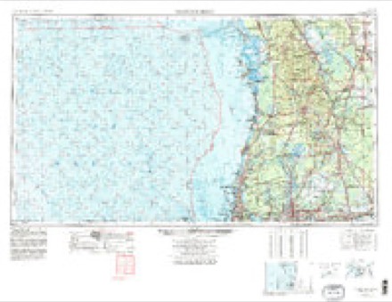
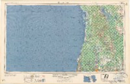
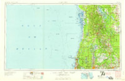
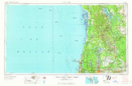
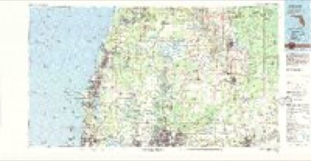
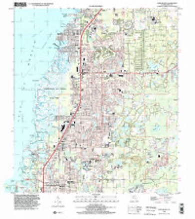
8 surveys from 15 printed sheetsMatched by testing this settlement's coordinate against the published boundary of every sheet in the United States Geological Survey's historical collection. Each opens the scanned sheet at the Survey.
- 1954 USGS Port Richey quadrangle1:24000, 4 printings
- 1955 USGS Plant City quadrangle1:250000, 3 printings
- 1955 USGS Tarpon Springs quadrangle1:250000, 3 printings
- 1958 USGS Plant City quadrangle1:250000
- 1959 USGS Plant City quadrangle1:250000
- 1964 USGS Plant City quadrangle1:250000
- 1978 USGS Tarpon Springs quadrangle1:100000
- 1998 USGS Port Richey quadrangle1:24000
Fires near this place
151 since 1992Regional context, not property-specific evidence. The federal wildfire occurrence database lists 151 fires within 5 miles of Port Richey between 1992 and 2018, burning about 1,369 acres in total. 21 started naturally. 41 were recorded as arson. Distance is straight-line from the map coordinates, so a fire counted here may appear on a neighbouring settlement's page as well.
| Reported cause | Fires |
|---|---|
| Arson/incendiarism | 41 |
| Equipment and vehicle use | 26 |
| Misuse of fire by a minor | 25 |
| Natural | 21 |
| Recreation and ceremony | 16 |
| Railroad operations and maintenance | 10 |
| Missing data/not specified/undetermined | 9 |
| Smoking | 1 |
| Power generation/transmission/distribution | 1 |
| Debris and open burning | 1 |
The most recent of them, most recent first, with the day each was reported and the service that recorded it.
| Date | Cause | Size | Reported by | Name on the report |
|---|---|---|---|---|
| 27 September 2000 | Natural | 3.5 acres | Florida Forest Service | not named |
| 23 September 2010 | Recreation and ceremony | 1.0 acres | Florida Forest Service | 51/ANCLOTE FIRE-0987 |
| 22 September 1996 | Railroad operations and maintenance | under an acre | Florida Forest Service | not named |
| 17 September 2013 | Arson/incendiarism | 2.5 acres | Florida Forest Service | MILLER BAYOU (51) |
| 17 September 1997 | Misuse of fire by a minor | 3.0 acres | Florida Forest Service | not named |
| 11 September 1997 | Misuse of fire by a minor | 4.0 acres | Florida Forest Service | not named |
| 22 August 1997 | Natural | 4.0 acres | Florida Forest Service | not named |
| 11 August 2007 | Arson/incendiarism | 51 acres | Florida Forest Service | 51/PARROTT HEAD FIRE/0958 |
Settlements close enough to share some of these fires:
Storms near this place
60 of 74 shownRegional context, not property-specific evidence. The National Weather Service names Port Richey in 74 storm reports between 1993 and 2024: 30 thunderstorm wind, 16 hail, 8 flood, 6 tornado. The reports record 2 deaths and 16 injuries. Each account below is quoted exactly as the forecast office filed it, from the NOAA Storm Events Database, and each date opens the federal record of that event.
| When | Event | Place named | Harm | What the report says |
|---|---|---|---|---|
| June 2012 | Flood | New Port Richey | 1 killed, $2,000,000 | The Anclote River at Elfers began to flood on the 24th due primarily to heavy rains from Tropical Storm Debby. The river crested early on the morning of the 26th at 26.74 feet, or 6.74 feet above flood stage, and then fell below flood stage on the 29th. As many as 15,000 people were evacuated from 7,000 homes due to the rising flood waters. Homes at Anclote River Estates were standing in several feet of water.||On the 27th, the body of a 46 year old man was found floating in the Anclote River. The Medical Examiner determined that the man died of accidental drowning, with a cardiovascular factor, but no other details are known. |
| June 1998 | Lightning | New Port Richey | 1 killed | Lightning struck and killed a 25 year-old male standing in a field along the 18000 block of Lester Dairy Road near the intersection of U.S. Highway 41 and State Road 54. |
| March 1993 | Tornado (F0) | New Port Richey | 11 hurt | A small tornado damaged several homes. Eleven people suffered minor injuries. |
| August 1997 | Lightning | New Port Richey | 3 hurt, $500 | Lightning struck and split a tree at the Crews Lake Park in Shady Hill. Three people that sought shelter under the tree, an adult female and two children, were slightly injured by the sideflash of the lightning bolt. |
| June 1996 | Lightning | New Port Richey | 1 hurt | no account filed |
| August 1996 | Lightning | Port Richey | 1 hurt | no account filed |
| June 2012 | Tornado (EF1) | New Port Richey | $650,000 | The New Port Richey Parks Department reported major damage to five homes in the Tanglewood Terrace subdivision with an estimated damage of $650,000. |
| March 1998 | Coastal Flood | New Port Richey | $175,000 | Winds in excess of 50 mph caused coastal flooding and beach erosion to several locations west of U.S. Highway 19 in New Port Richey. Several roads had water that covered roadways two to three feet deep and were impassable for several hours. |
| February 1998 | Hail | New Port Richey | $150,000 | Isolated tea cup sized hail was reported by the public at a restaurant in New Port Richey. A few vehicles and commercial rooftops incurred damage from the large hail. |
| July 2001 | Thunderstorm Wind | Port Richey | $100,000 | National Weather Service damage survey concluded that straight-line thunderstorm winds, estimated between 60 and 65 mph, downed over 100 large trees, several branches, numerous power lines and caused minor roof and lanai damage along a one half mile long by two mile wide area over western Pasco county. The western boundary of the damage was near the intersection of Starkey and Oak Loop Roads while the eastern boundary was near the intersection of County Road 587 and DeCubellis Road, approximately seven miles east of Port Richey.Most of the downed trees occurred along DeCubellis Road near the intersection of River Ridge Boulevard near the River Ridge Golf Course east of Port Richey in western Pasco county. |
| February 1998 | Thunderstorm Wind | Port Richey | $100,000 | Thunderstorm winds downed several large trees, numerous power lines, and damaged vehicles and the roofs of a few homes and businesses, mainly in the 6200 block of Florida Avenue in Port Richey. |
| August 1996 | Thunderstorm Wind | Port Richey | $100,000 | no account filed |
| August 1996 | Thunderstorm Wind | Port Richey | $60,000 | no account filed |
| December 2018 | Tornado (EF1) | New Port Richey | $50,000 | The majority of damage was EF0 in nature with large tree limbs,|branches and powerlines down in a small area off of Bolam Avenue near|Atis Street. Minor roof damage was also observed with some homes|having shingles and roofing felt blown off. One large oak tree was|found to have been snapped in two different places and this was|consistent with EF1 damage in the 90-100 mph range. |
| January 2017 | Thunderstorm Wind | New Port Richey | $50,000 | Pasco County Emergency Management reported numerous trees and power lines down around Holiday, New Port Richey, and Hudson associated with a strong thunderstorm ahead of the squall line. Several structures also sustained minor damage. Most of the damage involved car ports or metal roofing being removed or loosened, and one home in New Port Richey had a large branch break through a window. |
| March 2001 | Hail | New Port Richey | $50,000 | Skywarn Spotters reported golfball sized hail from U.S. Highway 19 to Little Road, three miles east of New Port Richey. The large hail damaged the tops and windshields of a few vehicles in New Port Richey. |
| February 1998 | Thunderstorm Wind | New Port Richey | $50,000 | Thunderstorm winds snapped several power poles and downed trees in New Port Richey. |
| April 2019 | Thunderstorm Wind | New Port Richey | $25,000 | Multiple trees were reported down near New Port Richey. |
| June 2003 | Lightning | New Port Richey | $25,000 | An eyewitness saw a lightning strike hit a palm tree and bounce into a home. The resulting fire heavily damaged one bedroom while the rest of the home received smoke damage. Two dogs in cages died of smoke inhalation. |
| June 1998 | Thunderstorm Wind | New Port Richey | $25,000 | Thunderstorm winds downed several large trees which severely damaged a few mobile homes in the Moon Lake Estates five miles northeast of New Port Richey to Bass Lake in New Port Richey. |
| July 1998 | Flood | New Port Richey | $25,000 | Heavy rainfall caused localized flooding of intersections and a few homes in low-lying areas of New Port Richey. |
| September 1996 | Thunderstorm Wind | New Port Richey | $25,000 | no account filed |
| July 2002 | Thunderstorm Wind | Port Richey | $20,000 | Strong winds downed trees and billboards, tore the roof off a mobile home, and part of a roof of a permanent home. |
| January 1998 | Flood | Port Richey | $20,000 | Heavy rains of two to four inches in less than two hours caused minor flooding of roads and low lying areas in Port Richey. A few cars stalled and incurred water damage from the floodwaters along U.S. Highway 19. |
| March 1998 | Thunderstorm Wind | New Port Richey | $20,000 | Thunderstorm winds downed a 50 foot radio antenna near the intersection of U.S. Highway 19 and Ridge Road in New Port Richey. |
| August 1996 | Flood | New Port Richey | $15,000 | no account filed |
| March 2001 | Thunderstorm Wind | New Port Richey | $10,000 | A Skywarn Spotter reported that thunderstorm winds downed a few large trees and power lines on Sycamore Road in New Port Richey. |
| February 1998 | Thunderstorm Wind | New Port Richey | $10,000 | Thunderstorm winds caused roof and shingle damage to a single family dwelling near County Road 587 and County Road 1. |
| August 1995 | Tornado (F0) | Port Richey | $10,000 | A tornado, 25-feet wide briefly touched down in the Tri- Leisure Apartments near the intersection U.S. 19 and Scenic in Port Richey. Two apartment buildings received minor to moderate roof damage. The tornado briefly touched down along its northward trek and a downed a few trees west of U.S. 19. The last brief touchdown occurred at the intersection of Clark and Sommers Avenue in Hudson Beach where a shed was severely damaged. |
| August 1996 | Thunderstorm Wind | Port Richey | $10,000 | no account filed |
| September 1996 | Tornado (F0) | New Port Richey | $10,000 | no account filed |
| July 2013 | Thunderstorm Wind | New Port Richey | $5,000 | New Port Richey Police Department relayed reports of three trees knocked down by wind gusts and another tree knocked on down a power line. |
| June 2012 | Thunderstorm Wind | New Port Richey | $5,000 | Broadcast media reported two homes sustained roof damage at State Road 54 and Madison Street. |
| January 2008 | Thunderstorm Wind | Port Richey | $5,000 | A home weather station measured sustained winds of 61 MPH and a wind gust of 73 MPH. The wind uprooted pine trees which tore down power lines and blocked traffic. |
| July 2002 | Thunderstorm Wind | Port Richey | $5,000 | Strong winds downed trees which damaged a duplex in the Jasmine Estates area. |
| September 1996 | Hail | New Port Richey | $5,000 | no account filed |
| January 2008 | Thunderstorm Wind | Port Richey | $3,000 | Trees were downed at Regency Park. The 60 MPH wind gust was measured by a home weather station. |
| March 2010 | Heavy Rain | Port Richey | $2,000 | There were several road closures across Holiday, Bayonet Point, Dade City, and Zephyrhills due to high waters and flooded streets. Throughout the entire event, the Cooperative Station at Saint Leo received 4.10 inches of rain. A mesonet site about one mile east-northeast of Zephyrhills had 4.75 inches of rain. Other mesonet sites had 4.37 inches 2 miles east-northeast of New Port Richey, 4.33 inches 1.8 miles west-southwest of Dade City, and 4.02 inches 2 miles north-northeast of Port Richey. |
| May 2015 | Thunderstorm Wind | New Port Richey | $1,000 | A trained spotter reported power lines and a tree down across the intersection of Washington Rd. and Virginia Rd. |
| May 2015 | Thunderstorm Wind | New Port Richey | $500 | An amateur radio operator reported a large tree down near Main St. and Grand Blvd. |
| March 1993 | Thunderstorm Wind | New Port Richey | $500 | Thunderstorm winds blew shingles off roofs. |
| April 2024 | Flood | New Port Richey | - | EM reported around a foot of standing water due to heavy rainfall near New Port Richey near the intersection of US Hwy 19 and Green Key Rd. |
| June 2012 | Heavy Rain | New Port Richey | - | A trained spotter reported road flooding on US 19 and Alternate 19 with only one lane passable in each direction. Near Rowan Road and Massachusetts Avenue, 2-3 feet of water was reported covering the roads. In Hudson, amateur radio reported 2 feet of water flooded the inside of a Wal-Mart on US 19. |
| June 2009 | Hail | Port Richey | - | Quarter sized hail was reported in Port Richey. |
| July 2008 | Heavy Rain | New Port Richey | - | A trained spotter reported 2.32 inches of rain in 30 minutes. |
| July 2008 | Heavy Rain | New Port Richey | - | The Pasco Fire Rescue reported stranded vehicles in rising water along US 19 south of New Port Richey. |
| July 2008 | Heavy Rain | Port Richey | - | Four inches of rain fell along Aurora Drive, flooding up to 5 inches of water into two homes leaving six people displaced. |
| January 2008 | Thunderstorm Wind | Port Richey | - | A home weather station measured a 62 MPH wind gust. |
| June 2008 | Hail | Port Richey | - | Pea to Penny size hail reported across Port Richey. |
| December 2007 | Thunderstorm Wind | New Port Richey | - | The public reported damage to a retractable metal awning that is rated to 70 mph winds. |
| July 2006 | Hail | New Port Richey | - | A trained spotter reported nickel size hail. |
| August 2004 | Tornado (F0) | New Port Richey | - | A brief tornado was reported near Osceola Drive and Massachusetts. No damage was reported. |
| June 2003 | Thunderstorm Wind | New Port Richey | - | Several trees were downed by a brief thunderstorm wind gust. |
| July 2002 | Thunderstorm Wind | New Port Richey | - | Many trees and power lines down near the corner of Ceclia Drive and Madison. |
| March 2000 | Waterspout | New Port Richey | - | A short-lived waterspout was observed by Skywarn Spotters two miles north northwest of the U.S. Highway 41 and County Road 587A (Ridge Road) intersection in New Port Richey. |
| August 2000 | Hail | New Port Richey | - | The public reported nickel sized hail, through Bay News Nine Cable of Pinellas Park, in New Port Richey. |
| July 1999 | Thunderstorm Wind | New Port Richey | - | A 60 mph wind gust was reported by a Skywarn Spotter near Ridge Road in New Port Richey. |
| June 1999 | Hail | New Port Richey | - | Dime sized hail was reported by the public in New Port Richey through WFLA-TV of Tampa. |
| July 1998 | Lightning | New Port Richey | - | Lightning ignited and burned 1,500 acres of woodlands in the Jay B. Starkey Wilderness Park between State Roads 52 and 54, east of County Road 587. |
| March 1998 | Thunderstorm Wind | New Port Richey | - | Thunderstorm winds of 58 mph were measured from a boat anchored at Anclote Key by a Skywarn Spotter. |
Nearest settlements
The eight closest, with where each one stands in the county. Distances are straight-line, computed from the Geographic Names Information System coordinates.
| Map | Place | Distance | Sheets |
|---|---|---|---|
| New Port Richey | 1.9 miles | 17 | |
| Jasmine Estates | 2.1 miles | 15 | |
| Gulf Harbors | 3.3 miles | 18 | |
| Elfers | 3.8 miles | 17 | |
| Bayonet Point | 4.2 miles | 15 | |
| Beacon Lakes | 4.4 miles | 17 | |
| Beacon Square | 4.7 miles | 18 | |
| Seven Springs | 5.0 miles | 17 |
Elsewhere
Matched on this settlement's Geographic Names Information System number rather than its name, so it cannot be a different place of the same name in another state.
| Wikipedia article on Port Richey | An encyclopaedic summary. Its text is share-alike, so it is linked here rather than copied. |
| Wikidata item Q2152062 | The structured record the population and elevation above come from. Public domain (CC0). |
Provenance
This settlement is recorded in the Geographic Names Information System as feature 289237. The sheet list is computed by point-in-boundary test against the United States Geological Survey's historical topographic inventory. Both are works of the United States government and carry no copyright under 17 U.S.C. 105.
Wildfire. Short, Karen C. 2022. Spatial wildfire occurrence data for the United States, 1992-2020 [FPA_FOD_20221014]. 6th Edition. Fort Collins, CO: Forest Service Research Data Archive. https://doi.org/10.2737/RDS-2013-0009.6 Collected with United States Government funding and usable without additional permissions or fees.
Storms. NOAA National Centers for Environmental Information, Storm Events Database https://www.ncei.noaa.gov/stormevents/ A work of the United States government, no copyright under 17 U.S.C. 105. Narratives are quoted verbatim from the National Weather Service report and are not edited or summarised.