 Block
BlockKey West, Florida
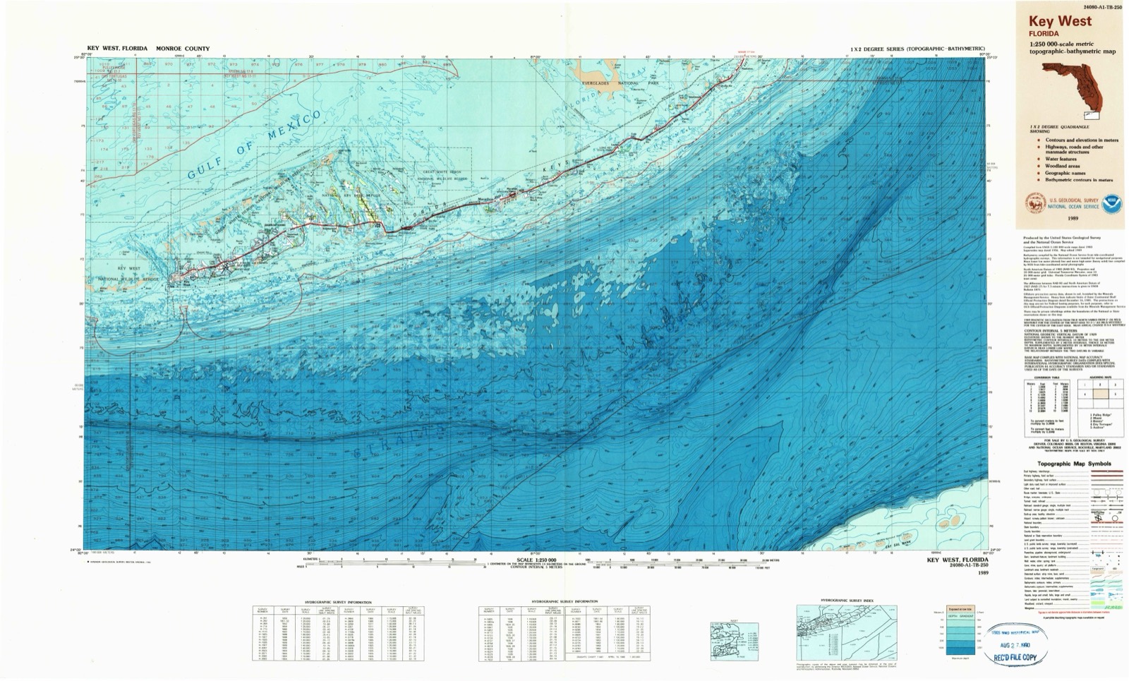
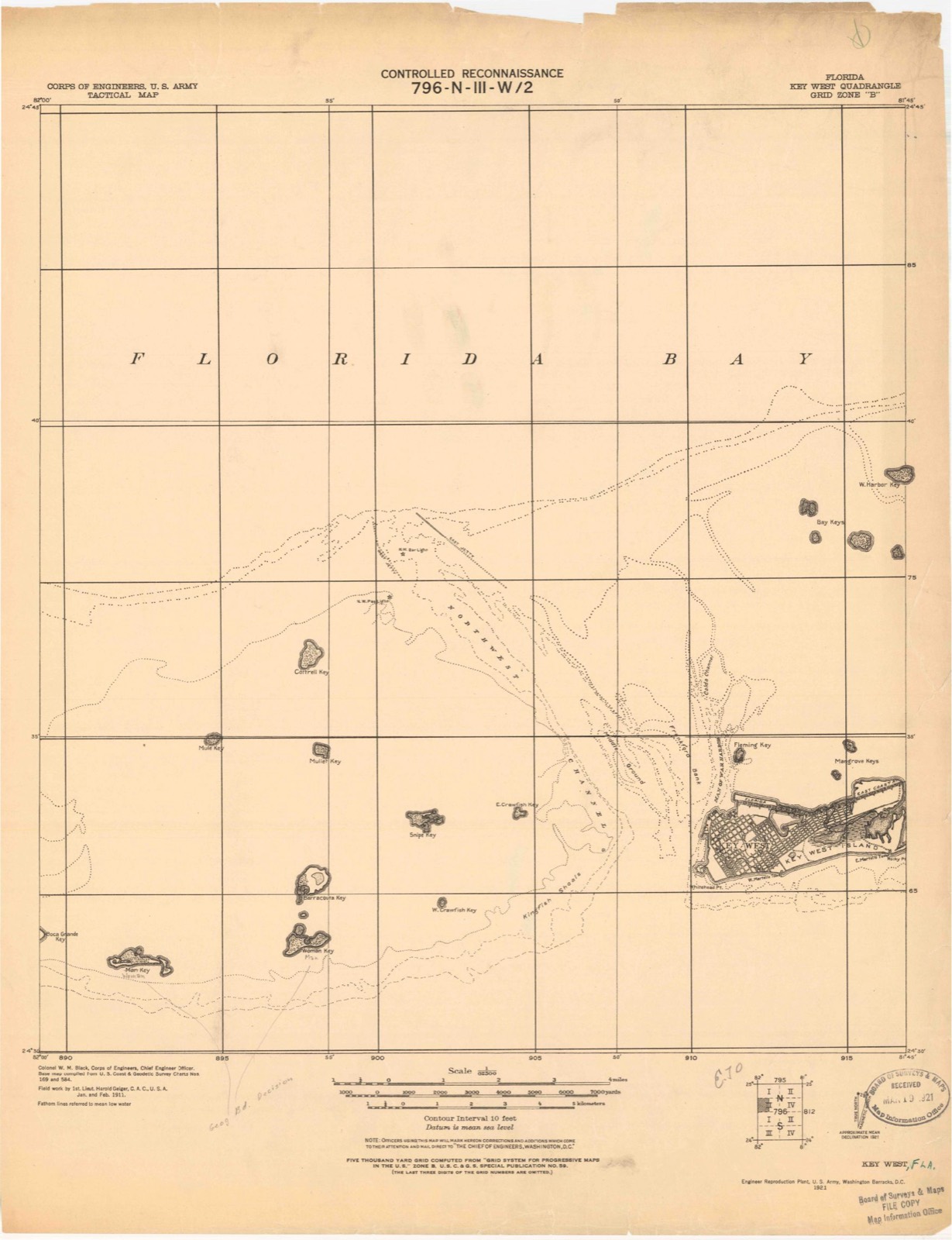
10 topographic sheets cover this place, the earliest surveyed in 1921 and the latest in 1989. It stands in the Key West census division. It lies in ZIP code area 33040. It stands on Key West. The Survey maps it on the Key West quadrangle. 26,444 people lived here at the 2020 count. It stands 13 feet above sea level.
Then and now
1921 to 1989The same ground, surveyed 68 years apart. Drag the handle to wipe between them. Both sheets are United States Geological Survey originals; neither has been altered.
On record in Key West
Buildings and businesses the archive holds for this place. Each opens its own page, with the source record it came from.
On the National Register 12 of 22 shown
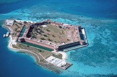 Dry Tortugas National ParkNational Historic Landmark · listed 1992
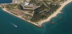 Fort Zachary TaylorNational Historic Landmark · listed 1971
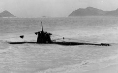 HA. 19 (Japanese Midget Submarine)National Historic Landmark · listed 1989
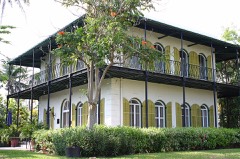 Ernest Hemingway HouseNational Historic Landmark · listed 1968
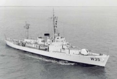 INGHAM (USCGC)National Historic Landmark · listed 1992
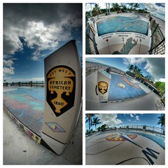 African Cemetery at Higgs Beachlisted 2012
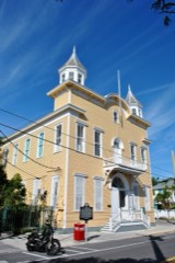 Armory, Thelisted 1971
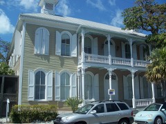 Eduardo H. Gato Houselisted 1973
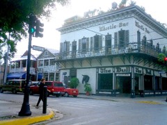 Key West Historic Districtlisted 1971
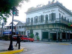 Key West Historic District (Boundary Increase)listed 1983
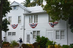 Little White Houselisted 1974
 Martello Gallery-Key West Art and Historical Museumlisted 1972
Population over time
2 figuresKey West grew from 24,649 to 26,444 between 2010 and 2020. These are the recorded population figures Wikidata holds for this place, reached through the Geographic Names Information System number this page is keyed on rather than by name, so they belong to this place and not to another of the same name. Most are census counts, but not all are: an early figure may be a founding or settlement estimate, and an estimate published within five years of a census is left out. The change column is computed, and is left blank where more than 20 years separate a figure from the one before it, because a gap that long is not a change between two counts.
| Year | People | Change |
|---|---|---|
| 2010 | 24,649 | |
| 2020 | 26,444 | +1,795 (+7%) |
Topographic sheets covering this place
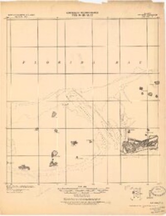
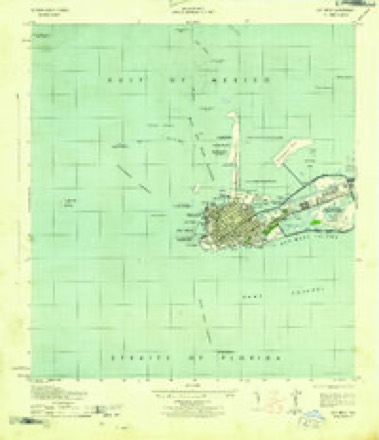
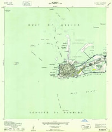
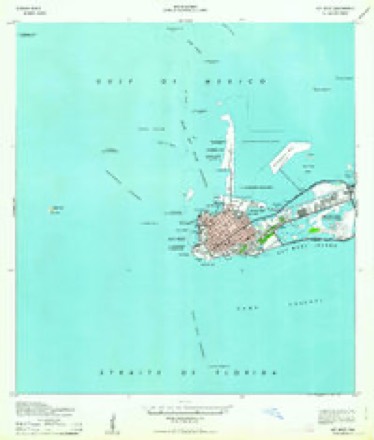
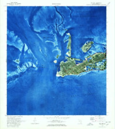
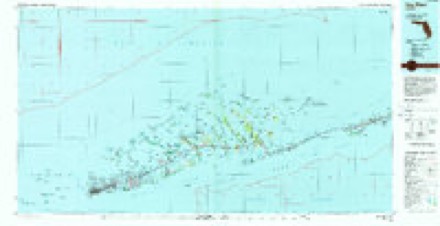
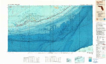
7 surveys from 10 printed sheetsMatched by testing this settlement's coordinate against the published boundary of every sheet in the United States Geological Survey's historical collection. Each opens the scanned sheet at the Survey.
- 1921 USGS Key West quadrangle1:62500
- 1943 USGS Key West quadrangle1:25000
- 1943 USGS Key West quadrangle1:24000, 2 printings
- 1962 USGS Key West quadrangle1:24000
- 1971 USGS Key West quadrangle1:24000, 2 printings
- 1983 USGS Key West quadrangle1:100000, 2 printings
- 1989 USGS Key West quadrangle1:250000
Storms near this place
44 since 1993Regional context, not property-specific evidence. The National Weather Service names Key West in 44 storm reports between 1993 and 2005: 22 waterspout, 11 funnel cloud, 5 thunderstorm wind, 4 tornado. The reports record 1 injury. Each account below is quoted exactly as the forecast office filed it, from the NOAA Storm Events Database, and each date opens the federal record of that event.
| When | Event | Place named | Harm | What the report says |
|---|---|---|---|---|
| July 2000 | Lightning | Key West | 1 hurt | Lightning struck a boat just west of Key West. 5 people were knocked out of the boat with one person injured with burns. |
| June 1998 | Tornado (F0) | Key West | $15,000 | Funnel cloud moved onshore and lowered resulting in a F0 tornado. The tornado moved along 10th ST between North Roosevelt Ave and Flagler Ave. Tree were toppled...roofs and awnings were damaged...powerlines were downed and a shack was tipped over. |
| September 2002 | Thunderstorm Wind | Key West | $500 | Tree limbs 8 to 10 inches in diameter felled, along with damage to wood commercial signs in western portions of Old Town Key West, and a city lamp post near Whitehead and Front Streets. |
| May 2005 | Thunderstorm Wind | Key West | - | Tree downed at Front Street and 16th Terrace in Key West. 5-inch diameter limbs down on 12th Street in Key West. |
| May 2005 | Thunderstorm Wind | Key West | - | Marine reported 4 boats broke anchorages in waters between Christmas Tree Island and Fleming Key and driven ashore. Estimated wind gusts to 50 knots (58 mph). |
| October 2003 | Tornado (F0) | Key West | - | Waterspout moved ashore and crossed Key Haven Road in Key Haven section of Key West. Palm fronds were broken off palm trees, but there was no damage to structures or boats. |
| May 2001 | Waterspout | Key West | - | Waterspout observed 5 miles southwest of Key West. |
| May 2001 | Waterspout | Key West | - | Waterspout observed 5 miles southwest of Key West. |
| August 2001 | Funnel Cloud | Key West | - | Funnel cloud observed 2 miles north of Key West. |
| July 2000 | Flood | Key West | - | Minor street flooding along streets adnin business in downtown Key West. |
| August 2000 | Waterspout | Key West | - | Waterspout observed 10 miles west of the Marquesas Keys or about 30 miles west of Key West. |
| July 1999 | Waterspout | Key West | - | Waterspout observed 5 miles southwest of Key West |
| May 1999 | Tornado (F0) | Key West | - | Waterspout dissipated quickly after moving onshore |
| May 1999 | Waterspout | Key West | - | 1/2 mile east of Key West, moved onshore as a tornado |
| July 1999 | Waterspout | Key West | - | Waterspout observed 1 miles south of Higgs Beach in Key West |
| June 1998 | Waterspout | Key West | - | Several waterspouts reported from 5 - 10 miles north of Key West. Reports came from several sources. |
| June 1998 | Funnel Cloud | Key West | - | Funnel cloud observed 4 miles north of Key West. |
| July 1998 | Funnel Cloud | Key West | - | Three funnel clouds were observed 3 nm north of Key West. |
| July 1998 | Waterspout | Key West | - | Observed just north northwest of Key West. |
| August 1998 | Funnel Cloud | Key West | - | Funnel cloud observed 5nm southeast of Key West. |
| July 1998 | Waterspout | Key West | - | Waterspout observed 5nm southeast of Key West. |
| July 1998 | Funnel Cloud | Key West | - | Oberved 7-8 nm northwest of Key West. |
| July 1998 | Funnel Cloud | Key West | - | Funnel cloud observed just northwest of Key West. |
| July 1998 | Waterspout | Key West | - | Waterspout observed 5nm north of Key West. Also reported as large waterspout north of Key West at 1330 EST by Monroe County Sheriffs office. |
| July 1998 | Waterspout | Key West | - | Waterspout observed 7nm northwest of Key West. |
| June 1998 | Waterspout | Key West | - | Weather observer sighted waterspout 2nm north of Key West International Airport. Movement was toward the west at 7 MPH. |
| June 1998 | Funnel Cloud | Key West | - | Weather observer sighted funnel cloud 5nm northwest of Key West International Airport. |
| July 1998 | Waterspout | Key West | - | Waterspout observed several miles southeast of Key West. |
| July 1997 | Funnel Cloud | Key West | - | reported by observer ne of keyw. radar indicated storm cell about 12nm nne. |
| September 1997 | Waterspout | Key West | - | two waterspouts observed about 15nm n of keyw. |
| September 1997 | Waterspout | Key West | - | observed 5 to 10 nm southeast of keyw. |
| January 1995 | Thunderstorm Wind | Key West | - | Wind gust of 58 mph reported at Key West International Airport. |
| April 1993 | Thunderstorm Wind | Key West | - | A wind gust of 58 mph was observed at Weather Service Office, Key West as a line of thunderstorms passed the station. |
| May 1999 | Tornado (F0) | Key West | - | no account filed |
| August 1998 | Funnel Cloud | Key West | - | no account filed |
| August 1998 | Waterspout | Key West | - | no account filed |
| August 1998 | Funnel Cloud | Key West | - | no account filed |
| July 1998 | Waterspout | Key West | - | no account filed |
| August 1998 | Funnel Cloud | Key West | - | no account filed |
| August 1998 | Waterspout | Key West | - | no account filed |
| August 1998 | Waterspout | Key West | - | no account filed |
| August 1998 | Waterspout | Key West | - | no account filed |
| August 1998 | Waterspout | Key West | - | no account filed |
| August 1998 | Waterspout | Key West | - | no account filed |
Nearest settlements
The eight closest, with where each one stands in the county. Distances are straight-line, computed from the Geographic Names Information System coordinates.
| Map | Place | Distance | Sheets |
|---|---|---|---|
| Stock Island | 2.5 miles | 7 | |
| Big Coppitt Key | 7.1 miles | 7 | |
| El Chico | 7.1 miles | 7 | |
| Bay Point | 11.2 miles | 9 | |
| Perky | 12.9 miles | 9 | |
| Sugarloaf Shores | 13.2 miles | 9 | |
| Pirates Cove | 15.6 miles | 9 | |
| Cudjoe Key | 17.1 miles | 5 |
Elsewhere
Matched on this settlement's Geographic Names Information System number rather than its name, so it cannot be a different place of the same name in another state.
| Wikipedia article on Key West | An encyclopaedic summary. Its text is share-alike, so it is linked here rather than copied. |
| Wikidata item Q485186 | The structured record the population and elevation above come from. Public domain (CC0). |
Provenance
This settlement is recorded in the Geographic Names Information System as feature 294048. The sheet list is computed by point-in-boundary test against the United States Geological Survey's historical topographic inventory. Both are works of the United States government and carry no copyright under 17 U.S.C. 105.
Storms. NOAA National Centers for Environmental Information, Storm Events Database https://www.ncei.noaa.gov/stormevents/ A work of the United States government, no copyright under 17 U.S.C. 105. Narratives are quoted verbatim from the National Weather Service report and are not edited or summarised.