 Block
BlockWellington, Florida
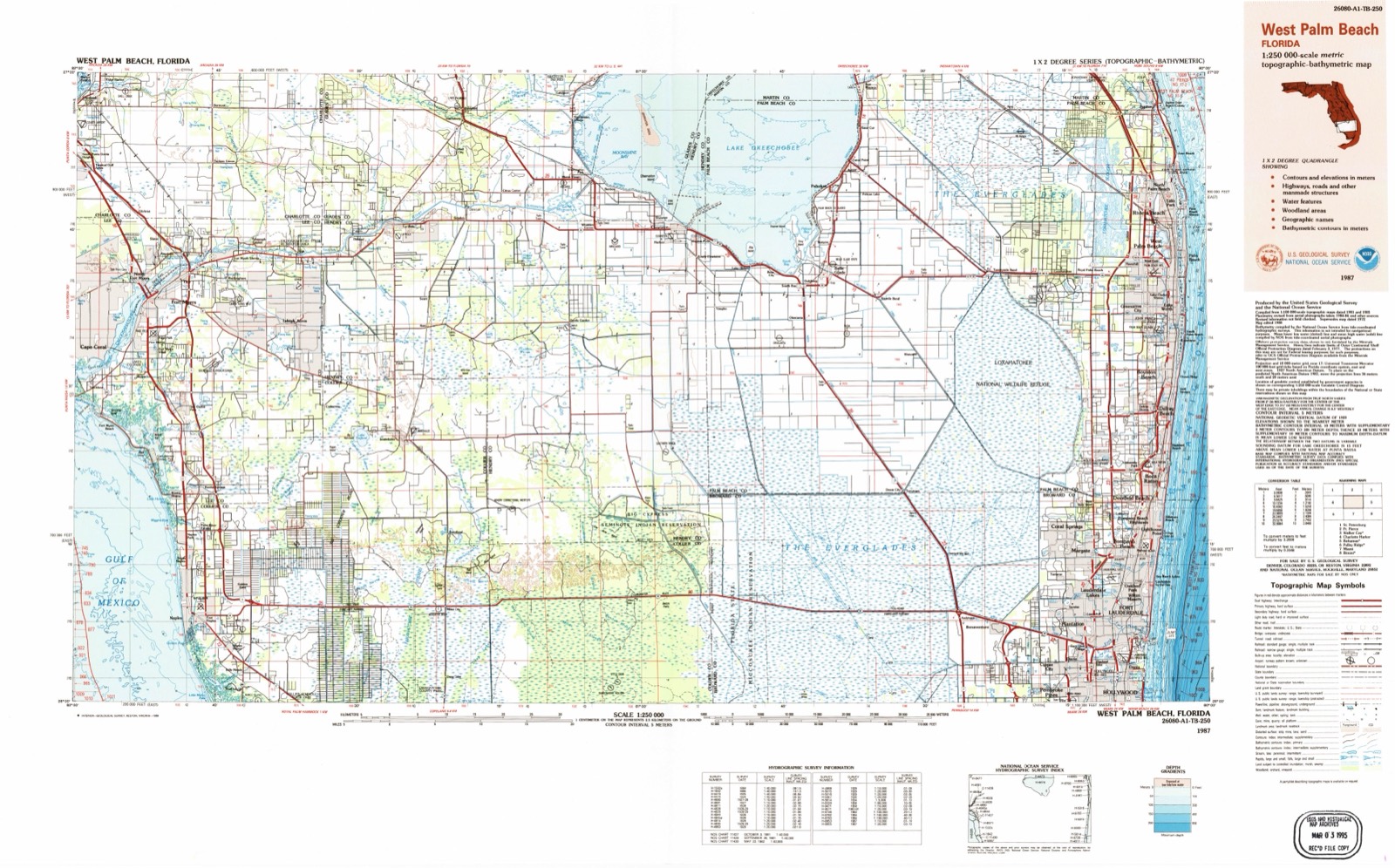
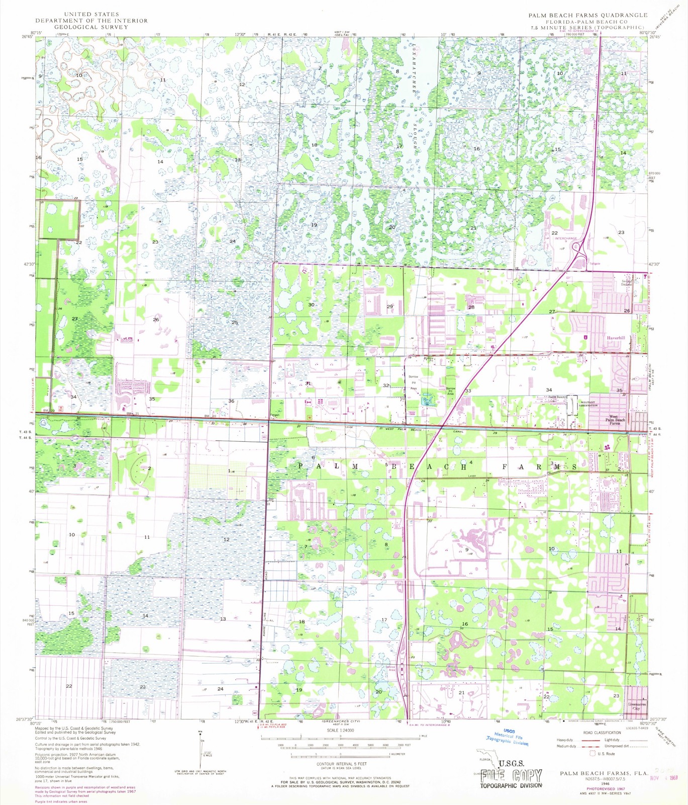
14 topographic sheets cover this place, the earliest surveyed in 1946 and the latest in 1987. It stands in the Sunshine Parkway census division. It lies in ZIP code area 33414. The Survey maps it on the Palm Beach Farms quadrangle. 61,637 people lived here at the 2020 count. It stands 16 feet above sea level.
Then and now
1946 to 1987The same ground, surveyed 41 years apart. Drag the handle to wipe between them. Both sheets are United States Geological Survey originals; neither has been altered.
Compare 1946 against another survey:
Population over time
2 figuresWellington grew from 56,508 to 61,637 between 2010 and 2020. These are the recorded population figures Wikidata holds for this place, reached through the Geographic Names Information System number this page is keyed on rather than by name, so they belong to this place and not to another of the same name. Most are census counts, but not all are: an early figure may be a founding or settlement estimate, and an estimate published within five years of a census is left out. The change column is computed, and is left blank where more than 20 years separate a figure from the one before it, because a gap that long is not a change between two counts.
| Year | People | Change |
|---|---|---|
| 2010 | 56,508 | |
| 2020 | 61,637 | +5,129 (+9%) |
Topographic sheets covering this place
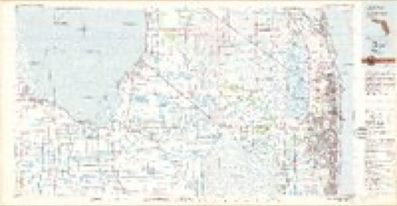
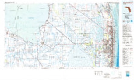
8 surveys from 14 printed sheetsMatched by testing this settlement's coordinate against the published boundary of every sheet in the United States Geological Survey's historical collection. Each opens the scanned sheet at the Survey.
- 1946 USGS Palm Beach Farms quadrangle1:24000, 3 printings
- 1949 USGS Palm Beach Farms quadrangle1:24000, 2 printings
- 1956 USGS West Palm Beach quadrangle1:250000, 2 printings
- 1957 USGS West Palm Beach quadrangle1:250000
- 1958 USGS West Palm Beach quadrangle1:250000, 2 printings
- 1981 USGS West Palm Beach quadrangle1:100000
- 1985 USGS West Palm Beach quadrangle1:100000
- 1987 USGS West Palm Beach quadrangle1:250000, 2 printings




Fires near this place
99 since 1992Regional context, not property-specific evidence. The federal wildfire occurrence database lists 99 fires within 5 miles of Wellington between 1992 and 2020, burning about 1,324 acres in total. 13 started naturally. 6 were recorded as arson. Distance is straight-line from the map coordinates, so a fire counted here may appear on a neighbouring settlement's page as well.
| Reported cause | Fires |
|---|---|
| Railroad operations and maintenance | 26 |
| Misuse of fire by a minor | 25 |
| Natural | 13 |
| Equipment and vehicle use | 8 |
| Missing data/not specified/undetermined | 7 |
| Debris and open burning | 7 |
| Arson/incendiarism | 6 |
| Recreation and ceremony | 3 |
| Power generation/transmission/distribution | 3 |
| Smoking | 1 |
The most recent of them, most recent first, with the day each was reported and the service that recorded it.
| Date | Cause | Size | Reported by | Name on the report |
|---|---|---|---|---|
| 12 September 2007 | Natural | under an acre | Florida Forest Service | COLLECTING CANAL FIRE |
| 4 August 2007 | Misuse of fire by a minor | under an acre | Florida Forest Service | MADISON COMMD. FIRE |
| 21 August 2000 | Natural | 30 acres | Florida Forest Service | not named |
| 13 August 1998 | Natural | 3.0 acres | Florida Forest Service | not named |
| 11 August 1993 | Natural | under an acre | Florida Forest Service | not named |
| 11 August 1993 | Natural | 6.0 acres | Florida Forest Service | not named |
| 7 July 1994 | Railroad operations and maintenance | 3.0 acres | Florida Forest Service | not named |
| 5 July 2006 | Misuse of fire by a minor | under an acre | Florida Forest Service | PEARSON ROAD COMMAND |
Settlements close enough to share some of these fires:
Mines and quarries near this place
1 within 5 milesRegional context, not property-specific evidence. The federal mineral resources record lists 1 working within 5 miles of Wellington: 1 past producer. None of them still produces. What was taken out: Stone, Crushed/Broken. Distance is straight-line from the map coordinates, so a quarry counted here may appear on a neighbouring settlement's page as well.
| Where | Site | Commodity | Status | Recorded |
|---|---|---|---|---|
| Golden Lakes Pit | Stone, Crushed/Broken | Past Producer |
Storms near this place
58 since 1993Regional context, not property-specific evidence. The National Weather Service names Wellington in 58 storm reports between 1993 and 2025: 19 hail, 18 thunderstorm wind, 6 funnel cloud, 6 lightning. The reports record 1 death and 9 injuries. Each account below is quoted exactly as the forecast office filed it, from the NOAA Storm Events Database, and each date opens the federal record of that event.
| When | Event | Place named | Harm | What the report says |
|---|---|---|---|---|
| July 2019 | Lightning | Wellington | 1 killed, 5 hurt | Palm Beach Post reported 6 people, a woman and 5 men, were struck by lightning at the Shakerwood development off of Wellington Trace. This is west of the Mall at Wellington Green. The victims were working on the roof of a townhouse when the lightning struck. Two people, a 20-year-old woman and a man, were knocked off the roof by the lightning strike and were taken to a local hospital trauma center where the women was in critical condition. The woman died from her injuries on August 9th. ||Two others were taken to local hospitals and recovered, while the remaining two victims were treated at the scene and released. ||Based on lightning detection network data, the lightning strike was likely the first strike from a thunderstorm that developed very close to the location. |
| August 2004 | Lightning | Wellington | 2 hurt | In two separate incidents, women were struck by lightning while in parking lots. One woman was taken to the hospital in critical condition. |
| September 2016 | Lightning | Wellington | 1 hurt | A local newspaper reported a man was struck by lightning in Wellington in Palm Beach County. The incident occured in the 15000 block of Sunnyland Lane. The man was taken to a local trauma center for treatment. |
| June 2013 | Tornado (EF1) | Wellington | 1 hurt | An EF-1 tornado tracked almost due north in the Acreage community of north central Palm Beach County. The tornado moved across a suburban, residential community just west of 130th Path North between 69th St. North and 87th St. North. Several homes sustained minor to moderate roof damage, mainly in the form of shingles and roof covering torn off. A couple of homes sustained more substantial rood damage with partial uplift of roofs. Numerous trees were uprooted or sheared off near the trunk, along with plenty of large branches broken or split from the main trunk. Trees damaged consisted primarily of Oaks, Slash Pines and Palms. Flying debris from trees resulted in broken windows in several homes.||One serious injury required hospitalization in a home on 76th Road North. An 85-year old woman was injured when she was struck by flying debris from a large Oak tree which broke through her bedroom window. One home sustained damage to the garage door, causing the door to blow in and leading to the roof being completely punctured above the garage. A few vehicles were moved from their original locations and a 30-foot boat was flipped on its side. |
| August 2008 | Tornado (EF2) | Wellington | $1,250,000 | Tornado moved through a number of Equine Farms and Polo Grounds as well as two subdivisions in Wellington. Worst damage was to Palm Beach Equine Clinic, 13125 Southfield Road, where roofs were blown off of stables, power poles snapped, and many trees down in criss-crossing patterns. The Equine Veterinary roof was more than 95 percent detiled, a heavy trailer was tossed about 40 yards from its previous location northwest of the International Polo Club, and an apartment home roof near Folkstone Circle was about 70 percent detiled. Maximum estimated wind speed was around 115 MPH. Most of the track was around 70 to 80 yards wide, but at the widest point the tornado was around 100 yards in width. |
| September 2022 | Tornado (EF1) | Wellington | $200,000 | Tornado began in Wellington just north of Greenbriar Park, causing EF-0 to EF-1 damage in the form of torn roof tiles and many broken tree branches in the Wanderer's Golf Course community. The tornado moved northwest into the Lakefield West and Meadow Wood of the Landings communities, causing minor roof damage before crossing Flying Cow Ranch Road and moving over open land south of Southern Boulevard. ||Damage totals are estimated based on at least 2 dozen homes sustaining roof damage.||The tornado crossed Southern Boulevard near Lion Country Safari Road, causing significant tree damage, then passed just west of Lion Country Safari into Loxahatchee where tree trunks were snapped in the Buck Ridge Trail and Hanover Circle area. |The last reported damage was fence damage at Hanover Circle and Duellant Road. |
| April 2023 | Thunderstorm Wind | Wellington | $10,000 | A member of the public sent pictures and a video of damage to fences, sheds, and trees in Loxahatchee. Evidence and radar data suggest the likelihood of a localized area of microburst originated winds of 60-70 mph. |
| August 2008 | Lightning | Wellington | $5,000 | Lightning struck a Royal Palm complex setting ablaze to a few condominiums. The fire forced residents out of six units as fire spread through the attic and water from the hoses was pumped in damaging lower floors. |
| July 2006 | Lightning | Wellington | $5,000 | Lightning struck a home near the South Florida Fairgrounds, causing a fire in the attic. No one was injured. Approximately 400 lightning strikes were noted in central Palm Beach County between 7 and 9 PM. |
| April 2021 | Thunderstorm Wind | Wellington | $3,000 | A member of the public reported roof damage with several tiles removed and strewn over the lawn in a neighborhood located off of Forest Hill Blvd, east of State Rd 7. Damage is thought to be from a downburst and wind speed is estimated based on the level of damage. |
| February 2010 | Thunderstorm Wind | Wellington | $2,000 | Front door blown in, downed tree branches and flipped vending machine at Lake Worth Road and US 441. Dime size hail also reported. |
| August 2020 | Thunderstorm Wind | Wellington | $1,000 | A member of the public reported via social media a thunderstorm wind gust of 62 mph (54 knots) that was measured by a home weather station in Loxahatchee. The post also mentioned the downburst associated with the passing thunderstorm, resulting in some downed trees and branches. |
| October 2020 | Thunderstorm Wind | Wellington | $1,000 | A thunderstorm wind gust of 59 mph (51 knots) was recorded at the Earthnetwork site WLLCH located at Wellington High School. |
| June 2019 | Thunderstorm Wind | Wellington | $1,000 | A trained spotter called to report small to medium sized tree branches were downed in the Wellington area due to a thunderstorm wind gust. Gust were estimated to be 55-60 mph in the area. |
| September 2015 | Lightning | Wellington | $1,000 | Palm Beach County Fire Rescue reported damage to a Wellington Petco roof with debris from the lightning strike on the ground. Store is located at 920 S. State Road 7. There were no injuries reported. |
| February 1993 | Thunderstorm Wind | Wellington | $500 | Strong thunderstorm winds uprooted several large trees. |
| March 2025 | Hail | Wellington | - | A trained spotter reported quarter sized hail with passing thunderstorm in Wellington. |
| May 2023 | Hail | Wellington | - | Penny to nickel sized hail was reported by the public in Wellington near the Polo Country Club. |
| May 2023 | Thunderstorm Wind | Wellington | - | Palm Beach County Sheriff's Office reported downed power lines at the intersection of South Rambling Drive and South Rambling Drive Circle in Wellington as a severe thunderstorm moved through the area. |
| May 2022 | Hail | Wellington | - | Quarter size hail was reported by the public in Wellington. Report received via social media. |
| May 2022 | Thunderstorm Wind | Wellington | - | A personal weather station (KFLLOXAH76) measured a 58 mph wind gust. Anemometer height is 43 feet. |
| April 2021 | Hail | Wellington | - | Mix of small hail with a few dime sized pieces reported by the public near intersection of SR-7 and US 441. Pea-sized hail was also reported by a trained spotter near South Shore Blvd. |
| April 2020 | Hail | Wellington | - | Reports received from the public and broadcast media of quarter size hail in The Acreage. Small dents to the roofs of vehicles was observed, as well as small branches broken. |
| April 2020 | Thunderstorm Wind | Wellington | - | Trained spotter estimated 60+ mph winds, with trees down and nickel size hail. Located on Royal Palm Beach Blvd in Loxahatchee. Time is estimated from radar. |
| May 2020 | Hail | Wellington | - | Quarter inch hail was reported with a strong thunderstorm. |
| May 2020 | Hail | Wellington | - | Reports via social media of hail up to the size of pennies in Wellington. |
| May 2020 | Funnel Cloud | Wellington | - | A trained spotter reported a funnel cloud to the SW of the intersection of Big Blue Trace and Wellington Trace from a thunderstorm moving through the area. |
| May 2020 | Hail | Wellington | - | A trained spotter reported nickel sized hail and wind gusts high enough to knock down some weak tree branches at Big Blue Trace and Wellington Trace in Wellington, FL. |
| September 2020 | Flood | Wellington | - | A trained weather spotter reported street flooding at the intersection of Forest Hill Boulevard and Southern Boulevard in Wellington, FL and vicinity due to passing storms. Rainfall estimates were around 2 inches within an hour. |
| June 2020 | Hail | Wellington | - | Several social media reports of dime sized hail near Southshore Blvd and Big Blue Trace in Wellington from a strong thunderstorm that moved through the area. A trained spottered also reported trees where bending very good, but no branches broke off from winds of 50 to 55 mph associated with the storms. |
| June 2019 | Hail | Wellington | - | A trained spotter called to report one inch size hail in Wellington. Reports of smaller size hail also in the area. |
| June 2019 | Hail | Wellington | - | Penny size hail was reported in Royal Palm Beach associated with a thunderstorm moving through the region. |
| May 2019 | Funnel Cloud | Wellington | - | A member of the public via social media shared photo of a funnel cloud from Northlake Blvd looking north. The funnel never reached the ground. |
| March 2015 | Thunderstorm Wind | Wellington | - | Winds measured by hand-held instrument as high as 71 mph near the Mall at Wellington Green. |
| June 2015 | Thunderstorm Wind | Wellington | - | A trained spotter reported trees down onto power lines. Time was estimated by radar. |
| August 2014 | Hail | Wellington | - | SKYWARN (TM) spotters reported hail up to penny size in the Acreage and Royal Palm Beach areas. |
| June 2014 | Hail | Wellington | - | A report and picture of hail slightly larger than dime size was received through social media. |
| March 2014 | Thunderstorm Wind | Wellington | - | A playhouse was blown to pieces across the yard and fan blades were blown off an outside porch. This was relayed through social media and located 2 miles east-southeast of Wellington. |
| May 2013 | Flash Flood | Wellington | - | A cluster of very heavy showers moved into northeast Palm Beach County during the early morning producing rainfall estimates of 4 to 7 inches in the areas from The Acreage to Boynton Beach. Flood waters was reported to be entering garages in The Acreage and Park Vista High School in Boynton Beach was reported closed due to flooded parking lots. |
| June 2013 | Funnel Cloud | Wellington | - | Public reported a funnel cloud near the intersection of Southern Blvd. and State Road 7. The funnel did not touch down. |
| August 2012 | Flood | Wellington | - | Flooding persisted over the western communities of Palm Beach County through the end of August as a result of torrential rains from Tropical Storm Isaac which fell on August 26th and 27th. ||Damage estimates and impacts caused by the flooding is included in the Flash Flood entry for Palm Beach County. |
| October 2012 | Funnel Cloud | Wellington | - | Palm Beach County Emergency Management relayed a report of a funnel cloud near Pierson Road and South Shore Boulevard in Wellington. |
| June 2012 | Hail | Wellington | - | Reported in Loxahatchee. Time is approximate. |
| July 2012 | Thunderstorm Wind | Wellington | - | Public reported multiple trees downed across the road near the intersection of Wellington Trace Road and Forest Hill Boulevard. |
| June 2011 | Hail | Wellington | - | A member of the public near the intersection of State Route 7 and Southern Boulevard reported nickel-sized hail and estimated winds around 50 mph. Several small trees were downed. |
| March 2008 | Flash Flood | Wellington | - | Heavy rain across the Wellington area produced multiple reports of knee deep water in yards and across roadways. |
| July 2007 | Tornado (EF0) | Wellington | - | WPTV Channel 5 in West Palm Beach showed video of an apparent EF0 tornado just east of Lion Country Safari. No damage was reported. |
| April 2007 | Hail | Wellington | - | Spotter in Hollyhock Road area of Wellington reported golf ball size hail. |
| March 2007 | Thunderstorm Wind | Wellington | - | Several reports of tree branches down and power outages in the Wellington and Royal Palm Beach area. |Florida Power and Light estimated about 8,000 customers were without power. |
| March 2007 | Thunderstorm Wind | Wellington | - | Wind picked up and moved a 15 foot boat next to a house in Royal Palm Beach. |
| March 2007 | Thunderstorm Wind | Wellington | - | Basketball hoop and plastic outdoor storage container blow down by strong thunderstorm winds. |
| March 2007 | Thunderstorm Wind | Wellington | - | Reports of large tree branches broken off and power lines down along Forest Hill Boulevard. |
| July 2005 | Tornado (F0) | Wellington | - | A tornado touched down for 30 seconds in a field near the intersection of U.S. 441 and U.S. 98. |
| June 2005 | Funnel Cloud | Wellington | - | The police sighted two funnel clouds near Lion Country Safari. |
| August 2003 | Funnel Cloud | Wellington | - | The Sheriff's Office reported a funnel cloud on South Shore Blvd near Pearson St. |
| July 2003 | Hail | Wellington | - | Nickel-size hail was seen. |
| July 2003 | Hail | Wellington | - | A SKYWARN spotter saw three-quarter inch hail. |
| April 2007 | Hail | Wellington | - | no account filed |
Nearest settlements
The eight closest, with where each one stands in the county. Distances are straight-line, computed from the Geographic Names Information System coordinates.
| Map | Place | Distance | Sheets |
|---|---|---|---|
| Loxahatchee Groves | 2.7 miles | 11 | |
| Royal Palm Beach | 3.5 miles | 14 | |
| Palm Beach Farms | 4.9 miles | 14 | |
| Poincianna Place | 4.9 miles | 14 | |
| Golden Lakes | 5.0 miles | 14 | |
| Florida Gardens | 5.1 miles | 14 | |
| Lake Belvedere Estates | 6.1 miles | 14 | |
| West Palm Beach Farms | 6.1 miles | 14 |
Elsewhere
Matched on this settlement's Geographic Names Information System number rather than its name, so it cannot be a different place of the same name in another state.
| Wikipedia article on Wellington | An encyclopaedic summary. Its text is share-alike, so it is linked here rather than copied. |
| Wikidata item Q992652 | The structured record the population and elevation above come from. Public domain (CC0). |
Provenance
This settlement is recorded in the Geographic Names Information System as feature 1759737. The sheet list is computed by point-in-boundary test against the United States Geological Survey's historical topographic inventory. Both are works of the United States government and carry no copyright under 17 U.S.C. 105.
Wildfire. Short, Karen C. 2022. Spatial wildfire occurrence data for the United States, 1992-2020 [FPA_FOD_20221014]. 6th Edition. Fort Collins, CO: Forest Service Research Data Archive. https://doi.org/10.2737/RDS-2013-0009.6 Collected with United States Government funding and usable without additional permissions or fees.
Mines and quarries. USGS Mineral Resources Data System (MRDS) https://mrdata.usgs.gov/mrds/ A work of the United States government, no copyright under 17 U.S.C. 105.
Storms. NOAA National Centers for Environmental Information, Storm Events Database https://www.ncei.noaa.gov/stormevents/ A work of the United States government, no copyright under 17 U.S.C. 105. Narratives are quoted verbatim from the National Weather Service report and are not edited or summarised.