BlockBefore
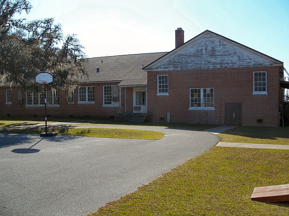
Photograph of Old Hernando Elementary School
Photograph by Ebyabe, CC BY 2.5. Via Wikimedia Commons.

Hernando Elementary School, Old

Listed on the National Register of Historic Places in 2001. 10 historic topographic surveys show this location, the earliest from 1895.

From the record

“The Old Hernando Elementary School is a historic site in Hernando, Florida, United States. It is located at 2435 North Florida Avenue.”

Wikipedia article Old Hernando Elementary School, CC BY-SA 4.0.

One of 7 National Register listings published here for Citrus County · listed in 2001 · category: Building.

Sources: the Wikipedia article · the case file at the National Archives · the National Register database, National Park Service

The listing

  • What is counted as historic. The nomination lists 1 building as contributing to the listing.
  • Address. 2435 N. Florida Ave., Hernando, 34442
  • When was it listed? May 2001
  • Category. building
  • Census division. Inverness
  • Architectural style. Colonial Revival architecture
  • National Register reference number. 00001129 - the number the National Park Service assigned this property when it was listed, and the key its nomination file is catalogued under at the National Archives.

Fires near this property

173 since 1992

Regional context, not property-specific evidence. The federal wildfire occurrence database lists 173 fires within 5 miles of Hernando Elementary School, Old between 1992 and 2020, burning about 2,949 acres in total. 35 started naturally. 28 were recorded as arson. Distance is straight-line from the map coordinates, so a fire counted here may appear on a neighbouring settlement's page as well.

Reported cause Fires
Natural35
Arson/incendiarism28
Railroad operations and maintenance27
Debris and open burning24
Missing data/not specified/undetermined23
Equipment and vehicle use20
Misuse of fire by a minor8
Recreation and ceremony4
Power generation/transmission/distribution2
Fireworks1
Smoking1

The most recent of them, most recent first, with the day each was reported and the service that recorded it.

DateCause SizeReported by Name on the report
7 September 1992Missing data/not specified/undeterminedunder an acreFlorida Forest Servicenot named
20 September 1997Misuse of fire by a minor1.5 acresFlorida Forest Servicenot named
15 September 2005Debris and open burning1.0 acresFlorida Forest Service09/SAND FIRE 0628
25 August 2000Railroad operations and maintenance1.5 acresFlorida Forest Servicenot named
20 August 2006Debris and open burningunder an acreFlorida Forest Service09/ST JAMES FIRE/0916
12 August 2007Naturalunder an acreFlorida Forest Service09/MIKES TRAIL 13 FIRE/0971
12 August 2006Debris and open burningunder an acreFlorida Forest Service09/HAMMOCK FIRE/0884
11 August 2020Natural40 acresFlorida Forest ServiceTRAIL 11 (09)

Every fire recorded in Citrus County

Mines and quarries near this property

7 within 5 miles

Regional context, not property-specific evidence. The federal mineral resources record lists 7 workings within 5 miles of Hernando Elementary School, Old: 2 past producers, 2 plants, 1 occurrence, 1 unknown. 3 still produce. What was taken out: Phosphorus-Phosphates, Sand, Stone, Crushed/Broken. Distance is straight-line from the map coordinates, so a quarry counted here may appear on a neighbouring settlement's page as well.

Where SiteCommodity StatusRecorded
Unnamed Aggregate QuarryStone, Crushed/BrokenOccurrence
Citrus Co. Board of Co. Comm. - Landfill Expansion MineSandUnknown
J and L Croft Co. - Croft PitSandProducer
Acton Mine & MillPhosphorus-PhosphatesPlant
Howard Phosphate MinePhosphorus-PhosphatesPast Producer
Kellogg Mine & MillPhosphorus-PhosphatesPlant
Manko Co Section 5 MinePhosphorus-PhosphatesPast Producer

Every working recorded in Citrus County

Storms near this property

12 since 1995

Regional context, not property-specific evidence. The National Weather Service names Hernando, the town this property stands in, in 12 storm reports between 1995 and 2019: 6 thunderstorm wind, 2 lightning, 2 hail, 1 tornado. The reports record 5 injuries. Each account below is quoted exactly as the forecast office filed it, from the NOAA Storm Events Database, and each date opens the federal record of that event.

WhenEvent Place namedHarm What the report says
June 2000LightningHernando4 hurtLightning struck and injured four people, three men and a woman, at the Andres of Citrus Hills golf course in Hernando. The four struck by lightning had sought shelter beneath a covered golf bag rack 30 feet from the pro shop at the golf course. Two men who received the greatest injuries were knocked unconscious and had their hearts stopped by the lightning strike. All four victims were resuscitated with CPR. The female struck was thrown several feet by the force of the lightning bolt.
March 2001Tornado (F0)Hernando1 hurt, $75,000Citrus county emergency management reported that a F0 tornado initially touched down near East Bryant Street and North Croft Avenue, two miles south-southwest of Hernando, and sporadically touched down as it moved northeast across mixed residential neighborhoods near U.S. Highway 41. The tornado continued northeast, then lifted and dissipated near East Parson Point Road, one mile east of Hernando. The tornado caused mainly minor damage to roof tiles, awnings, sheds, lanais of homes and toppled a few trees along its narrow path. A woman was injured from shattered glass when wind blown debris broke her vehicle's windshield along North Croft Avenue.
June 2004Thunderstorm WindHernando$20,000Thunderstorms developed along the sea breeze front. One of the storms produced 50 knot winds that downed trees and power lines. Roof damage was reported on two homes, one caused by a fallen tree.
August 1999LightningHernando$20,000Lightning struck and burned to the ground a wood cabin home on Warner Terrace Road east of Van Ness Road in Hernando. Eyewitness observed the lightning enter the home through the kitchen window.
January 1995Thunderstorm WindHernando$20,000Thunderstorm downburst wind blew a tree onto a house in Hernando. Roof damage and damage to concrete statues occurred near Connel Heights. Power lines were downed in Ozello.
June 2014Thunderstorm WindHernando$5,000A large tree fell on a mobile home. Time of the incident was estimated by radar.
March 2000Thunderstorm WindHernando$1,000Thunderstorm wind gusts of up to 50 mph snapped a few tree branches which downed power lines on Tasha Court in Hernando of northeast Citrus County.
July 2019Thunderstorm WindHernando-Citrus County Emergency Management reported trees down north of E Parsons Point Rd.
August 2011HailHernando-Nickel sized hail was reported near the city of Hernando.
March 2010Thunderstorm WindHernando-Four trees were downed six miles north of Hernando.
July 2007Heavy RainHernando-A trained spotter reported 4.85 inches of rain. The ditches were full of water but no significant flooding was observed.
May 2003HailHernando-no account filed

Every storm recorded in Citrus County

Maps showing this location

10 surveys

United States Geological Survey topographic sheets whose coverage includes this point. Matched by taking the coordinate the National Park Service records for this property, then testing that coordinate against the published boundary of every sheet.

Listed places nearby

2 within 8 miles

Other National Register properties close enough to walk or drive between, ordered by distance from this one. Both positions come from the same geocoding pass that matched these properties to their map sheets.

Photograph PropertyDistance Listed
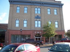
The Masonic Temple of Citrus, Lodge #18, F. and A.M.5.0 miles2010
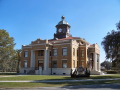
Citrus County Courthouse, Old5.0 miles1992

Sources for this property

National Archives recordThe nomination case file for reference 00001129 in Record Group 79.
Wikipedia articleCommunity-written account of this property, licensed CC BY-SA.
Citrus CountyAll 7 listed properties in this county.

Provenance

  • Listing record. National Park Service National Register of Historic Places, listed-properties dataset, current to 2026-05-22.
  • Map join. Address geocoded through the United States Census geocoder, then tested against the published boundary of every sheet in the USGS Historical Topographic Map Collection.
  • How this page is made. Listing fields come from federal records; map-sheet coverage is a labelled coordinate-to-boundary calculation, not a source-field claim.
  • Wildfire. Short, Karen C. 2022. Spatial wildfire occurrence data for the United States, 1992-2020 [FPA_FOD_20221014]. 6th Edition. Fort Collins, CO: Forest Service Research Data Archive. https://doi.org/10.2737/RDS-2013-0009.6 Collected with United States Government funding and usable without additional permissions or fees.
  • Mines and quarries. USGS Mineral Resources Data System (MRDS) https://mrdata.usgs.gov/mrds/ A work of the United States government, no copyright under 17 U.S.C. 105.
  • Storms. NOAA National Centers for Environmental Information, Storm Events Database https://www.ncei.noaa.gov/stormevents/ A work of the United States government, no copyright under 17 U.S.C. 105. Narratives are quoted verbatim from the National Weather Service report and are not edited or summarised.