BlockBefore
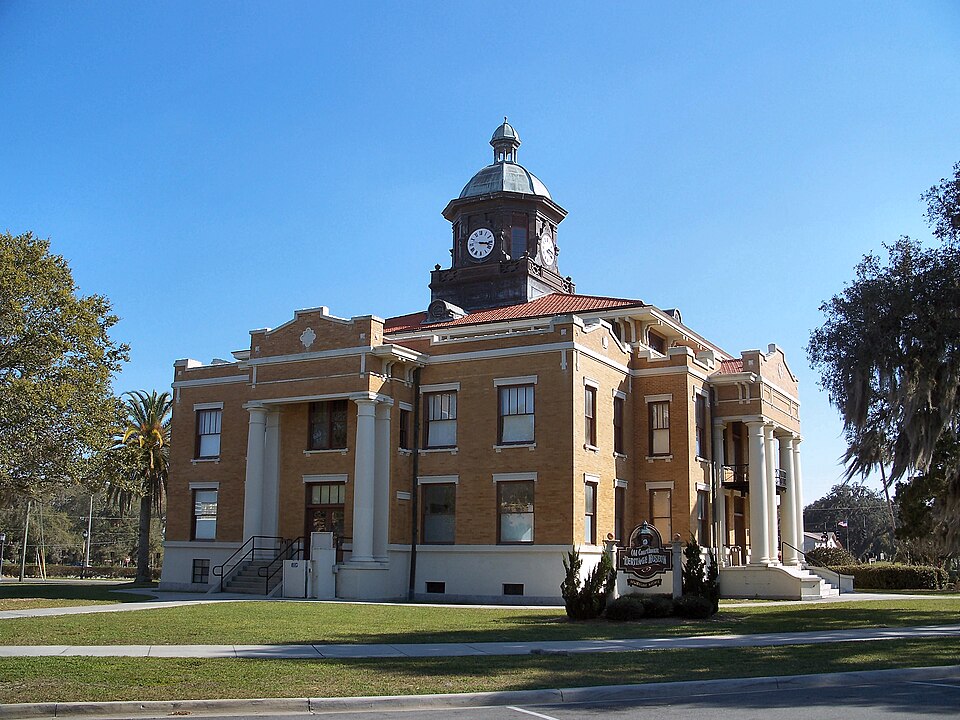
Photograph of Old Citrus County Courthouse
Photograph by Ebyabe, CC BY 2.5. Via Wikimedia Commons.

Citrus County Courthouse, Old

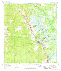
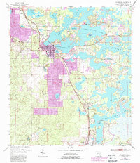
Listed on the National Register of Historic Places in 1992. 9 historic topographic surveys show this location, the earliest from 1895.

From the record

“The Old Citrus County Courthouse is a historic site in Inverness, Florida located at 1 Courthouse Square. On April 17, 1992, it was added to the U.S.”

Wikipedia article Old Citrus County Courthouse, CC BY-SA 4.0.

One of 7 National Register listings published here for Citrus County · listed in 1992 · category: Building.

Sources: the Wikipedia article · the case file at the National Archives · the National Register database, National Park Service

The listing

  • What is counted as historic. The nomination lists 1 building as contributing to the listing.
  • Address. 1 Courthouse Sq., Inverness, 34450
  • When was it listed? April 1992
  • Category. building
  • Census division. Inverness
  • Architectural style. Neoclassical architecture
  • Architect. J. Reginald MacEachron
  • National Register reference number. 92000340 - the number the National Park Service assigned this property when it was listed, and the key its nomination file is catalogued under at the National Archives.

Fires near this property

154 since 1992

Regional context, not property-specific evidence. The federal wildfire occurrence database lists 154 fires within 5 miles of Citrus County Courthouse, Old between 1992 and 2020, burning about 4,089 acres in total. 30 started naturally. 23 were recorded as arson. Distance is straight-line from the map coordinates, so a fire counted here may appear on a neighbouring settlement's page as well.

Reported cause Fires
Natural30
Equipment and vehicle use30
Arson/incendiarism23
Railroad operations and maintenance19
Missing data/not specified/undetermined16
Debris and open burning15
Misuse of fire by a minor12
Power generation/transmission/distribution5
Recreation and ceremony3
Fireworks1

The most recent of them, most recent first, with the day each was reported and the service that recorded it.

DateCause SizeReported by Name on the report
20 September 1997Misuse of fire by a minor1.5 acresFlorida Forest Servicenot named
18 September 2001Misuse of fire by a minorunder an acreFlorida Forest Servicenot named
14 September 1999Natural2.0 acresFlorida Forest Servicenot named
5 August 1996Natural17 acresFlorida Forest Servicenot named
21 August 2000Natural57 acresFlorida Forest Servicenot named
20 August 1998Natural2.0 acresFlorida Forest Servicenot named
11 August 2020Natural40 acresFlorida Forest ServiceTRAIL 11 (09)
9 July 2012Natural12 acresFlorida Forest ServiceAMY RD (09)

Every fire recorded in Citrus County

Mines and quarries near this property

3 within 5 miles

Regional context, not property-specific evidence. The federal mineral resources record lists 3 workings within 5 miles of Citrus County Courthouse, Old: 2 past producers, 1 producer. 1 still produces. What was taken out: Phosphorus-Phosphates, Stone, Crushed/Broken, Sand. Distance is straight-line from the map coordinates, so a quarry counted here may appear on a neighbouring settlement's page as well.

Where SiteCommodity StatusRecorded
Howard Phosphate MinePhosphorus-PhosphatesPast Producer
J and L Croft Co. - Croft PitSandProducer
Lecanto QuarryStone, Crushed/BrokenPast Producer

Every working recorded in Citrus County

Storms near this property

36 since 1993

Regional context, not property-specific evidence. The National Weather Service names Inverness, the town this property stands in, in 36 storm reports between 1993 and 2015: 18 thunderstorm wind, 14 hail, 3 lightning, 1 heavy rain. No death or injury is recorded in these reports. Each account below is quoted exactly as the forecast office filed it, from the NOAA Storm Events Database, and each date opens the federal record of that event.

WhenEvent Place namedHarm What the report says
June 1998Thunderstorm WindInverness$150,000Thunderstorm winds damaged thirteen homes in the Citrus Hills subdivision. Six homes incurred minor to moderate roof and shingle damage while seven had minor damage to lanais and pool cages. Several large one to two foot wide oak trees were snapped at the base by thunderstorm winds along Falconry Court Road.
July 2015LightningInverness$75,000Florida Division of Emergency Management relayed a report of a water treatment facility in Inverness that was damaged by a lightning strike, disrupting the drinking water supply to the town. As a result, a boil water notice went into effect and was not lifted until July 20th.
January 1999Thunderstorm WindInverness$50,000Thunderstorm winds downed several trees and power lines in the city of Inverness.
June 1998Thunderstorm WindInverness$50,000Thunderstorm winds damaged an aluminum and screened pool enclosure on Ren Place near the Inverness Golf and Country Club. Thunderstorm winds also downed several large trees and damaged the roofs of a few homes along South Waterview Drive on Gospel Island, one mile northeast of Inverness.
April 1997Thunderstorm WindInverness$50,000Thunderstorm winds downed several trees and power lines throughout Inverness.
July 1997Thunderstorm WindInverness$25,000Thunderstorm winds damaged three homes, one vehicle and downed numerous trees near U.S. Highway 41 in Floral City.
June 1998Thunderstorm WindInverness$15,000Thunderstorm winds damaged the roof of a boat dock and downed several large trees along U.S. Highway 41 in Floral City. Also, thunderstorm winds downed a few small trees and limbs near the intersection of U.S. Highway 41 and State Road 486.
January 2010Thunderstorm WindInverness$10,000Large branches were snapped off of several trees along Aquarius Drive in Inverness. Four homes and one mobile home sustained roof damage from the fallen tree branches.
June 1998Thunderstorm WindInverness$10,000Thunderstorm winds downed several large trees in the Heathwood Estates subdivision northwest of Inverness.
June 2001Thunderstorm WindInverness$5,000Citrus county fire & rescue reported that thunderstorm winds downed several large and medium sized branches throughout Inverness.
June 2001LightningInverness$5,000Citrus county fire & rescue reported that lightning struck, ignited and partially damaged a mobile home in Inverness.
March 1993Thunderstorm WindInverness$5,000Strong thunderstorm winds downed numerous trees and power lines.
August 2000Thunderstorm WindInverness$2,000The Citrus County Sheriffs Department reported that thunderstorm winds downed a couple large trees and a few branches on the Atwood Street in Inverness.
December 1995Thunderstorm WindInverness$2,000Thunderstorm winds knocked trees and power lines down.
July 2000Thunderstorm WindInverness$1,000Thunderstorm winds, estimated at 50 mph by the Citrus County Sheriffs Department, downed a few drought stressed and diseased trees in Inverness.
July 1995Thunderstorm WindInverness$1,000A few trees and power lines were downed which caused minor damage to two mobile homes.
June 2011HailInverness-A trained spotter reported up to quarter sized hail falling in downtown Inverness.
June 2011HailInverness-Quarter sized hail was reported at the sheriff's office.
May 2009HailInverness-EMS in south Inverness reported quarter size hail.
April 2009Thunderstorm WindInverness-Several trees were down across the city.
May 2009HailInverness-There were numerous public reports of penny to nickel size hail across the city.
August 2008Thunderstorm WindInverness-Law enforcement reported trees and power lines blown down in Inverness.
June 2007HailInverness-Quarter inch hail was reported along the 1000 block of Meadow Lane.
April 2006HailInverness-Nickel to quarter size hail was reported by a trained spotter near Highways 44 and 581. A second spotter reported penny size hail just southwest of Inverness.
April 2006Heavy RainInverness-A trained spotter reported 5.5 inches of rain in 3 hours. Radar estimates showed a narrow band of 2-5 inches along Highway 41 in the eastern part of the county.
June 2004HailInverness-The storm also produced 50 MPH winds that ripped the fascia from a roof, blew a couple of small limbs down and moved a boat that was on a trailer into the side of the neighbors house.
December 2004Thunderstorm WindInverness-A severe thunderstorm developed as a cold front moved through the area, producing winds of 50 knots. This downed several trees and caused some roof damage to a mobile home.
June 2001HailInverness-Citrus county fire & rescue reported dime sized hail in Inverness.
June 2001HailInverness-Dime sized hail, which lasted for three minutes, was reported by the Inverness police department.
June 2000HailInverness-The Citrus County Sheriffs Department reported that quarter sized hail was observed along U.S. Highway 41 from the south end of Inverness to Floral City.
April 1999HailInverness-Golfball to quarter sized hail was reported by the public three miles west of Inverness.
July 1994HailInverness-Dime-size hail reported by a TV station.
March 2003HailInverness-no account filed
June 2002HailInverness-no account filed
June 1996Thunderstorm WindInverness-no account filed
June 1996LightningInverness-no account filed

Every storm recorded in Citrus County

Maps showing this location

9 surveys

United States Geological Survey topographic sheets whose coverage includes this point. Matched by taking the coordinate the National Park Service records for this property, then testing that coordinate against the published boundary of every sheet.

Listed places nearby

3 within 8 miles

Other National Register properties close enough to walk or drive between, ordered by distance from this one. Both positions come from the same geocoding pass that matched these properties to their map sheets.

Photograph PropertyDistance Listed
The Masonic Temple of Citrus, Lodge #18, F. and A.M.under 500 feet2010
Hernando Elementary School, Old5.0 miles2001
Floral City Historic District6.3 miles1993

Sources for this property

National Archives recordThe nomination case file for reference 92000340 in Record Group 79.
Wikipedia articleCommunity-written account of this property, licensed CC BY-SA.
Citrus CountyAll 7 listed properties in this county.

Provenance

  • Listing record. National Park Service National Register of Historic Places, listed-properties dataset, current to 2026-05-22.
  • Map join. Address geocoded through the United States Census geocoder, then tested against the published boundary of every sheet in the USGS Historical Topographic Map Collection.
  • How this page is made. Listing fields come from federal records; map-sheet coverage is a labelled coordinate-to-boundary calculation, not a source-field claim.
  • Wildfire. Short, Karen C. 2022. Spatial wildfire occurrence data for the United States, 1992-2020 [FPA_FOD_20221014]. 6th Edition. Fort Collins, CO: Forest Service Research Data Archive. https://doi.org/10.2737/RDS-2013-0009.6 Collected with United States Government funding and usable without additional permissions or fees.
  • Mines and quarries. USGS Mineral Resources Data System (MRDS) https://mrdata.usgs.gov/mrds/ A work of the United States government, no copyright under 17 U.S.C. 105.
  • Storms. NOAA National Centers for Environmental Information, Storm Events Database https://www.ncei.noaa.gov/stormevents/ A work of the United States government, no copyright under 17 U.S.C. 105. Narratives are quoted verbatim from the National Weather Service report and are not edited or summarised.