BlockBefore
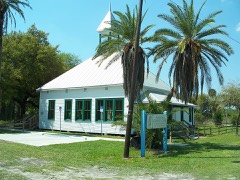
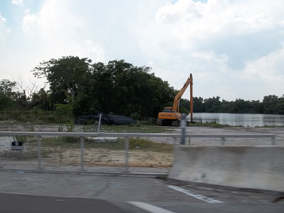
Photograph of Menge-Hansen Marine Ways
Photograph by Ebyabe, CC BY-SA 3.0. Via Wikimedia Commons.

Menge-Hansen Marine Ways

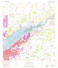
Listed on the National Register of Historic Places in 2009. 7 historic topographic surveys show this location, the earliest from 1956.

From the record

“Menge-Hansen Marine Ways is a national historic site located at 5605 Palm Beach Boulevard, Fort Myers, Florida in Lee County. It is a shipyard on the Orange River built in the 1880s.”

Wikipedia article Menge-Hansen Marine Ways, CC BY-SA 4.0.

One of 50 National Register listings published here for Lee County · listed in 2009 · category: Building.

Sources: the Wikipedia article · the case file at the National Archives · the National Register database, National Park Service


The listing

  • What is counted as historic. The nomination lists 2 structuress, 1 building, 1 object as contributing to the listing.
  • Address. 5605 Palm Beach Blvd., Fort Myers, 33905
  • When was it listed? September 2009
  • Category. building
  • Census division. Fort Myers
  • National Register reference number. 09000670 - the number the National Park Service assigned this property when it was listed, and the key its nomination file is catalogued under at the National Archives.

Fires near this property

337 since 1992

Regional context, not property-specific evidence. The federal wildfire occurrence database lists 337 fires within 5 miles of Menge-Hansen Marine Ways between 1992 and 2020, burning about 2,076 acres in total. 92 started naturally. 15 were recorded as arson. Distance is straight-line from the map coordinates, so a fire counted here may appear on a neighbouring settlement's page as well.

Reported cause Fires
Natural92
Railroad operations and maintenance82
Missing data/not specified/undetermined51
Debris and open burning30
Equipment and vehicle use22
Recreation and ceremony18
Arson/incendiarism15
Misuse of fire by a minor12
Power generation/transmission/distribution6
Smoking4
Other causes3
Fireworks2

The most recent of them, most recent first, with the day each was reported and the service that recorded it.

DateCause SizeReported by Name on the report
9 September 1994Naturalunder an acreFlorida Forest Servicenot named
27 September 2006Debris and open burningunder an acreFlorida Forest Service36/0506-NOV
27 September 1993Natural20 acresFlorida Forest Servicenot named
25 September 1993Railroad operations and maintenanceunder an acreFlorida Forest Servicenot named
2 September 2009Naturalunder an acreFlorida Forest Service36/THE HUNTER FIRE
10 September 1992Naturalunder an acreFlorida Forest Servicenot named
27 August 2014Natural2.0 acresFlorida Forest ServicePOWERLINE (36)
23 August 2000Natural22 acresFlorida Forest Servicenot named

Every fire recorded in Lee County

Storms near this property

20 since 1993

Regional context, not property-specific evidence. The National Weather Service names Fort Myers, the town this property stands in, in 20 storm reports between 1993 and 2022: 8 thunderstorm wind, 8 hail, 3 lightning, 1 funnel cloud. The reports record 2 deaths and 1 injury. Each account below is quoted exactly as the forecast office filed it, from the NOAA Storm Events Database, and each date opens the federal record of that event.

WhenEvent Place namedHarm What the report says
June 2017LightningFort Myers1 killed, 1 hurtLocal broadcast media reported that a 9 month pregnant woman was struck by lightning in a neighborhood in Fort Myers. She was transported to a local hospital. After arriving at the hospital, doctors delivered the baby. After a few weeks in intensive care, the child passed away. The mother was eventually released from the hospital and is back home recovering from her injuries.
September 2007LightningFort Myers1 killedA 53-year-old man was struck by lightning while standing on a pier on the Caloosahatchee River near Freemont Street. He was taken to the hospital and died the next day.
March 1993Thunderstorm WindFort Myers$5,000,000Page Field Airport measured a wind gust to 59 mph at 0302 EST. Traffic signals and signs were blown down in San Carlos, with damage to homes and business buildings in Cape Coral and North Fort Myers. Southwest Florida Regional Airport recorded a gust to 69 mph at 0303 EST.
September 2022LightningFort Myers$50,000Social media video depicted damage at Forest Lake Town Homes caused by a lightning strike downing a tree onto one of the buildings.
April 1993Thunderstorm WindFort Myers$50,000High winds caved in a hangar door at Page Field (FMY) damaging an EMS helicopter. Several nearby residences received minor wind damage.
June 2019Thunderstorm WindNorth Fort Myers$10,000Images were posted to social media of a tree down on a fence and home in North Fort Myers.
June 2010Thunderstorm WindNorth Fort Myers$3,000Minor roof damage occurred to the Kings Way Christian Center in North Fort Myers.
July 1995Thunderstorm WindFort Myers$2,000Thunderstorm winds of 45 to 50 mph downed a half dozen trees and a few power lines near U.S. Highway 41 and College Parkway in the Villas section of Fort Myers.
June 2019Funnel CloudFort Myers-Television stations showed video of a long lived funnel cloud over Fort Myers. There were no reports of a touchdown.
June 2019Thunderstorm WindNorth Fort Myers-Video of a few downed trees and numerous branches three inches in diameter ripped from trees.
May 2011HailFort Myers-A trained spotter reported half-dollar sized hail just south of Colonial Boulevard on Six Mile Cypress Parkway.
May 2011HailFort Myers-A ham radio operator reported half-dollar sized hail on Dupree Street in Fort Myers.
May 2009HailFort Myers-Quarter size hail was reported on Interstate 75 near mile marker 136.
May 2007HailFort Myers-A trained spotter reported quarter size hail in the Gateway subdivision.
May 2007HailFort Myers-Numerous reports of nickel to quarter size hail were received.
July 2007HailNorth Fort Myers-Penny size hail was reported near the Edison Bridge near Oak Street and 7th Way.
July 2007HailNorth Fort Myers-Quarter size hail was reported near Bay Shore and Business Highway 41.
June 1994Thunderstorm WindFort Myers-Wind gusts of 58 mph was observed at Regional Southwest Airport.
January 1993Thunderstorm WindFort Myers-Strong thunderstorm winds downed trees in North Fort Myers.
August 1993HailFort Myers-Quarter-size hail fell.

Every storm recorded in Lee County

Maps showing this location

7 surveys

United States Geological Survey topographic sheets whose coverage includes this point. Matched by taking the coordinate the National Park Service records for this property, then testing that coordinate against the published boundary of every sheet.

Listed places nearby

6 within 8 miles

Other National Register properties close enough to walk or drive between, ordered by distance from this one. Both positions come from the same geocoding pass that matched these properties to their map sheets.

Photograph PropertyDistance Listed
Tice Grammer School2.0 miles1999
Terry Park Ballfield3.6 miles1995
Buckingham School4.1 miles1989
Dean Park Historic Residential District4.6 miles2013
Paul Lawrence Dunbar School4.7 miles1992
Gilmer Heitman House4.9 miles1996

Sources for this property

National Archives recordThe nomination case file for reference 09000670 in Record Group 79.
Wikipedia articleCommunity-written account of this property, licensed CC BY-SA.
Lee CountyAll 50 listed properties in this county.

Provenance

  • Listing record. National Park Service National Register of Historic Places, listed-properties dataset, current to 2026-05-22.
  • Map join. Address geocoded through the United States Census geocoder, then tested against the published boundary of every sheet in the USGS Historical Topographic Map Collection.
  • How this page is made. Listing fields come from federal records; map-sheet coverage is a labelled coordinate-to-boundary calculation, not a source-field claim.
  • Wildfire. Short, Karen C. 2022. Spatial wildfire occurrence data for the United States, 1992-2020 [FPA_FOD_20221014]. 6th Edition. Fort Collins, CO: Forest Service Research Data Archive. https://doi.org/10.2737/RDS-2013-0009.6 Collected with United States Government funding and usable without additional permissions or fees.
  • Storms. NOAA National Centers for Environmental Information, Storm Events Database https://www.ncei.noaa.gov/stormevents/ A work of the United States government, no copyright under 17 U.S.C. 105. Narratives are quoted verbatim from the National Weather Service report and are not edited or summarised.