 Block
From the record
4 National Register listings published here.
Sources: the National Register database, National Park Service
35 topographic sheets and 6 fire insurance atlases across 1 place.
4 National Register listings published here.
Sources: the National Register database, National Park Service
Taken for the Office of War Information and the Farm Security Administration, who photographed the country between 1935 and 1944. Works of United States government photographers, with no known restriction on use. Each opens its catalogue record.

Every property in this county listed on the National Register of Historic Places, with the year it was listed and the federal nomination document.
| Photograph | Property | Type | Listed | Reference |
|---|---|---|---|---|
 | Butts County Courthouse | building | 1980 | 80000982 |
 | J. R. Carmichael House | building | 1977 | 77000411 |
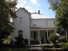 | Idlewilde | building | 1999 | 99000293 |
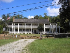 | Indian Springs Hotel | building | 1973 | 73000612 |
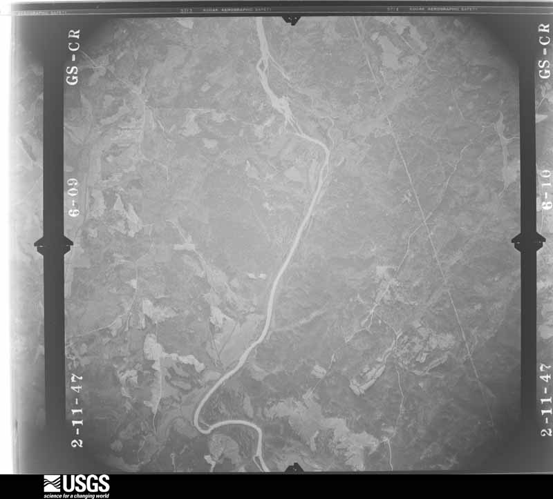
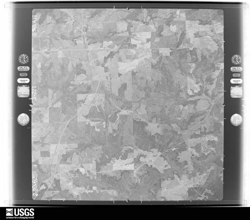
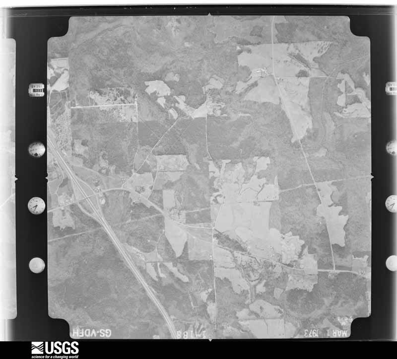
Flown by the U.S. Geological Survey between 1937 and 1989, the Aerial Photo Single Frames collection is the definitive mid-century view of the land: fields, roads and rivers as the camera saw them. The Survey holds 660 frames inside the rectangle that bounds this county; the 36 frames below were taken over the county itself, chosen across the decades of flights (at most four a year from that rectangle), so one flight cannot crowd out the rest. The full set is free to browse and download at EarthExplorer under the dataset Aerial Photo Single Frames.

































The thermometers that kept this county's weather, and the gages that measured the flow of its streams, as the federal records hold them. The extremes below are measured values from those records, not estimates.
Who lived here in 1950, one enumeration district at a time, as the Census Bureau described each district. Each row opens its official National Archives result, with Population Schedules and ED Maps available there.
Every wildfire the federal occurrence database records inside this county: 499 of them, burning about 1,607 acres. 16 started naturally and 30 were recorded as arson. Each settlement page carries the fires within five miles of it.
| Reported cause | Fires |
|---|---|
| Debris and open burning | 269 |
| Equipment and vehicle use | 39 |
| Missing data/not specified/undetermined | 37 |
| Smoking | 34 |
| Arson/incendiarism | 30 |
| Misuse of fire by a minor | 29 |
| Railroad operations and maintenance | 27 |
| Recreation and ceremony | 18 |
| Natural | 16 |
The five largest, by the area the report gives. None of them was recorded as arson.
| Date | Cause | Size | Reported by | Name on the report |
|---|---|---|---|---|
| 4 July 1993 | Natural | 72 acres | Georgia Forestry Commission | not named |
| 23 March 2007 | Debris and open burning | 70 acres | Georgia Forestry Commission | not named |
| 22 October 2016 | Recreation and ceremony | 50 acres | Georgia Forestry Commission | FY2017-BUTTS-004 |
| 24 November 2005 | Missing data/not specified/undetermined | 48 acres | Georgia Forestry Commission | not named |
| 9 April 1999 | Debris and open burning | 47 acres | Georgia Forestry Commission | not named |
| 14 March 1996 | Railroad operations and maintenance | 41 acres | Georgia Forestry Commission | not named |
| 22 March 2017 | Debris and open burning | 40 acres | Georgia Forestry Commission | FY2017-BUTTS-021 |
| 27 February 2011 | Debris and open burning | 33 acres | Georgia Forestry Commission | FY2011-BUTTS-006 |
Every settlement page carries the fires within five miles of it - see the settlement index below.
The NOAA Storm Events Database holds 172 reports for this county, causing 3 deaths, 11 injuries and about $3,139,800 in recorded property damage. Each settlement page carries the reports that name it.
| Kind of event | Reports |
|---|---|
| Thunderstorm Wind | 108 |
| Hail | 41 |
| Tornado | 12 |
| Lightning | 5 |
| Flash Flood | 3 |
| Winter Storm | 2 |
| Flood | 1 |
The most serious of them, by death, then injury, then recorded damage. The accounts are quoted exactly as the forecast office filed them.
| When | Event | Place named | Harm | What the report says |
|---|---|---|---|---|
| April 2011 | Thunderstorm Wind | Jenkinsburg | 2 killed, $200,000 | The Butts County Emergency Management Director reported that over 100 trees were down across the entire county. One large tree fell on a home on Seventh Street in Jackson killing a 34-year old man along with his 4-year old son. In addition to the widespread tree damage, the side of an outbuilding near Stark suffered significant damage when one side was blown away. |
| January 2023 | Tornado (EF2) | Jenkinsburg | 1 killed, 10 hurt | Radar data, areal surveys and ground surveys confirm that a long track EF2 tornado occurred beginning a few miles east of Griffin GA through Butts, Newton and into Jasper counties. The tornado was part of a larger mesocyclone which can be traced west all the way back to the Selma Alabama tornado which spawned numerous tornadoes during its lifecycle. This particular tornado first touched down in an area around Crouch road and Wild Plum Road snapping and uprooting trees. The tornado struck a Rinai building causing damage to the roof, windows and outside walls. The tornado continued northeast snapping and uprooting trees quickly intensifying as it crossed hwy 19 becoming and EF2. Widespread tree damage was noted along S. McDonough Road and Walnut Grove Road north of Hwy 16. A well built home sustained significant roof and structure damage consistent with high end EF2 winds. The tornado continued northeast crossing High Falls Road, N. Walkers Mill Road, Yamacraw road snapping and uprooting trees consistent with EF1 damage. As the tornado continued northeast, it became the dominant circulation within the larger mesocyclone as the previous Griffin tornado began to occlude within the large circulation. The tornado crossed Jackson road and paralleled Jenkinsburg road before crossing I75 near Jenkinsburg Road. Snapped and uprooted trees were noted along both sides of I75 where the tornado crossed. As the storm became the dominant circulation within the mesocyclone, the wind field expanded and the damage became fairly consistent with high end EF1 to low EF2 thereafter. The tornado crossed Locust Road, Dean Patrick Road and England Chapel Road were numerous trees were snapped and uprooted. Some home damage was noted in the area as well, particularly as it approached Shiloah Road. Several homes were damaged along Plaza Dr and Smith Dr. The tornado continued NE crossing Hwy 23 striking a large warehouse. Severe roof and exterior wall damage was noted as debris was spread across the highway and to the NE of the hwy. As the tornado crossed the highway it struck a train on the tracks and overturned 3 rail cars just west Walter Moore Rd. The storm continued northeast crossing Wolf Creek Road snapping and uprooting trees near several homes consistent with EF1 wind damage. The tornado continued northeast crossing Rising Star Church road and Brown road snapping and uprooting trees. As the storm continued northeast beyond this point, the remnant circulation which last produced damage near Locust Grove regenerated a new tornado a little over a mile to the northwest along Fincherville Road. The two tornadoes would continue to the NE nearly parallel through the Jackson Lake area. This particular tornado continued northeast and would intensify to EF2 as it crossed Hwy 36 north of Keys Ferry Road and Haley Road. The fatality and critical injury directly associated with this tornado occurred along Haley Road when a tree fell onto a vehicle injuring the driver and fatally wounding a passenger. EF2 damage was noted East of hwy36 along Haley Road, Pocahontas St. Chickasaw lane and several neighborhoods along the lake. The tornado crossed into Southern Newton County causing severe damage along Parker Road, Ray Road, Malcom Rd, Quarry Ct, Pebble Ridge Dr, Hunters Trace, Campbell Rd and Hwy 212 as it entered Jasper County near the Franks Restaurant. EF1 to low end EF2 damage was intermittent along Yancy Rd, Dallas Tr, Gem Lane, Lees Cove, Alcovy N. Dr, Rainbow Dr and County Line Road. The Bear Creek Marian was destroyed and several campers were destroyed. The storm continued NE crossing Henderson Mill Road snapping and uprooting trees, County line Trail and Hwy 11 before weakening and lifting as it approached Margery Lake. A second fatality was resulted the following day when a lineman was knocked out of a bucket truck in Jasper County after being struck by a large tree branch while attempting to restore powerlines. The fatality, is considered indirect but will be tied to this particular tornado. Widespread wind damage can be seen via areal survey and ground survey throughout northern Butts, Southern Newton and Western Jasper counties and surveying this particular storm was a challenge to discern where the tornado actually ended and where the severe wind damage started. The path width is an approximation based on the most severe damage swaths which were surveyed however, strong inflow winds occurred for much of the lifecycle of this tornado making a very wide swath of damage along its 30+ mile long path. |
| November 2002 | Thunderstorm Wind | Jenkinsburg | 1 hurt, $450,000 | The Butts county Emergency Management Director and the local newspaper, the Jackson Progress Argus, reported that extensive damage occurred to five homes and two apartment buildings. Two of the structures had the roofs removed. However, most of the damage was the result of downed trees. on the structures. Numerous trees and several power lines were also blown down. One tree fell on the city's new dump truck causing damage. The Jackson Progress Argus newspaper reported that the city of Jenkinsburg not only suffered substantial property loses, but also lost some of its most prized hardwood trees that had graced the city streets for over 100 years. These trees were uprooted and blown down on homes, barns (including a one year-old workshop) up and down Oak Street, one of the most historic streets in Jenkinsburg. Most of the storm damage occurred within a one mile square area within town. Several residents of the apartment buildings had to be moved to temporary shelters. One eight year-old girl at the Miller apartments was injured by debris and had to be taken to a local hospital. Several others received bruises and scratches from the storm debris. The governor declared Butts county to be in a state of emergency. |
| June 2009 | Thunderstorm Wind | Fincherville | $550,000 | The Butts County Emergency Management Director reported that an apparent thunderstorm downburst or microburst caused extensive damage to trees, power lines, and property in the northeastern part of the county from the Henry county line, just northwest of Fincherville to the south side of Lake Jackson along the Butts/Jasper county line. At least 40 trees were down along this path. Some of the most significant damage occurred near the intersection of Georgia Highway 36 and Barnetts Bridge Road, where a number of trees and power lines were down and one home in the area suffered major damage. A total of six homes sustained damage, two of which were severely damaged and four others sustained moderate damage. |
| November 2010 | Tornado (EF0) | Jenkinsburg | $250,000 | A damage survey conducted by the National Weather Service Forecast office in Peachtree City, Georgia confirmed that a second, weaker EF0 tornado touched down within the same quasi-linear convective system that spawned the EF2 tornado in Gwinnett county. This tornado originated in extreme western Butts county approximately four miles southwest of Jenkinsburg, crossed very briefly into extreme eastern Henry county, before crossing back into extreme western Butts county and then lifting immediately thereafter. The tornado had a total path length of 2.5 miles, mostly in Butts county. The maximum path width was determined to be 50 yards with maximum wind gusts estimated at 80 mph. Within Butts county four homes were damaged and at least 200 trees were blown down or uprooted along the path of the tornado. Several outbuildings were damaged or destroyed, including six storage buildings blown across U.S. Highway 23. |
| February 2009 | Hail | Fincherville | $240,000 | The Butts County Emergency Management Director reported nickel to golf ball-sized hail across northern and northeastern Butts county. Nickel-sized hail was observed near Worthville and golf ball-sized hail further southeast toward the Jasper county line. Half-dollar-sized hail was observed near Lake Jackson. |
| March 2008 | Hail | Jackson | $200,000 | The Butts County Sheriff's observed golf ball-sized hail in western Jackson county near Interstate-75. The public observed half-dollar-sized hail in southeast Butts county near Flovilla. Radar supported half this large or larger tracked across much of western and southern Butts county. |
| August 2010 | Lightning | Jackson | $150,000 | The Jackson Progress Argus reported that lightning struck a home on First Street near downtown Jackson. The structure sustained major fire and smoke damage as a result of the lightning strike. |
| March 2008 | Tornado (EF0) | Towaliga | $150,000 | An aerial survey conducted by the National Weather Service Forecast Office in Peachtree City, GA in cooperation with the Georgia State Patrol confirmed that an EF0 tornado touched down in southwest Butts county and made a three mile track across southern Butts county. The tornado touched down near the intersection of Joe Land Road and Kinards Mill Road and lifted near the intersection of Brooks Road and Nathan Thaxton Road. The path length was between three and four miles long. The Emergency Management Director reported that 136 homes suffered minor damage. In addition, one barn was destroyed and many trees were blown down along the path of the tornado. The combination of the high winds and quarter-sized hail caused the siding and paint on several homes to be damaged. |
| May 2003 | Lightning | Jenkinsburg | $150,000 | The Butts county 911 center reported that lightning struck a home. The home was set on fire and completely destroyed. |
| June 2014 | Thunderstorm Wind | Jackson | $120,000 | The Butts County Emergency Manager reported numerous trees down in Jackson. Two or three trees fell on a house and a large limb fell on a fire station awning. |
| June 2010 | Thunderstorm Wind | Jenkinsburg | $50,000 | The Butts County Emergency Management Director reported that an apparent thunderstorm downburst from a small, yet severe thunderstorm had downed nearly a dozen trees approximately two miles west-southwest of McKibben in the western part of Butts county. Most of the damage was near the junction of Interstate-75 and Georgia Highway 16. Several trees were down on homes on Caldwell Road causing two homes to sustain minor roof damage. The porch was ripped off one home on Caldwell Road as well. |
| April 2008 | Thunderstorm Wind | Jenkinsburg | $50,000 | The Butts County Emergency Management Director reported that more than 12 trees were blown down in the northern part of the county, generally between Georgia Highway 16, 42, and 36. A tree fell on a home on England Chapel Road in the Jenkinsburg area causing damage to the structure. Several trees were also down near the Jasper and Newton county lines in the east and northeast part of the county. There seemed to be a concentrated area of tree damage along Georgia Highway 36 northeast of Jackson toward the Newton county line. All together, more than 12 trees had been blown down. A couple of roads were also blocked by downed trees as well. |
| March 2018 | Thunderstorm Wind | Jackson | $40,000 | The Butts County Emergency Manager reported numerous trees blown down across the northern end of the county from the city of Jackson up Stark Road to Keys Ferry Road. |
| September 2011 | Thunderstorm Wind | Worthville | $35,000 | FOX 5 Television of Atlanta relayed a report of strong thunderstorm downburst winds that caused damage in the Lake Jackson area in the far eastern part of Butts county along the Jasper county line. Several large trees and power lines were down with at least one tree on the home with roof damage. |
| April 2019 | Thunderstorm Wind | Towaliga | $30,000 | Reports were received from amateur radio operators and the local media of trees and power lines blown down from near the Highway 16 and I-75 interchange to north of Jackson along Old Bethel Road near Rising Star Church Road. |
| April 2011 | Tornado (EF0) | Cork | $30,000 | A damage survey conducted by the National Weather Service Forecast Office in Peachtree City, Georgia confirmed that the tornado, which originated in southeast Pike county, strengthened to an EF3 and tracked across central Lamar resulting in extensive structural damage and two fatalities, then into northern Monroe county as an EF2, also causing extensive structural damage, weakened to an EF0 and briefly moved into extreme southeast Butts county before finally lifting. The tornado was in Butts county only about 1/2 mile. Damage within Butts county was confined to several downed trees in the area. One structure within Butts county suffered major damage along this final segment of the tornado's path.||[04/27-04/28/11: Tornado #12, County #4-4, EF3, Pike-Lamar-Monroe-Butts, 2011:021]. |
| April 2009 | Thunderstorm Wind | Jackson | $30,000 | The Butts County Emergency Management Director reported that many trees were down across the county. A tree was down on a home on Georgia Highway 16 causing damage to the structure. |
| July 2003 | Thunderstorm Wind | Cork | $30,000 | The Jackson News Argus reported that a large 150 year-old Red Oak tree was uprooted during a thunderstorm. The tree fell on a 1992 Buick, destroying the vehicle, and also caused damage to the garage and part of the house. A cat, hiding underneath the vehicle, was also killed during the event. |
| November 2014 | Tornado (EF0) | Jackson Flying H Arp | $25,000 | A NWS storm survey team found that the EF-1 tornado that touched down in Lamar County crossed into southwest Butts County along Bucksnort Road near Interstate Highway 75. The tornado moved northeast across Butts County for just over 16.5 miles before crossing the South River on the upper reaches of Lake Jackson into Newton County. Maximum wind speeds were around 95 MPH with mainly damage to trees. Numerous hardwood and softwood trees were snapped or uprooted. Small outbuildings near the intersection of Cooper Road and State Highway 36 suffered the loss of roof panels. [11/23/14: Tornado #8, County #2-3, EF1, Lamar-Butts-Newton, 2014:025]. |
| February 2008 | Lightning | Jackson | $25,000 | The public reported that lightning struck a home causing damage to the structure. A portion of an outside wall was ripped apart and wires in the electrical circuit breaker box were charred. However, the structure did not sustain any fire or smoke damage. |
| June 2005 | Flash Flood | Jackson | $25,000 | The Butts County Emergency Management Director reported that a persistent cluster of thunderstorms had resulted in the washout of one road. Several streams and creeks in the area had overflowed their banks as well. |
| July 2017 | Thunderstorm Wind | Jenkinsburg | $20,000 | The Butts County 911 center reported that part of the metal roof on an apartment building on England Chapel Road in Jenkinsburg was blown off and a large tree was blown down northwest of Jackson on Paul Mattox Road near Brookwood Avenue. |
| May 2021 | Thunderstorm Wind | Flovilla | $15,000 | The Butts County Emergency Manager reported several trees blown down around the city of Flovilla. One tree fell onto a vehicle. |
| February 2020 | Thunderstorm Wind | Jackson | $15,000 | The Butts County Emergency Manager reported over a dozen trees blown down across the county from southwest of Jackson to through northeast of Jackson. |
| July 2011 | Thunderstorm Wind | Jenkinsburg | $15,000 | The public reported that a roof was blown off a barn and a chimney was blown off a house on Maple Drive in Jenkinsburg in extreme west central Butts county. |
| July 2025 | Thunderstorm Wind | Pepperton | $10,000 | Tree reported down through the roof of a home on Harper St. |
| June 2017 | Thunderstorm Wind | Jackson | $10,000 | A National Weather Service survey team determined that straight-line winds caused minor shingle damage to the roof of a funeral home and blew down a large limb in the parking lot of the business. An Oak tree was also blown down around 50 yards east of the funeral home across Old Griffin Road. No injuries were reported. |
| March 2013 | Thunderstorm Wind | Towaliga | $10,000 | The Butts County Emergency Manager reported that numerous trees and power lines were blown down county wide. Tree damage was especially heavy near Flovilla. |
| June 2010 | Thunderstorm Wind | Jackson | $10,000 | The Butts County Emergency Management Director reported that more than a dozen trees were down in the eastern part of the county, east of Jackson southward toward Flovilla. Several roads around Flovilla were blocked by downed trees and had to be closed. Roads affected included Higgins Road, Riley Road, and Pratt Smith Road in the Pine View subdivision, as well as Georgia Highways 16 and 42. |
| December 2009 | Thunderstorm Wind | Jackson | $10,000 | The Butts County 911 Center reported that a few trees were down north of Jackson. One of the trees fell on a vehicle. No injuries were reported. |
| July 2008 | Thunderstorm Wind | Jackson | $10,000 | The Butts County Emergency Management Director reported that up to 10 trees were blown down, mainly across the eastern portion of the county. A tree was down on a home on Old Hardy Farm Road and another tree was blown onto railroad tracks between Jackson and Flovilla. |
| June 2002 | Thunderstorm Wind | Jackson | $10,000 | The Butts county 911 center reported that numerous trees and several power lines had been blown down. |
| August 2020 | Thunderstorm Wind | Worthville | $8,000 | The Butts County Emergency Manager reported a few trees blown down along and near Highway 36 from Jackson northeast to the near the county line. |
| June 2016 | Thunderstorm Wind | Worthville | $8,000 | The Butts County Emergency Manager reported several trees blown down across the county from northern half into the southeastern portion. |
| July 1997 | Thunderstorm Wind | Flovilla | $7,000 | Several trees were knocked down, one falling on a car. |
| April 2016 | Thunderstorm Wind | Flovilla | $6,000 | The public reported several trees blown down in the Flovilla community. |
| April 1997 | Thunderstorm Wind | Jackson | $6,000 | no account filed |
| May 2025 | Thunderstorm Wind | Stark | $5,000 | Emergency manager reported several trees down along Halls Bridge Rd, between Stark Rd and Singley Rd. |
| July 2025 | Thunderstorm Wind | Stark | $5,000 | Multiple trees and power lines reported down, blocking the road on Scout Island Rd near Jackson Lake. |
| June 2021 | Thunderstorm Wind | Jenkinsburg | $5,000 | The Butts County Emergency Manager reported several trees blown down around the intersection of England Chapel Road and County Line Road. |
| January 2020 | Thunderstorm Wind | Towaliga | $5,000 | The Butts County Emergency Manager reported several trees blown down in the McKibben area from around the intersection of Highway 16 and I-75 to English Chapel Road. |
| August 2020 | Thunderstorm Wind | Towaliga | $5,000 | The Butts County Emergency Manager reported around a half of a dozen trees blown down in the southwestern portion of the county along High Falls Road between Kinard Mill Road and Sims Road. |
| July 2017 | Thunderstorm Wind | Worthville | $5,000 | The Butts County 911 center reported several trees blown down along Highway 36 including near Keys Ferry Road. |
| June 2013 | Thunderstorm Wind | Mcmichael Crossroads | $5,000 | The Butts County Emergency Manager reported at least 14 trees down on roadways north of Jackson. Power lines were down as well. |
| August 2010 | Lightning | Stark | $5,000 | The Jackson Progress Argus reported that lightning struck a home on Halls Bridge Road, which happened to be the home of the Butts county sheriff. Only minor damage was reported to the structure. |
| March 2005 | Thunderstorm Wind | Countywide | $5,000 | The Butts County Sheriff reported that several trees were down across roads throughout the county. |
| July 1999 | Thunderstorm Wind | Indian Spgs | $5,000 | A newspaper account indicated thunderstorm winds knocked trees down at the Indian Springs State Park. The trees damaged a bridge and playground equipment. |
| May 1998 | Thunderstorm Wind | Indian Spgs | $5,000 | Police and rescue units reported trees knocked down across the county. There were reports of funnel clouds and 3 tornado touchdowns, but no confirmation. |
| March 1997 | Thunderstorm Wind | Jackson | $5,000 | no account filed |
| January 2020 | Thunderstorm Wind | Pepperton | $4,000 | The Butts County Emergency Manager reported trees blown down near the intersection of Highway 36 and East Ball Road. |
| May 2017 | Thunderstorm Wind | Towaliga | $4,000 | The Butts County Emergency Manager reported trees blown down on Highway 16 just east of I-75, on High Falls Road and on Levi Barnes Road. |
| June 2010 | Thunderstorm Wind | Fincherville | $4,000 | The Butts County Emergency Management Director reported that 20 trees were down in the vicinity of Haley Road near Worthville. |
| July 1997 | Thunderstorm Wind | Jackson | $3,000 | Several trees were knocked down and power lines were snapped by thunderstorm winds. |
| May 1969 | Tornado (F2) | not stated | $2,500 | no account filed |
| August 2023 | Thunderstorm Wind | Worthville | $2,000 | Emergency Manager reported two trees down near the Butts and Newton county line. |
| March 2017 | Thunderstorm Wind | Worthville | $2,000 | The Butts County 911 center reported a tree blown down onto power lines along Southern Shores Road. |
| July 2016 | Thunderstorm Wind | Stark | $2,000 | The Butts County 911 center reported multiple trees blown down along Highway 36 near Stark. |
| April 2009 | Thunderstorm Wind | Jackson | $2,000 | The Butts County Emergency Management Director reported that at least 10 trees were down in the far southern portion of the county, south of Indian Springs near the Monroe county line. |
| June 2009 | Thunderstorm Wind | Jenkinsburg | $2,000 | The Butts County 911 Center reported that at least six trees were down scattered about the county from northwest to southeast. |
Named settlements recorded in the Geographic Names Information System, each with the topographic sheets covering it. Villages, hamlets and abandoned places alike. Each is shown with the nearest named watercourse or landform and the survey quadrangle it falls on. The 1 place that was also surveyed for fire insurance comes first, with the number of atlases and photographs held for them.
Jackson census division · 30233 · On Watson Creek · Jackson quadrangle
12 sheets, 1953 to 1988
Fire insurance: 6 atlases
Jackson census division · 30233 · Jackson quadrangle
12 sheets, 1953 to 1988
No longer a settlement
Flovilla census division · 30216 · On Little Sandy Creek · Berner quadrangle
14 sheets, 1951 to 1988
Southwest Butts census division · 30233 · High Falls quadrangle
11 sheets, 1951 to 1979
No longer a settlement
Flovilla census division · 30216 · On Aboothlacoosta Creek · Jackson quadrangle
12 sheets, 1953 to 1988
Flovilla census division · 30216 · On Aboothlacoosta Creek · Indian Springs quadrangle
14 sheets, 1951 to 1988
Flovilla census division · 30233 · Jackson quadrangle
12 sheets, 1953 to 1988
Flovilla census division · 30216 · On Douglas Creek · Indian Springs quadrangle
14 sheets, 1951 to 1988
Southwest Butts census division · 30233 · On Cabin Creek · High Falls quadrangle
11 sheets, 1951 to 1979
No longer a settlement
Worthville census division · 30233 · On Baker Branch · Worthville quadrangle
11 sheets, 1953 to 1988
The vanished settlements of Butts County: the places named above that are no longer on the map.
12 topographic sheets and 6 fire insurance atlases, 1895 to 1941
The complete index, with nothing left out. Each of these is a separate record with its own page: a federal survey report, or the case file that argued a property on to the National Register. Both are public domain and reproduced word for word.
The vanished settlements of Butts County, the places these records name that are no longer on the map.