 Block
Jenkinsburg, Georgia
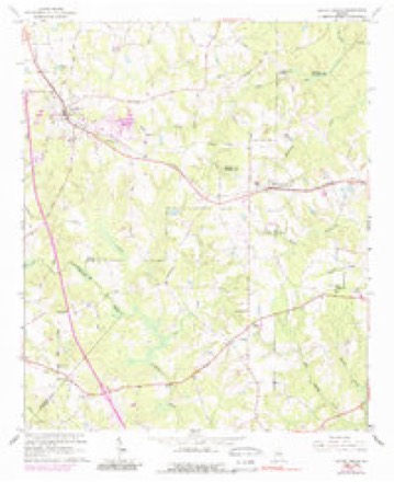
10 topographic sheets cover this place, the earliest surveyed in 1953 and the latest in 1979. It stands in the Jenkinsburg census division. It lies in ZIP code area 30234. The Survey maps it on the Locust Grove quadrangle. 391 people lived here at the 2020 count. It stands 764 feet above sea level.
On record in Jenkinsburg
Buildings and businesses the archive holds for this place. Each opens its own page, with the source record it came from.
Surveyed buildings and structures 1 record
- Butts County Road 230 Bridge, Spanning Indian Creek on County Road 230, Jenkinsburgfederal building survey, 3 photographs
Population over time
2 figuresJenkinsburg grew from 370 to 391 between 2010 and 2020. These are the recorded population figures Wikidata holds for this place, reached through the Geographic Names Information System number this page is keyed on rather than by name, so they belong to this place and not to another of the same name. Most are census counts, but not all are: an early figure may be a founding or settlement estimate, and an estimate published within five years of a census is left out. The change column is computed, and is left blank where more than 20 years separate a figure from the one before it, because a gap that long is not a change between two counts.
| Year | People | Change |
|---|---|---|
| 2010 | 370 | |
| 2020 | 391 | +21 (+6%) |
Topographic sheets covering this place
5 surveys from 10 printed sheetsMatched by testing this settlement's coordinate against the published boundary of every sheet in the United States Geological Survey's historical collection. Each opens the scanned sheet at the Survey.
- 1953 USGS Atlanta quadrangle1:250000, 2 printings
- 1957 USGS Atlanta quadrangle1:250000
- 1958 USGS Atlanta quadrangle1:250000
- 1964 USGS Locust Grove quadrangle1:24000, 3 printings
- 1979 USGS Griffin quadrangle1:100000, 3 printings




Photographs
1 photograph,Taken for the Office of War Information and the Farm Security Administration, who photographed the country between 1935 and 1944. Works of United States government photographers, with no known restriction on use. Each opens its catalogue record.
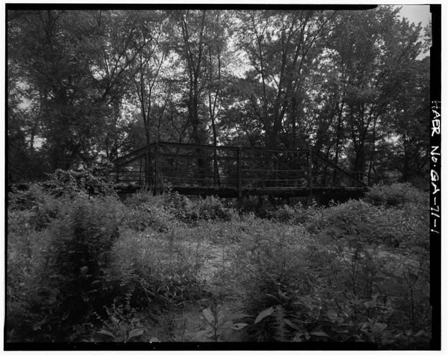
Photographer not recorded. Library of Congress
Fires near this place
203 since 1992Regional context, not property-specific evidence. The federal wildfire occurrence database lists 203 fires within 5 miles of Jenkinsburg between 1992 and 2020, burning about 498 acres in total. 6 started naturally. 19 were recorded as arson. Distance is straight-line from the map coordinates, so a fire counted here may appear on a neighbouring settlement's page as well.
| Reported cause | Fires |
|---|---|
| Debris and open burning | 96 |
| Missing data/not specified/undetermined | 21 |
| Arson/incendiarism | 19 |
| Smoking | 18 |
| Equipment and vehicle use | 17 |
| Misuse of fire by a minor | 17 |
| Natural | 6 |
| Recreation and ceremony | 5 |
| Railroad operations and maintenance | 4 |
The most recent of them, most recent first, with the day each was reported and the service that recorded it.
| Date | Cause | Size | Reported by | Name on the report |
|---|---|---|---|---|
| 6 September 1997 | Debris and open burning | under an acre | Georgia Forestry Commission | not named |
| 25 September 2008 | Equipment and vehicle use | 6.7 acres | Georgia Forestry Commission | not named |
| 24 September 2011 | Missing data/not specified/undetermined | 5.2 acres | Georgia Forestry Commission | FY2012-HENRY-007 |
| 23 September 2005 | Debris and open burning | under an acre | Georgia Forestry Commission | not named |
| 20 September 1997 | Debris and open burning | under an acre | Georgia Forestry Commission | not named |
| 13 September 2019 | Debris and open burning | under an acre | Georgia Forestry Commission | FY2020BUTTS001 |
| 12 September 2005 | Debris and open burning | under an acre | Georgia Forestry Commission | not named |
| 12 September 2003 | Equipment and vehicle use | 1.0 acres | Georgia Forestry Commission | not named |
Settlements close enough to share some of these fires:
Storms near this place
26 since 1999Regional context, not property-specific evidence. The National Weather Service names Jenkinsburg in 26 storm reports between 1999 and 2025: 16 thunderstorm wind, 5 tornado, 4 hail, 1 lightning. The reports record 3 deaths and 11 injuries. Each account below is quoted exactly as the forecast office filed it, from the NOAA Storm Events Database, and each date opens the federal record of that event.
| When | Event | Place named | Harm | What the report says |
|---|---|---|---|---|
| April 2011 | Thunderstorm Wind | Jenkinsburg | 2 killed, $200,000 | The Butts County Emergency Management Director reported that over 100 trees were down across the entire county. One large tree fell on a home on Seventh Street in Jackson killing a 34-year old man along with his 4-year old son. In addition to the widespread tree damage, the side of an outbuilding near Stark suffered significant damage when one side was blown away. |
| January 2023 | Tornado (EF2) | Jenkinsburg | 1 killed, 10 hurt | Radar data, areal surveys and ground surveys confirm that a long track EF2 tornado occurred beginning a few miles east of Griffin GA through Butts, Newton and into Jasper counties. The tornado was part of a larger mesocyclone which can be traced west all the way back to the Selma Alabama tornado which spawned numerous tornadoes during its lifecycle. This particular tornado first touched down in an area around Crouch road and Wild Plum Road snapping and uprooting trees. The tornado struck a Rinai building causing damage to the roof, windows and outside walls. The tornado continued northeast snapping and uprooting trees quickly intensifying as it crossed hwy 19 becoming and EF2. Widespread tree damage was noted along S. McDonough Road and Walnut Grove Road north of Hwy 16. A well built home sustained significant roof and structure damage consistent with high end EF2 winds. The tornado continued northeast crossing High Falls Road, N. Walkers Mill Road, Yamacraw road snapping and uprooting trees consistent with EF1 damage. As the tornado continued northeast, it became the dominant circulation within the larger mesocyclone as the previous Griffin tornado began to occlude within the large circulation. The tornado crossed Jackson road and paralleled Jenkinsburg road before crossing I75 near Jenkinsburg Road. Snapped and uprooted trees were noted along both sides of I75 where the tornado crossed. As the storm became the dominant circulation within the mesocyclone, the wind field expanded and the damage became fairly consistent with high end EF1 to low EF2 thereafter. The tornado crossed Locust Road, Dean Patrick Road and England Chapel Road were numerous trees were snapped and uprooted. Some home damage was noted in the area as well, particularly as it approached Shiloah Road. Several homes were damaged along Plaza Dr and Smith Dr. The tornado continued NE crossing Hwy 23 striking a large warehouse. Severe roof and exterior wall damage was noted as debris was spread across the highway and to the NE of the hwy. As the tornado crossed the highway it struck a train on the tracks and overturned 3 rail cars just west Walter Moore Rd. The storm continued northeast crossing Wolf Creek Road snapping and uprooting trees near several homes consistent with EF1 wind damage. The tornado continued northeast crossing Rising Star Church road and Brown road snapping and uprooting trees. As the storm continued northeast beyond this point, the remnant circulation which last produced damage near Locust Grove regenerated a new tornado a little over a mile to the northwest along Fincherville Road. The two tornadoes would continue to the NE nearly parallel through the Jackson Lake area. This particular tornado continued northeast and would intensify to EF2 as it crossed Hwy 36 north of Keys Ferry Road and Haley Road. The fatality and critical injury directly associated with this tornado occurred along Haley Road when a tree fell onto a vehicle injuring the driver and fatally wounding a passenger. EF2 damage was noted East of hwy36 along Haley Road, Pocahontas St. Chickasaw lane and several neighborhoods along the lake. The tornado crossed into Southern Newton County causing severe damage along Parker Road, Ray Road, Malcom Rd, Quarry Ct, Pebble Ridge Dr, Hunters Trace, Campbell Rd and Hwy 212 as it entered Jasper County near the Franks Restaurant. EF1 to low end EF2 damage was intermittent along Yancy Rd, Dallas Tr, Gem Lane, Lees Cove, Alcovy N. Dr, Rainbow Dr and County Line Road. The Bear Creek Marian was destroyed and several campers were destroyed. The storm continued NE crossing Henderson Mill Road snapping and uprooting trees, County line Trail and Hwy 11 before weakening and lifting as it approached Margery Lake. A second fatality was resulted the following day when a lineman was knocked out of a bucket truck in Jasper County after being struck by a large tree branch while attempting to restore powerlines. The fatality, is considered indirect but will be tied to this particular tornado. Widespread wind damage can be seen via areal survey and ground survey throughout northern Butts, Southern Newton and Western Jasper counties and surveying this particular storm was a challenge to discern where the tornado actually ended and where the severe wind damage started. The path width is an approximation based on the most severe damage swaths which were surveyed however, strong inflow winds occurred for much of the lifecycle of this tornado making a very wide swath of damage along its 30+ mile long path. |
| November 2002 | Thunderstorm Wind | Jenkinsburg | 1 hurt, $450,000 | The Butts county Emergency Management Director and the local newspaper, the Jackson Progress Argus, reported that extensive damage occurred to five homes and two apartment buildings. Two of the structures had the roofs removed. However, most of the damage was the result of downed trees. on the structures. Numerous trees and several power lines were also blown down. One tree fell on the city's new dump truck causing damage. The Jackson Progress Argus newspaper reported that the city of Jenkinsburg not only suffered substantial property loses, but also lost some of its most prized hardwood trees that had graced the city streets for over 100 years. These trees were uprooted and blown down on homes, barns (including a one year-old workshop) up and down Oak Street, one of the most historic streets in Jenkinsburg. Most of the storm damage occurred within a one mile square area within town. Several residents of the apartment buildings had to be moved to temporary shelters. One eight year-old girl at the Miller apartments was injured by debris and had to be taken to a local hospital. Several others received bruises and scratches from the storm debris. The governor declared Butts county to be in a state of emergency. |
| November 2010 | Tornado (EF0) | Jenkinsburg | $250,000 | A damage survey conducted by the National Weather Service Forecast office in Peachtree City, Georgia confirmed that a second, weaker EF0 tornado touched down within the same quasi-linear convective system that spawned the EF2 tornado in Gwinnett county. This tornado originated in extreme western Butts county approximately four miles southwest of Jenkinsburg, crossed very briefly into extreme eastern Henry county, before crossing back into extreme western Butts county and then lifting immediately thereafter. The tornado had a total path length of 2.5 miles, mostly in Butts county. The maximum path width was determined to be 50 yards with maximum wind gusts estimated at 80 mph. Within Butts county four homes were damaged and at least 200 trees were blown down or uprooted along the path of the tornado. Several outbuildings were damaged or destroyed, including six storage buildings blown across U.S. Highway 23. |
| May 2003 | Lightning | Jenkinsburg | $150,000 | The Butts county 911 center reported that lightning struck a home. The home was set on fire and completely destroyed. |
| June 2010 | Thunderstorm Wind | Jenkinsburg | $50,000 | The Butts County Emergency Management Director reported that an apparent thunderstorm downburst from a small, yet severe thunderstorm had downed nearly a dozen trees approximately two miles west-southwest of McKibben in the western part of Butts county. Most of the damage was near the junction of Interstate-75 and Georgia Highway 16. Several trees were down on homes on Caldwell Road causing two homes to sustain minor roof damage. The porch was ripped off one home on Caldwell Road as well. |
| April 2008 | Thunderstorm Wind | Jenkinsburg | $50,000 | The Butts County Emergency Management Director reported that more than 12 trees were blown down in the northern part of the county, generally between Georgia Highway 16, 42, and 36. A tree fell on a home on England Chapel Road in the Jenkinsburg area causing damage to the structure. Several trees were also down near the Jasper and Newton county lines in the east and northeast part of the county. There seemed to be a concentrated area of tree damage along Georgia Highway 36 northeast of Jackson toward the Newton county line. All together, more than 12 trees had been blown down. A couple of roads were also blocked by downed trees as well. |
| July 2017 | Thunderstorm Wind | Jenkinsburg | $20,000 | The Butts County 911 center reported that part of the metal roof on an apartment building on England Chapel Road in Jenkinsburg was blown off and a large tree was blown down northwest of Jackson on Paul Mattox Road near Brookwood Avenue. |
| July 2011 | Thunderstorm Wind | Jenkinsburg | $15,000 | The public reported that a roof was blown off a barn and a chimney was blown off a house on Maple Drive in Jenkinsburg in extreme west central Butts county. |
| June 2021 | Thunderstorm Wind | Jenkinsburg | $5,000 | The Butts County Emergency Manager reported several trees blown down around the intersection of England Chapel Road and County Line Road. |
| June 2009 | Thunderstorm Wind | Jenkinsburg | $2,000 | The Butts County 911 Center reported that at least six trees were down scattered about the county from northwest to southeast. |
| July 2000 | Thunderstorm Wind | Jenkinsburg | $2,000 | The Butts county 911 center reported that a tree knocked down by thunderstorm winds caused a power line to fall. |
| June 2013 | Thunderstorm Wind | Jenkinsburg | $1,500 | The Butts County 911 Center reported that several trees were blown down across Shiloh Road and Highway 42. |
| August 2014 | Thunderstorm Wind | Jenkinsburg | $1,250 | The Emergency Manager reported 4-5 trees blown down and pea-sized hail. |
| May 2025 | Thunderstorm Wind | Jenkinsburg | $1,000 | Emergency manager reported a tree down on Plaza Dr. |
| August 2023 | Thunderstorm Wind | Jenkinsburg | $1,000 | Tree down near intersection of Wolf Creek Road and hwy 42N. |
| June 2023 | Thunderstorm Wind | Jenkinsburg | $1,000 | Tree down along Wolf Creek Rd near Oak Road. |
| March 2005 | Thunderstorm Wind | Jenkinsburg | $1,000 | The Jenkinsburg Post Office reported that a number of trees were down throughout the county. |
| July 2012 | Thunderstorm Wind | Jenkinsburg | $500 | The Butts County 911 Center reported a couple of trees down west of Jackson. |
| November 2010 | Tornado (EF0) | Jenkinsburg | $500 | A damage survey conducted by the National Weather Service Forecast office in Peachtree City, Georgia confirmed that a second, weaker EF0 tornado touched down within the same quasi-linear convective system that spawned the EF2 tornado in Gwinnett county. This tornado originated in extreme western Butts county approximately four miles southwest of Jenkinsburg, crossed very briefly into extreme eastern Henry county, before crossing back into extreme western Butts county and then lifting immediately thereafter. The tornado had a total path length of 2.5 miles, mostly in Butts county. The maximum path width was determined to be 50 yards with maximum wind gusts estimated at 80 mph. This final portion of the tornado lasted less than one minute and covered a distance of only 0.1 miles within Butts county. Damage was confined to a few trees. |
| May 2025 | Tornado (EF0) | Jenkinsburg | - | The tornado briefly entered Butts county before quickly returning to Henry County, and returning to Butts once again. |
| May 2025 | Tornado (EF0) | Jenkinsburg | - | The tornado continued east into Butts County crossing Deer|Point Cir and Dean Patrick Roads snapping off a few trees. The|tornado continued east snapping and uprooting a few trees along|County Line Road, England Chapel Road, and Shiloh roads. |Ironically, the damage within portions of this track coincided|with damage still present from the January 2023 tornado path. The|tornado continued east crossing Walter Moore Road snapping a few|trees before lifting east of the road before reaching the|northern portion of the City of Jackson in Butts County. |
| June 2023 | Hail | Jenkinsburg | - | Report from Mping of 0.75 hail near W 3rd Street and Woodcrest Dr. |
| July 2008 | Hail | Jenkinsburg | - | The Butts County Emergency Management Director reported penny-sized hail. |
| May 2003 | Hail | Jenkinsburg | - | The Butts county 911 center reported penny-sized hail. |
| May 1999 | Hail | Jenkinsburg | - | The public reported quarter size hail. |
Nearest settlements
The eight closest, with where each one stands in the county. Distances are straight-line, computed from the Geographic Names Information System coordinates.
| Map | Place | Distance | Sheets |
|---|---|---|---|
| McMichael Crossroads | 3.8 miles | 12 | |
| Jackson | 4.2 miles | 12 | |
| Pepperton | 5.3 miles | 12 | |
| Towaliga (historical) | 6.2 miles | 11 | |
| Bibb (historical) | 6.6 miles | 12 | |
| Stark | 6.9 miles | 12 | |
| Elgin (historical) | 7.0 miles | 11 | |
| Fincherville | 7.3 miles | 11 |
Elsewhere
Matched on this settlement's Geographic Names Information System number rather than its name, so it cannot be a different place of the same name in another state.
| Wikipedia article on Jenkinsburg | An encyclopaedic summary. Its text is share-alike, so it is linked here rather than copied. |
| Wikidata item Q383941 | The structured record the population and elevation above come from. Public domain (CC0). |
Provenance
This settlement is recorded in the Geographic Names Information System as feature 332094. The sheet list is computed by point-in-boundary test against the United States Geological Survey's historical topographic inventory. Both are works of the United States government and carry no copyright under 17 U.S.C. 105.
Wildfire. Short, Karen C. 2022. Spatial wildfire occurrence data for the United States, 1992-2020 [FPA_FOD_20221014]. 6th Edition. Fort Collins, CO: Forest Service Research Data Archive. https://doi.org/10.2737/RDS-2013-0009.6 Collected with United States Government funding and usable without additional permissions or fees.
Storms. NOAA National Centers for Environmental Information, Storm Events Database https://www.ncei.noaa.gov/stormevents/ A work of the United States government, no copyright under 17 U.S.C. 105. Narratives are quoted verbatim from the National Weather Service report and are not edited or summarised.