 Block
Worthville, Georgia
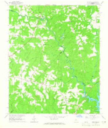
11 topographic sheets cover this place, the earliest surveyed in 1953 and the latest in 1988. It stands in the Worthville census division. It lies in ZIP code area 30233. It stands on Baker Branch. The Survey maps it on the Worthville quadrangle.
Topographic sheets covering this place
7 surveys from 11 printed sheetsMatched by testing this settlement's coordinate against the published boundary of every sheet in the United States Geological Survey's historical collection. Each opens the scanned sheet at the Survey.
- 1953 USGS Athens quadrangle1:250000, 3 printings
- 1958 USGS Athens quadrangle1:250000
- 1959 USGS Athens quadrangle1:250000
- 1963 USGS Athens quadrangle1:250000
- 1964 USGS Worthville quadrangle1:24000, 2 printings
- 1981 USGS Milledgeville quadrangle1:100000, 2 printings
- 1988 USGS Athens quadrangle1:250000

Fires near this place
235 since 1992Regional context, not property-specific evidence. The federal wildfire occurrence database lists 235 fires within 5 miles of Worthville between 1992 and 2020, burning about 651 acres in total. 9 started naturally. 28 were recorded as arson. Distance is straight-line from the map coordinates, so a fire counted here may appear on a neighbouring settlement's page as well.
| Reported cause | Fires |
|---|---|
| Debris and open burning | 133 |
| Arson/incendiarism | 28 |
| Misuse of fire by a minor | 16 |
| Smoking | 15 |
| Equipment and vehicle use | 13 |
| Missing data/not specified/undetermined | 12 |
| Natural | 9 |
| Recreation and ceremony | 9 |
The most recent of them, most recent first, with the day each was reported and the service that recorded it.
| Date | Cause | Size | Reported by | Name on the report |
|---|---|---|---|---|
| 8 September 2015 | Debris and open burning | under an acre | Georgia Forestry Commission | FY2016-BUTTS-001 |
| 5 September 1997 | Debris and open burning | under an acre | Georgia Forestry Commission | not named |
| 2 September 1997 | Debris and open burning | under an acre | Georgia Forestry Commission | not named |
| 19 September 2008 | Equipment and vehicle use | under an acre | Georgia Forestry Commission | not named |
| 16 September 2018 | Recreation and ceremony | under an acre | Georgia Forestry Commission | FY2019JASPER001 |
| 15 September 1999 | Debris and open burning | under an acre | Georgia Forestry Commission | not named |
| 14 September 1999 | Debris and open burning | under an acre | Georgia Forestry Commission | not named |
| 12 September 1999 | Misuse of fire by a minor | 1.8 acres | Georgia Forestry Commission | not named |
Settlements close enough to share some of these fires:
Storms near this place
10 since 2001Regional context, not property-specific evidence. The National Weather Service names Worthville in 10 storm reports between 2001 and 2025: 9 thunderstorm wind, 1 tornado. No death or injury is recorded in these reports. Each account below is quoted exactly as the forecast office filed it, from the NOAA Storm Events Database, and each date opens the federal record of that event.
| When | Event | Place named | Harm | What the report says |
|---|---|---|---|---|
| September 2011 | Thunderstorm Wind | Worthville | $35,000 | FOX 5 Television of Atlanta relayed a report of strong thunderstorm downburst winds that caused damage in the Lake Jackson area in the far eastern part of Butts county along the Jasper county line. Several large trees and power lines were down with at least one tree on the home with roof damage. |
| August 2020 | Thunderstorm Wind | Worthville | $8,000 | The Butts County Emergency Manager reported a few trees blown down along and near Highway 36 from Jackson northeast to the near the county line. |
| June 2016 | Thunderstorm Wind | Worthville | $8,000 | The Butts County Emergency Manager reported several trees blown down across the county from northern half into the southeastern portion. |
| July 2017 | Thunderstorm Wind | Worthville | $5,000 | The Butts County 911 center reported several trees blown down along Highway 36 including near Keys Ferry Road. |
| August 2023 | Thunderstorm Wind | Worthville | $2,000 | Emergency Manager reported two trees down near the Butts and Newton county line. |
| March 2017 | Thunderstorm Wind | Worthville | $2,000 | The Butts County 911 center reported a tree blown down onto power lines along Southern Shores Road. |
| February 2001 | Thunderstorm Wind | Worthville | $2,000 | The Butts county 911 center reported 2 trees down, one on a power line. |
| July 2025 | Thunderstorm Wind | Worthville | $1,000 | Tree down at Keys Ferry and Peoples Rd . |
| August 2023 | Thunderstorm Wind | Worthville | $1,000 | A tree was downed onto a power line on Strickland Pasture Rd and Wilson Rd. |
| February 2025 | Tornado (EF1) | Worthville | - | An EF1 tornado with maximum winds of 100 to 105 mph touched down in northeastern Butts County February 15, 2025 at 5:16AM EST. The tornado spun up within a strong line of storms moving rapidly eastward across northern GA early in the morning hours. The Tornado first touched down in a wooded region west of Winding Way road located west of Hwy 36. The tornado crossed Winding Way snapping and uprooting trees including one onto a home causing severe damage to the home. The tornado continued ENE reaching maximum intensity as it crossed Keys Ferry Road snapping and uprooting numerous trees. Additionally, approximately a dozen homes along Keys Ferry road sustained damage either directly from the wind or from falling trees consistent with mid and high end EF1 winds. Several homes had portions of the roof blown off while others were missing shingles. Several homes with trees on them sustained more significant damage. The tornado continued ENE crossing Walthall Road snapping and uprooting trees before reaching HWY 36 where one business sustained roof damage. The tornado continued eastward crossing Martin Road snapping trees and through an uninhabited area north of Haley Road snapping trees. Coincidentally, the area along Hwy 36 eastward through Martin road to the edge of Lake Jackson is the same area hit by the January 2023 tornado and damage from that tornado was still very evident among the new tornado damage. The tornado began to weaken as it crossed Henry Higgins Road and Haley road while still snapping and uprooting some trees. A home was damaged along Henry Higgins road from a tree. The tornado damage became more sporadic as it crossed Jackson Lake into Newton County where trees were downed in a wooded region along Mitchell Road. The tornado crossed the lake again knocking over a few trees near hwy 212 before lifting as it reached Blue Herron Dr. |
Nearest settlements
The eight closest, with where each one stands in the county. Distances are straight-line, computed from the Geographic Names Information System coordinates.
| Map | Place | Distance | Sheets |
|---|---|---|---|
| Fincherville | 2.2 miles | 11 | |
| Stark | 4.0 miles | 12 | |
| McMichael Crossroads | 4.5 miles | 12 | |
| Pepperton | 6.8 miles | 12 | |
| Jackson | 7.0 miles | 12 | |
| Iron Springs Crossroads | 7.2 miles | 12 | |
| Bibb (historical) | 7.3 miles | 12 | |
| Jenkinsburg | 7.6 miles | 10 |
Provenance
This settlement is recorded in the Geographic Names Information System as feature 326600. The sheet list is computed by point-in-boundary test against the United States Geological Survey's historical topographic inventory. Both are works of the United States government and carry no copyright under 17 U.S.C. 105.
Wildfire. Short, Karen C. 2022. Spatial wildfire occurrence data for the United States, 1992-2020 [FPA_FOD_20221014]. 6th Edition. Fort Collins, CO: Forest Service Research Data Archive. https://doi.org/10.2737/RDS-2013-0009.6 Collected with United States Government funding and usable without additional permissions or fees.
Storms. NOAA National Centers for Environmental Information, Storm Events Database https://www.ncei.noaa.gov/stormevents/ A work of the United States government, no copyright under 17 U.S.C. 105. Narratives are quoted verbatim from the National Weather Service report and are not edited or summarised.