 Block
From the record
2 National Register listings published here.
Sources: the National Register database, National Park Service
12 topographic sheets and 4 fire insurance atlases across 1 place.
2 National Register listings published here.
Sources: the National Register database, National Park Service
Taken for the Office of War Information and the Farm Security Administration, who photographed the country between 1935 and 1944. Works of United States government photographers, with no known restriction on use. Each opens its catalogue record.
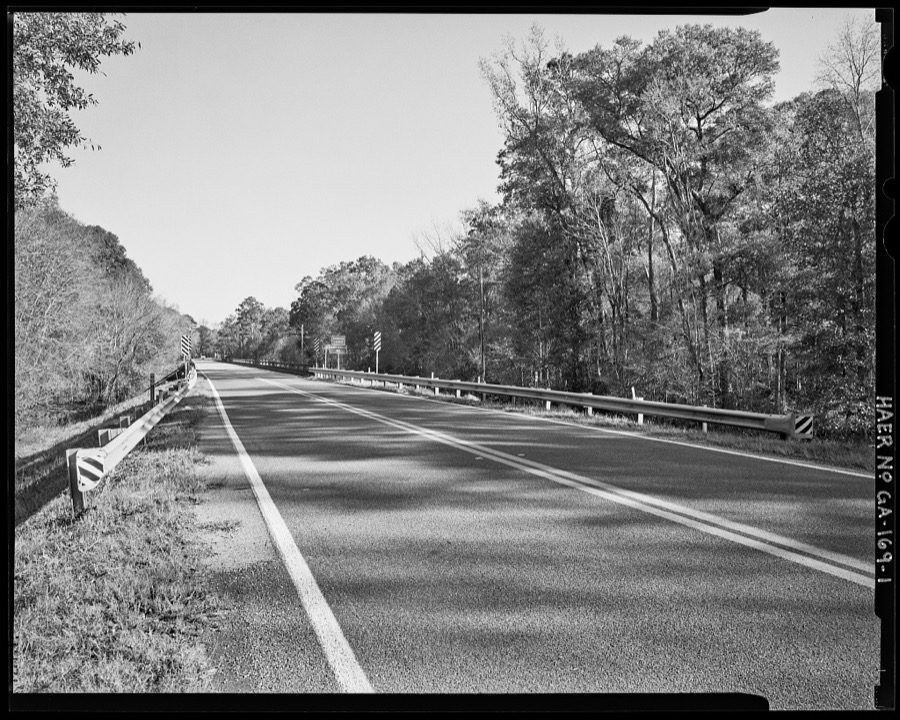
Every property in this county listed on the National Register of Historic Places, with the year it was listed and the federal nomination document.
| Photograph | Property | Type | Listed | Reference |
|---|---|---|---|---|
 | Grice Inn | building | 1978 | 78000993 |
 | Johnson County Courthouse | building | 1980 | 80001101 |
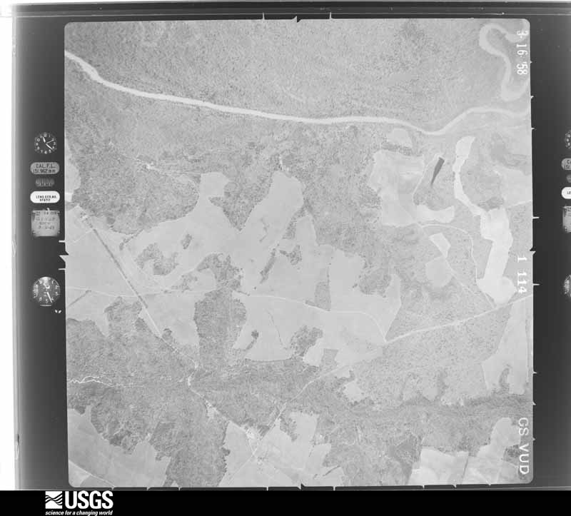
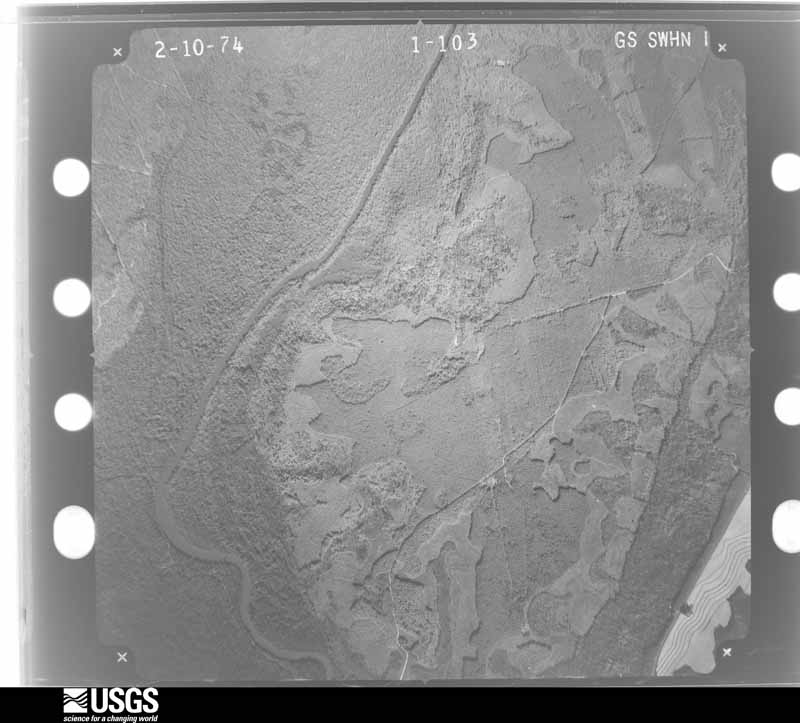
Flown by the U.S. Geological Survey between 1937 and 1989, the Aerial Photo Single Frames collection is the definitive mid-century view of the land: fields, roads and rivers as the camera saw them. The Survey holds 761 frames inside the rectangle that bounds this county; the 26 frames below were taken over the county itself, chosen across the decades of flights (at most four a year from that rectangle), so one flight cannot crowd out the rest. The full set is free to browse and download at EarthExplorer under the dataset Aerial Photo Single Frames.
























The thermometers that kept this county's weather, as the federal records hold them. The extremes below are measured values from those records, not estimates.
Who lived here in 1950, one enumeration district at a time, as the Census Bureau described each district. Each row opens its official National Archives result, with Population Schedules and ED Maps available there.
Every wildfire the federal occurrence database records inside this county: 1,607 of them, burning about 5,735 acres. 100 started naturally and 279 were recorded as arson. Each settlement page carries the fires within five miles of it.
| Reported cause | Fires |
|---|---|
| Debris and open burning | 847 |
| Arson/incendiarism | 279 |
| Equipment and vehicle use | 168 |
| Missing data/not specified/undetermined | 111 |
| Natural | 100 |
| Misuse of fire by a minor | 43 |
| Recreation and ceremony | 31 |
| Smoking | 27 |
| Railroad operations and maintenance | 1 |
The five largest, by the area the report gives. Two of them were set deliberately.
| Date | Cause | Size | Reported by | Name on the report |
|---|---|---|---|---|
| 20 November 2016 | Debris and open burning | 193 acres | Georgia Forestry Commission | FY2017-JOHNSON-017 |
| 16 March 2012 | Debris and open burning | 144 acres | Georgia Forestry Commission | FY2012-JOHNSON-062 |
| 18 February 2002 | Debris and open burning | 122 acres | Georgia Forestry Commission | FY2002-JOHNSON-034 |
| 3 March 1992 | Arson/incendiarism | 109 acres | Georgia Forestry Commission | not named |
| 23 July 2002 | Natural | 92 acres | Georgia Forestry Commission | FY2003-JOHNSON-006 |
| 20 August 1997 | Natural | 87 acres | Georgia Forestry Commission | not named |
| 17 February 2006 | Arson/incendiarism | 85 acres | Georgia Forestry Commission | not named |
| 28 July 2016 | Debris and open burning | 85 acres | Georgia Forestry Commission | FY2017-JOHNSON-004 |
Every settlement page carries the fires within five miles of it - see the settlement index below.
The NOAA Storm Events Database holds 170 reports for this county, causing no deaths, 10 injuries and about $25,365,250 in recorded property damage. Each settlement page carries the reports that name it.
| Kind of event | Reports |
|---|---|
| Thunderstorm Wind | 104 |
| Hail | 36 |
| Tornado | 11 |
| Lightning | 10 |
| Flash Flood | 4 |
| Flood | 3 |
| Funnel Cloud | 1 |
| Heavy Rain | 1 |
The most serious of them, by death, then injury, then recorded damage. The accounts are quoted exactly as the forecast office filed them.
| When | Event | Place named | Harm | What the report says |
|---|---|---|---|---|
| May 2008 | Tornado (EF1) | Spann | 5 hurt, $15,000,000 | A damage survey conducted by the National Weather Service Forecast Office in Peachtree City, Georgia confirmed that the EF1 tornado, that initially touched down in extreme northern Laurens just west-southwest of Tuckers Crossroads, continued on an eastward track into Johnson county, lifting a little less than one mile northeast of Wrightsville. Dozen of mobile and site-built homes in Wrightsville sustained minor to moderate damage as a result of this tornado, some of which were destroyed. Five injuries were reported from mobile homes destroyed with this tornado. An additional indirect injury resulted when a tree fell on an individual during debris clean up. In addition, numerous trees and power lines were downed along the path of the tornado through western Johnson county. The overall tornado path length was 10 miles, of which nearly nine occurred within Johnson county. The maximum path width was estimated to be up to 1/3 mile wide.||Within Johnson county, 227 homes were damaged, 22 of which were destroyed and 67 of which sustained major damage. Six public buildings also sustained minor to moderate damage. In addition, a total of five injuries were reported as a result of this tornado, four of which occurred as a result of damaged or destroyed mobile homes. The Georgia Forestry Commission reported extensive loss to timber within Johnson county when the tornado destroyed several hundred pine trees. |
| May 2008 | Tornado (EF2) | Kite | 3 hurt, $7,000,000 | A damage survey conducted by the National Weather Service in Peachtree City, Georgia confirmed that yet another tornado had touched down within Johnson county. This tornado was an EF2 and touched down in far eastern Johnson county, about one mile northwest of Kite and continued on an east-northeastward track into Emanuel county, crossing into Emanuel county just west of the city of Blundale. Maximum winds within the tornado were estimated to be 130 mph and the maximum path width was determined to be up to 1/2 mile wide. As the tornado touched down northwest of Kite, a mobile home was rolled and several other homes and vehicles were damaged along U.S. Highway 221 north of Kite. The most significant damage occurred about three miles north of Kite, along Minton Chapel Road, where a mobile home was completely destroyed and the debris thrown up to 50 feet away. Three injuries were reported as a result of the destruction of this mobile home. An additional indirect injury occurred later when a tree fell on an individual during debris clean up. A well constructed metal building in the same general area sustained substantial wall, frame, and column anchor failures. A number of trees and several power lines were downed along the path of the tornado as well. |
| July 2003 | Heavy Rain | Wrightsville | 2 hurt, $5,000 | The Johnson Journal of Wrightsville reported that very heavy rain, up to four inches during the evening hours, caused the awning on a one-year old building to fall on two male patrons that were standing underneath. One of the men was seriously injured and remained in critical condition several hours later. The other also sustained significant injuries. |
| June 2009 | Thunderstorm Wind | Wrightsville | $300,000 | The Johnson County Emergency Management Director reported that many trees and a number of power lines were down across the county from Wrightsville to Kite and southward toward Spann. Several roads were blocked from downed trees, including parts of Georgia Highway 15 south of Wrightsville. Two homes in the Kite area were completely destroyed from downed trees and strong winds. Two others homes in the area sustained minor to moderate damage. Several animal shelters and pole barns were damaged as well. |
| August 2010 | Thunderstorm Wind | Wrightsville | $250,000 | The Johnson County Emergency Management Director reported that a strong thunderstorm downburst, wind gusts of 60 mph or greater, blew down dozens of trees and several power lines from northeast of Wrightsville to three miles west-southwest of Wrightsville. Six homes across this path sustained minor to moderate damage from downed trees. Several trees were down and a trampoline was blown away from a residence near U.S. Highway 319 on Tucker Grove Church Road west of Wrightsville. |
| June 2008 | Lightning | Wrightsville | $250,000 | The Johnson County Emergency Management Director reported that lightning struck a large 3500 square foot home on the west side of Wrightsville igniting a fire. The structure was completely destroyed by the fire. This fire was started while a separate lightning sparked fire was ongoing in the woods between Wrightsville and Kite. |
| May 2008 | Thunderstorm Wind | Kite | $250,000 | A damage survey conducted by the National Weather Service Forecast Office in Peachtree City, Georgia concluded that in addition to an EF2 tornado that tracked from just northwest of Kite east-northeast into Emanuel county just west of Blundale, extensive straight-line wind damage was observed along and up to two miles south of the tornado track. These winds were estimated to be as strong as 90 mph. Primarily minor structural damage was observed to several homes in this area, including within the city of Kite. The most significant structural damage was to a school gymnasium in Kite which sustained masonry wall and roof damage. Widespread tree damage was also observed throughout this area. |
| April 2007 | Tornado (EF1) | Scott | $250,000 | A survey conducted by the National Weather Service in Peachtree City, Georgia confirmed that the EF1 tornado, which originated in extreme western Treutlen county and briefly crossed into Emanuel county, continued into southern Johnson county, causing considerable damage to the city of Adrian on the Johnson/Emanuel county line. This tornado then continued to travel north-northeast through the extreme southeast corner of Johnson county before exiting once again into Emanuel county. The EF1 tornado traveled approximately three miles within Johnson county with a maximum path width of 440 yards. A good portion of the city of Adrian, the center of which lies in Emanuel county, lies within Johnson county. All together, at least a dozen homes, some mobile homes, were damaged in the Adrian community. A number of these were on the Johnson county side of the line. Two homes in a campground just northeast of Adrian were heavily damaged from downed trees. Numerous trees down throughout this area as a result of the tornado. |
| April 2007 | Tornado (EF1) | Scott | $250,000 | An aerial and ground survey conducted by the National Weather Service in Peachtree City, Georgia confirmed that the second tornado that originated in Laurens county five miles southeast of Dublin tracked northeast to east-northeast across northeast Laurens county into Johnson county, approximately three miles north of Kite, and then continued on an east-northeastward track lifting about five miles southwest of Kite. The overall tornado path length was 19 miles, of which approxmiately five miles fell within Johnson county. The maximum tornado path length was 100 yards with maximum winds estimated at 100 mph. The majority of the damage along this portion of the tornado path occurred just north of Scott, where several homes sustained minor to moderate damage. A church in this area sustained minor damage and a family life center suffered considerable damage when it was shifted slightly off its foundation. Elsewhere along the tornado path within Johnson county, damage was confined mostly to trees and some power lines. |
| January 2006 | Tornado (F1) | Kite | $250,000 | A damage survey conducted by the National Weather Service and the Johnson County Emergency Management Director concluded that an F1 tornado had touched down approximately five miles north of Kite near the intersection of U.S. Highway 221 and U.S. Highway 319 and traveled east-southeast to a point four miles east-northeast of Kite. The tornado than continued into Emanuel county. The damage path within Johnson county was approximately five miles long and 1/4 mile wide. Overall, the tornado traveled a 12 mile long path across Johnson and Emanuel counties. Near the tornado's touchdown point, siding was blown off the Gum Log Church. Then, six homes along the path of the tornado sustained damage from downed trees. In addition, a couple of silos were destroyed and several vehicles were damaged. |
| November 2011 | Thunderstorm Wind | Wrightsville | $225,000 | The Johnson County Emergency Management Director reported that thunderstorm winds had caused significant damage across Johnson county. A total of six homes sustained damage, mostly minor to moderate. However, one home suffered significant damage when a large pine tree fell through the structure. An adjacent car was also heavily damaged. A portion of a carport was also blown up on the roof of the home. Several pump houses being built were blown several feet away from their original location. A total of 16 large trees were down across the county. |
| August 2008 | Lightning | Scott | $150,000 | The Johnson County Emergency Management Director reported that two homes were struck and set on fire by lightning. One of the homes was on Georgia Highway 15 and the other was on Archer Pond Road off Georgia Highway 15, just northeast of Scott. |
| August 2002 | Lightning | Countywide | $80,000 | The Johnson county Emergency Management Director and the Journal of Wrightsville reported that lightning struck a tree, two homes, a vehicle, and a barn. One of the homes struck was on Georgia Highway 15 in Wrightsville. This home sustained moderate damage. The other home affected was on Pinehill Church Road near the Piney Mountain and Gaines Mills communities. This home only suffered minor damage. A newly built hay barn with an attached shop was also struck and set on fire by lightning. The barn was destroyed, while the shop suffered minor damage. In Kite, on Georgia Highway 57, a tree was struck and set on fire, but heavy rain extinguished the fire. |
| April 2009 | Flood | Tom | $70,000 | The Johnson County Emergency Management Director reported flooding to woodlands and adjacent fields and lowlands along Swain Creek in the eastern part of the county and the Little Ohopee River near Kite. Power line road was washed out and closed. Six other roads in the area had water flowing over the road. In addition, three camp houses along the Oconee River on the western side of the county were threatened from high water. The combination of saturated soil and windy conditions caused six trees to fall on homes near the Oconee River resulting in minor damage to the structures. |
| February 2021 | Hail | Scott | $50,000 | The Johnson County Emergency Manager reported golf ball size hail near Adrian. |
| July 2019 | Thunderstorm Wind | Tom | $50,000 | Several reports of minor structural damage to homes (porches damages and shingles blown off roofs) along Williams and Price Road to Badger Road, just east-northeast of Kite. Multiple trees down in the area as well. Time estimated from radar. |
| July 2013 | Flash Flood | Wrightsville | $50,000 | The emergency manager reported several roads were washed out in and around Wrightsville. A couple of homes also had water in them. |
| June 2011 | Lightning | Scott | $50,000 | The Johnson County Emergency Management Director reported that a house was struck and set on fire by lightning in Scott. Minor to moderate damage to the structure was observed. |
| June 2011 | Lightning | Scott | $50,000 | The Johnson County Emergency Management Director reported that a well pump house was burned and the fire alarm system at a nursing home were disabled by a lightning strike. |
| October 2010 | Hail | Scott | $50,000 | The Johnson County Emergency Management Director relayed that numerous reports of quarter-sized hail were received from the south part of the county from north of Scott to Meeks and Kite, including the Moore's Chapel area. Golf ball-sized hail was observed near Meeks and also on Georgia Highway 15 south of Wrightsville toward Meeks. At least one home in the Meeks area sustained significant roof damage from the large hail. |
| December 2005 | Tornado (F1) | Spann | $50,000 | The Laurens County Emergency Management Director confirmed that the tornado that first touched down in northeast Laurens county approximately seven miles northeast of Dublin continued across Georgia Highway 319 along the Laurens/Johnson county border and to near the town of Spann in extreme western Johnson county. Damage was confined mainly to trees, power lines, and a few outbuildings. |
| December 2005 | Hail | Wrightsville | $50,000 | The public reported baseball-sized hail. |
| March 2011 | Hail | Kite | $48,000 | The public observed golf ball-sized hail across east central Johnson county near Kite. |
| March 2011 | Hail | Scott | $48,000 | The Johnson County Emergency Management Director reported nickel-sized hail from the Scott area. As the thunderstorm moved east-southeast it intensified. The public and a trained spotter observed half-dollar-sized hail to golf ball-sized hail in Adrian along the Emanuel county line. |
| February 2014 | Tornado (EF1) | Spann | $40,000 | A National Weather Service storm survey team determined that the tornado that began in Laurens County continued into Johnson County. A mobile home was lifted off its foundation while another had its porch blown off by the storm. Doors of the Piney Mountain Fire Station were also blown off by the tornado. The tornado eventually dissipated northeast of the intersection between Highway 15/78 and Snell Bridge Road.|[02/21/14: Tornado #1, County #2-2, EF2, Laurens-Johnson, 2014:002]. |
| August 2007 | Thunderstorm Wind | Wrightsville | $35,000 | The Johnson County Emergency Management Director reported that many trees were down from Wrightsville to Kite. The most concentrated area of damage was in the Kite area. In addition to numerous trees and power line down in the Kite area, including some on roads. a canopy was blown off a gas station in Kite. |
| July 2013 | Flood | Wrightsville | $30,000 | The Johnson County emergency manager reported numerous washed out or flooded roads in the county and around Wrightsville. Additional rainfall of around two inches on already wet soils overwhelmed the drainage systems. In some areas there was so much water that maintenance crews could not get out to fix the box culverts and washed out roads. |
| July 2003 | Thunderstorm Wind | Kite | $30,000 | The Forest Blade of Swainsboro reported that thunderstorm winds associated with the remnants of Tropical Storm Bill uprooted several trees onto a car and house on Pinetucky Road near Kite. Some residents in the area reported seeing a funnel cloud. |
| July 2016 | Thunderstorm Wind | Wrightsville | $25,000 | The Johnson County Emergency Manager reported that parts of the roof on two barns were blown off along Highway 57 Near Moores Chapel. Six trees were also blown down in this area. |
| August 2007 | Thunderstorm Wind | Wrightsville | $25,000 | The Johnson County Emergency Management Director reported that a thunderstorm downburst or microburst caused considerable damage across Johnson county. The thunderstorm travelled from north to south, with the strongest winds observed in the western and central part of the county. Several large trees were down on Georgia Highway 57 at Jim Underwood Road and several power lines were down as well. In this same general area, a utility building was rolled over and the roof was turn off several storage or utility structures. Several homes sustained minor roof damage as well. The entire county was left without power for several hours in the wake of the storm. |
| July 2002 | Lightning | Wrightsville | $25,000 | The Wrightsville Headlight reported that lightning struck a restored, older home in town, igniting a fire, and causing considerable damage. The kitchen was heavily damaged, with much of the house suffering minor cosmetic damage because of heat and smoke. This home on North Marcus Street, was believed to be one of the oldest homes in the town, built in 1880. |
| March 1980 | Tornado (F1) | not stated | $25,000 | no account filed |
| June 1974 | Tornado (F1) | not stated | $25,000 | no account filed |
| March 2011 | Thunderstorm Wind | Wrightsville | $15,000 | The Johnson County Emergency Management Director reported that a tree fell on a mobile home in the far western part of the county, approximately eight miles west-northwest of Wrightsville. The tree punctured the roof of the home. In addition, four more trees were blown down in the far southern part of the county in the Scott area. |
| April 2011 | Thunderstorm Wind | Spann | $15,000 | The Johnson County Emergency Management Director reported that dozens of trees and a number of power lines were down throughout the county. However, the majority of the damage was between Meeks and Kite in the southeast part of the county. Georgia Highway 15 was blocked from downed trees in Wrightsville. More than hundred residents of the county were left without power for several hours following the storms. |
| June 2025 | Thunderstorm Wind | Wrightsville | $10,000 | Maintenance doors at a county facility blown off per EMA in Wrightsville along Idylwild Drive. Multiple trees down across the area as well. |
| April 2017 | Thunderstorm Wind | Wrightsville | $10,000 | The Johnson County Emergency Manager reported that a tree fell on a car, trapping the driver inside. No injuries were reported. |
| January 2017 | Tornado (EF0) | Wrightsville | $10,000 | A National Weather Service survey team found that a EF0 tornado with maximum wind speeds of 85 MPH and a maximum path width of 100 yards began along Moores Chapel Road in central Johnson County. The tornado travelled over 6 miles northeast crossing Highway 57, Leaston Powell Road, Gum Log Road and Blizzard Road before ending near the intersection of Harrison Road and Fortner Road. Several trees were blown down along the path of the tornado. [01/21/17: Tornado #19, County #1/1, EF0, Johnson, 2017:020]. |
| February 2016 | Flash Flood | Spann | $10,000 | The Johnson County Emergency Manager reported several secondary roads from Wrightsville to Kite were closed due to flowing flood waters from nearby creeks. Some erosion to the road beds occurred. |
| June 2014 | Thunderstorm Wind | Wrightsville | $10,000 | The Johnson County Emergency Manager reported 20 trees down and a few houses with shingle damage west of Wrightsville. |
| September 2014 | Thunderstorm Wind | Spann | $10,000 | The Johnson County Emergency Manager reported four structures damaged by winds, including a mobile home blown off of a cinder block foundation and rolled, the roof of a hay barn blown off and shingles blown off a home. |
| April 2010 | Thunderstorm Wind | Wrightsville | $10,000 | The Johnson County Emergency Management Director reported that at least seven trees were down between Wrightsville and Kite. Two trees fell on and destroyed a batting cage on private property in Wrightsville. A tree in Kite fell on an unoccupied vehicle. Most of the downed trees were around Wrightsville. Power was out in much of the county for about two hours. |
| January 2017 | Thunderstorm Wind | Meeks | $7,000 | The Johnson County 911 center reported trees and power lines blown down along Highway 15. |
| June 2018 | Thunderstorm Wind | Wrightsville | $6,000 | The Johnson County Emergency Manager reported several trees blown down along Jonah Hall Road and Lawrence Road. A pumphouse was damaged along Lawrence Road. |
| November 2014 | Thunderstorm Wind | Wrightsville | $6,000 | The Johnson County Emergency Manager reported trees down across the county. An outbuilding was also destroyed. |
| June 2013 | Flash Flood | Donovan | $6,000 | Hurricane Branch overflowed a portion of Oaky Grove Church Road with around one foot of water. Cypress Creek overflowed a portion of Powerline Road with around one foot of water. A drainage branch overflowed a portion of Carters Road near Georgia Highway 15 with around one foot of water. |
| August 2023 | Thunderstorm Wind | Kite | $5,000 | Multiple trees down at Bobby Fortner Rd and Midas Brantley Rd. |
| May 2018 | Thunderstorm Wind | Wrightsville | $5,000 | The Wrightsville Fire Department reported trees and power lines blown down on Highway 57 west of Wrightsville. |
| July 2015 | Thunderstorm Wind | Tom | $5,000 | A Johnson County official reported a few trees Blown down in the northeast part of the county. |
| August 2013 | Thunderstorm Wind | Wrightsville | $5,000 | The Johnson County Emergency Manager reported trees and power lines down on Tucker Grove Church Road, Georgia Highway 57, U.S. Highway 319, Old Buckeye Road, and New Buckeye Road. |
| June 2010 | Thunderstorm Wind | Wrightsville | $5,000 | The Johnson County Emergency Management Director reported that two trees were blown down from strong winds caused by thunderstorm outflow well north of the actual thunderstorms across the southern part of the county and counties immediately to the south. The trees also brought down a power line which ignited a small wildfire. |
| June 2008 | Lightning | Wrightsville | $5,000 | The Johnson County Emergency Management Director reported that lightning started a forest fire between Wrightsville and Kite in eastern Johnson county. |
| August 2008 | Thunderstorm Wind | Meeks | $5,000 | The public reported that at least three trees were down between Georgia Highway 15/78 and just west of Meeks. An outbuilding sustained major damage on Carroll Road, just off Georgia Highway 15/78. |
| December 2005 | Hail | Wrightsville | $5,000 | The public reported golf ball to baseball-sized hail. |
| July 2003 | Flash Flood | Kite | $5,000 | The Johnson county 911 center, as well as the public, reported that a small dam failed and washed out a road. The Johnson Journal of Wrightsville reported that up to four inches of rain fell in parts of the county during the evening. |
| July 2000 | Thunderstorm Wind | Countywide | $5,000 | The Johnson county 911 center reported trees down countywide. |
| July 2000 | Thunderstorm Wind | Countywide | $5,000 | The Johnson county 911 center reported trees down on county roads across the county. |
| April 1999 | Hail | Wrightsville | $5,000 | Two public reports indicated dime to quarter size hail fell in Wrightville and 2 inch diameter hail broke windows in a house and caused damage to a truck just west of Wrightsville. This storm was close behind the first one that moved across the county. |
| July 2022 | Thunderstorm Wind | Kite | $4,000 | Report of two trees down on Hwy 57 near Kite. |
| June 2023 | Thunderstorm Wind | Wrightsville | $3,000 | Multiple trees reported down in Wrightsville. |
The Survey's mineral resources record lists 1 working inside this county. It is closed or unrecorded. Each settlement page carries the workings within five miles of it.
| Commodity | Workings |
|---|---|
| Sand and Gravel, Construction | 1 |
The least common of them first, because a county's hundredth gravel pit says nothing its first ten did not.
| Where | Site | Commodity | Status | Recorded |
|---|---|---|---|---|
| Unnamed Sand Deposit | Sand and Gravel, Construction | Past Producer | Alluvium |
Named settlements recorded in the Geographic Names Information System, each with the topographic sheets covering it. Villages, hamlets and abandoned places alike. Each is shown with the nearest named watercourse or landform and the survey quadrangle it falls on. The 1 place that was also surveyed for fire insurance comes first, with the number of atlases and photographs held for them.
Wrightsville census division · 31096 · Wrightsville quadrangle
7 sheets, 1957 to 1988
Fire insurance: 4 atlases
Wrightsville census division · 31096 · On Little Cedar Creek · Harrison quadrangle
7 sheets, 1957 to 1988
7 topographic sheets and 4 fire insurance atlases, 1906 to 1937
The complete index, with nothing left out. Each of these is a separate record with its own page: a federal survey report, or the case file that argued a property on to the National Register. Both are public domain and reproduced word for word.