 Block
Wrightsville, Georgia
7 topographic sheets cover this place, the earliest surveyed in 1957 and the latest in 1988. It stands in the Wrightsville census division. It lies in ZIP code area 31096. The Survey maps it on the Wrightsville quadrangle. 3,449 people lived here at the 2020 count. It stands 344 feet above sea level.
Research this city
On record in Wrightsville
Buildings and businesses the archive holds for this place. Each opens its own page, with the source record it came from.
On the National Register 2 records
 Grice Innlisted 1978
 Johnson County Courthouselisted 1980
Surveyed buildings and structures 1 record
- Georgia DOT Bridge No. 167-0007-0, U.S. Highway 80/State Route 26 spanning the Ohoopee River, Adrianfederal building survey, 3 photographs
Population over time
2 figuresWrightsville grew from 2,195 to 3,449 between 2010 and 2020. These are the recorded population figures Wikidata holds for this place, reached through the Geographic Names Information System number this page is keyed on rather than by name, so they belong to this place and not to another of the same name. Most are census counts, but not all are: an early figure may be a founding or settlement estimate, and an estimate published within five years of a census is left out. The change column is computed, and is left blank where more than 20 years separate a figure from the one before it, because a gap that long is not a change between two counts.
| Year | People | Change |
|---|---|---|
| 2010 | 2,195 | |
| 2020 | 3,449 | +1,254 (+57%) |
Topographic sheets covering this place
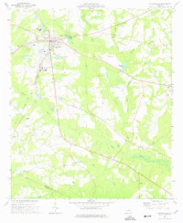
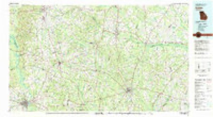
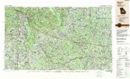
6 surveys from 7 printed sheetsMatched by testing this settlement's coordinate against the published boundary of every sheet in the United States Geological Survey's historical collection. Each opens the scanned sheet at the Survey.
- 1957 USGS Macon quadrangle1:250000
- 1958 USGS Macon quadrangle1:250000
- 1964 USGS Macon quadrangle1:250000, 2 printings
- 1974 USGS Wrightsville quadrangle1:24000
- 1981 USGS Dublin quadrangle1:100000
- 1988 USGS Macon quadrangle1:250000
Fires near this place
486 since 1992Regional context, not property-specific evidence. The federal wildfire occurrence database lists 486 fires within 5 miles of Wrightsville between 1992 and 2020, burning about 1,373 acres in total. 29 started naturally. 51 were recorded as arson. Distance is straight-line from the map coordinates, so a fire counted here may appear on a neighbouring settlement's page as well.
| Reported cause | Fires |
|---|---|
| Debris and open burning | 269 |
| Arson/incendiarism | 51 |
| Equipment and vehicle use | 50 |
| Missing data/not specified/undetermined | 50 |
| Natural | 29 |
| Misuse of fire by a minor | 17 |
| Smoking | 10 |
| Recreation and ceremony | 10 |
The most recent of them, most recent first, with the day each was reported and the service that recorded it.
| Date | Cause | Size | Reported by | Name on the report |
|---|---|---|---|---|
| 8 September 1997 | Missing data/not specified/undetermined | under an acre | Georgia Forestry Commission | not named |
| 4 September 1997 | Debris and open burning | 1.3 acres | Georgia Forestry Commission | not named |
| 30 September 2019 | Debris and open burning | under an acre | Georgia Forestry Commission | FY2020JOHNSON007 |
| 30 September 2008 | Debris and open burning | 1.7 acres | Georgia Forestry Commission | not named |
| 30 September 2008 | Debris and open burning | 1.0 acres | Georgia Forestry Commission | not named |
| 29 September 2001 | Arson/incendiarism | under an acre | Georgia Forestry Commission | FY2002-JOHNSON-005 |
| 29 September 1994 | Arson/incendiarism | under an acre | Georgia Forestry Commission | not named |
| 28 September 2008 | Smoking | 1.1 acres | Georgia Forestry Commission | not named |
Settlements close enough to share some of these fires:
Storms near this place
60 of 72 shownRegional context, not property-specific evidence. The National Weather Service names Wrightsville in 72 storm reports between 1995 and 2025: 46 thunderstorm wind, 18 hail, 4 lightning, 1 heavy rain. The reports record 2 injuries. Each account below is quoted exactly as the forecast office filed it, from the NOAA Storm Events Database, and each date opens the federal record of that event.
| When | Event | Place named | Harm | What the report says |
|---|---|---|---|---|
| July 2003 | Heavy Rain | Wrightsville | 2 hurt, $5,000 | The Johnson Journal of Wrightsville reported that very heavy rain, up to four inches during the evening hours, caused the awning on a one-year old building to fall on two male patrons that were standing underneath. One of the men was seriously injured and remained in critical condition several hours later. The other also sustained significant injuries. |
| June 2009 | Thunderstorm Wind | Wrightsville | $300,000 | The Johnson County Emergency Management Director reported that many trees and a number of power lines were down across the county from Wrightsville to Kite and southward toward Spann. Several roads were blocked from downed trees, including parts of Georgia Highway 15 south of Wrightsville. Two homes in the Kite area were completely destroyed from downed trees and strong winds. Two others homes in the area sustained minor to moderate damage. Several animal shelters and pole barns were damaged as well. |
| August 2010 | Thunderstorm Wind | Wrightsville | $250,000 | The Johnson County Emergency Management Director reported that a strong thunderstorm downburst, wind gusts of 60 mph or greater, blew down dozens of trees and several power lines from northeast of Wrightsville to three miles west-southwest of Wrightsville. Six homes across this path sustained minor to moderate damage from downed trees. Several trees were down and a trampoline was blown away from a residence near U.S. Highway 319 on Tucker Grove Church Road west of Wrightsville. |
| June 2008 | Lightning | Wrightsville | $250,000 | The Johnson County Emergency Management Director reported that lightning struck a large 3500 square foot home on the west side of Wrightsville igniting a fire. The structure was completely destroyed by the fire. This fire was started while a separate lightning sparked fire was ongoing in the woods between Wrightsville and Kite. |
| November 2011 | Thunderstorm Wind | Wrightsville | $225,000 | The Johnson County Emergency Management Director reported that thunderstorm winds had caused significant damage across Johnson county. A total of six homes sustained damage, mostly minor to moderate. However, one home suffered significant damage when a large pine tree fell through the structure. An adjacent car was also heavily damaged. A portion of a carport was also blown up on the roof of the home. Several pump houses being built were blown several feet away from their original location. A total of 16 large trees were down across the county. |
| July 2013 | Flash Flood | Wrightsville | $50,000 | The emergency manager reported several roads were washed out in and around Wrightsville. A couple of homes also had water in them. |
| December 2005 | Hail | Wrightsville | $50,000 | The public reported baseball-sized hail. |
| August 2007 | Thunderstorm Wind | Wrightsville | $35,000 | The Johnson County Emergency Management Director reported that many trees were down from Wrightsville to Kite. The most concentrated area of damage was in the Kite area. In addition to numerous trees and power line down in the Kite area, including some on roads. a canopy was blown off a gas station in Kite. |
| July 2013 | Flood | Wrightsville | $30,000 | The Johnson County emergency manager reported numerous washed out or flooded roads in the county and around Wrightsville. Additional rainfall of around two inches on already wet soils overwhelmed the drainage systems. In some areas there was so much water that maintenance crews could not get out to fix the box culverts and washed out roads. |
| July 2016 | Thunderstorm Wind | Wrightsville | $25,000 | The Johnson County Emergency Manager reported that parts of the roof on two barns were blown off along Highway 57 Near Moores Chapel. Six trees were also blown down in this area. |
| August 2007 | Thunderstorm Wind | Wrightsville | $25,000 | The Johnson County Emergency Management Director reported that a thunderstorm downburst or microburst caused considerable damage across Johnson county. The thunderstorm travelled from north to south, with the strongest winds observed in the western and central part of the county. Several large trees were down on Georgia Highway 57 at Jim Underwood Road and several power lines were down as well. In this same general area, a utility building was rolled over and the roof was turn off several storage or utility structures. Several homes sustained minor roof damage as well. The entire county was left without power for several hours in the wake of the storm. |
| July 2002 | Lightning | Wrightsville | $25,000 | The Wrightsville Headlight reported that lightning struck a restored, older home in town, igniting a fire, and causing considerable damage. The kitchen was heavily damaged, with much of the house suffering minor cosmetic damage because of heat and smoke. This home on North Marcus Street, was believed to be one of the oldest homes in the town, built in 1880. |
| March 2011 | Thunderstorm Wind | Wrightsville | $15,000 | The Johnson County Emergency Management Director reported that a tree fell on a mobile home in the far western part of the county, approximately eight miles west-northwest of Wrightsville. The tree punctured the roof of the home. In addition, four more trees were blown down in the far southern part of the county in the Scott area. |
| June 2025 | Thunderstorm Wind | Wrightsville | $10,000 | Maintenance doors at a county facility blown off per EMA in Wrightsville along Idylwild Drive. Multiple trees down across the area as well. |
| April 2017 | Thunderstorm Wind | Wrightsville | $10,000 | The Johnson County Emergency Manager reported that a tree fell on a car, trapping the driver inside. No injuries were reported. |
| January 2017 | Tornado (EF0) | Wrightsville | $10,000 | A National Weather Service survey team found that a EF0 tornado with maximum wind speeds of 85 MPH and a maximum path width of 100 yards began along Moores Chapel Road in central Johnson County. The tornado travelled over 6 miles northeast crossing Highway 57, Leaston Powell Road, Gum Log Road and Blizzard Road before ending near the intersection of Harrison Road and Fortner Road. Several trees were blown down along the path of the tornado. [01/21/17: Tornado #19, County #1/1, EF0, Johnson, 2017:020]. |
| June 2014 | Thunderstorm Wind | Wrightsville | $10,000 | The Johnson County Emergency Manager reported 20 trees down and a few houses with shingle damage west of Wrightsville. |
| April 2010 | Thunderstorm Wind | Wrightsville | $10,000 | The Johnson County Emergency Management Director reported that at least seven trees were down between Wrightsville and Kite. Two trees fell on and destroyed a batting cage on private property in Wrightsville. A tree in Kite fell on an unoccupied vehicle. Most of the downed trees were around Wrightsville. Power was out in much of the county for about two hours. |
| June 2018 | Thunderstorm Wind | Wrightsville | $6,000 | The Johnson County Emergency Manager reported several trees blown down along Jonah Hall Road and Lawrence Road. A pumphouse was damaged along Lawrence Road. |
| November 2014 | Thunderstorm Wind | Wrightsville | $6,000 | The Johnson County Emergency Manager reported trees down across the county. An outbuilding was also destroyed. |
| May 2018 | Thunderstorm Wind | Wrightsville | $5,000 | The Wrightsville Fire Department reported trees and power lines blown down on Highway 57 west of Wrightsville. |
| August 2013 | Thunderstorm Wind | Wrightsville | $5,000 | The Johnson County Emergency Manager reported trees and power lines down on Tucker Grove Church Road, Georgia Highway 57, U.S. Highway 319, Old Buckeye Road, and New Buckeye Road. |
| June 2010 | Thunderstorm Wind | Wrightsville | $5,000 | The Johnson County Emergency Management Director reported that two trees were blown down from strong winds caused by thunderstorm outflow well north of the actual thunderstorms across the southern part of the county and counties immediately to the south. The trees also brought down a power line which ignited a small wildfire. |
| June 2008 | Lightning | Wrightsville | $5,000 | The Johnson County Emergency Management Director reported that lightning started a forest fire between Wrightsville and Kite in eastern Johnson county. |
| December 2005 | Hail | Wrightsville | $5,000 | The public reported golf ball to baseball-sized hail. |
| April 1999 | Hail | Wrightsville | $5,000 | Two public reports indicated dime to quarter size hail fell in Wrightville and 2 inch diameter hail broke windows in a house and caused damage to a truck just west of Wrightsville. This storm was close behind the first one that moved across the county. |
| June 2023 | Thunderstorm Wind | Wrightsville | $3,000 | Multiple trees reported down in Wrightsville. |
| June 2000 | Thunderstorm Wind | Wrightsville | $3,000 | The Johnson county 911 center reported trees down on power lines in Wrightsville. |
| June 1997 | Thunderstorm Wind | Wrightsville | $3,000 | Two trees were knocked down on Georgia Highways 15 and 57. |
| March 1997 | Thunderstorm Wind | Wrightsville | $3,000 | no account filed |
| June 2013 | Thunderstorm Wind | Wrightsville | $2,500 | The Johnson County Fire Department dispatch reported that several trees and power lines were blown down across the county. |
| July 2012 | Thunderstorm Wind | Wrightsville | $2,500 | The Johnson County 911 Center reported that at least ten trees were blown down across the county. |
| August 2024 | Thunderstorm Wind | Wrightsville | $2,000 | Two trees downed along GA57 west of Wrightsville to Tucker Grove Church Rd. |
| June 2011 | Thunderstorm Wind | Wrightsville | $2,000 | The Johnson County Emergency Management Director reported that at least six trees and a couple of power lines were down from two separate areas of thunderstorms that moved across the county in the 1000 to 1030 pm EDT time frame. The first area affected was just south of Wrightsville, while the second area affected was near Scott. |
| June 2009 | Lightning | Wrightsville | $2,000 | The Johnson County Emergency Management Director reported that a home was struck by lightning just north of Wrightsville causing damage to the structure. |
| July 2007 | Thunderstorm Wind | Wrightsville | $2,000 | The Johnson County Emergency Management Director, along with the county 911 center and a storm spotter all reported that trees and power lines were down in both the Wrightsville and Adrian areas. At least three trees and two power lines were down in Wrightsville and one tree and power line were down in the Adrian community. |
| March 2007 | Thunderstorm Wind | Wrightsville | $2,000 | The Johnson County Emergency Management Director reported that a number of trees were down in the far western part of the county along Georgia Highway 57. |
| April 1998 | Thunderstorm Wind | Wrightsville | $2,000 | The sheriff's office reported thunderstorm winds knocked trees down, some of which caused power outages as they fell on power lines. |
| June 1997 | Thunderstorm Wind | Wrightsville | $2,000 | A couple of trees were knocked down on Snell Bridge Road. |
| March 2025 | Thunderstorm Wind | Wrightsville | $1,000 | Emergency manager reports tree down on east court st in wrightsville. |
| August 2024 | Thunderstorm Wind | Wrightsville | $1,000 | A tree was downed near the sweats portable buildings business on ga-57. |
| August 2024 | Thunderstorm Wind | Wrightsville | $1,000 | A tree was blown down on cross cedar road at carlos snell road. |
| August 2024 | Thunderstorm Wind | Wrightsville | $1,000 | One tree down on hwy 57 just west of downtown wrightsville. |
| August 2023 | Thunderstorm Wind | Wrightsville | $1,000 | A tree was downed on James Grove Church Rd . |
| August 2023 | Thunderstorm Wind | Wrightsville | $1,000 | A tree was downed on Spring St in Wrightsville. |
| June 2023 | Thunderstorm Wind | Wrightsville | $1,000 | Tree down along Hwy 57 West near Mcafee Road. |
| March 2021 | Thunderstorm Wind | Wrightsville | $1,000 | The Johnson County Emergency Manager reported a tree blown down across Highway 15. |
| February 2003 | Thunderstorm Wind | Wrightsville | $1,000 | The Johnson county 911 center reported that several trees were down. |
| July 1995 | Thunderstorm Wind | Wrightsville | $1,000 | Thunderstorm winds knocked down three parking signs, power was out throughout the city for six hours. |
| July 2020 | Thunderstorm Wind | Wrightsville | $500 | The Johnson County Emergency Manager reported a highway sign blown down in the intersection of Highway 319 and Highway 15 in Wrightsville. |
| July 2002 | Thunderstorm Wind | Wrightsville | $500 | The Wrightsville Fire Department/Rescue Squad reported that some trees were blown down. |
| August 2000 | Thunderstorm Wind | Wrightsville | $500 | The Johnson county 911 center reported a tree down across the road. |
| June 1998 | Thunderstorm Wind | Wrightsville | $500 | Johnson county 911 reported a tree and several large limbs were blown down. |
| January 2024 | Thunderstorm Wind | Wrightsville | - | Secondary roof blown off of a home along Kents Lane and into the powerlines nearby. |
| May 2022 | Hail | Wrightsville | - | Golf ball sized hail at the intersection of Watermelon Rd and Hwy 157. |
| May 2022 | Thunderstorm Wind | Wrightsville | - | Roof removed from a manufactured home on Ralph Young Rd. |
| June 2022 | Thunderstorm Wind | Wrightsville | - | Metal roof blown off building near intersection of College St and JH Rowland Rd. |
| June 2022 | Thunderstorm Wind | Wrightsville | - | Multiple reports of trees and powerlines down in Wrightsville including on North Valley St, US 319, East College St, and GA 15. |
| April 2020 | Hail | Wrightsville | - | Penny-sized hail reported 1 mile east of Wrightsville on Hwy 319. |
| September 2017 | Hail | Wrightsville | - | The Johnson County Emergency Manager reported quarter size hail along Highway 319 1/2 mile outside of Wrightsville. |
Nearest settlements
The eight closest, with where each one stands in the county. Distances are straight-line, computed from the Geographic Names Information System coordinates.
Elsewhere
Matched on this settlement's Geographic Names Information System number rather than its name, so it cannot be a different place of the same name in another state.
| Wikipedia article on Wrightsville | An encyclopaedic summary. Its text is share-alike, so it is linked here rather than copied. |
| Wikidata item Q1282919 | The structured record the population and elevation above come from. Public domain (CC0). |
Provenance
This settlement is recorded in the Geographic Names Information System as feature 325586. The sheet list is computed by point-in-boundary test against the United States Geological Survey's historical topographic inventory. Both are works of the United States government and carry no copyright under 17 U.S.C. 105.
Wildfire. Short, Karen C. 2022. Spatial wildfire occurrence data for the United States, 1992-2020 [FPA_FOD_20221014]. 6th Edition. Fort Collins, CO: Forest Service Research Data Archive. https://doi.org/10.2737/RDS-2013-0009.6 Collected with United States Government funding and usable without additional permissions or fees.
Storms. NOAA National Centers for Environmental Information, Storm Events Database https://www.ncei.noaa.gov/stormevents/ A work of the United States government, no copyright under 17 U.S.C. 105. Narratives are quoted verbatim from the National Weather Service report and are not edited or summarised.