 Block
Spann, Georgia
7 topographic sheets cover this place, the earliest surveyed in 1957 and the latest in 1988. It stands in the West Johnson census division. It lies in ZIP code area 31096. The Survey maps it on the Wrightsville quadrangle.
Topographic sheets covering this place
6 surveys from 7 printed sheetsMatched by testing this settlement's coordinate against the published boundary of every sheet in the United States Geological Survey's historical collection. Each opens the scanned sheet at the Survey.
- 1957 USGS Macon quadrangle1:250000
- 1958 USGS Macon quadrangle1:250000
- 1964 USGS Macon quadrangle1:250000, 2 printings
- 1974 USGS Wrightsville quadrangle1:24000
- 1981 USGS Dublin quadrangle1:100000
- 1988 USGS Macon quadrangle1:250000
Photographs
1 photograph,Taken for the Office of War Information and the Farm Security Administration, who photographed the country between 1935 and 1944. Works of United States government photographers, with no known restriction on use. Each opens its catalogue record.
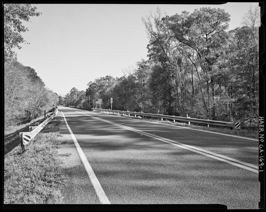
Photographer not recorded. Library of Congress
Fires near this place
480 since 1992Regional context, not property-specific evidence. The federal wildfire occurrence database lists 480 fires within 5 miles of Spann between 1992 and 2020, burning about 1,254 acres in total. 38 started naturally. 41 were recorded as arson. Distance is straight-line from the map coordinates, so a fire counted here may appear on a neighbouring settlement's page as well.
| Reported cause | Fires |
|---|---|
| Debris and open burning | 271 |
| Missing data/not specified/undetermined | 49 |
| Equipment and vehicle use | 47 |
| Arson/incendiarism | 41 |
| Natural | 38 |
| Misuse of fire by a minor | 14 |
| Recreation and ceremony | 11 |
| Smoking | 9 |
The most recent of them, most recent first, with the day each was reported and the service that recorded it.
| Date | Cause | Size | Reported by | Name on the report |
|---|---|---|---|---|
| 8 September 1997 | Missing data/not specified/undetermined | under an acre | Georgia Forestry Commission | not named |
| 6 September 2016 | Debris and open burning | 1.2 acres | Georgia Forestry Commission | FY2017-LAURENS-030 |
| 5 September 2002 | Debris and open burning | under an acre | Georgia Forestry Commission | FY2003-JOHNSON-020 |
| 4 September 1997 | Debris and open burning | 1.3 acres | Georgia Forestry Commission | not named |
| 30 September 2019 | Debris and open burning | under an acre | Georgia Forestry Commission | FY2020JOHNSON007 |
| 30 September 2008 | Debris and open burning | 1.7 acres | Georgia Forestry Commission | not named |
| 30 September 1993 | Equipment and vehicle use | under an acre | Georgia Forestry Commission | not named |
| 29 September 2001 | Arson/incendiarism | under an acre | Georgia Forestry Commission | FY2002-JOHNSON-005 |
Settlements close enough to share some of these fires:
Storms near this place
14 since 2005Regional context, not property-specific evidence. The National Weather Service names Spann in 14 storm reports between 2005 and 2024: 8 thunderstorm wind, 3 tornado, 1 hail, 1 lightning. The reports record 5 injuries. Each account below is quoted exactly as the forecast office filed it, from the NOAA Storm Events Database, and each date opens the federal record of that event.
| When | Event | Place named | Harm | What the report says |
|---|---|---|---|---|
| May 2008 | Tornado (EF1) | Spann | 5 hurt, $15,000,000 | A damage survey conducted by the National Weather Service Forecast Office in Peachtree City, Georgia confirmed that the EF1 tornado, that initially touched down in extreme northern Laurens just west-southwest of Tuckers Crossroads, continued on an eastward track into Johnson county, lifting a little less than one mile northeast of Wrightsville. Dozen of mobile and site-built homes in Wrightsville sustained minor to moderate damage as a result of this tornado, some of which were destroyed. Five injuries were reported from mobile homes destroyed with this tornado. An additional indirect injury resulted when a tree fell on an individual during debris clean up. In addition, numerous trees and power lines were downed along the path of the tornado through western Johnson county. The overall tornado path length was 10 miles, of which nearly nine occurred within Johnson county. The maximum path width was estimated to be up to 1/3 mile wide.||Within Johnson county, 227 homes were damaged, 22 of which were destroyed and 67 of which sustained major damage. Six public buildings also sustained minor to moderate damage. In addition, a total of five injuries were reported as a result of this tornado, four of which occurred as a result of damaged or destroyed mobile homes. The Georgia Forestry Commission reported extensive loss to timber within Johnson county when the tornado destroyed several hundred pine trees. |
| December 2005 | Tornado (F1) | Spann | $50,000 | The Laurens County Emergency Management Director confirmed that the tornado that first touched down in northeast Laurens county approximately seven miles northeast of Dublin continued across Georgia Highway 319 along the Laurens/Johnson county border and to near the town of Spann in extreme western Johnson county. Damage was confined mainly to trees, power lines, and a few outbuildings. |
| February 2014 | Tornado (EF1) | Spann | $40,000 | A National Weather Service storm survey team determined that the tornado that began in Laurens County continued into Johnson County. A mobile home was lifted off its foundation while another had its porch blown off by the storm. Doors of the Piney Mountain Fire Station were also blown off by the tornado. The tornado eventually dissipated northeast of the intersection between Highway 15/78 and Snell Bridge Road.|[02/21/14: Tornado #1, County #2-2, EF2, Laurens-Johnson, 2014:002]. |
| April 2011 | Thunderstorm Wind | Spann | $15,000 | The Johnson County Emergency Management Director reported that dozens of trees and a number of power lines were down throughout the county. However, the majority of the damage was between Meeks and Kite in the southeast part of the county. Georgia Highway 15 was blocked from downed trees in Wrightsville. More than hundred residents of the county were left without power for several hours following the storms. |
| February 2016 | Flash Flood | Spann | $10,000 | The Johnson County Emergency Manager reported several secondary roads from Wrightsville to Kite were closed due to flowing flood waters from nearby creeks. Some erosion to the road beds occurred. |
| September 2014 | Thunderstorm Wind | Spann | $10,000 | The Johnson County Emergency Manager reported four structures damaged by winds, including a mobile home blown off of a cinder block foundation and rolled, the roof of a hay barn blown off and shingles blown off a home. |
| June 2020 | Thunderstorm Wind | Spann | $3,000 | The Johnson County Emergency Manager reported a few trees blown down along Piney Mount Church Road. |
| November 2018 | Thunderstorm Wind | Spann | $2,000 | The Johnson County Emergency Manager reported trees blown down along Calvary Church Road. |
| August 2024 | Thunderstorm Wind | Spann | $1,000 | A tree was downed on piney mount church road at snell bridge road. |
| June 2018 | Thunderstorm Wind | Spann | $1,000 | The Johnson County Emergency Manager reported a tree blown down on Rex Jackson Road. |
| August 2015 | Thunderstorm Wind | Spann | $1,000 | The Johnson County 911 Center reported a tree blown down on Highway 15 South. |
| April 2015 | Lightning | Spann | $1,000 | The Johnson County Emergency Manager reported a building on Calvary Church Road near the Oconee River sustained damage after being struck by lightning. |
| July 2017 | Thunderstorm Wind | Spann | $500 | The Johnson County Emergency Manager reported a treetop snapped by winds that fell onto Liberty Grove Church Road near Cypress Creek Road. |
| May 2011 | Hail | Spann | - | The Johnson County Emergency Management Director reported penny-sized hail around Wrightsville. |
Nearest settlements
The eight closest, with where each one stands in the county. Distances are straight-line, computed from the Geographic Names Information System coordinates.
Provenance
This settlement is recorded in the Geographic Names Information System as feature 333096. The sheet list is computed by point-in-boundary test against the United States Geological Survey's historical topographic inventory. Both are works of the United States government and carry no copyright under 17 U.S.C. 105.
Wildfire. Short, Karen C. 2022. Spatial wildfire occurrence data for the United States, 1992-2020 [FPA_FOD_20221014]. 6th Edition. Fort Collins, CO: Forest Service Research Data Archive. https://doi.org/10.2737/RDS-2013-0009.6 Collected with United States Government funding and usable without additional permissions or fees.
Storms. NOAA National Centers for Environmental Information, Storm Events Database https://www.ncei.noaa.gov/stormevents/ A work of the United States government, no copyright under 17 U.S.C. 105. Narratives are quoted verbatim from the National Weather Service report and are not edited or summarised.