 Block
From the record
9 National Register listings published here.
Sources: the National Register database, National Park Service
29 topographic sheets and 8 fire insurance atlases across 1 place.
9 National Register listings published here.
Sources: the National Register database, National Park Service
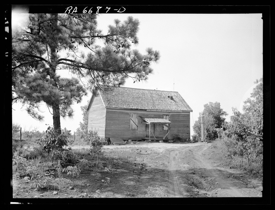
Taken for the Office of War Information and the Farm Security Administration, who photographed the country between 1935 and 1944. Works of United States government photographers, with no known restriction on use. Each opens its catalogue record.











Every property in this county listed on the National Register of Historic Places, with the year it was listed and the federal nomination document.
| Photograph | Property | Type | Listed | Reference |
|---|---|---|---|---|
 | Eatonton Historic District | district | 1975 | 75000605 |
| Gatewood House | building | 1975 | 75000606 | |
| Rockville Academy and St. Paul Methodist Church Historic District | district | 2002 | 02001382 | |
| Singleton House | building | 1974 | 74000701 | |
| Strong-Davis-Rice-George House | building | 2006 | 06000987 | |
| Terrell-Sadler House | district | 2000 | 00000303 | |
 | Tompkins Inn | building | 1978 | 78001002 |
| Turnwold | building | 1980 | 80001225 | |
| Woodland | building | 1979 | 79000741 |
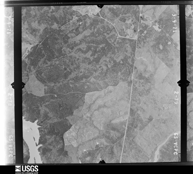
Flown by the U.S. Geological Survey between 1937 and 1989, the Aerial Photo Single Frames collection is the definitive mid-century view of the land: fields, roads and rivers as the camera saw them. The Survey holds 377 frames inside the rectangle that bounds this county; the 24 frames below were taken over the county itself, chosen across the decades of flights (at most four a year from that rectangle), so one flight cannot crowd out the rest. The full set is free to browse and download at EarthExplorer under the dataset Aerial Photo Single Frames.























The thermometers that kept this county's weather, and the gages that measured the flow of its streams, as the federal records hold them. The extremes below are measured values from those records, not estimates.
Who lived here in 1950, one enumeration district at a time, as the Census Bureau described each district. Each row opens its official National Archives result, with Population Schedules and ED Maps available there.
Every wildfire the federal occurrence database records inside this county: 869 of them, burning about 3,520 acres. 58 started naturally and 70 were recorded as arson. Each settlement page carries the fires within five miles of it.
| Reported cause | Fires |
|---|---|
| Debris and open burning | 510 |
| Equipment and vehicle use | 81 |
| Arson/incendiarism | 70 |
| Missing data/not specified/undetermined | 62 |
| Natural | 58 |
| Recreation and ceremony | 29 |
| Smoking | 29 |
| Misuse of fire by a minor | 26 |
| Power generation/transmission/distribution | 3 |
| Railroad operations and maintenance | 1 |
The five largest, by the area the report gives. None of them was recorded as arson.
| Date | Cause | Size | Reported by | Name on the report |
|---|---|---|---|---|
| 27 March 2017 | Debris and open burning | 138 acres | Georgia Forestry Commission | FY2017-PUTNAM-027 |
| 19 July 1993 | Natural | 136 acres | Georgia Forestry Commission | not named |
| 3 March 2017 | Natural | 115 acres | Chattahoochee-Oconee National Forest | CEDAR CREEK |
| 20 November 2016 | Debris and open burning | 65 acres | Georgia Forestry Commission | FY2017-PUTNAM-014 |
| 9 March 1993 | Debris and open burning | 55 acres | Georgia Forestry Commission | not named |
| 17 July 2000 | Debris and open burning | 54 acres | Georgia Forestry Commission | FY2001-PUTNAM-005 |
| 29 March 1998 | Missing data/not specified/undetermined | 53 acres | Georgia Forestry Commission | not named |
| 14 March 2004 | Debris and open burning | 49 acres | Georgia Forestry Commission | not named |
Every settlement page carries the fires within five miles of it - see the settlement index below.
The NOAA Storm Events Database holds 184 reports for this county, causing 4 deaths, 59 injuries and about $28,818,500 in recorded property damage. Each settlement page carries the reports that name it.
| Kind of event | Reports |
|---|---|
| Thunderstorm Wind | 108 |
| Hail | 47 |
| Flash Flood | 16 |
| Tornado | 7 |
| Lightning | 4 |
| Flood | 2 |
The most serious of them, by death, then injury, then recorded damage. The accounts are quoted exactly as the forecast office filed them.
| When | Event | Place named | Harm | What the report says |
|---|---|---|---|---|
| November 1992 | Tornado (F4) | not stated | 4 killed, 55 hurt, $25,000,000 | no account filed |
| July 1997 | Thunderstorm Wind | Eatonton | 3 hurt, $40,000 | Thunderstorm winds associated with a downburst knocked down several trees, overturned a couple of trailers, caused extensive damage to Lakeside Bait and Tackle, and caused a car to slide into Lake Sinclair. Several eyewitnesses reported hearing a roaring sound similar to a freight train. The winds first hit another bait and tackle shop on the west side of Georgia highway 441, damaging the low profile roof. Winds punched in the front doors and windows of the Lakeside Bait and Tackle shop, lifting and flipping the roof off to land some 100 yards away. The cinder block constructed building was a total loss. One lady, the co-owner, had seven stitches administered to the back of her head where she was hit by a flying cinder block. Two customers were also injured to a lesser degree. |
| February 2009 | Tornado (EF1) | Willard | 1 hurt, $200,000 | An aerial and ground survey conducted by the National Weather Service Forecast Office in cooperation with the Putnam County Emergency Management Director confirmed that an EF1 tornado carved an approximate 8-9 mile track across Putnam county very near Georgia Highway 16. The tornado first touched down near Williard, west of Eatonton and continued on an east-southeastward track toward, lifting very near the Hancock county line. Much of the resulting damage occurred near Glenwood Springs Road. A restaurant and two other commercial buildings were completely destroyed on the southwest side of Eatonton. At least one person was injured from debris in this area. A number of trees were either uprooted or snapped along the path of the tornado, along with many downed power lines. U.S. Highway 129, south of Eatonton, was closed for several hours as it was blocked from numerous downed trees and power lines. Several individuals were trapped in their vehicles in this area. The tornado was determined to have a maximum path width of 3/4 mile. Maximum winds gusts within the tornado were estimated to have been 110 mph. |
| April 2011 | Tornado (EF1) | Flat Rock | $1,000,000 | A damage survey conducted by the National Weather Service Forecast Office in Peachtree City, Georgia confirmed that yet another EF1 tornado had touched down in east central Georgia. This was a weak EF1 tornado that touched down in southeast Putnam county near the town of Flat Rock and traveled northeast into western Hancock county before lifting. The tornado weakened to an EF0 strength as it moved into Hancock county and lifted approximately six miles northwest of Devereux. The total path length of the tornado was determined to be seven miles, of which slightly less than four miles fell within Putnam county. The maximum path width was determined to be 200 yards with maximum winds estimated to be 90 mph. Much of the path of the tornado was across Lake Sinclair. There were essentially two segments of the tornado path, but both segments were within two miles of each other. Thus, this has been considered as one tornado path. Four homes were heavily damaged or destroyed near the lake and the eastern border of Putnam county, mostly from uprooted large trees down on the structures. A nearby outbuilding had its roof completely lifted off. Dozens of trees were snapped or uprooted along the path of the tornado. Several power lines were also down as well.||[04/27-04/28/11: Tornado #14, County #1-2, EF1, Putnam-Hancock, 2011:023]. |
| June 2008 | Lightning | Eatonton | $500,000 | The Eatonton Messenger reported that lightning struck Oconee Porter Fireplace and Insulation Building, a warehouse off Sammons Industrial Boulevard on the northwest side of Eatonton, was destroyed when a lightning strike set the roof and piles of insulation on fire. |
| March 2013 | Hail | Hunts | $222,000 | The public reported golfball sized hail in Eatonton. The hail was so deep it covered the ground completely. |
| August 2015 | Thunderstorm Wind | Reids Crossroads | $200,000 | Analysis of damage photos by the National Weather Service determined that microburst winds up to 85 mph downed 50 to 100 trees at the Rock Eagle 4-H Center. Two cars were destroyed and seven cabins were damaged due by falling trees or limbs. Four hundred students and adults were visiting the center at the time, however no injuries reported. |
| June 2001 | Flash Flood | Countywide | $200,000 | The Putnam County 911 center reported that several roads in the county were flooded, including some state highways. Several secondary roads had to be closed, but most were reopened. While no major damage was reported, rather extensive repairs were required to some roads because of culvert damage and erosion caused by the high water. Rainfall of 3 to 5 inches in a 3 to 5 hour time period contributed to the flooding. |
| February 2009 | Hail | Eatonton | $130,000 | The Putnam County Emergency Management Director reported golf ball-sized hail in the Eatonton area. Several reports of golf ball-sized hail were received from the southwest to the northeast part of the county. Radar supported that hail of this size likely fell across in a swath from west to east near and just north of Georgia Highway 16. |
| March 2008 | Hail | Reids Crossroads | $130,000 | The public reported golf ball-sized hail from the Eatonton area as yet another severe thunderstorm tracked across northern Putnam county. Radar supported that large hail fell across much of northwest, north central, and east central Putnam county. |
| December 2009 | Tornado (EF0) | Eatonton | $120,000 | A damage survey conducted by the National Weather Service Forecast Office in Peachtree City, Georgia confirmed that yet a third tornado had touched down in central Georgia. This tornado also touched down in Putnam county, but this time was rated an EF1 with maximum winds of 90 mph. This tornado touched down near Little Road and Harmony Road, approximately 8.2 miles north-north of Eatonton, then moved north-northeast to a point near 9.0 miles north-northeast of Eatonton. The maximum path width was determined to be 100 yards. Hundreds of trees and several power lines were down along the path of the tornado. One mobile home was rolled over on its side. The occupant of the mobile home escaped uninjured, but was taken to the hospital anyway because of a coronary episode. At least one outbuilding was destroyed, tin roofing was blown off a portion of one home's roof, and some fencing was also blown down along the path of the tornado. |
| April 2020 | Tornado (EF1) | Willard | $100,000 | A high-end EF1 tornado touched down along Shady Dale Rd in Putnam County knocking down a few trees. The tornado continued NE through the Oconee National Forest downing trees and crossing Godfrey Rd where numerous trees were snapped or|uprooted. Most of the damage to this point was rated EF0 to low-end EF1. As the tornado moved NE crossing Reids Rd it intensified to maximum intensity snapping hundreds of trees 10 feet off the ground as it crossed the road. The storm continued NE crossing Hwy 129 snapping and uprooting trees. Three homes located along the hwy |sustained minor roof damage from the storm. The storm crossed Bethel Church Rd snapping trees and across Lower Harmony Road where the top of a silo was torn off in addition to roofing material from a nearby barn. The storm eventually crossed Denham |road knocking over a few trees before lifting as it approached a neighborhood along Hunters Chase Ct. [04/13/20: Tornado #16, County #1/1, EF-1, Putnam, 2020:022]. |
| July 2011 | Lightning | Resseaus Xrds | $100,000 | The Putnam County Emergency Management Director reported that lightning struck and set a home on fire in the Resseaus Crossroads area in the far southern part of the county near the Baldwin and Jones county line. A couple of trees were down from strong thunderstorm winds in the northern part of the county near the 4H Camp. One tree was down on Glades Road in the northwest part of the county and another on Phoenix Road in the northeast part of the county. |
| July 2011 | Lightning | Resseaus Xrds | $100,000 | The Putnam County Emergency Management Director reported that lightning struck and set a home on fire in the Resseaus Crossroads area in the far southern part of the county near the Baldwin and Jones county line. A couple of trees were down in the northern part of the county near the 4H Camp from strong thunderstorms winds. One tree was down on Glades Road in the northwest part of the county and another on Phoenix Road in the northeast part of the county. |
| December 2009 | Tornado (EF0) | Eatonton | $100,000 | A damage survey conducted by the National Weather Service in Peachtree City, Georgia confirmed that yet another brief EF0 tornado touched down in central Georgia, this time in western Putnam county. This tornado, as was the case with the earlier one in northern Jones county, touched down in a heavily forested area of the Oconee National Forest in western Putnam county. The tornado touched down approximately 4.3 miles west of Eatonton and traveled approximately 1.5 miles on a northeastward path before lifting about 3.5 miles west-northwest of Eatonton. Maximum winds with this tornado were estimated to be 85 mph with a maximum path width of 100 yards. As was the case with the Jones county tornado, the damage was confined to trees. In this case, nearly 500 trees were snapped off or uprooted along the damage path. At least 50 of these trees were down across forestry roads. Two hunters were trapped in the area by the downed trees, but were subsequently rescued unharmed when the forestry roads were cleared. |
| March 2008 | Hail | Reids Crossroads | $100,000 | The Putnam County Emergency Management Director report golf ball-sized hail across the northern portion of the county. At least two vehicles suffered significant damage from the hail. |
| June 2010 | Thunderstorm Wind | Rockville | $75,000 | The local newspaper for the city of Eatonton reported that numerous trees were blown down in the vicinity of the Oconee Wildlife Management Agency. Trees were down on a home, a vehicle, and at least one power line. Most of the damage occurred in the vicinity of Village Court and Jamestown Drive. |
| July 2008 | Thunderstorm Wind | Eatonton | $75,000 | The public reported that a number of trees were down on the south side of Eatonton. Damage was reported to some buildings and vehicles in the area as a result of the downed trees. Several homes in the area sustained damage when trees fell on them. The Eatonton Messenger reported that most of the damage in Eatonton was along North Jefferson, Magnolia, and Putnam Avenues, or along South Washington and Church Street, or Agnes Drive. |
| April 2009 | Thunderstorm Wind | Eatonton | $50,000 | The Putnam County Emergency Management Director reported that several trees and power lines were down around Eatonton. Trees were down on at least three mobile homes causing damage to the structures. Radar data suggests that this storm traveled from just west of Eatonton to the southeast corner of the county near Flat Rock. |
| April 2011 | Flash Flood | Harmony | $30,000 | The Putnam County Emergency Management Director reported that a small drainage branch washed out a small portion of Little River Trail near Lake Sinclair. Another small drainage branch washed out a small portion of Martin Luther King Road near Eatonton. Rainfall of three to four inches was common across much of the county between 2 am and 5 am EDT on this day. Damages were to fixed washed out roads and culverts and remove debris. |
| March 2010 | Hail | Eatonton | $26,000 | The Putnam County 911 Center reported golf ball-sized hail approximately six miles southeast of Eatonton. The public observed quarter-sized hail on the Putnam county sided of Reynolds Plantation on Lake Oconee. |
| January 2017 | Tornado (EF0) | Dennis | $25,000 | The Putnam County Emergency Manager reported an EF0 tornado with a maximum path width of 50 yards and maximum wind speeds of 75 MPH in the Lake Sinclair area of southern Putnam County. Several trees were blown down damaging some homes from around Bluegill Road SW and Ford Road across Dennis Station Road to Dennis Way. [01/21/17: Tornado #16, County #1/1, EF0, Putnam, 2017:017]. |
| August 2005 | Thunderstorm Wind | Rudden | $25,000 | The Lake Oconee News reported that thunderstorm winds blew down a number of trees in the far northeast part of the county. Several homes near Lake Oconee were damaged by fallen trees. Most of the damage was minor, however. |
| June 2016 | Thunderstorm Wind | Eatonton | $20,000 | The Eatonton Messenger newspaper reported numerous trees and power lines blown down across the county. Some locations include on East Walnut Street in Eatonton; off of Milledgeville Road where a large branch severely damaged an automobile; Pea Ridge Road; Martin Luther King Jr. Drive; Oconee Springs Road; and Scuffleboro Road. |
| December 2009 | Thunderstorm Wind | Oconee Springs | $15,000 | A damage survey conducted by the National Weather Service in Peachtree City, Georgia confirmed that strong straight-line winds up to 80 mph affected the northern parts of Lake Sinclair in southeastern Putnam county, near the Baldwin and Hancock county lines. A mobile home on Twisting Hill Road suffered damage. A loosely attached screen porch was thrown 20 yards from the mobile home and destroyed. In addition, at least 20 trees were also down in the area from these strong winds. |
| March 2010 | Hail | Warfield | $10,000 | A storm spotter observed golf ball-sized hail in the southeast part of the county, southeast of Warfield. |
| September 2009 | Flash Flood | Hearnville | $10,000 | The USGS stream gage on the Little River near Eatonton reached its flood stage of 20 feet at 945 pm EDT. It remained above flood stage for several hours thereafter. Some areas near the river experienced minor flooding. Monetary damage was limited to debris removal adjacent to the river. |
| July 2008 | Thunderstorm Wind | Reids Crossroads | $10,000 | The Putnam County Emergency Management Director reported that numerous trees and power lines were blown down throughout the county. Wind gusts were estimated to be 60 mph. |
| January 2021 | Thunderstorm Wind | Dennis | $8,000 | The Putnam County Emergency Manager reported several trees blown down near the intersection of Twin Bridges Road and Dennis Station Road. |
| April 2020 | Thunderstorm Wind | Eatonton | $8,000 | EM reported multiple trees down along Old Glenwood Springs Road. |
| June 2000 | Thunderstorm Wind | Flat Rock | $8,000 | The Gold Store in Flat Rock reported several trees down, including one that damaged a house. |
| March 2018 | Thunderstorm Wind | The Glades | $6,000 | The Putnam County 911 center reported trees blown down from northwest of Eatonton near the intersection of Godfrey Road and Glades Road to around Twisting Hill Road and Forest Hill Drive southeast of Eatonton on Lake Sinclair. |
| July 2024 | Thunderstorm Wind | Linchburg | $5,000 | Multiple trees as well as power lines were reported down in the area of Glenwood Springs Road at Halls Road. |
| June 2018 | Thunderstorm Wind | Flat Rock | $5,000 | The Putnam County Emergency Manager reported trees blown down in the Lake Sinclair area from around Crooked Creek Road and Scuffleboro Road to around Twisting Hill Road and Twisting Hill Drive. |
| June 2015 | Thunderstorm Wind | Flat Rock | $5,000 | The Putnam County 911 Center reported two trees down on power lines at the intersection of Pea Ridge Road and Flatrock Road. |
| February 2012 | Thunderstorm Wind | Hunts | $5,000 | The Putnam County 911 Center reported that several trees were blown down along Route 129 and in Eatonton. Traffic lights were were out in Eatonton as well. |
| October 2010 | Thunderstorm Wind | Eatonton | $5,000 | The public reported that at least a dozen trees were down on the east and southeast side of Eatonton. Several power lines were also down. Some roads were blocked. Widespread power outages were noted in the area. |
| April 2009 | Thunderstorm Wind | Willard | $5,000 | The Putnam County Emergency Management Director reported that many trees were blown down throughout the county. No structural damage was reported. |
| May 2008 | Thunderstorm Wind | Eatonton | $5,000 | The Putnam County 911 Center reported that several trees were down around the city of Eatonton. |
| June 2007 | Thunderstorm Wind | Rudden | $5,000 | The Putnam County Emergency Management Director reported that up to a dozen trees were down in the far northeast part of the county, about 10 miles northeast of Eatonton. Several of the trees were down on roads and several others were down on power lines. |
| June 2004 | Flash Flood | Eatonton | $5,000 | The Eatonton Messenger reported that very heavy rain in a 2 1/2 hour period resulted in significant flooding to homes and businesses in the area. At least four roads had to be closed because of flood waters. A non-empty storage shed was swept down a road by the flood waters and a refrigerator, left on the curb for pickup, was also swept down another street by flood waters. The heavy rain caused sewer pipes near City Hall to backup and resulted in over 8 inches of water getting into the basement of the facility, causing damage to materials stored in the area. Several yards in the area were also flooded. The Putnam County 911 center reported that the heavy rain had also caused minor flooding on a dirt road. |
| July 2003 | Thunderstorm Wind | Eatonton | $5,000 | The Putnam county 911 center reported that several trees and power lines were down on Georgia Highway 16 just west of town. |
| May 2003 | Flash Flood | Eatonton | $5,000 | The Eatonton Messenger reported that very heavy rain resulted in flooding of ditches, streets, yards, and driveways. Some driveways were even washed away. Rooty Creek also quickly exceeded bankfull and flooded the lawn of the Putnam Senior Citizen Center. |
| May 2003 | Thunderstorm Wind | Countywide | $5,000 | The Putnam county 911 center reported that a number of trees were blown down around the county. |
| June 1994 | Thunderstorm Wind | Eatonton | $5,000 | Several large trees were blown down or uprooted at Oconee Springs Park by thunderstorm winds. |
| June 1994 | Thunderstorm Wind | Eatonton | $5,000 | Several large trees were downed by thunderstorm winds. |
| June 1994 | Thunderstorm Wind | Eatonton | $5,000 | Several large trees and power lines were blown down by thunderstorm winds. |
| June 1994 | Thunderstorm Wind | Eatonton | $5,000 | Several large trees and power lines were downed by thunder- storm winds across the county. |
| August 1994 | Thunderstorm Wind | Eatonton | $5,000 | Thunderstorm winds blew off a tin roof from a barn at a dairy farm which downed power lines and caused power outages across the county for a couple of hours. Several large trees were also downed across the county by thunderstorm winds. |
| July 2020 | Thunderstorm Wind | Resseaus Xrds | $4,000 | The Putnam County 911 center reported trees blown down near the intersection of Highway 212 and Twin Bridges Road SW and along Thomas Drive in the far southern portion of the county. |
| July 2017 | Thunderstorm Wind | Note | $4,000 | The Putnam County Emergency Manager reported trees blown from around the intersection of Holden Road and Old Macon Circle to around the intersection of Pea Ridge Road and Possum Point Drive. |
| June 2016 | Thunderstorm Wind | Clopton | $4,000 | The Putnam County Emergency Manager reported several trees blown down along Highway 44 in the northeastern portion of the county. |
| December 2015 | Flash Flood | Apollo | $3,000 | The Putnam County Emergency Manager reported minor flooding of woodlands and fields along the Little River upstream from Georgia Highway 16 or 5 miles west of Eatonton. |
| May 2012 | Thunderstorm Wind | Hunts | $3,000 | The Putnam County 911 Center reported that several trees and a few power lines were blown down in Eatonton. |
| July 2010 | Thunderstorm Wind | Eatonton | $3,000 | The public reported that several trees were blown down around Eatonton. A portion of U.S. 441 Business Highway in the city of Eatonton was closed. |
| September 2009 | Flood | Hearnville | $3,000 | The USGS stream gage on the Little River along Georgia Highway 16 near Eatonton remained over the 20.0 foot flood stage much of the early morning hours from earlier flash flooding. Several other creeks and streams across the county were at or above bankfull. A few roads sustained minor damage. |
| May 2008 | Thunderstorm Wind | Flat Rock | $3,000 | The Putnam County Emergency Management Director reported that several trees were down in the southeast part of the county around Flat Rock. |
| June 2024 | Thunderstorm Wind | Flat Rock | $2,000 | Em reports two trees down across 700 block of Milledgeville Rd. |
| June 2018 | Thunderstorm Wind | Clopton | $2,000 | The Putnam County 911 center reported a tree blown down at the intersection of Highway 44 and Wesley Chapel Road. The fallen tree pulled down power lines as well. |
| May 2017 | Thunderstorm Wind | Resseaus Xrds | $2,000 | The Putnam County Emergency Manager reported trees blown down near the intersection of Rabbit Skip Road and Highway 129. |
Named settlements recorded in the Geographic Names Information System, each with the topographic sheets covering it. Villages, hamlets and abandoned places alike. Each is shown with the nearest named watercourse or landform and the survey quadrangle it falls on. The 1 place that was also surveyed for fire insurance comes first, with the number of atlases and photographs held for them.
Eatonton census division · 31024 · On Rocky Branch · Eatonton quadrangle
11 sheets, 1953 to 1988
Fire insurance: 8 atlases
Eatonton census division · 31024 · Smithboro quadrangle
11 sheets, 1953 to 1988
No longer a settlement
Little River census division · 31024 · On Cold Branch · Resseaus Crossroads quadrangle
12 sheets, 1953 to 1988
No longer a settlement
Little River census division · 31024 · On Little Creek · Lake Sinclair West quadrangle
10 sheets, 1953 to 1988
Phoenix census division · 30625 · On Jacks Fork · Harmony quadrangle
12 sheets, 1953 to 1988
Little River census division · 31024 · On Baker Branch · Eatonton quadrangle
11 sheets, 1953 to 1988
No longer a settlement
Little River census division · 31024 · Lake Sinclair West quadrangle
10 sheets, 1953 to 1988
Eatonton census division · 31024 · On Hone Branch · Shady Dale quadrangle
11 sheets, 1953 to 1988
No longer a settlement
Little River census division · 31024 · On Beaverdam Creek · Eatonton quadrangle
11 sheets, 1953 to 1988
No longer a settlement
Phoenix census division · 31024 · On Jacks Fork · Harmony quadrangle
12 sheets, 1953 to 1988
Eatonton census division · 31024 · On Glady Creek · Eatonton quadrangle
11 sheets, 1953 to 1988
Little River census division · 31024 · On Little Branch · Meda quadrangle
10 sheets, 1953 to 1988
Phoenix census division · 31024 · On Jenkins Branch · Rockville quadrangle
11 sheets, 1953 to 1988
Eatonton census division · 31024 · On Baltimore Branch · Rock Eagle Lake quadrangle
10 sheets, 1953 to 1988
Little River census division · 31024 · On Cold Branch · Resseaus Crossroads quadrangle
12 sheets, 1953 to 1988
Phoenix census division · 31024 · On Buckshot Branch · Rockville quadrangle
11 sheets, 1953 to 1988
Eatonton census division · 31024 · On Weaver Branch · Harmony quadrangle
12 sheets, 1953 to 1988
Phoenix census division · 31024 · Harmony quadrangle
12 sheets, 1953 to 1988
No longer a settlement
Little River census division · 31024 · Stanfordville quadrangle
12 sheets, 1953 to 1988
Eatonton census division · 31024 · Rock Eagle Lake quadrangle
10 sheets, 1953 to 1988
No longer a settlement
Eatonton census division · 31024 · On Little Branch · Eatonton quadrangle
11 sheets, 1953 to 1988
The vanished settlements of Putnam County: the places named above that are no longer on the map.
11 topographic sheets and 8 fire insurance atlases, 1884 to 1945
The complete index, with nothing left out. Each of these is a separate record with its own page: a federal survey report, or the case file that argued a property on to the National Register. Both are public domain and reproduced word for word.
The vanished settlements of Putnam County, the places these records name that are no longer on the map.