 Block
Willard, Georgia
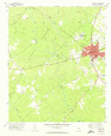
11 topographic sheets cover this place, the earliest surveyed in 1953 and the latest in 1988. It stands in the Eatonton census division. It lies in ZIP code area 31024. The Survey maps it on the Eatonton quadrangle. It stands 554 feet above sea level.
On record in Willard
Buildings and businesses the archive holds for this place. Each opens its own page, with the source record it came from.
On the National Register within a mile 1 record
The National Register names another town for these. They stand within one mile of this settlement's coordinate.
- Singleton Houselisted 1974 · 0.9 miles away
Topographic sheets covering this place
7 surveys from 11 printed sheetsMatched by testing this settlement's coordinate against the published boundary of every sheet in the United States Geological Survey's historical collection. Each opens the scanned sheet at the Survey.
- 1953 USGS Athens quadrangle1:250000, 3 printings
- 1958 USGS Athens quadrangle1:250000
- 1959 USGS Athens quadrangle1:250000
- 1963 USGS Athens quadrangle1:250000
- 1972 USGS Eatonton quadrangle1:24000, 2 printings
- 1981 USGS Milledgeville quadrangle1:100000, 2 printings
- 1988 USGS Athens quadrangle1:250000

Fires near this place
164 since 1992Regional context, not property-specific evidence. The federal wildfire occurrence database lists 164 fires within 5 miles of Willard between 1992 and 2020, burning about 529 acres in total. 14 started naturally. 17 were recorded as arson. Distance is straight-line from the map coordinates, so a fire counted here may appear on a neighbouring settlement's page as well.
| Reported cause | Fires |
|---|---|
| Debris and open burning | 78 |
| Equipment and vehicle use | 17 |
| Arson/incendiarism | 17 |
| Missing data/not specified/undetermined | 16 |
| Natural | 14 |
| Recreation and ceremony | 7 |
| Smoking | 7 |
| Misuse of fire by a minor | 7 |
| Power generation/transmission/distribution | 1 |
The most recent of them, most recent first, with the day each was reported and the service that recorded it.
| Date | Cause | Size | Reported by | Name on the report |
|---|---|---|---|---|
| 8 September 2007 | Equipment and vehicle use | under an acre | Georgia Forestry Commission | not named |
| 7 September 2016 | Debris and open burning | 3.0 acres | Georgia Forestry Commission | FY2017-PUTNAM-006 |
| 6 September 2010 | Debris and open burning | under an acre | Georgia Forestry Commission | FY2011-PUTNAM-001 |
| 6 September 2010 | Debris and open burning | under an acre | Georgia Forestry Commission | FY2011-PUTNAM-003 |
| 6 September 2010 | Debris and open burning | 5.7 acres | Georgia Forestry Commission | FY2011-PUTNAM-002 |
| 5 September 1999 | Debris and open burning | 2.5 acres | Georgia Forestry Commission | not named |
| 3 September 1997 | Debris and open burning | under an acre | Georgia Forestry Commission | not named |
| 25 September 1999 | Debris and open burning | under an acre | Georgia Forestry Commission | not named |
Settlements close enough to share some of these fires:
Storms near this place
13 since 1998Regional context, not property-specific evidence. The National Weather Service names Willard in 13 storm reports between 1998 and 2020: 5 hail, 5 thunderstorm wind, 2 tornado, 1 lightning. The reports record 1 injury. Each account below is quoted exactly as the forecast office filed it, from the NOAA Storm Events Database, and each date opens the federal record of that event.
| When | Event | Place named | Harm | What the report says |
|---|---|---|---|---|
| February 2009 | Tornado (EF1) | Willard | 1 hurt, $200,000 | An aerial and ground survey conducted by the National Weather Service Forecast Office in cooperation with the Putnam County Emergency Management Director confirmed that an EF1 tornado carved an approximate 8-9 mile track across Putnam county very near Georgia Highway 16. The tornado first touched down near Williard, west of Eatonton and continued on an east-southeastward track toward, lifting very near the Hancock county line. Much of the resulting damage occurred near Glenwood Springs Road. A restaurant and two other commercial buildings were completely destroyed on the southwest side of Eatonton. At least one person was injured from debris in this area. A number of trees were either uprooted or snapped along the path of the tornado, along with many downed power lines. U.S. Highway 129, south of Eatonton, was closed for several hours as it was blocked from numerous downed trees and power lines. Several individuals were trapped in their vehicles in this area. The tornado was determined to have a maximum path width of 3/4 mile. Maximum winds gusts within the tornado were estimated to have been 110 mph. |
| April 2020 | Tornado (EF1) | Willard | $100,000 | A high-end EF1 tornado touched down along Shady Dale Rd in Putnam County knocking down a few trees. The tornado continued NE through the Oconee National Forest downing trees and crossing Godfrey Rd where numerous trees were snapped or|uprooted. Most of the damage to this point was rated EF0 to low-end EF1. As the tornado moved NE crossing Reids Rd it intensified to maximum intensity snapping hundreds of trees 10 feet off the ground as it crossed the road. The storm continued NE crossing Hwy 129 snapping and uprooting trees. Three homes located along the hwy |sustained minor roof damage from the storm. The storm crossed Bethel Church Rd snapping trees and across Lower Harmony Road where the top of a silo was torn off in addition to roofing material from a nearby barn. The storm eventually crossed Denham |road knocking over a few trees before lifting as it approached a neighborhood along Hunters Chase Ct. [04/13/20: Tornado #16, County #1/1, EF-1, Putnam, 2020:022]. |
| April 2009 | Thunderstorm Wind | Willard | $5,000 | The Putnam County Emergency Management Director reported that many trees were blown down throughout the county. No structural damage was reported. |
| April 2011 | Thunderstorm Wind | Willard | $2,000 | The Putnam County 911 Center reported that at least half-a-dozen trees were down across the county, probably more. |
| June 2001 | Thunderstorm Wind | Willard | $1,500 | The Putnam County 911 center reported that nine trees were blown down in the western portion of the county, five on Georgia Highway 16 between Willard and Eatonton, five on Georgia Highway 142 near Willard, and two on U.S. Highway 441 near Eatonton. |
| June 2019 | Thunderstorm Wind | Willard | $1,000 | The Putnam County Emergency Manager reported a tree blown down across the road at the intersection of Highways 16 and 142. |
| October 2010 | Lightning | Willard | $500 | The Eatonton Messenger reported that lightning struck a tree in the Oconee National Forest setting the tree on fire. The fire was contained quickly by the Georgia Forestry Service. Heavy rain ongoing at the time also helped to keep the fire from spreading. |
| May 2015 | Thunderstorm Wind | Willard | - | Couple of trees down along Highway 16, west of Eatonton. Time estimated by radar. |
| April 2011 | Hail | Willard | - | The Putnam county 911 center observed nickel to quarter-sized hail in Eatonton outside the County 911 Building. WSR-88D radar data suggests that similar-sized hail likely fell across much of the county from the southwest corner to the northeast corner. |
| April 2009 | Hail | Willard | - | The Putnam County 911 Center reported penny-sized hail near Eatonton. Radar data suggests that similar sized-hail or larger likely fell across the northwest part of the county. |
| April 2009 | Hail | Willard | - | The public observed nickel-sized hail in the Eatonton area. Radar data suggests that penny to nickel-sized hail likely fell across much of the central portion of the county from west to east. |
| May 2003 | Hail | Willard | - | The Putnam county 911 center reported penny-sized hail. |
| April 1998 | Hail | Willard | - | Dime size hail was reported near the intersection of highways 142 and 300. |
Nearest settlements
The eight closest, with where each one stands in the county. Distances are straight-line, computed from the Geographic Names Information System coordinates.
| Map | Place | Distance | Sheets |
|---|---|---|---|
| Linchburg | 1.7 miles | 11 | |
| Note | 2.9 miles | 11 | |
| Huron (historical) | 3.2 miles | 11 | |
| Glenwoods Spring (historical) | 3.4 miles | 11 | |
| Apollo (historical) | 4.6 miles | 11 | |
| Hunts | 4.7 miles | 11 | |
| Imperial | 4.9 miles | 11 | |
| Eatonton | 5.2 miles | 11 |
Elsewhere
Matched on this settlement's Geographic Names Information System number rather than its name, so it cannot be a different place of the same name in another state.
| Wikipedia article on Willard | An encyclopaedic summary. Its text is share-alike, so it is linked here rather than copied. |
| Wikidata item Q8003350 | The structured record the population and elevation above come from. Public domain (CC0). |
Provenance
This settlement is recorded in the Geographic Names Information System as feature 333430. The sheet list is computed by point-in-boundary test against the United States Geological Survey's historical topographic inventory. Both are works of the United States government and carry no copyright under 17 U.S.C. 105.
Wildfire. Short, Karen C. 2022. Spatial wildfire occurrence data for the United States, 1992-2020 [FPA_FOD_20221014]. 6th Edition. Fort Collins, CO: Forest Service Research Data Archive. https://doi.org/10.2737/RDS-2013-0009.6 Collected with United States Government funding and usable without additional permissions or fees.
Storms. NOAA National Centers for Environmental Information, Storm Events Database https://www.ncei.noaa.gov/stormevents/ A work of the United States government, no copyright under 17 U.S.C. 105. Narratives are quoted verbatim from the National Weather Service report and are not edited or summarised.