 Block
Eatonton, Georgia
11 topographic sheets cover this place, the earliest surveyed in 1953 and the latest in 1988. It stands in the Eatonton census division. It lies in ZIP code area 31024. It stands on Rocky Branch. The Survey maps it on the Eatonton quadrangle. 6,307 people lived here at the 2020 count. It stands 568 feet above sea level.
Research this city
On record in Eatonton
Buildings and businesses the archive holds for this place. Each opens its own page, with the source record it came from.
On the National Register 8 records
 Eatonton Historic Districtlisted 1975
 Tompkins Innlisted 1978
- Gatewood Houselisted 1975
- Rockville Academy and St. Paul Methodist Church Historic Districtlisted 2002
- Singleton Houselisted 1974
- Strong-Davis-Rice-George Houselisted 2006
- Turnwoldlisted 1980
- Woodlandlisted 1979
Surveyed buildings and structures 3 records
- Paschal-Sammons House, Maple Avenue, Eatontonfederal building survey, 1 photograph
- Putnam County Courthouse, Town Square, Eatontonfederal building survey, 1 photograph
- Rock Eagle Mound, Rock Eagle State Park, U.S. Route 441, Eatontonfederal building survey, 1 photograph
Population over time
2 figuresEatonton fell from 6,480 to 6,307 between 2010 and 2020. These are the recorded population figures Wikidata holds for this place, reached through the Geographic Names Information System number this page is keyed on rather than by name, so they belong to this place and not to another of the same name. Most are census counts, but not all are: an early figure may be a founding or settlement estimate, and an estimate published within five years of a census is left out. The change column is computed, and is left blank where more than 20 years separate a figure from the one before it, because a gap that long is not a change between two counts.
| Year | People | Change |
|---|---|---|
| 2010 | 6,480 | |
| 2020 | 6,307 | -173 (-3%) |
Topographic sheets covering this place
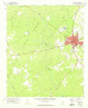
7 surveys from 11 printed sheetsMatched by testing this settlement's coordinate against the published boundary of every sheet in the United States Geological Survey's historical collection. Each opens the scanned sheet at the Survey.
- 1953 USGS Athens quadrangle1:250000, 3 printings
- 1958 USGS Athens quadrangle1:250000
- 1959 USGS Athens quadrangle1:250000
- 1963 USGS Athens quadrangle1:250000
- 1972 USGS Eatonton quadrangle1:24000, 2 printings
- 1981 USGS Milledgeville quadrangle1:100000, 2 printings
- 1988 USGS Athens quadrangle1:250000



Photographs
8 of 12 photographs shown, 1936Taken for the Office of War Information and the Farm Security Administration, who photographed the country between 1935 and 1944. Works of United States government photographers, with no known restriction on use. Each opens its catalogue record.

Evans, Walker, 1936. Library of Congress

Mydans, Carl, photographer, 1936. Library of Congress

Evans, Walker, 1936. Library of Congress

Mydans, Carl, photographer, 1936. Library of Congress
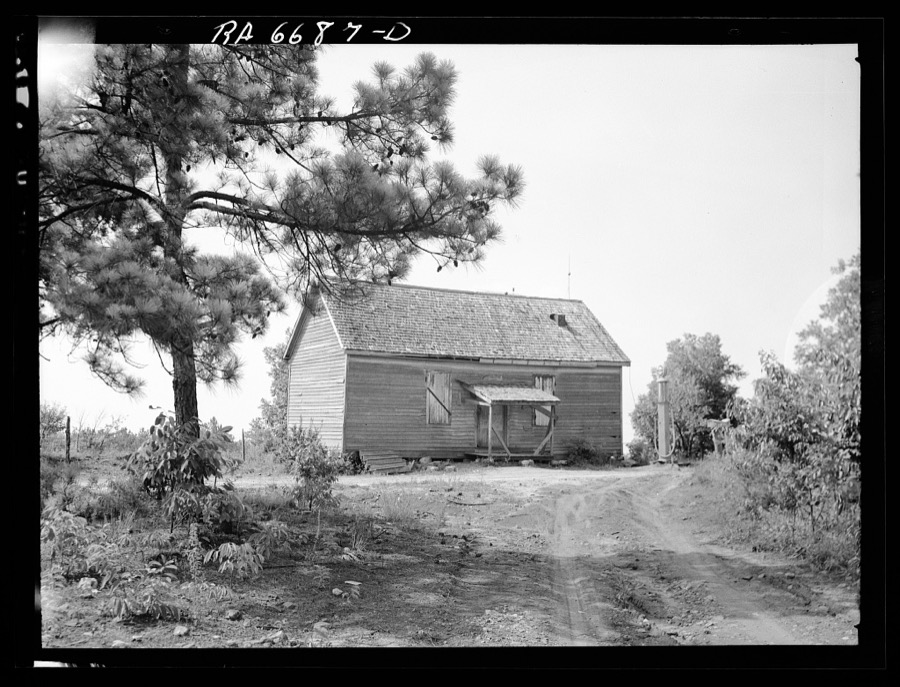
Mydans, Carl, photographer, 1936. Library of Congress
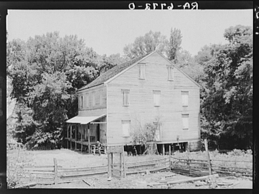
Mydans, Carl, photographer, 1936. Library of Congress

Mydans, Carl, photographer, 1936. Library of Congress

Mydans, Carl, photographer, 1936. Library of Congress
Every photograph of Putnam County
Fires near this place
219 since 1992Regional context, not property-specific evidence. The federal wildfire occurrence database lists 219 fires within 5 miles of Eatonton between 1992 and 2020, burning about 768 acres in total. 9 started naturally. 17 were recorded as arson. Distance is straight-line from the map coordinates, so a fire counted here may appear on a neighbouring settlement's page as well.
| Reported cause | Fires |
|---|---|
| Debris and open burning | 113 |
| Equipment and vehicle use | 31 |
| Missing data/not specified/undetermined | 17 |
| Arson/incendiarism | 17 |
| Misuse of fire by a minor | 12 |
| Smoking | 9 |
| Natural | 9 |
| Recreation and ceremony | 9 |
| Railroad operations and maintenance | 1 |
| Power generation/transmission/distribution | 1 |
The most recent of them, most recent first, with the day each was reported and the service that recorded it.
| Date | Cause | Size | Reported by | Name on the report |
|---|---|---|---|---|
| 8 September 2010 | Debris and open burning | under an acre | Georgia Forestry Commission | FY2011-PUTNAM-006 |
| 7 September 2016 | Debris and open burning | 3.0 acres | Georgia Forestry Commission | FY2017-PUTNAM-006 |
| 7 September 2010 | Debris and open burning | 13 acres | Georgia Forestry Commission | FY2011-PUTNAM-005 |
| 7 September 2010 | Debris and open burning | 16 acres | Georgia Forestry Commission | FY2011-PUTNAM-004 |
| 5 September 1999 | Debris and open burning | 2.5 acres | Georgia Forestry Commission | not named |
| 28 September 2008 | Debris and open burning | under an acre | Georgia Forestry Commission | not named |
| 28 September 2006 | Equipment and vehicle use | 1.9 acres | Georgia Forestry Commission | not named |
| 26 September 1993 | Recreation and ceremony | 2.6 acres | Chattahoochee-Oconee National Forest | not named |
Settlements close enough to share some of these fires:
Storms near this place
56 since 1994Regional context, not property-specific evidence. The National Weather Service names Eatonton in 56 storm reports between 1994 and 2025: 31 thunderstorm wind, 20 hail, 2 flash flood, 2 tornado. The reports record 3 injuries. Each account below is quoted exactly as the forecast office filed it, from the NOAA Storm Events Database, and each date opens the federal record of that event.
| When | Event | Place named | Harm | What the report says |
|---|---|---|---|---|
| July 1997 | Thunderstorm Wind | Eatonton | 3 hurt, $40,000 | Thunderstorm winds associated with a downburst knocked down several trees, overturned a couple of trailers, caused extensive damage to Lakeside Bait and Tackle, and caused a car to slide into Lake Sinclair. Several eyewitnesses reported hearing a roaring sound similar to a freight train. The winds first hit another bait and tackle shop on the west side of Georgia highway 441, damaging the low profile roof. Winds punched in the front doors and windows of the Lakeside Bait and Tackle shop, lifting and flipping the roof off to land some 100 yards away. The cinder block constructed building was a total loss. One lady, the co-owner, had seven stitches administered to the back of her head where she was hit by a flying cinder block. Two customers were also injured to a lesser degree. |
| June 2008 | Lightning | Eatonton | $500,000 | The Eatonton Messenger reported that lightning struck Oconee Porter Fireplace and Insulation Building, a warehouse off Sammons Industrial Boulevard on the northwest side of Eatonton, was destroyed when a lightning strike set the roof and piles of insulation on fire. |
| February 2009 | Hail | Eatonton | $130,000 | The Putnam County Emergency Management Director reported golf ball-sized hail in the Eatonton area. Several reports of golf ball-sized hail were received from the southwest to the northeast part of the county. Radar supported that hail of this size likely fell across in a swath from west to east near and just north of Georgia Highway 16. |
| December 2009 | Tornado (EF0) | Eatonton | $120,000 | A damage survey conducted by the National Weather Service Forecast Office in Peachtree City, Georgia confirmed that yet a third tornado had touched down in central Georgia. This tornado also touched down in Putnam county, but this time was rated an EF1 with maximum winds of 90 mph. This tornado touched down near Little Road and Harmony Road, approximately 8.2 miles north-north of Eatonton, then moved north-northeast to a point near 9.0 miles north-northeast of Eatonton. The maximum path width was determined to be 100 yards. Hundreds of trees and several power lines were down along the path of the tornado. One mobile home was rolled over on its side. The occupant of the mobile home escaped uninjured, but was taken to the hospital anyway because of a coronary episode. At least one outbuilding was destroyed, tin roofing was blown off a portion of one home's roof, and some fencing was also blown down along the path of the tornado. |
| December 2009 | Tornado (EF0) | Eatonton | $100,000 | A damage survey conducted by the National Weather Service in Peachtree City, Georgia confirmed that yet another brief EF0 tornado touched down in central Georgia, this time in western Putnam county. This tornado, as was the case with the earlier one in northern Jones county, touched down in a heavily forested area of the Oconee National Forest in western Putnam county. The tornado touched down approximately 4.3 miles west of Eatonton and traveled approximately 1.5 miles on a northeastward path before lifting about 3.5 miles west-northwest of Eatonton. Maximum winds with this tornado were estimated to be 85 mph with a maximum path width of 100 yards. As was the case with the Jones county tornado, the damage was confined to trees. In this case, nearly 500 trees were snapped off or uprooted along the damage path. At least 50 of these trees were down across forestry roads. Two hunters were trapped in the area by the downed trees, but were subsequently rescued unharmed when the forestry roads were cleared. |
| July 2008 | Thunderstorm Wind | Eatonton | $75,000 | The public reported that a number of trees were down on the south side of Eatonton. Damage was reported to some buildings and vehicles in the area as a result of the downed trees. Several homes in the area sustained damage when trees fell on them. The Eatonton Messenger reported that most of the damage in Eatonton was along North Jefferson, Magnolia, and Putnam Avenues, or along South Washington and Church Street, or Agnes Drive. |
| April 2009 | Thunderstorm Wind | Eatonton | $50,000 | The Putnam County Emergency Management Director reported that several trees and power lines were down around Eatonton. Trees were down on at least three mobile homes causing damage to the structures. Radar data suggests that this storm traveled from just west of Eatonton to the southeast corner of the county near Flat Rock. |
| March 2010 | Hail | Eatonton | $26,000 | The Putnam County 911 Center reported golf ball-sized hail approximately six miles southeast of Eatonton. The public observed quarter-sized hail on the Putnam county sided of Reynolds Plantation on Lake Oconee. |
| June 2016 | Thunderstorm Wind | Eatonton | $20,000 | The Eatonton Messenger newspaper reported numerous trees and power lines blown down across the county. Some locations include on East Walnut Street in Eatonton; off of Milledgeville Road where a large branch severely damaged an automobile; Pea Ridge Road; Martin Luther King Jr. Drive; Oconee Springs Road; and Scuffleboro Road. |
| April 2020 | Thunderstorm Wind | Eatonton | $8,000 | EM reported multiple trees down along Old Glenwood Springs Road. |
| October 2010 | Thunderstorm Wind | Eatonton | $5,000 | The public reported that at least a dozen trees were down on the east and southeast side of Eatonton. Several power lines were also down. Some roads were blocked. Widespread power outages were noted in the area. |
| May 2008 | Thunderstorm Wind | Eatonton | $5,000 | The Putnam County 911 Center reported that several trees were down around the city of Eatonton. |
| June 2004 | Flash Flood | Eatonton | $5,000 | The Eatonton Messenger reported that very heavy rain in a 2 1/2 hour period resulted in significant flooding to homes and businesses in the area. At least four roads had to be closed because of flood waters. A non-empty storage shed was swept down a road by the flood waters and a refrigerator, left on the curb for pickup, was also swept down another street by flood waters. The heavy rain caused sewer pipes near City Hall to backup and resulted in over 8 inches of water getting into the basement of the facility, causing damage to materials stored in the area. Several yards in the area were also flooded. The Putnam County 911 center reported that the heavy rain had also caused minor flooding on a dirt road. |
| July 2003 | Thunderstorm Wind | Eatonton | $5,000 | The Putnam county 911 center reported that several trees and power lines were down on Georgia Highway 16 just west of town. |
| May 2003 | Flash Flood | Eatonton | $5,000 | The Eatonton Messenger reported that very heavy rain resulted in flooding of ditches, streets, yards, and driveways. Some driveways were even washed away. Rooty Creek also quickly exceeded bankfull and flooded the lawn of the Putnam Senior Citizen Center. |
| June 1994 | Thunderstorm Wind | Eatonton | $5,000 | Several large trees were blown down or uprooted at Oconee Springs Park by thunderstorm winds. |
| June 1994 | Thunderstorm Wind | Eatonton | $5,000 | Several large trees were downed by thunderstorm winds. |
| June 1994 | Thunderstorm Wind | Eatonton | $5,000 | Several large trees and power lines were blown down by thunderstorm winds. |
| June 1994 | Thunderstorm Wind | Eatonton | $5,000 | Several large trees and power lines were downed by thunder- storm winds across the county. |
| August 1994 | Thunderstorm Wind | Eatonton | $5,000 | Thunderstorm winds blew off a tin roof from a barn at a dairy farm which downed power lines and caused power outages across the county for a couple of hours. Several large trees were also downed across the county by thunderstorm winds. |
| July 2010 | Thunderstorm Wind | Eatonton | $3,000 | The public reported that several trees were blown down around Eatonton. A portion of U.S. 441 Business Highway in the city of Eatonton was closed. |
| March 2008 | Thunderstorm Wind | Eatonton | $2,000 | The public reported that dozens of trees in the area along the north and west side of Lake Sinclair had their tops sheared or blown off. |
| March 2007 | Thunderstorm Wind | Eatonton | $2,000 | The Putnam County Emergency Management Director reported that 10 trees were down in the eastern part of the county, near Georgia Highway 16. One of the downed trees washed into and clogged a storm drain causing minor flooding of one roadway. Between two and four inches of rain fell across much of the eastern half of the county. |
| May 2003 | Thunderstorm Wind | Eatonton | $2,000 | The public reported that several trees were blown down. |
| June 2001 | Thunderstorm Wind | Eatonton | $2,000 | The Eatonton Sheriff's Office reported that some trees were blown down in town. |
| July 1998 | Thunderstorm Wind | Eatonton | $2,000 | The Eatonton Fire department reported several power lines were blown down, causing widespread power outages. |
| July 1997 | Thunderstorm Wind | Eatonton | $2,000 | Several large trees were knocked down in Eatonton. |
| March 2025 | Thunderstorm Wind | Eatonton | $1,000 | Portions of the roof of a warehouse building located on the 100 block of e marion st were peeled back/damaged. |
| March 2008 | Thunderstorm Wind | Eatonton | $1,000 | The Putnam County 911 Center reported that a couple of trees were down in the Eatonton area, one was down on a power line. |
| September 2004 | Thunderstorm Wind | Eatonton | $500 | The Putnam County Sheriff reported that a couple of trees were blown down. In addition, the public reported pea-sized hail and that 4.2 inches of rain fell in the area during a one hour period between 10 pm and 11 pm EDT. |
| August 2004 | Thunderstorm Wind | Eatonton | $500 | The Eatonton Messenger newspaper reported that thunderstorm winds knocked down a few tree limbs in the area and one tree. The tree fell on a shed, causing damage to the structure. |
| July 1998 | Thunderstorm Wind | Eatonton | $500 | The Eatonton fire department reported large limbs were blown down and blocked traffic. |
| July 1995 | Thunderstorm Wind | Eatonton | $500 | Thunderstorm winds knocked trees down. |
| July 1995 | Thunderstorm Wind | Eatonton | $500 | Thunderstorm winds knocked trees down across Cole Branch and Pea Ridge Roads. |
| June 1994 | Thunderstorm Wind | Eatonton | $500 | A few large trees were downed by thunderstorm winds. |
| June 2004 | Thunderstorm Wind | Eatonton | $250 | The Putnam County 911 center reported that a tree was blown down onto a power line. |
| April 2023 | Hail | Eatonton | - | Report of Quarter-Sized hail in downtown Eatonton. |
| May 2011 | Hail | Eatonton | - | The public observed penny-sized hail south of Phoenix in east central Putnam county. |
| May 2008 | Hail | Eatonton | - | The public observed nickel-sized hail in the Eatonton area. Radar data supported that hail of similar size likely fell across much of the county from the northern border near Godfrey in Morgan county to the southern border of Baldwin county, south of Flat Rock. |
| May 2008 | Hail | Eatonton | - | The public observed penny-sized hail northeast of Eatonton. Radar supported that hail this size or possibly larger continued into the east central part of Putnam county along and near Georgia Highway 16. |
| May 2003 | Hail | Eatonton | - | The public reported that penny-sized hail fell for up to 10 minutes at some locations. |
| August 2003 | Hail | Eatonton | - | The public reported quarter to half-dollar-sized hail. |
| May 2002 | Hail | Eatonton | - | A storm spotter reported dime to golf ball size hail 6 miles west of Eatonton, near Willard. He also reported that one tree was blown down on Georgia Highway 16. Several other reports were received from the public and the county Emergency Management Director of dime size hail in the city of Eatonton. |
| May 2002 | Hail | Eatonton | - | The public reported dime size hail. |
| July 2002 | Hail | Eatonton | - | The public reported nickel size hail. |
| August 1999 | Hail | Eatonton | - | The public reported dime size hail. |
| August 1999 | Hail | Eatonton | - | A public report indicated golf ball size hail. |
| October 1995 | Thunderstorm Wind | Eatonton | - | Several trees were knocked down by thunderstorm winds. |
| May 1995 | Thunderstorm Wind | Eatonton | - | Thunderstorm winds knocked down numerous trees. A roof was blown off of a home. Powerlines were snapped and Eatonton was without power for several hours. |
| June 1999 | Hail | Eatonton | - | no account filed |
| April 1998 | Hail | Eatonton | - | no account filed |
| April 1998 | Hail | Eatonton | - | no account filed |
| June 1998 | Hail | Eatonton | - | no account filed |
| May 1996 | Hail | Eatonton | - | no account filed |
| March 1996 | Hail | Eatonton | - | no account filed |
| June 1995 | Hail | Eatonton | - | no account filed |
Nearest settlements
The eight closest, with where each one stands in the county. Distances are straight-line, computed from the Geographic Names Information System coordinates.
Elsewhere
Matched on this settlement's Geographic Names Information System number rather than its name, so it cannot be a different place of the same name in another state.
| Wikipedia article on Eatonton | An encyclopaedic summary. Its text is share-alike, so it is linked here rather than copied. |
| Wikidata item Q1010015 | The structured record the population and elevation above come from. Public domain (CC0). |
Provenance
This settlement is recorded in the Geographic Names Information System as feature 331628. The sheet list is computed by point-in-boundary test against the United States Geological Survey's historical topographic inventory. Both are works of the United States government and carry no copyright under 17 U.S.C. 105.
Wildfire. Short, Karen C. 2022. Spatial wildfire occurrence data for the United States, 1992-2020 [FPA_FOD_20221014]. 6th Edition. Fort Collins, CO: Forest Service Research Data Archive. https://doi.org/10.2737/RDS-2013-0009.6 Collected with United States Government funding and usable without additional permissions or fees.
Storms. NOAA National Centers for Environmental Information, Storm Events Database https://www.ncei.noaa.gov/stormevents/ A work of the United States government, no copyright under 17 U.S.C. 105. Narratives are quoted verbatim from the National Weather Service report and are not edited or summarised.