 Block
Atwater, Georgia
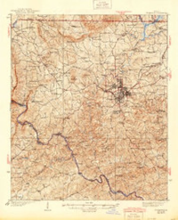
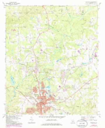
12 topographic sheets cover this place, the earliest surveyed in 1935 and the latest in 1981. It stands in the Thomaston census division. It lies in ZIP code area 30286. The Survey maps it on the Thomaston quadrangle.
Topographic sheets covering this place
7 surveys from 12 printed sheetsMatched by testing this settlement's coordinate against the published boundary of every sheet in the United States Geological Survey's historical collection. Each opens the scanned sheet at the Survey.
- 1935 USGS Thomaston quadrangle1:48000
- 1939 USGS Thomaston quadrangle1:62500, 3 printings
- 1955 USGS Phenix City quadrangle1:250000, 3 printings
- 1957 USGS Phenix City quadrangle1:250000
- 1958 USGS Phenix City quadrangle1:250000
- 1971 USGS Thomaston quadrangle1:24000, 2 printings
- 1981 USGS Thomaston quadrangle1:100000

Fires near this place
478 since 1992Regional context, not property-specific evidence. The federal wildfire occurrence database lists 478 fires within 5 miles of Atwater between 1992 and 2020, burning about 1,976 acres in total. 13 started naturally. 61 were recorded as arson. Distance is straight-line from the map coordinates, so a fire counted here may appear on a neighbouring settlement's page as well.
| Reported cause | Fires |
|---|---|
| Debris and open burning | 306 |
| Arson/incendiarism | 61 |
| Missing data/not specified/undetermined | 28 |
| Equipment and vehicle use | 25 |
| Misuse of fire by a minor | 23 |
| Recreation and ceremony | 19 |
| Natural | 13 |
| Smoking | 3 |
The most recent of them, most recent first, with the day each was reported and the service that recorded it.
| Date | Cause | Size | Reported by | Name on the report |
|---|---|---|---|---|
| 9 September 2005 | Equipment and vehicle use | under an acre | Georgia Forestry Commission | not named |
| 9 September 1999 | Debris and open burning | under an acre | Georgia Forestry Commission | not named |
| 9 September 1996 | Smoking | under an acre | Georgia Forestry Commission | not named |
| 5 September 1997 | Missing data/not specified/undetermined | 4.7 acres | Georgia Forestry Commission | not named |
| 5 September 1997 | Debris and open burning | 12 acres | Georgia Forestry Commission | not named |
| 4 September 1995 | Arson/incendiarism | 1.4 acres | Georgia Forestry Commission | not named |
| 3 September 2011 | Missing data/not specified/undetermined | under an acre | Georgia Forestry Commission | FY2012-PIKE-002 |
| 29 September 2019 | Arson/incendiarism | under an acre | Georgia Forestry Commission | FY2020UPSON013 |
Settlements close enough to share some of these fires:
Mines and quarries near this place
4 within 5 milesRegional context, not property-specific evidence. The federal mineral resources record lists 4 workings within 5 miles of Atwater: 2 prospects, 2 past producers. None of them still produces. What was taken out: Mica. Distance is straight-line from the map coordinates, so a quarry counted here may appear on a neighbouring settlement's page as well.
| Where | Site | Commodity | Status | Recorded |
|---|---|---|---|---|
| F M Thompson Property | Mica | Prospect | ||
| J.A.Partridge Mine | Mica | Past Producer | ||
| Partridge Mine | Mica | Past Producer | ||
| Thompson Prospect | Mica | Prospect |
Storms near this place
11 since 1995Regional context, not property-specific evidence. The National Weather Service names Atwater in 11 storm reports between 1995 and 2025: 9 thunderstorm wind, 1 lightning, 1 tornado. No death or injury is recorded in these reports. Each account below is quoted exactly as the forecast office filed it, from the NOAA Storm Events Database, and each date opens the federal record of that event.
| When | Event | Place named | Harm | What the report says |
|---|---|---|---|---|
| April 2011 | Thunderstorm Wind | Atwater | $30,000 | The Upson County Emergency Management Director reported that dozens of trees and power lines were down throughout the county. Power outages were widespread. Four structures in the county suffered minor damage from either downed trees and/or wind damage. Georgia Highway 36 was blocked at the railroad track because of a large tree down across the track. |
| July 2002 | Lightning | Atwater | $25,000 | The Upson county 911 Emergency Management Director and the Thomaston Times Newspaper reported that two homes were struck by lightning and set on fire. At one home the lightning traveled on the electrical system causing a short and resultant fire in a lamp. Damage to the room with the lamp was extensive, but the fire was quickly put out before further damage to the house occurred. At the other home, the lightning once again traveled in on the electrical line, but damage to the house was very minor. At the 911 center in Thomaston, a power surge, caused by a nearby lightning strike, disabled the communications equipment. Lightning was also believed to have caused a gas surge at a gas pumping station in Thomaston. Numerous reports of lightning related damage were received from all over the county, such as electrical sockets being blown out of walls, electrical panels and meters blown out, and many computer and modem related damage calls. |
| February 2019 | Thunderstorm Wind | Atwater | $15,000 | The Upson County Emergency Manager reported numerous trees and power lines blown down across the far northern part of the county from around the intersection of Weems Road and Smyrna Church Road to Highway 19 near the Pike County line, Rocky Bottom Road, and Piedmont and Mud Bridge Roads in The Rock. |
| August 2008 | Thunderstorm Wind | Atwater | $7,000 | The Upson County Emergency Management Director reported that a couple of power lines were down on Smyrna Church Road near the Pike county line. One of the power lines was down on a vehicle. |
| May 2025 | Thunderstorm Wind | Atwater | $2,000 | Amateur radio operator reported power lines down along Thompson Rd, which led to a fire. |
| June 2025 | Thunderstorm Wind | Atwater | $1,000 | Tree down along Harrell Road near Waller Rd. |
| August 2023 | Thunderstorm Wind | Atwater | $1,000 | Amateur Radio reported a tree down across Thompson Rd. |
| August 2022 | Thunderstorm Wind | Atwater | $1,000 | Power lines were downed on Smyrna Church Rd near Weems Rd. |
| August 1995 | Thunderstorm Wind | Atwater | $800 | Thunderstorm winds knocked down trees and power lines. |
| June 2025 | Tornado (EF1) | Atwater | - | At approximately 1:10 AM EDT on Thursday June 26, 2025 an EF1 |tornado touched down in northern Upson County with maximum winds |of 95-100mph. The tornado developed as a result of 2 colliding |outflow boundaries from storms moving southwest which moved into |Georgia from South Carolina and storms moving north originating |along the Florida gulf coast. The boundaries collided over |northern Upson County and generated enough low level shear that |the storms in the area were able to generate a short lived |tornado. The tornado first touched down in a field west of Day |Road near the intersection of Thompson Road. At the end of the |field was a grove of pine trees with several snapped off where the|tornado crossed into the wooded region. The tornado continued |west through a heavily wooded region before emerging out at |Atwater Road. Numerous trees were snapped and uprooted on the east|side of Atwater around 2 homes. A large grove of hardwood trees |were mostly snapped which is where it is presumed the tornado |reached max intensity of 95 to 100mph winds. At approximately 1:10|to 1:11 AM and over this location is when the KFFC radar first |determined the presence of a TDS (tornado debris signature). The |tornado continued moving west along Atwater road snapping and |uprooting trees on both sides of the road. At approximately 1:12 |AM the tornado continued west along Weems Road snapping and |uprooting numerous trees on both sides of the road. The TDS |continued through the 1:15 AM scan over a mostly wooded region |west of Weems road where the tornado is presumed lifted at |approximately 1:16AM as a result of no damages being observed west|of the heavily wooded region. The exact end of path is estimated |without an areal survey. We would like to thank Upson County |Emergency Management and the Georgia Emergency Management Agency |for their assistance with the survey. |
| August 2022 | Thunderstorm Wind | Atwater | - | Trees were downed on power lines on Vickery Rd. |
Nearest settlements
The eight closest, with where each one stands in the county. Distances are straight-line, computed from the Geographic Names Information System coordinates.
| Map | Place | Distance | Sheets |
|---|---|---|---|
| Hannahs Mill | 2.7 miles | 12 | |
| Delray | 3.8 miles | 12 | |
| Pickard | 4.0 miles | 12 | |
| Paynes Mill | 4.1 miles | 12 | |
| Silvertown | 4.6 miles | 12 | |
| Crest | 4.7 miles | 12 | |
| Barker Spring | 4.9 miles | 12 | |
| McKinney | 5.0 miles | 12 |
Elsewhere
Matched on this settlement's Geographic Names Information System number rather than its name, so it cannot be a different place of the same name in another state.
| Wikipedia article on Atwater | An encyclopaedic summary. Its text is share-alike, so it is linked here rather than copied. |
| Wikidata item Q43080455 | The structured record the population and elevation above come from. Public domain (CC0). |
Provenance
This settlement is recorded in the Geographic Names Information System as feature 331064. The sheet list is computed by point-in-boundary test against the United States Geological Survey's historical topographic inventory. Both are works of the United States government and carry no copyright under 17 U.S.C. 105.
Wildfire. Short, Karen C. 2022. Spatial wildfire occurrence data for the United States, 1992-2020 [FPA_FOD_20221014]. 6th Edition. Fort Collins, CO: Forest Service Research Data Archive. https://doi.org/10.2737/RDS-2013-0009.6 Collected with United States Government funding and usable without additional permissions or fees.
Mines and quarries. USGS Mineral Resources Data System (MRDS) https://mrdata.usgs.gov/mrds/ A work of the United States government, no copyright under 17 U.S.C. 105.
Storms. NOAA National Centers for Environmental Information, Storm Events Database https://www.ncei.noaa.gov/stormevents/ A work of the United States government, no copyright under 17 U.S.C. 105. Narratives are quoted verbatim from the National Weather Service report and are not edited or summarised.