 Block
Calhoun, Georgia
19 topographic sheets cover this place, the earliest surveyed in 1886 and the latest in 1981. It stands in the Calhoun census division. It lies in ZIP code area 30701. It stands on Oothkalooga Creek. The Survey maps it on the Calhoun North quadrangle. 16,949 people lived here at the 2020 count. It stands 659 feet above sea level.
Research this city
On record in Calhoun
Buildings and businesses the archive holds for this place. Each opens its own page, with the source record it came from.
On the National Register 3 records
 New EchotaNational Historic Landmark · listed 1970
 Calhoun Depotlisted 1982
- Calhoun Downtown Historic Districtlisted 2011
Population over time
2 figuresCalhoun grew from 15,650 to 16,949 between 2010 and 2020. These are the recorded population figures Wikidata holds for this place, reached through the Geographic Names Information System number this page is keyed on rather than by name, so they belong to this place and not to another of the same name. Most are census counts, but not all are: an early figure may be a founding or settlement estimate, and an estimate published within five years of a census is left out. The change column is computed, and is left blank where more than 20 years separate a figure from the one before it, because a gap that long is not a change between two counts.
| Year | People | Change |
|---|---|---|
| 2010 | 15,650 | |
| 2020 | 16,949 | +1,299 (+8%) |
Topographic sheets covering this place
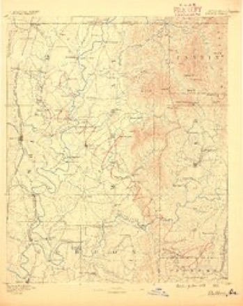
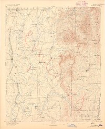
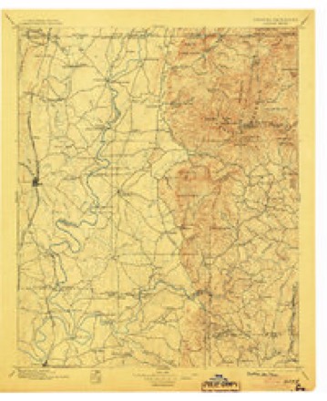
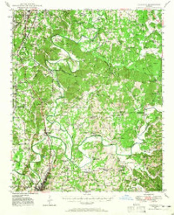
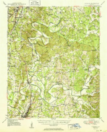
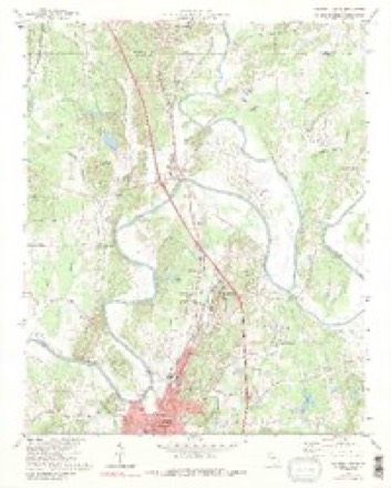
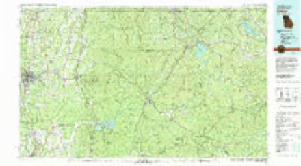
11 surveys from 19 printed sheetsMatched by testing this settlement's coordinate against the published boundary of every sheet in the United States Geological Survey's historical collection. Each opens the scanned sheet at the Survey.
- 1886 USGS Dalton quadrangle1:125000
- 1892 USGS Dalton quadrangle1:125000
- 1897 USGS Dalton quadrangle1:125000, 4 printings
- 1949 USGS Calhoun quadrangle1:62500
- 1951 USGS Calhoun quadrangle1:62500, 2 printings
- 1955 USGS Rome quadrangle1:250000
- 1958 USGS Rome quadrangle1:250000, 3 printings
- 1961 USGS Rome quadrangle1:250000
- 1963 USGS Rome quadrangle1:250000
- 1972 USGS Calhoun North quadrangle1:24000, 3 printings
- 1981 USGS Dalton quadrangle1:100000




Fires near this place
358 since 1992Regional context, not property-specific evidence. The federal wildfire occurrence database lists 358 fires within 5 miles of Calhoun between 1992 and 2019, burning about 595 acres in total. 3 started naturally. 88 were recorded as arson. Distance is straight-line from the map coordinates, so a fire counted here may appear on a neighbouring settlement's page as well.
| Reported cause | Fires |
|---|---|
| Debris and open burning | 151 |
| Arson/incendiarism | 88 |
| Equipment and vehicle use | 64 |
| Misuse of fire by a minor | 19 |
| Missing data/not specified/undetermined | 11 |
| Smoking | 11 |
| Recreation and ceremony | 9 |
| Natural | 3 |
| Railroad operations and maintenance | 2 |
The most recent of them, most recent first, with the day each was reported and the service that recorded it.
| Date | Cause | Size | Reported by | Name on the report |
|---|---|---|---|---|
| 8 September 1995 | Debris and open burning | under an acre | Georgia Forestry Commission | not named |
| 8 September 1993 | Debris and open burning | 1.3 acres | Georgia Forestry Commission | not named |
| 7 September 1997 | Arson/incendiarism | under an acre | Georgia Forestry Commission | not named |
| 6 September 2002 | Arson/incendiarism | under an acre | Georgia Forestry Commission | FY2003-GORDON-007 |
| 6 September 1999 | Debris and open burning | under an acre | Georgia Forestry Commission | not named |
| 5 September 1995 | Debris and open burning | under an acre | Georgia Forestry Commission | not named |
| 30 September 1998 | Equipment and vehicle use | under an acre | Georgia Forestry Commission | not named |
| 3 September 1997 | Arson/incendiarism | under an acre | Georgia Forestry Commission | not named |
Settlements close enough to share some of these fires:
Mines and quarries near this place
1 within 5 milesRegional context, not property-specific evidence. The federal mineral resources record lists 1 working within 5 miles of Calhoun: 1 past producer. None of them still produces. What was taken out: Clay. Distance is straight-line from the map coordinates, so a quarry counted here may appear on a neighbouring settlement's page as well.
| Where | Site | Commodity | Status | Recorded |
|---|---|---|---|---|
| Calhoun Shale Pit | Clay | Past Producer |
Storms near this place
60 since 1993Regional context, not property-specific evidence. The National Weather Service names Calhoun in 60 storm reports between 1993 and 2024: 28 hail, 19 thunderstorm wind, 7 flash flood, 3 lightning. No death or injury is recorded in these reports. Each account below is quoted exactly as the forecast office filed it, from the NOAA Storm Events Database, and each date opens the federal record of that event.
| When | Event | Place named | Harm | What the report says |
|---|---|---|---|---|
| February 1993 | Tornado (F0) | Calhoun | $500,000 | A small tornado briefly touched down about 6 miles east of Calhoun in central Gordon County eight A-frame homes suffered minor to moderate damage. Parts of roofs, facings and blockwork were blown off houses and electric power meters were stripped from their structures. Several large trees and powerlines were downed. Two witnesses observed the tornado. |
| February 2005 | Hail | Calhoun | $350,000 | A number of reports were received from amateur radio operators and the public of one to two inch diameter hail. Nickel-sized hail in Calhoun at 519 pm EST, was followed by quarter to half-dollar-sized hail in both Calhoun and Plainville at 527 pm EST, and then golf ball to 2.0 inch diameter hail at 530 pm EST about 4.5 miles south of Calhoun. |
| March 2013 | Thunderstorm Wind | Calhoun | $150,000 | The Gordon County Emergency Manager reported that numerous trees were blown down. Ten homes and an in-home daycare were impacted by falling trees. One detached garage was also blown down. |
| April 2009 | Hail | Calhoun | $50,000 | The Gordon County Emergency Management Director reported golf ball-sized hail in the far northeast part of the county along the Gilmer county line. Radar data suggests that hail of at least penny size likely fell from west of Calhoun to northeast of Ranger. |
| July 2003 | Thunderstorm Wind | Calhoun | $40,000 | The Calhoun police department reported that thunderstorm winds blew part of a roof off an apartment building, tore down a couple of traffic signals, and blew down a number of trees. Most of this damage occurred along and near Georgia Highway 156, Redbud Road in Calhoun. |
| June 2005 | Flash Flood | Calhoun | $25,000 | The Gordon County Emergency Management Director reported that persistent thunderstorms dumped several inches of rain across the eastern portions of Gordon county between midnight and 3 am, resulting in flash flooding along and near Dews Pond and Baxter Roads east of Calhoun. Water rose five to six feet deep in the area and flooded five to six homes. Some rescues were required. In addition, Dews Pond Road and a portion of U.S. Highway 41 southeast of Calhoun at Salem Road were closed because of the flooding. |
| April 2002 | Thunderstorm Wind | Calhoun | $15,000 | The public reported that several trees were blown down both in Calhoun and at Spring Valley, just west of Calhoun. The Calhoun Times reported that a large tree was blown over onto a home in the city causing damage to the garage and a neighboring house. |
| June 2001 | Thunderstorm Wind | Calhoun | $7,000 | The Gordon County 911 center reported that several power lines and three to four trees were blown down. |
| July 2024 | Thunderstorm Wind | Calhoun | $5,000 | Multiple reports of trees down along Linda Lane. |
| April 2009 | Thunderstorm Wind | Calhoun | $5,000 | The Gordon County Emergency Management Director reported that strong straight line winds associated with a line of thunderstorms blew down several trees and power lines from Calhoun to Redbud. A haybarn near Calhoun was destroyed with the debris scattered all about the adjacent field. |
| May 2003 | Flash Flood | Calhoun | $5,000 | The public reported that a number of roads in the city were flooded with water flowing across them. |
| June 2003 | Flash Flood | Calhoun | $5,000 | The Gordon county 911 center reported considerable flooding of roads in Calhoun. Several downtown streets had at least one foot of water flowing over them. |
| June 2002 | Thunderstorm Wind | Calhoun | $5,000 | The Gordon county 911 center reported that numerous trees were blown down. |
| April 1998 | Flash Flood | Calhoun | $5,000 | Along with the other recent rains, around an inch-and-a -half of rain in a three hour period caused a serious flooding problem in Gordon county. Water was over roads and in some homes and businesses. Schools were closed the next day. There was an inch or two of water in a couple of the buildings at Fairmount Elementary. Several businesses in the Fairmount area were also affected by the flooding.. |
| June 1994 | Thunderstorm Wind | Calhoun | $5,000 | Numerous trees and power lines were downed in Calhoun by thunderstorm winds. |
| September 2010 | Thunderstorm Wind | Calhoun | $3,000 | The local electric management cooperative reported that three trees were down on power lines in the eastern part of the county, including one on Irwin Hill Road and another on Windy Hills Lane near Sonaraville. Pea-sized hail was also observed in Calhoun. |
| May 2002 | Tornado (F1) | Calhoun | $3,000 | A National Weather Disaster Survey team observed that a weak F0 to F1 tornado made two touchdowns, one just southwest and another just east of downtown Calhoun. These tornado spinups occurred on the south side of a southeastward moving thunderstorm macroburst which traveled from northwest to southeast across the county. The macroburst was associated with 80 to 100 mph damaging straight line winds. The areas affected by the weak tornadoes received some of the most significant damage within the county. Dozens of trees were twisted, uprooted, and shredded by the tornadic winds which caused extensive damage to homes and businesses alike. |
| February 2011 | Thunderstorm Wind | Calhoun | $2,000 | The Gordon County Emergency Management Director reported that a few power lines were down across the county. |
| May 2000 | Thunderstorm Wind | Calhoun | $2,000 | Gordon county 911 reported several trees down in Calhoun, and power lines knocked down between Sugar Valley and Resaca. Hail was also reported, but the size was not given. |
| April 1998 | Hail | Calhoun | $2,000 | Golfball size hail damaged a vehicle. |
| July 1995 | Thunderstorm Wind | Calhoun | $2,000 | Thunderstorm winds knocked over more than twenty trees, destroyed a barn and extensively damaged three buildings. |
| February 2011 | Lightning | Calhoun | $1,000 | The Gordon County Emergency Management Director reported that lightning struck an abandoned trailer. Specific details regarding damages were not provided. |
| June 2008 | Lightning | Calhoun | $1,000 | The Calhoun Times reported that lightning struck a substation adjacent to an Omnova Solutions Chemical Plant. This caused a power failure that resulted in leakage of a toxic chemical solution used to make latex adhesives. Plant employees contained the spill within a few minutes. |
| August 1999 | Thunderstorm Wind | Calhoun | $1,000 | A HAM radio operator and North Georgia EMC reported 3 trees down on power lines. One was a 2 to 3 foot diameter tree that fell on a power line on Dews Pond Road. |
| May 1999 | Thunderstorm Wind | Calhoun | $1,000 | The public reported a lot of trees down. |
| March 1997 | Thunderstorm Wind | Calhoun | $1,000 | no account filed |
| March 1997 | Thunderstorm Wind | Calhoun | $1,000 | no account filed |
| July 2001 | Thunderstorm Wind | Calhoun | $750 | The Gordon county 911 center reported that three trees were blown down. One of the downed trees was located one mile north of Calhoun and the other three miles southwest of Calhoun. |
| September 2010 | Hail | Calhoun | - | The Gordon County 911 Center reported penny-sized hail near Calhoun. |
| April 2009 | Funnel Cloud | Calhoun | - | Amateur radio operators relayed reports of funnel clouds near Calhoun. Radar data suggests that the thunderstorm in this area was very close to producing a tornado at this point. As this circulation continued into neighboring Pickens county to the east, an EF1 tornado touched down at 604 pm EDT just northeast of Jasper. |
| April 2009 | Hail | Calhoun | - | The public observed penny-sized hail near and southeast of Calhoun as yet a second severe thunderstorm tracked from northwest to southeast across the county. |
| April 2009 | Hail | Calhoun | - | The public observed nickel-sized hail in the far northeast part of the county near Oakman and the Murray county line. Penny-sized hail was observed by the public southeast of Calhoun as the storm first became severe. |
| March 2008 | Hail | Calhoun | - | The public observed quarter-sized hail in the Calhoun area. |
| May 2005 | Hail | Calhoun | - | The Gordon County 911 Center reported penny-sized hail. |
| December 2004 | Hail | Calhoun | - | The public reported nickel-sized hail. |
| July 2004 | Lightning | Calhoun | - | The Gordon County Emergency Manager reported that lightning struck at the 911 center causing extensive damage to electronic equipment and telephones at the facility. |
| August 2003 | Flash Flood | Calhoun | - | The United States Post Office in Calhoun reported that several roads in the city were flooded with around one foot of water on them. Mail couriers in the area were having difficulty navagating the flooded roadways. |
| August 2003 | Hail | Calhoun | - | The public reported penny to nickel-sized hail. |
| May 2003 | Hail | Calhoun | - | The Gordon county 911 center reported penny-sized hail and the public reported quarter-sized hail. |
| May 2003 | Hail | Calhoun | - | The public reported quarter-sized hail. |
| May 2003 | Flash Flood | Calhoun | - | The public and amateur radio operators reported flash flooding on Georgia Highway 53, both in Sonoraville and in Fairmount. A creek in Sonoraville, near Georgia Highway 53, quickly rose out of its banks flooding nearby land and property. Flooding was also reported on some streets in Calhoun. Street flooding was also reported in Redbud. |
| May 2003 | Hail | Calhoun | - | Amateur radio operators reported penny-sized hail in Redbud and penny to quarter-sized hail southeast of Calhoun. |
| May 2003 | Hail | Calhoun | - | The public reported penny to quarter-sized hail. |
| July 2003 | Hail | Calhoun | - | The Calhoun police department reported penny-sized hail. |
| April 2002 | Hail | Calhoun | - | Numerous reports of hail were received from storm spotters, amateur radio operators, and the public. While most of the hail sizes reported ranged from dimes to quarters, some reports of hail as large as golf balls were received from Calhoun and just west of Calhoun in Spring Valley. |
| June 2002 | Hail | Calhoun | - | The Gordon county Emergency Manager reported dime to quarter size hail. |
| July 2002 | Thunderstorm Wind | Calhoun | - | The Gordon county 911 center reported that some tree limbs were down and the public reported pea size hail. |
| May 2001 | Hail | Calhoun | - | The public reported dime size hail and minor street flooding. |
| August 2000 | Hail | Calhoun | - | Several reports of dime to quarter size hail were received from the public. |
| May 1999 | Hail | Calhoun | - | The public reported dime size hail. |
| January 1999 | Hail | Calhoun | - | A report from the public indicated "big size" hail hitting the tin roof of her home between Calhoun and Fairmount. The hail was probably at least 3/4 of an inch in diameter. |
| February 1993 | Thunderstorm Wind | Calhoun | - | Six homes sustained structural damage due to very strong wind. |
| April 1998 | Hail | Calhoun | - | no account filed |
| April 1998 | Hail | Calhoun | - | no account filed |
| April 1998 | Hail | Calhoun | - | no account filed |
| April 1998 | Hail | Calhoun | - | no account filed |
| May 1997 | Hail | Calhoun | - | no account filed |
| May 1997 | Hail | Calhoun | - | no account filed |
| January 1996 | Flash Flood | Calhoun | - | no account filed |
| June 1995 | Hail | Calhoun | - | no account filed |
Nearest settlements
The eight closest, with where each one stands in the county. Distances are straight-line, computed from the Geographic Names Information System coordinates.
| Map | Place | Distance | Sheets |
|---|---|---|---|
| Echota | 1.3 miles | 19 | |
| New Town | 3.1 miles | 19 | |
| McDaniels | 3.3 miles | 19 | |
| Damascus | 3.4 miles | 19 | |
| Oostanaula | 3.7 miles | 17 | |
| Blackwood | 4.1 miles | 19 | |
| Reeves | 4.3 miles | 17 | |
| Crane Eater | 4.4 miles | 18 |
Elsewhere
Matched on this settlement's Geographic Names Information System number rather than its name, so it cannot be a different place of the same name in another state.
| Wikipedia article on Calhoun | An encyclopaedic summary. Its text is share-alike, so it is linked here rather than copied. |
| Wikidata item Q1022996 | The structured record the population and elevation above come from. Public domain (CC0). |
Provenance
This settlement is recorded in the Geographic Names Information System as feature 354936. The sheet list is computed by point-in-boundary test against the United States Geological Survey's historical topographic inventory. Both are works of the United States government and carry no copyright under 17 U.S.C. 105.
Wildfire. Short, Karen C. 2022. Spatial wildfire occurrence data for the United States, 1992-2020 [FPA_FOD_20221014]. 6th Edition. Fort Collins, CO: Forest Service Research Data Archive. https://doi.org/10.2737/RDS-2013-0009.6 Collected with United States Government funding and usable without additional permissions or fees.
Mines and quarries. USGS Mineral Resources Data System (MRDS) https://mrdata.usgs.gov/mrds/ A work of the United States government, no copyright under 17 U.S.C. 105.
Storms. NOAA National Centers for Environmental Information, Storm Events Database https://www.ncei.noaa.gov/stormevents/ A work of the United States government, no copyright under 17 U.S.C. 105. Narratives are quoted verbatim from the National Weather Service report and are not edited or summarised.