 Block
Dawsonville, Georgia
18 topographic sheets cover this place, the earliest surveyed in 1890 and the latest in 1997. It stands in the Dawsonville census division. It lies in ZIP code area 30534. It stands on Burt Creek. The Survey maps it on the Dawsonville quadrangle. 3,720 people lived here at the 2020 count. It stands 1,365 feet above sea level.
Research this city
On record in Dawsonville
Buildings and businesses the archive holds for this place. Each opens its own page, with the source record it came from.
On the National Register 3 records
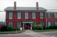 Dawson County Courthouselisted 1980
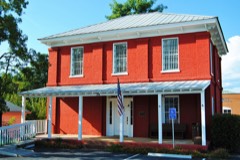 Dawson Couty Jaillisted 1985
 Boyd and Sallie Gilleland Houselisted 2009
Population over time
2 figuresDawsonville grew from 2,536 to 3,720 between 2010 and 2020. These are the recorded population figures Wikidata holds for this place, reached through the Geographic Names Information System number this page is keyed on rather than by name, so they belong to this place and not to another of the same name. Most are census counts, but not all are: an early figure may be a founding or settlement estimate, and an estimate published within five years of a census is left out. The change column is computed, and is left blank where more than 20 years separate a figure from the one before it, because a gap that long is not a change between two counts.
| Year | People | Change |
|---|---|---|
| 2010 | 2,536 | |
| 2020 | 3,720 | +1,184 (+47%) |
Topographic sheets covering this place
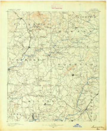
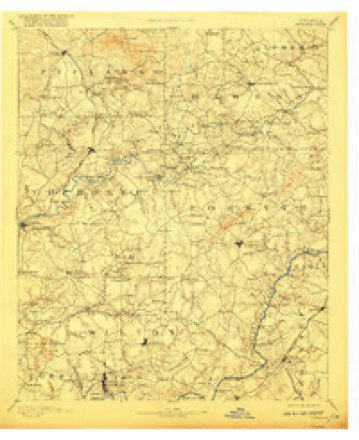
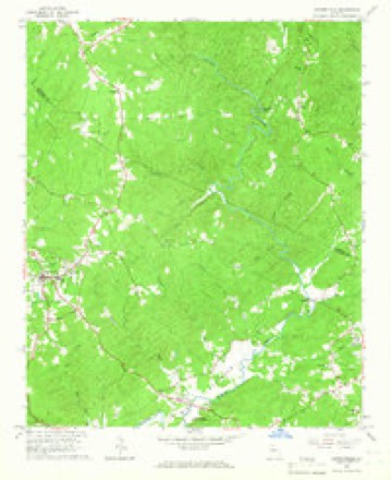
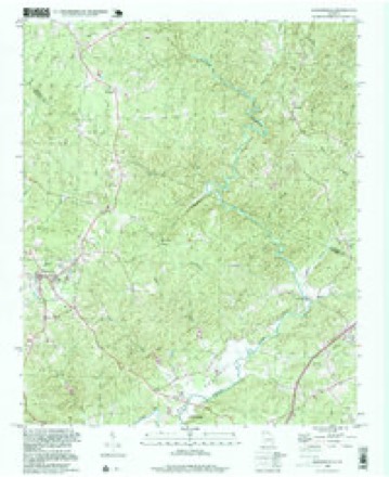
9 surveys from 18 printed sheetsMatched by testing this settlement's coordinate against the published boundary of every sheet in the United States Geological Survey's historical collection. Each opens the scanned sheet at the Survey.
- 1890 USGS Suwanee quadrangle1:125000
- 1894 USGS Suwanee quadrangle1:125000, 6 printings
- 1955 USGS Rome quadrangle1:250000
- 1958 USGS Rome quadrangle1:250000, 3 printings
- 1961 USGS Rome quadrangle1:250000
- 1963 USGS Rome quadrangle1:250000
- 1964 USGS Dawsonville quadrangle1:24000, 2 printings
- 1981 USGS Cartersville quadrangle1:100000, 2 printings
- 1997 USGS Dawsonville quadrangle1:24000




Fires near this place
326 since 1992Regional context, not property-specific evidence. The federal wildfire occurrence database lists 326 fires within 5 miles of Dawsonville between 1992 and 2019, burning about 750 acres in total. 6 started naturally. 85 were recorded as arson. Distance is straight-line from the map coordinates, so a fire counted here may appear on a neighbouring settlement's page as well.
| Reported cause | Fires |
|---|---|
| Debris and open burning | 183 |
| Arson/incendiarism | 85 |
| Missing data/not specified/undetermined | 24 |
| Recreation and ceremony | 9 |
| Equipment and vehicle use | 7 |
| Natural | 6 |
| Smoking | 6 |
| Misuse of fire by a minor | 6 |
The most recent of them, most recent first, with the day each was reported and the service that recorded it.
| Date | Cause | Size | Reported by | Name on the report |
|---|---|---|---|---|
| 9 September 1993 | Arson/incendiarism | under an acre | Georgia Forestry Commission | not named |
| 3 September 2011 | Debris and open burning | under an acre | Georgia Forestry Commission | FY2012-DAWSON-001 |
| 26 September 2004 | Equipment and vehicle use | 1.2 acres | Georgia Forestry Commission | not named |
| 12 September 2002 | Arson/incendiarism | 6.3 acres | Georgia Forestry Commission | FY2003-FORSYTH-004 |
| 6 August 1999 | Debris and open burning | under an acre | Georgia Forestry Commission | not named |
| 23 August 1999 | Arson/incendiarism | 2.0 acres | Georgia Forestry Commission | not named |
| 22 August 1996 | Missing data/not specified/undetermined | under an acre | Georgia Forestry Commission | not named |
| 9 July 1996 | Arson/incendiarism | under an acre | Georgia Forestry Commission | not named |
Settlements close enough to share some of these fires:
Mines and quarries near this place
10 of 23 shownRegional context, not property-specific evidence. The federal mineral resources record lists 23 workings within 5 miles of Dawsonville: 13 prospects, 10 past producers. None of them still produces. What was taken out: Gold, Barium-Barite. Distance is straight-line from the map coordinates, so a quarry counted here may appear on a neighbouring settlement's page as well.
| Where | Site | Commodity | Status | Recorded |
|---|---|---|---|---|
| Whatley Property | Barium-Barite | Past Producer | ||
| Amicalola | Gold | Prospect | Vein, Some Placers | |
| Baby Pl. | Gold | Prospect | Vein, Some Placers | |
| Church | Gold | Prospect | Vein | |
| Cooper | Gold | Prospect | Vein | |
| Danae Mine | Gold | Past Producer | ||
| Ellsworth | Gold | Prospect | Vein, Some Placers | |
| Etowah Gold Mining Properties | Gold | Past Producer | ||
| G.E. Russell | Gold | Prospect | Vein | |
| Gold Hill Mine | Gold | Past Producer |
Storms near this place
60 of 72 shownRegional context, not property-specific evidence. The National Weather Service names Dawsonville in 72 storm reports between 1993 and 2022: 35 thunderstorm wind, 26 hail, 8 lightning, 2 flash flood. The reports record 1 death. Each account below is quoted exactly as the forecast office filed it, from the NOAA Storm Events Database, and each date opens the federal record of that event.
| When | Event | Place named | Harm | What the report says |
|---|---|---|---|---|
| July 2014 | Lightning | Dawsonville | 1 killed | The Lumpkin County Emergency Manager reported that a woman was struck by lightning while trimming hedges at a location off Crawford Falls Road off GA Highway 9. The woman was transported to the hospital and died as a result of her injuries on July 15, 2014. |
| March 2008 | Hail | Dawsonville | $1,000,000 | An amateur radio operator reported baseball-sized hail in eastern Dawson county. |
| February 2005 | Lightning | Dawsonville | $600,000 | The Dawson News & Advertiser reported that lightning struck and destroyed a $600,000 home in the Ridgeview community. |
| January 1995 | Thunderstorm Wind | Dawsonville | $500,000 | Thunderstorm winds destroyed five chicken houses and a shed along Georgia Highway 52. In addition, a barn and a chicken house were damaged. A mobile home was also severely damaged by the tornado. |
| March 2008 | Hail | Dawsonville | $300,000 | The public observed golf ball-sized hail. |
| November 2002 | Lightning | Dawsonville | $250,000 | The Dawson News and Advertiser reported that lightning struck and destroyed two homes in extreme western Dawson county near the Pickens county border on Mulkey Road. Eight people were left homeless as a result. A vehicle also suffered extensive damage at one of the residences. In addition, one family lost one of their pets in the fire. |
| April 2008 | Thunderstorm Wind | Dawsonville | $100,000 | A damage survey conducted by the Cherokee and Dawson county emergency managers confirmed that the damage caused by thunderstorm straight-line winds in northern Cherokee county continued into southwest and central Dawson county. The area of damage began just south of the Hollis Q. Latham Reservoir along the Cherokee/Dawson county line and continued on an east-northeastward track across the southern part of the county crossing Georgia Highway 53 near Dougherty and ended near Georgia Highway 400. Georgia Highway 53 was blocked from downed trees west of Georgia Highway 400. Numerous trees and power lines were down throughout the damage area. Several trees were down on homes causing minor to moderate roof damage. |
| July 2000 | Thunderstorm Wind | Dawsonville | $70,000 | The Dawson county Emergency Management Director, amateur radio operators, the Dawson News and Advertiser, and the public all reported extensive amounts of trees and power lines down across the county. The majority of the damage took place along Georgia Highway 53 from the western end of the county, through Dawsonville, to the eastern end of the county, including Georgia Highway 9. Hundreds of trees, along with power lines, were reported down along Georgia Highway 53. In addition, The First Baptist Church's Youth Center in Dawsonville was damaged and a car on Georgia Highway 9 was leveled by a large oak tree. Several other homes sustained damage in the county. A natural gas line was ruptured by a very large uprooted oak tree on West Highway 53. The damage was caused by a supercell thunderstorm that spawned an F0 to weak F1 tornado after moving further east into Hall and Banks counties. |
| July 2005 | Thunderstorm Wind | Dawsonville | $60,000 | The Dawson County Emergency Manager reported that a thunderstorm with a microburst or downburst caused significant damage in a localized area about three miles east of Dawsonville. Eight homes and three vehicles suffered significant damage. One vehicle was destroyed when a large tree fell on it. Several fences were also damaged. All together, it was estimated that around 125 trees were down in the area. |
| July 2007 | Thunderstorm Wind | Dawsonville | $50,000 | The public and the Dawson County 911 Center reported that many trees were down throughout Dawsonville and south and east of Dawsonville. The roof was blown off a store in the southeast part of Dawsonville and onto an adjacent vehicle. The public estimated that winds were in the 50 to 60 mph range for up to 15 minutes. |
| September 2002 | Flash Flood | Dawsonville | $50,000 | The Dawson county Emergency Management Director reported that very heavy rain, upwards of 2 inches in a 30 minute to one hour period washed out a road and six foot culvert to a subdivision in the southeastern portion of the county. This was the only road in/out of the subdivision. Hence, several families were stranded as a result. This water was part of the runoff into Toto Creek which eventually flows into Lake Sidney Lanier. |
| September 2017 | Thunderstorm Wind | Dawsonville | $20,000 | The Dawson County 911 center reported numerous reports of trees and power lines blown down across the city of Dawsonville extending east and southeast to around the intersection of Highways 53 and 19. A sign was blown off of an overpass on Highway 19 and struck a vehicle, no injuries were reported. |
| June 2001 | Lightning | Dawsonville | $15,000 | The Dawson County Emergency Management Director reported that lightning struck two homes and one business. One home, which sustained approximately $15,000 damage, was located in the extreme western part of the county in the Big Canoe Resort Area. The other home, which sustained approximately $5,000 damage was located about 1 mile south of downtown Dawsonville. The business that was struck was located about 2 miles south of Dawsonville, but sustained no significant damage. |
| November 2020 | Thunderstorm Wind | Dawsonville | $10,000 | The Dawson County Emergency Manager reported trees and power lines blown down from Stegall Place in the Dawsonville area to The Elliot Family Parkway and Greenway Road around Juno. |
| April 2011 | Thunderstorm Wind | Dawsonville | $10,000 | Amateur radio operators relayed reports that several trees and power lines were down across the central portion of the county. |
| April 2008 | Lightning | Dawsonville | $10,000 | The Dawson county Emergency Management Director reported that lightning struck a home setting it on fire. The fire was extinguished by the homeowner with resulting minimal damage. |
| July 2005 | Lightning | Dawsonville | $8,000 | The Dawson County Emergency Management Director reported that two homes near the intersection of Georgia Highway 136 and Georgia Highway 9 were struck and set on fire by lightning. The fires were contained quickly resulting in minimal damage to the structures. |
| February 2001 | Thunderstorm Wind | Dawsonville | $5,000 | The Dawson county 911 center reported numerous trees down on Georgia Highway 136 and Georgia Highway 400 in Dawsonville. |
| June 2001 | Thunderstorm Wind | Dawsonville | $5,000 | The Dawson County 911 center reported that two trees were blown down and some power lines were down as well. |
| May 1994 | Thunderstorm Wind | Dawsonville | $5,000 | Several large trees and numerous power lines were downed by thunderstorm winds. |
| June 1994 | Thunderstorm Wind | Dawsonville | $5,000 | Several large trees were blown down by thunderstorm winds. |
| July 2015 | Thunderstorm Wind | Dawsonville | $3,000 | The Dawson County Emergency Manager reported trees blown down around Highway 9 and Perimeter Road and on River Valley Road. |
| June 2010 | Thunderstorm Wind | Dawsonville | $3,000 | The Dawson County 911 Center reported that more than six trees, mostly pines, were either blown down or had the tops sheared, throughout a golf course off Cowart Road. Some telephone lines were affected by the downed trees. |
| July 2003 | Thunderstorm Wind | Dawsonville | $3,000 | The Dawson county 911 center reported that several trees and power lines were down. |
| May 2003 | Thunderstorm Wind | Dawsonville | $3,000 | The Dawson county 911 center reported that several trees were down in the area. A number of power outages had been reported. |
| May 1996 | Thunderstorm Wind | Dawsonville | $2,500 | no account filed |
| July 2004 | Thunderstorm Wind | Dawsonville | $2,000 | The Dawson County 911 center reported that several trees were blown down. |
| May 2002 | Thunderstorm Wind | Dawsonville | $2,000 | The Dawson county 911 center reported that several trees had been blown down across the city. |
| July 1998 | Thunderstorm Wind | Dawsonville | $2,000 | Dawson county 911 reported several trees down and power outages. |
| July 1997 | Thunderstorm Wind | Dawsonville | $2,000 | A few trees and power lines were knocked down by thunderstorm winds. |
| March 1997 | Thunderstorm Wind | Dawsonville | $2,000 | no account filed |
| February 2009 | Thunderstorm Wind | Dawsonville | $1,000 | The Dawson County 911 Center reported that a few trees were blown down on Georgia Highway 53 west of Dawsonville. |
| June 2007 | Thunderstorm Wind | Dawsonville | $1,000 | The Dawson County 911 Center reported that three trees were blown down along Georgia Highway 136 northwest of Dawsonville. |
| July 2002 | Lightning | Dawsonville | $1,000 | The Dawson county 911 center reported that lightning struck a tree, causing the tree to split and fall, as well as simultaneously knocking out an electrical transformer. |
| May 2014 | Thunderstorm Wind | Dawsonville | $750 | The Dawson County 911 Center reported that three trees were blown down. |
| August 2006 | Thunderstorm Wind | Dawsonville | $750 | The public reported that two to three trees were blown down. Wind gusts were estimated at 35 to 40 mph. Pea-sized hail was also reported. |
| January 2014 | Thunderstorm Wind | Dawsonville | $500 | The Dawson County 911 Center reported that a couple of trees were blown down in Dawsonville. |
| May 2000 | Thunderstorm Wind | Dawsonville | $500 | The Dawson county 911 center reported trees down in Dawsonville. |
| May 1999 | Thunderstorm Wind | Dawsonville | $500 | Dawson county 911 reported a couple of trees down. |
| May 1999 | Thunderstorm Wind | Dawsonville | $500 | A report from the Pickens county EMA indicated trees were topped near the Pickens/Dawson county line. |
| April 1993 | Thunderstorm Wind | Dawsonville | $500 | Thunderstorm winds blew down a couple of large trees along Georgia Highways 136 and 183. |
| December 2004 | Thunderstorm Wind | Dawsonville | $250 | The Dawson County 911 Center reported that one tree was down on Liberty Church Road. |
| July 1999 | Thunderstorm Wind | Dawsonville | $200 | Dawson county 911 reported trees blown down. |
| July 2022 | Thunderstorm Wind | Dawsonville | - | Large tree down on powerlines across Georgia Hwy 9 South. |
| October 2020 | Flash Flood | Dawsonville | - | The Emergency Manager reported flooding along Flat Creek in Dawsonville, resulting in the closure of Flat Creek Road, Jack Heard Road, and Maple Street South. Radar estimates indicate that 3 to 5 inches of rain occurred in the area, resulting in the flash flooding. |
| April 2015 | Hail | Dawsonville | - | The Dawson County Emergency Manager reported penny size hail at the Emergency Operation Center in Dawsonville. |
| March 2013 | Hail | Dawsonville | - | The Dawson County Emergency Manager reported quarter sized hail in Dawsonville. |
| April 2011 | Hail | Dawsonville | - | The public observed penny-sized hail near Dawsonville. |
| May 2011 | Hail | Dawsonville | - | The public observed penny-sized hail near Georgia 400 near Dougherty. |
| May 2010 | Hail | Dawsonville | - | The public observed penny-sized hail in Dawsonville. |
| September 2009 | Hail | Dawsonville | - | The Dawson County Emergency Management Director reported nickel-sized hail on the east side of the county, east of Dawsonville. |
| July 2007 | Hail | Dawsonville | - | The public observed penny to quarter-sized hail from Dawsonville to near the intersection of Georgia Highway 400 and Georgia Highway 53. The Dawson County 911 Center reported that nickel-sized hail fell in downtown Dawsonville. |
| June 2007 | Hail | Dawsonville | - | The Dawson County 911 Center reported that penny-sized hail was observed on Georgia Highway 400 and Georgia Highway 53 near Dougherty and southward toward the Forsyth county line. Pea-sized hail was observed in the Dawsonville area. |
| June 2007 | Hail | Dawsonville | - | The Dawson County 911 Center and the Dawson County Emergency Management Director reported penny-sized hail. |
| April 2007 | Hail | Dawsonville | - | The public observed ping pong-ball-sized hail near the Forsyth county line, from just north of Silver City to three miles south-southeast of Dougherty. Hail was observed on Georgia 400 just south of Dougherty. |
| April 2006 | Hail | Dawsonville | - | The public reported penny-sized hail along Georgia Highway 53 near the Pickens county line. |
| March 2005 | Hail | Dawsonville | - | Several reports of hail, ranging in size from pennies to golf balls, were received from the public. Mostly penny-sized hail was reported in the southeast part of the county near Lumpkin and Doughtery. |
| February 2005 | Hail | Dawsonville | - | The Dawson County 911 Center reported quarter-sized hail. |
| August 2005 | Funnel Cloud | Dawsonville | - | The Dawson County 911 Center relayed a report of a funnel cloud sightning near the intersection of Georgia Highways 53 and 400. This coincided with a definite mesocyclone circulation indicated on the WSR-88D Doppler radar in this area. |
| May 2004 | Hail | Dawsonville | - | The public reported pea to penny-sized hail. |
Nearest settlements
The eight closest, with where each one stands in the county. Distances are straight-line, computed from the Geographic Names Information System coordinates.
| Map | Place | Distance | Sheets |
|---|---|---|---|
| McKee | 2.9 miles | 19 | |
| Dougherty | 3.9 miles | 18 | |
| Landrum | 5.3 miles | 18 | |
| Juno | 5.5 miles | 19 | |
| Lumpkin | 5.6 miles | 19 | |
| Barrettsville | 6.0 miles | 22 | |
| Silver City | 6.0 miles | 19 | |
| Hubbardsville | 7.4 miles | 22 |
Elsewhere
Matched on this settlement's Geographic Names Information System number rather than its name, so it cannot be a different place of the same name in another state.
| Wikipedia article on Dawsonville | An encyclopaedic summary. Its text is share-alike, so it is linked here rather than copied. |
| Wikidata item Q1178896 | The structured record the population and elevation above come from. Public domain (CC0). |
Provenance
This settlement is recorded in the Geographic Names Information System as feature 331529. The sheet list is computed by point-in-boundary test against the United States Geological Survey's historical topographic inventory. Both are works of the United States government and carry no copyright under 17 U.S.C. 105.
Wildfire. Short, Karen C. 2022. Spatial wildfire occurrence data for the United States, 1992-2020 [FPA_FOD_20221014]. 6th Edition. Fort Collins, CO: Forest Service Research Data Archive. https://doi.org/10.2737/RDS-2013-0009.6 Collected with United States Government funding and usable without additional permissions or fees.
Mines and quarries. USGS Mineral Resources Data System (MRDS) https://mrdata.usgs.gov/mrds/ A work of the United States government, no copyright under 17 U.S.C. 105.
Storms. NOAA National Centers for Environmental Information, Storm Events Database https://www.ncei.noaa.gov/stormevents/ A work of the United States government, no copyright under 17 U.S.C. 105. Narratives are quoted verbatim from the National Weather Service report and are not edited or summarised.