 Block
Juno, Georgia
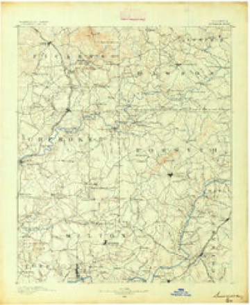
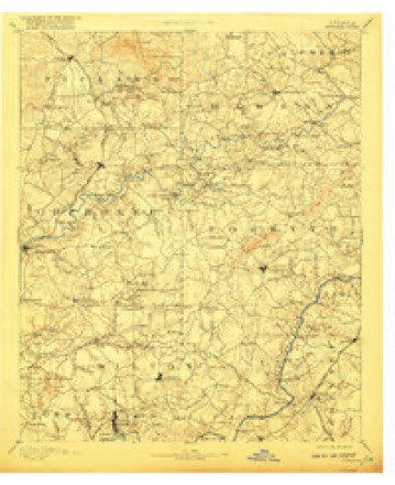
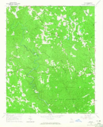
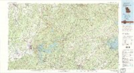
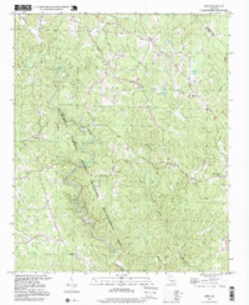
19 topographic sheets cover this place, the earliest surveyed in 1890 and the latest in 1997. It stands in the Dawsonville census division. It lies in ZIP code area 30534. The Survey maps it on the Juno quadrangle. It stands 1,493 feet above sea level.
Topographic sheets covering this place
9 surveys from 19 printed sheetsMatched by testing this settlement's coordinate against the published boundary of every sheet in the United States Geological Survey's historical collection. Each opens the scanned sheet at the Survey.
- 1890 USGS Suwanee quadrangle1:125000
- 1894 USGS Suwanee quadrangle1:125000, 6 printings
- 1955 USGS Rome quadrangle1:250000
- 1958 USGS Rome quadrangle1:250000, 3 printings
- 1961 USGS Rome quadrangle1:250000
- 1963 USGS Rome quadrangle1:250000
- 1964 USGS Juno quadrangle1:24000, 3 printings
- 1981 USGS Cartersville quadrangle1:100000, 2 printings
- 1997 USGS Juno quadrangle1:24000




Fires near this place
242 since 1992Regional context, not property-specific evidence. The federal wildfire occurrence database lists 242 fires within 5 miles of Juno between 1992 and 2019, burning about 389 acres in total. 1 started naturally. 60 were recorded as arson. Distance is straight-line from the map coordinates, so a fire counted here may appear on a neighbouring settlement's page as well.
| Reported cause | Fires |
|---|---|
| Debris and open burning | 144 |
| Arson/incendiarism | 60 |
| Missing data/not specified/undetermined | 15 |
| Recreation and ceremony | 7 |
| Smoking | 5 |
| Equipment and vehicle use | 5 |
| Misuse of fire by a minor | 3 |
| Fireworks | 2 |
| Natural | 1 |
The most recent of them, most recent first, with the day each was reported and the service that recorded it.
| Date | Cause | Size | Reported by | Name on the report |
|---|---|---|---|---|
| 9 September 2009 | Arson/incendiarism | under an acre | Georgia Forestry Commission | not named |
| 9 September 1993 | Arson/incendiarism | under an acre | Georgia Forestry Commission | not named |
| 3 September 2011 | Debris and open burning | under an acre | Georgia Forestry Commission | FY2012-DAWSON-001 |
| 3 September 1999 | Debris and open burning | 1.0 acres | Georgia Forestry Commission | not named |
| 21 September 2019 | Debris and open burning | 8.7 acres | Georgia Forestry Commission | FY2020DAWSON001 |
| 19 September 1998 | Equipment and vehicle use | under an acre | Georgia Forestry Commission | not named |
| 16 September 1999 | Arson/incendiarism | 2.6 acres | Georgia Forestry Commission | not named |
| 8 August 2000 | Arson/incendiarism | under an acre | Georgia Forestry Commission | FY2001-DAWSON-005 |
Settlements close enough to share some of these fires:
Mines and quarries near this place
1 within 5 milesRegional context, not property-specific evidence. The federal mineral resources record lists 1 working within 5 miles of Juno: 1 past producer. None of them still produces. What was taken out: Gold. Distance is straight-line from the map coordinates, so a quarry counted here may appear on a neighbouring settlement's page as well.
| Where | Site | Commodity | Status | Recorded |
|---|---|---|---|---|
| Scott (Old Steele) | Gold | Past Producer | Vein |
Storms near this place
16 since 1997Regional context, not property-specific evidence. The National Weather Service names Juno in 16 storm reports between 1997 and 2025: 10 thunderstorm wind, 3 hail, 2 flash flood, 1 tornado. The reports record 3 injuries. Each account below is quoted exactly as the forecast office filed it, from the NOAA Storm Events Database, and each date opens the federal record of that event.
| When | Event | Place named | Harm | What the report says |
|---|---|---|---|---|
| November 2002 | Tornado (F2) | Juno | 3 hurt, $200,000 | The Dawson county Emergency Management Director reported that the tornado that originated in Cherokee county and traveled across Pickens county, entered Dawson county in the Big Canoe area and continued to just east-northeast of the Big Canoe area before dissipating. Two double-wide mobile homes were completely destroyed just east of the Big Canoe area as large trees fell on the structures. While the contents of one were salvagable, those of the other were destroyed. Three injuries occurred at one of these mobile homes as the residents were trapped by the downed trees on the structure. In addition, there were four other homes that received minor damage in the Big Canoe area. Numerous trees and power lines were blown down in the area of the tornado and some roads were temporarily blocked as a result. Dawson county was one of five counties declared in a state of emergency by the governor. |
| July 1997 | Thunderstorm Wind | Juno | $125,000 | Thunderstorm winds associated with a downburst destroyed one chicken house, and damaged another chicken house and a mobile home. More than 37,000 baby chicks were injured. The surviving chicks were given away, since the owner would not rebuild the lost chicken houses. |
| March 2017 | Thunderstorm Wind | Juno | $40,000 | The Dawson County Emergency Manager reported trees and power lines blown down and wind damage to structures across the southern half of the county. A house on Sweetwater Juno Road sustained roof damage, a house along River Valley Road had roof and siding damage and a metal building on Grizzle Road had roof damage. |
| August 2013 | Flash Flood | Juno | $25,000 | Dawson County officials reported several drainage branches and streams were flooding portions of roads primarily north and southeast of Dawsonville. Some of the roads included Grizzle Road, Harry Sosebee Road, Tanner Hall Road, Blacks Mill Road and Nix Bridge Road. A house and car were damaged by flood waters in the 2700 block of Lumpkin Campground Road. |
| March 2011 | Thunderstorm Wind | Juno | $25,000 | The public reported that damaging straight-line thunderstorm winds caused considerable damage to trees and property around Dawsonville. Dozens of trees were blown down and several homes sustained at least minor damage. One individual reported that almost two-dozen shingles were blown off the roof of their home by the high winds. |
| August 2015 | Thunderstorm Wind | Juno | $10,000 | The Dawson County Emergency Manager reported numerous trees blown down across the county including on Highway 53 at Tinsley Road, on Cowart Road, on Steve Tate Highway and on Grover Burt Road at Highway 136. |
| April 1998 | Flash Flood | Juno | $10,000 | Dawson county 911 reported Scott Bailey Road was washed out. |
| May 2007 | Thunderstorm Wind | Juno | $6,000 | The Dawson County Emergency Management Director reported that a thunderstorm downburst resulted in damage to a hen house and adjacent egg storage building on Brenda Lane off Georgia Highway 136 in the Juno community area of northwest Dawson county. There were also a couple of trees down on power lines in the area as well. Pea-sized hail was reported two miles north of McKee. |
| April 1998 | Thunderstorm Wind | Juno | $2,000 | Thunderstorm winds knocked down numerous trees. |
| August 2024 | Thunderstorm Wind | Juno | $1,000 | Per local emc there was a broken and downed powerline along nugget ridge rd. |
| June 2006 | Thunderstorm Wind | Juno | $1,000 | The Dawson County 911 Center reported that a few trees were down. |
| July 1999 | Thunderstorm Wind | Juno | $1,000 | Dawson county 911 reported trees were blown down. |
| April 2025 | Hail | Juno | - | Golf ball sized hail reported along highway 53 near padgett road circle. |
| February 2011 | Thunderstorm Wind | Juno | - | The public measured sustained winds of 28 mph with gusts to 60 mph. |
| April 2009 | Hail | Juno | - | The public observed quarter-sized hail in the Dawonsville area. Radar data, and reports from neighboring counties to the west and east, supports that hail this size or larger likely fell in a west to east swath across the county from west of Dawonsville along the Pickens county line to the Hall county line east of Dawsonville. |
| May 1998 | Hail | Juno | - | no account filed |
Nearest settlements
The eight closest, with where each one stands in the county. Distances are straight-line, computed from the Geographic Names Information System coordinates.
| Map | Place | Distance | Sheets |
|---|---|---|---|
| Emma | 2.7 miles | 20 | |
| McKee | 3.0 miles | 19 | |
| Afton | 3.2 miles | 20 | |
| Johntown (historical) | 4.6 miles | 17 | |
| Dawsonville | 5.5 miles | 18 | |
| Amicalola | 6.3 miles | 17 | |
| Hubbardsville | 8.0 miles | 22 | |
| Dougherty | 9.4 miles | 18 |
Elsewhere
Matched on this settlement's Geographic Names Information System number rather than its name, so it cannot be a different place of the same name in another state.
| Wikipedia article on Juno | An encyclopaedic summary. Its text is share-alike, so it is linked here rather than copied. |
| Wikidata item Q6314025 | The structured record the population and elevation above come from. Public domain (CC0). |
Provenance
This settlement is recorded in the Geographic Names Information System as feature 332127. The sheet list is computed by point-in-boundary test against the United States Geological Survey's historical topographic inventory. Both are works of the United States government and carry no copyright under 17 U.S.C. 105.
Wildfire. Short, Karen C. 2022. Spatial wildfire occurrence data for the United States, 1992-2020 [FPA_FOD_20221014]. 6th Edition. Fort Collins, CO: Forest Service Research Data Archive. https://doi.org/10.2737/RDS-2013-0009.6 Collected with United States Government funding and usable without additional permissions or fees.
Mines and quarries. USGS Mineral Resources Data System (MRDS) https://mrdata.usgs.gov/mrds/ A work of the United States government, no copyright under 17 U.S.C. 105.
Storms. NOAA National Centers for Environmental Information, Storm Events Database https://www.ncei.noaa.gov/stormevents/ A work of the United States government, no copyright under 17 U.S.C. 105. Narratives are quoted verbatim from the National Weather Service report and are not edited or summarised.