 Block
Douglasville, Georgia
20 topographic sheets cover this place, the earliest surveyed in 1891 and the latest in 1999. It stands in the Douglasville-Lithia Springs census division. It lies in ZIP code area 30134. The Survey maps it on the Austell quadrangle. 34,650 people lived here at the 2020 count. It stands 1,201 feet above sea level.
Research this city
On record in Douglasville
Buildings and businesses the archive holds for this place. Each opens its own page, with the source record it came from.
On the National Register 5 records
 Basket Creek Cemeterylisted 2009
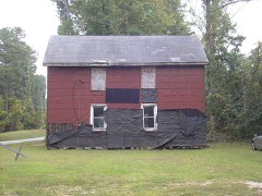 Beulah Grove Lodge No. 372, Free and Accepted York Masons-Pleasant Grove Schoollisted 2010
 Douglas County Courthouselisted 2002
 Douglasville Commercial Historic Districtlisted 1989
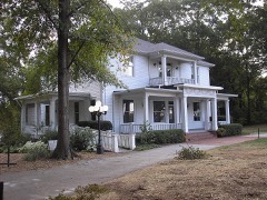 Col. William T. Roberts Houselisted 1989
Surveyed buildings and structures 3 records
- 6286 Cooper Street (House), Douglasvillefederal building survey, 6 photographs
- 6296 Cooper Street (House), Douglasvillefederal building survey, 6 photographs
- 6354 Cooper Street (House), Douglasvillefederal building survey, 6 photographs
Population over time
2 figuresDouglasville grew from 30,961 to 34,650 between 2010 and 2020. These are the recorded population figures Wikidata holds for this place, reached through the Geographic Names Information System number this page is keyed on rather than by name, so they belong to this place and not to another of the same name. Most are census counts, but not all are: an early figure may be a founding or settlement estimate, and an estimate published within five years of a census is left out. The change column is computed, and is left blank where more than 20 years separate a figure from the one before it, because a gap that long is not a change between two counts.
| Year | People | Change |
|---|---|---|
| 2010 | 30,961 | |
| 2020 | 34,650 | +3,689 (+12%) |
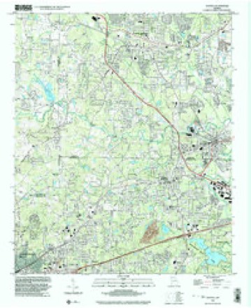
Topographic sheets covering this place
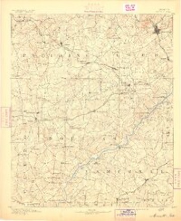
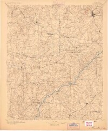
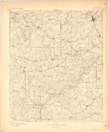
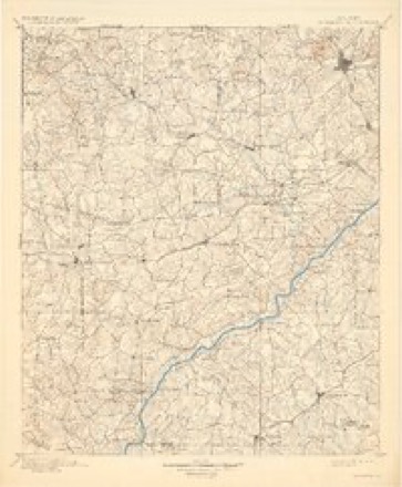
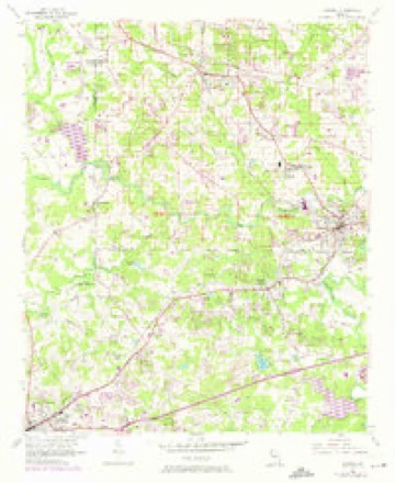
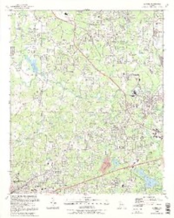
11 surveys from 20 printed sheetsMatched by testing this settlement's coordinate against the published boundary of every sheet in the United States Geological Survey's historical collection. Each opens the scanned sheet at the Survey.
- 1891 USGS Marietta quadrangle1:125000
- 1895 USGS Marietta quadrangle1:125000
- 1897 USGS Marietta quadrangle1:125000
- 1901 USGS Marietta quadrangle1:125000, 4 printings
- 1953 USGS Atlanta quadrangle1:250000, 2 printings
- 1954 USGS Austell quadrangle1:24000, 5 printings
- 1957 USGS Atlanta quadrangle1:250000
- 1958 USGS Atlanta quadrangle1:250000
- 1981 USGS Atlanta quadrangle1:100000
- 1992 USGS Austell quadrangle1:24000, 2 printings
- 1999 USGS Austell quadrangle1:24000




Photographs
3 photographs,Taken for the Office of War Information and the Farm Security Administration, who photographed the country between 1935 and 1944. Works of United States government photographers, with no known restriction on use. Each opens its catalogue record.
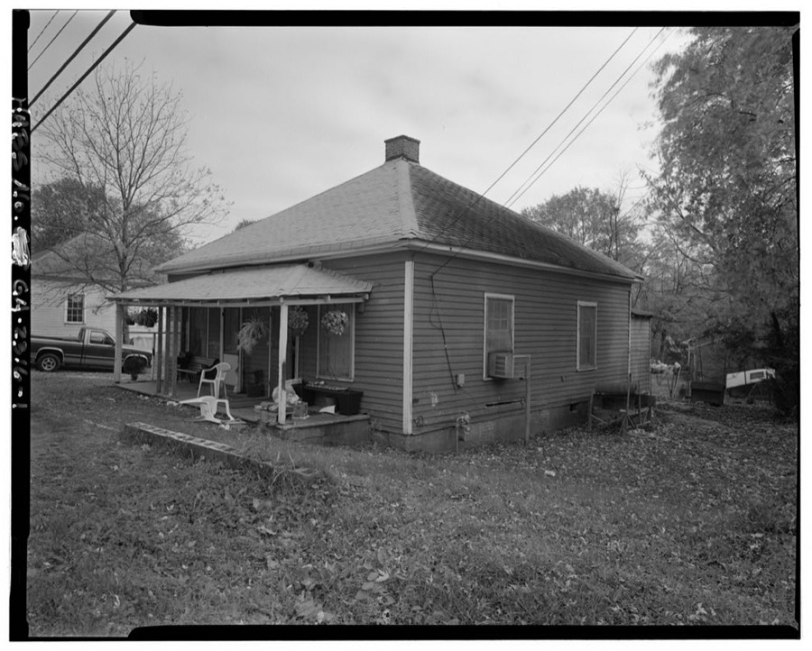
Photographer not recorded. Library of Congress
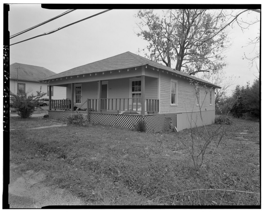
Photographer not recorded. Library of Congress
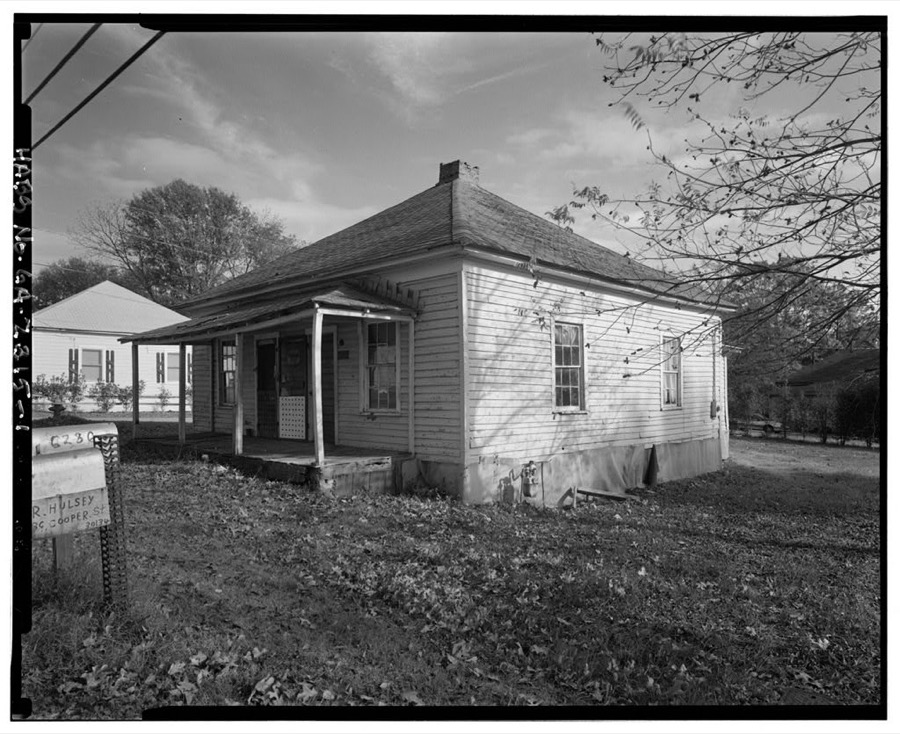
Photographer not recorded. Library of Congress
Fires near this place
149 since 1992Regional context, not property-specific evidence. The federal wildfire occurrence database lists 149 fires within 5 miles of Douglasville between 1992 and 2019, burning about 346 acres in total. 2 started naturally. 50 were recorded as arson. Distance is straight-line from the map coordinates, so a fire counted here may appear on a neighbouring settlement's page as well.
| Reported cause | Fires |
|---|---|
| Debris and open burning | 72 |
| Arson/incendiarism | 50 |
| Misuse of fire by a minor | 9 |
| Missing data/not specified/undetermined | 7 |
| Equipment and vehicle use | 4 |
| Recreation and ceremony | 3 |
| Smoking | 2 |
| Natural | 2 |
The most recent of them, most recent first, with the day each was reported and the service that recorded it.
| Date | Cause | Size | Reported by | Name on the report |
|---|---|---|---|---|
| 8 September 1995 | Arson/incendiarism | 2.6 acres | Georgia Forestry Commission | not named |
| 7 September 2002 | Misuse of fire by a minor | under an acre | Georgia Forestry Commission | FY2003-DOUGLAS-001 |
| 5 September 1995 | Debris and open burning | under an acre | Georgia Forestry Commission | not named |
| 30 September 1993 | Debris and open burning | under an acre | Georgia Forestry Commission | not named |
| 20 September 1993 | Arson/incendiarism | under an acre | Georgia Forestry Commission | not named |
| 15 September 1993 | Debris and open burning | under an acre | Georgia Forestry Commission | not named |
| 1 September 2011 | Arson/incendiarism | 3.1 acres | Georgia Forestry Commission | FY2012-PAULDING-007 |
| 5 August 2001 | Debris and open burning | under an acre | Georgia Forestry Commission | FY2002-DOUGLAS-001 |
Settlements close enough to share some of these fires:
Mines and quarries near this place
2 within 5 milesRegional context, not property-specific evidence. The federal mineral resources record lists 2 workings within 5 miles of Douglasville: 2 producers. All of them still produce. What was taken out: Stone, Crushed/Broken. Distance is straight-line from the map coordinates, so a quarry counted here may appear on a neighbouring settlement's page as well.
| Where | Site | Commodity | Status | Recorded |
|---|---|---|---|---|
| Douglasville Quarry | Stone, Crushed/Broken | Producer | ||
| Lithia Springs Quarry | Stone, Crushed/Broken | Producer |
Storms near this place
60 of 106 shownRegional context, not property-specific evidence. The National Weather Service names Douglasville in 106 storm reports between 1993 and 2026: 50 thunderstorm wind, 41 hail, 12 lightning, 2 flash flood. The reports record 4 injuries. Each account below is quoted exactly as the forecast office filed it, from the NOAA Storm Events Database, and each date opens the federal record of that event.
| When | Event | Place named | Harm | What the report says |
|---|---|---|---|---|
| July 2012 | Lightning | Douglasville | 1 hurt | The Douglas County Emergency Manager reported that a person was struck by lightning and injured on Lake Monroe near Douglasville. |
| March 2011 | Lightning | Douglasville | 1 hurt | The Douglas County Emergency Management Director reported that a middle-aged male was shocked indirectly by a nearby lightning strike while on a riding lawn mower just outside Douglasville. Although fire and emergency medical personnel were dispatched to the scene, no medical treatment was provided. |
| July 2010 | Lightning | Douglasville | 1 hurt | The Douglas County Emergency Manager, the Atlanta broadcast media, and the Douglas County Sentinel reported that a 15-year old male was struck by lightning while working with his father in the garage at their home on Bellemeade Drive off Coursey Lake Road. The teenage boy was apparently pushing the garage door opener button to close the door when the lightning strike occurred. The boy's arm was numb for several hours, but otherwise all injuries appeared to be minor. He was transported to a local hospital, treated, and released. |
| May 2001 | Lightning | Douglasville | 1 hurt | The Douglas county 911 center reported that a woman was struck by lightning. The extent of injury was not provided. |
| March 2013 | Hail | Douglasville | $2,290,000 | Ham radio operators relayed reports of golfball sized hail in Douglasville. |
| April 2009 | Hail | Douglasville | $1,300,000 | The public observed quarter-sized hail in northern Douglas county, north of Douglasville near the Douglas/Paulding county line, penny-sized hail in Douglasville, and golf ball-sized hail in the southeast part of the county near and southeast of Chapel Hill. The public reported that hail completely covered the ground in some areas. Significant damage to vehicles was reported from this area. |
| July 2008 | Lightning | Douglasville | $1,250,000 | The Douglas County Emergency Management Director reported that five homes in the Douglasville area were struck by lightning and set on fire. Three of the homes were completely destroyed and the other two suffered major damage. Most of the homes were located in the Chapel Hill area just off Georgia Highway 92, south of Douglasville. |
| July 2008 | Hail | Douglasville | $1,000,000 | The public observed quarter to golf ball-sized hail in the Douglasville area. |
| August 1996 | Flash Flood | Douglasville | $1,000,000 | no account filed |
| June 1998 | Thunderstorm Wind | Douglasville | $700,000 | An NWS survey team verified straight-line wind damage in the Douglasville area. As many as 100 homes were damaged, mostly from numerous falling trees. Shingles were torn from roofs and a few chimneys were damaged. A brick sign at a grocery store was toppled. Most of the damage occurred in a path from the Arbor Station subdivision to Chapel Hill Road just south of I-20. The path was about 200 yards wide and 1/2 mile long. All the trees were laying down in an easterly direction. Winds were estimated at 70 to 80 mph. There were reports of a funnel cloud in the area, but apparently it stayed just above the ground. |
| July 2011 | Lightning | Douglasville | $500,000 | Fox 5 Television of Atlanta reported that there were at least four almost simultaneous lightning-related fires in Douglas county during the evening, as relayed by Douglas County fire officials. One home near Douglasville was a total loss. |
| July 2002 | Lightning | Douglasville | $485,000 | The Douglas county Emergency Management Director reported that three homes and one outbuilding were set on fire by lightning strikes around the county. One home and its contents were completely destroyed off Georgia Highway 166 south of Douglasville, two other homes suffered major damage, and one outbuilding was destroyed in the Marie's Lake subdivision. |
| January 2001 | Lightning | Douglasville | $175,000 | The Douglas county 911 center, and later the Atlanta Journal and Constitution, reported that lightning struck a home in Douglasville. While no one was home at the time of the incident, the lightning started a fire that destroyed the home. In addition, a firefighter suffered a broken ankle battling the blaze. |
| May 2003 | Thunderstorm Wind | Douglasville | $150,000 | Numerous reports of downed trees were received from the public in the Douglasville area, especially between downtown and the Chapel Hill area southwest of Douglasville. Several trees fell on homes south and west of Douglasville along Central Church Road, Daniel Mill Road, Post Road, as well as in the Mirror Lake Country Club just east of Villa Rica. A number of power lines were also blown down or knocked down by fallen trees during this event and a large hotel sign was blown down in Douglasville. An off duty National Weather Service employee estimated that over 100 trees were blown down in just the Chapel Hill area alone. One person reported that his 1996 Toyota Camry was blown off the road, near Thorton Road and Interstate-20, with winds estimated in excess of 60 mph. |
| May 2013 | Thunderstorm Wind | Douglasville | $100,000 | The Douglas County Emergency Manager and 911 Center reported numerous trees down across the county. Several fell on power lines and homes, including on Pilgrims Drive, Windmark Place, David Drive, Greenbrook Drive, McKown Road, Hidden Branch Road, Bomar Road, and South Burnt Hickory Road. |
| October 2010 | Thunderstorm Wind | Douglasville | $100,000 | The Douglas County 911 Center reported that a tree had fallen on a home causing considerable damage to the structure and trapping the family inside. The family was rescued from the damaged home without incident or injury. |
| June 2010 | Thunderstorm Wind | Douglasville | $75,000 | WSB Television of Atlanta and the Douglas County 911 Center reported that several trees were down across the eastern half of the county. Several trees were down along or near Georgia Highway 5, Thornton Road, and Sam Alexander road in Douglasville Some trees were on homes and power lines. Power lines were also down in Lithia Springs. |
| June 2023 | Thunderstorm Wind | Douglasville | $30,000 | The 911 Center reported trees and/or powerlines down at numerous locations within Douglasville, including trees down at Alcris Drive, Cedar Mountain Road, Prestley Mill Road, Strickland Street at Timberlane Road, Rose Avenue, Clark Street at Park Street, Bowden Street at Clark Street, Rose Avenue at Starla Street, Countryside Way, Chicago Avenue, and Springwood Drive and powerlines down at Alcris Drive, Prestley Mill Road, Young Street, Warren Drive, Wenona Street, and Richland Drive. |
| July 2008 | Thunderstorm Wind | Douglasville | $30,000 | The Douglas County Emergency Management Director reported that a tree was blown down onto a home causing damage to the structure. When the tree fell, it also brought a power line down with it, which was also lying on the home. |
| June 1998 | Lightning | Douglasville | $30,000 | A mobile home off Anneewakee Road was burned to the ground after being hit by lightning. A residence on Tall Pines Drive suffered minor damage. |
| January 2012 | Thunderstorm Wind | Douglasville | $25,000 | The Douglas County Emergency Manager reported that signs at a shopping plaza were blown out and others twisted at the intersection of Fairburn Road and Shawnee Trail. Several businesses along Fairburn Road sustained minor structural damage to the roofs, with another sustaining moderate damage. One window was blown out, and several tree limbs were downed. |
| May 2010 | Lightning | Douglasville | $25,000 | The Douglas County Sentinel reported that lightning struck the county's 911 Center tower rendering the severe weather warning sirens for the city inoperative. |
| June 2008 | Thunderstorm Wind | Douglasville | $25,000 | A storm spotter reported that more than two dozen trees were down across the county. At least 20 roads were blocked and closed because of downed trees. One home sustained minor damage to gutters and outside lighting fixtures. The majority of the damage seemed to be in the Douglasville area. |
| May 2021 | Thunderstorm Wind | Douglasville | $10,000 | The Douglas County Emergency Manager reported a tree blown down onto a vehicle near the intersection of Campbelton Street and Spring Street. |
| January 2020 | Thunderstorm Wind | Douglasville | $10,000 | The Douglas County Emergency Manager reported trees and power lines blown down from northwest of Douglasville to near Chapel Hill. |
| May 2017 | Lightning | Douglasville | $10,000 | The Douglas County Emergency Manager reported a house fire caused by a lightning strike on Forest Hill Drive. |
| April 2011 | Thunderstorm Wind | Douglasville | $7,000 | The Douglas County 911 Center reported that a tree was blown down onto a home in Douglasville causing damage to the porch of the home. |
| June 2011 | Thunderstorm Wind | Douglasville | $7,000 | The Douglas County 911 Center reported that a number of power lines were down in the Douglasville area. WSR-88D base velocity data indicated that strong winds on the order of 50kts, possibly higher, affected areas southwest of Douglasville near Chapel Hill and Bill Arp. |
| February 2001 | Thunderstorm Wind | Douglasville | $5,000 | A storm spotter, who estimated winds at 70 mph, reported damage to a gas station in Douglasville. The public reported that one tree was down and pieces of a tin roof were blown off a barn about halfway between Douglasville and Lithia Springs. Other reports of tree limbs down were received from areas just south of Douglasville. |
| May 1995 | Thunderstorm Wind | Douglasville | $5,000 | Thunderstorm winds snapped a telephone pole at Brightstar Road. |
| April 1995 | Thunderstorm Wind | Douglasville | $3,000 | Thunderstorm winds lifted a roof off of a small shopping complex, broke windows, pulled panels off store fronts, and twisted a billboard along Georgia Highway 5 in Douglasville. |
| May 2025 | Thunderstorm Wind | Douglasville | $2,000 | Emergency manager reported a tree down on a power line near the intersection of Campbellton St and Rose Circle. |
| April 2020 | Thunderstorm Wind | Douglasville | $2,000 | Large tree down near Rose Ave and Selman Drive in Douglasville. |
| June 2007 | Thunderstorm Wind | Douglasville | $2,000 | The Douglas County 911 Center reported that several trees were blown down in the Lakeland Hills and South Burnt Hickory Road areas from a thunderstorm downburst. No property damage was reported, however. |
| April 2000 | Thunderstorm Wind | Douglasville | $2,000 | The public reported the tin roof blown off a barn. |
| April 1998 | Hail | Douglasville | $2,000 | Dime to golfball size hail was reported. A vehicle was damaged. |
| June 1998 | Thunderstorm Wind | Douglasville | $2,000 | Public and spotter reports indicated tree limbs were downed and a McDonalds sign was blown over. Winds were estimated at 60 to 75 mph. |
| June 1998 | Thunderstorm Wind | Douglasville | $2,000 | Thunderstorm winds knocked a tree down on a deck and another one was knocked down on a fence. |
| March 1997 | Thunderstorm Wind | Douglasville | $2,000 | no account filed |
| June 2013 | Thunderstorm Wind | Douglasville | $1,500 | The Douglas County Emergency Manager reported that several trees were down on Huey Road, Hillside Drive and Reynolds Road. Some power outages were reported as well. |
| January 2001 | Thunderstorm Wind | Douglasville | $1,500 | An off duty National Weather Service employee reported 4 trees down along Georgia Highway 166 south of Douglasville and another tree was also reported down by the public in the same general area. |
| March 2026 | Thunderstorm Wind | Douglasville | $1,000 | The emergency manager relayed a report of a downed tree blocking a portion of the roadway at parkway south and knollwood circle. |
| May 2025 | Thunderstorm Wind | Douglasville | $1,000 | Tree downed across roadway on 8100 block of thompson st. |
| May 2025 | Thunderstorm Wind | Douglasville | $1,000 | Powerline downed across roadway on teresa ln. |
| May 2025 | Thunderstorm Wind | Douglasville | $1,000 | Tree and powerline downed across roadway at intersection of vansant st and prestley mill rd. |
| May 2025 | Thunderstorm Wind | Douglasville | $1,000 | Tree downed across roadway on 8100 block of thompson st. |
| April 2025 | Thunderstorm Wind | Douglasville | $1,000 | Em reports tree down at n walton store and walton store rd. |
| January 2024 | Thunderstorm Wind | Douglasville | $1,000 | A tree was downed in the 9000 block of Parkway South. |
| July 2024 | Thunderstorm Wind | Douglasville | $1,000 | Utility lines were reported down in the 6300 block of Douglas Blvd. |
| August 2023 | Thunderstorm Wind | Douglasville | $1,000 | Tree and powerline down along Campbellton St. |
| August 2023 | Thunderstorm Wind | Douglasville | $1,000 | A tree was reported down on Brickleberry Way at hwy 92. |
| July 2023 | Thunderstorm Wind | Douglasville | $1,000 | A utility line was downed at Forest Trail and Hillside Drive. |
| June 2022 | Thunderstorm Wind | Douglasville | $1,000 | Tree and powerlines down on car near intersection of Old Dallas Hwy and Cave Springs Hwy. |
| June 2018 | Thunderstorm Wind | Douglasville | $1,000 | The Douglas County Emergency Manager reported power lines blown down at the intersection of Thompson Street and Lincoln Street. |
| October 2006 | Thunderstorm Wind | Douglasville | $1,000 | The Douglas County 911 Center reported that two trees were down in the area. A spotter in the area reported seeing a funnel cloud near Interstate-20. |
| February 1999 | Thunderstorm Wind | Douglasville | $1,000 | Douglas county 911 reported a tree and power line blown down by thunderstorm winds. |
| April 1995 | Thunderstorm Wind | Douglasville | $700 | Thunderstorm winds knocked down numerous trees in Douglasville. Lightning also struck a home, resulting in little damage and no injuries. |
| May 1999 | Thunderstorm Wind | Douglasville | $500 | The public reported 4 large trees down. |
| May 1994 | Thunderstorm Wind | Douglasville | $500 | Three large trees were downed by thunderstorm winds. |
| June 2001 | Thunderstorm Wind | Douglasville | $300 | Firestation Number 6 reported that one tree was blown down at the station on Lower River Road. |
Nearest settlements
The eight closest, with where each one stands in the county. Distances are straight-line, computed from the Geographic Names Information System coordinates.
| Map | Place | Distance | Sheets |
|---|---|---|---|
| Salem | 0.3 miles | 17 | |
| Lincoln Heights | 0.4 miles | 17 | |
| Alta Vista | 0.5 miles | 17 | |
| Dorris | 0.6 miles | 17 | |
| Forest Heights | 0.7 miles | 20 | |
| Malone Park | 0.8 miles | 20 | |
| Western Pines | 0.8 miles | 17 | |
| Westwood Heights | 1.0 miles | 17 |
Elsewhere
Matched on this settlement's Geographic Names Information System number rather than its name, so it cannot be a different place of the same name in another state.
| Wikipedia article on Douglasville | An encyclopaedic summary. Its text is share-alike, so it is linked here rather than copied. |
| Wikidata item Q2856147 | The structured record the population and elevation above come from. Public domain (CC0). |
Provenance
This settlement is recorded in the Geographic Names Information System as feature 355535. The sheet list is computed by point-in-boundary test against the United States Geological Survey's historical topographic inventory. Both are works of the United States government and carry no copyright under 17 U.S.C. 105.
Wildfire. Short, Karen C. 2022. Spatial wildfire occurrence data for the United States, 1992-2020 [FPA_FOD_20221014]. 6th Edition. Fort Collins, CO: Forest Service Research Data Archive. https://doi.org/10.2737/RDS-2013-0009.6 Collected with United States Government funding and usable without additional permissions or fees.
Mines and quarries. USGS Mineral Resources Data System (MRDS) https://mrdata.usgs.gov/mrds/ A work of the United States government, no copyright under 17 U.S.C. 105.
Storms. NOAA National Centers for Environmental Information, Storm Events Database https://www.ncei.noaa.gov/stormevents/ A work of the United States government, no copyright under 17 U.S.C. 105. Narratives are quoted verbatim from the National Weather Service report and are not edited or summarised.