 Block
Homestead Park, Georgia
8 topographic sheets cover this place, the earliest surveyed in 1954 and the latest in 1981. It stands in the Thomasville census division. It lies in ZIP code area 31792. The Survey maps it on the Thomasville quadrangle.
On record in Homestead Park
Buildings and businesses the archive holds for this place. Each opens its own page, with the source record it came from.
On the National Register within a mile 6 records
The National Register names another town for these. They stand within one mile of this settlement's coordinate.
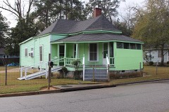 Dewey City Historic Districtlisted 2008 · 0.1 miles away
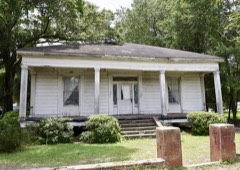 Stevens Street Historic Districtlisted 2001 · 0.6 miles away
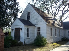 Church of the Good Shepherdlisted 1987 · 0.7 miles away
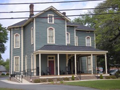 Judge Henry William and Francesca Hopkins Houselisted 2013 · 0.8 miles away
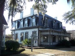 Dr. David Brandon Houselisted 1970 · 1.0 miles away
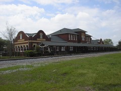 Thomasville Depotlisted 1988 · 1.0 miles away
Topographic sheets covering this place
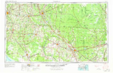
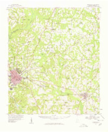
6 surveys from 8 printed sheetsMatched by testing this settlement's coordinate against the published boundary of every sheet in the United States Geological Survey's historical collection. Each opens the scanned sheet at the Survey.
- 1954 USGS Valdosta quadrangle1:250000, 2 printings
- 1957 USGS Thomasville quadrangle1:62500
- 1958 USGS Valdosta quadrangle1:250000
- 1959 USGS Valdosta quadrangle1:250000
- 1975 USGS Thomasville quadrangle1:24000, 2 printings
- 1981 USGS Valdosta quadrangle1:100000
Fires near this place
219 since 1992Regional context, not property-specific evidence. The federal wildfire occurrence database lists 219 fires within 5 miles of Homestead Park between 1992 and 2018, burning about 829 acres in total. 1 started naturally. 34 were recorded as arson. Distance is straight-line from the map coordinates, so a fire counted here may appear on a neighbouring settlement's page as well.
| Reported cause | Fires |
|---|---|
| Debris and open burning | 141 |
| Arson/incendiarism | 34 |
| Equipment and vehicle use | 16 |
| Misuse of fire by a minor | 10 |
| Railroad operations and maintenance | 7 |
| Recreation and ceremony | 5 |
| Smoking | 3 |
| Missing data/not specified/undetermined | 2 |
| Natural | 1 |
The most recent of them, most recent first, with the day each was reported and the service that recorded it.
| Date | Cause | Size | Reported by | Name on the report |
|---|---|---|---|---|
| 9 September 1997 | Debris and open burning | under an acre | Georgia Forestry Commission | not named |
| 30 September 1993 | Arson/incendiarism | 2.6 acres | Georgia Forestry Commission | not named |
| 24 September 1999 | Arson/incendiarism | 1.4 acres | Georgia Forestry Commission | not named |
| 17 September 2010 | Debris and open burning | 3.8 acres | Georgia Forestry Commission | FY2011-THOMAS-006 |
| 10 September 2009 | Equipment and vehicle use | under an acre | Georgia Forestry Commission | not named |
| 5 August 1999 | Debris and open burning | under an acre | Georgia Forestry Commission | not named |
| 25 August 1993 | Equipment and vehicle use | under an acre | Georgia Forestry Commission | not named |
| 21 August 1993 | Equipment and vehicle use | under an acre | Georgia Forestry Commission | not named |
Settlements close enough to share some of these fires:
Storms near this place
36 since 2009Regional context, not property-specific evidence. The National Weather Service names Homestead Park in 36 storm reports between 2009 and 2025: 20 thunderstorm wind, 7 flash flood, 6 hail, 2 tornado. The reports record 1 injury. Each account below is quoted exactly as the forecast office filed it, from the NOAA Storm Events Database, and each date opens the federal record of that event.
| When | Event | Place named | Harm | What the report says |
|---|---|---|---|---|
| June 2012 | Flash Flood | Homestead Park | 1 hurt, $750,000 | Significant flash flooding occurred in Thomasville. Between 5 and 8 roads were closed in Thomasville due to high water with cars submerged in many areas. Water was up to the car bumpers on Walcott and Young Streets with some basements flooding as well. The Days Inn located near the intersection of the Thomasville Bypass and E Jackson Street had water in the first floor rooms with a water mark around 2 feet high. Radar estimates and rain gauge measurements indicate that between 5 and 7 inches of rain fell in around a 3 hour period with over 4 inches of rain falling in just one hour northwest of town. A 12 year old boy was sucked into a manhole on Remington Avenue and required hospitalization. Monetary damage was estimated. |
| February 2009 | Tornado (EF2) | Homestead Park | $10,000,000 | The tornado crossed from adjacent Grady County into Thomas County along Lower Cairo Road where it caused extensive damage to a pine forest plantation. Three homes on the south side of the tornado's path were damaged, with one home losing part of its roof. A barn and two garages were damaged or destroyed. Along its path toward U.S. Highway 319 and Cindy Road, numerous pine trees were snapped or uprooted and fell on homes. Brookwood School and its grounds sustained significant damage, including a hole in the roof of the main building. The tornado crossed U.S. Highway 319 near Metcalf Road and moved toward the Southwest Georgia State Hospital just south of Pinetree Boulevard. It snapped more pine trees and removed two air conditioning units from the roof of one of the hospital buildings. Another hospital building was heavily damaged. The tornado began to weaken as it approached U.S. Highway 19 south of Glen Arven Country Club, and crossed U.S. Highway 19 just south of Sunset Drive. Damage in this area was limited to power lines and a few trees. Before lifting, the tornado moved across County Farm Road at the Thomas County Landfill, where a storage building was damaged with debris blown several hundred yards. According to the Thomas County Emergency Management Agency, nine mobile homes were destroyed, 29 single family homes were destroyed, and a total of 170 structures were damaged. About 4,200 residents were without power. The Governor declared a state of emergency in Thomas County. |
| July 2014 | Thunderstorm Wind | Homestead Park | $20,000 | A large tree fell in a car on Lansing Street. This report was received via Twitter from WALB-TV. |
| April 2011 | Thunderstorm Wind | Homestead Park | $20,000 | Trees, power lines, and power poles were blown down across the county. The monetary damage figure provided is a rough estimate. |
| May 2012 | Thunderstorm Wind | Homestead Park | $5,000 | A tree was blown down onto a residence on Crawford Street in Thomasville. Monetary damage was estimated. |
| June 2015 | Thunderstorm Wind | Homestead Park | $3,000 | Trees were blown down onto power lines per a post to the WCTV facebook page. |
| March 2022 | Thunderstorm Wind | Homestead Park | $2,000 | Downed trees and power lines were reported near Briar Cliff Drive. |
| September 2018 | Thunderstorm Wind | Homestead Park | $2,000 | A tree was blown down onto power lines along Highway 319. |
| March 2012 | Flash Flood | Homestead Park | $2,000 | Water entered a residence on Passmore Street due to excessive rainfall of several inches in a short period of time. Monetary damage was estimated. |
| February 2016 | Thunderstorm Wind | Homestead Park | $1,000 | A power line was blown down near Thomasville. |
| October 2014 | Thunderstorm Wind | Homestead Park | $1,000 | Trees were blown down on Highway 3 near Thomasville. |
| June 2025 | Thunderstorm Wind | Homestead Park | - | There were three reports of trees down in Thomas county. |
| January 2024 | Thunderstorm Wind | Homestead Park | - | Trees were blown down in Thomasville. |
| August 2024 | Flash Flood | Homestead Park | - | The intersection of MLK Jr Drive and Wolf Street was flooded and closed. |
| April 2023 | Tornado (EF1) | Homestead Park | - | A brief tornado touched down along U.S. Highway 84 near Greenwood Plantation. The tornado caused extensive tree damage consistent with EF-1 winds of approximately 100 mph. The tornado just missed several homes just to the southeast and remained over wooded areas before dissipating as it crossed the U.S. 84 Bypass. Thanks to Thomas County EMA for assistance with the damage survey. |
| January 2023 | Thunderstorm Wind | Homestead Park | - | A tree was blown down a Highway 3 and Old Cassidy Road. |
| May 2023 | Flash Flood | Homestead Park | - | Neel Street was flooded between MLK Drive and West Jackson Street. |
| May 2023 | Flash Flood | Homestead Park | - | N Spair Street was flooded at E Monroe Street. |
| July 2023 | Thunderstorm Wind | Homestead Park | - | A tree blew near the intersection of the Highway 84 Bypass and Highway 3. |
| June 2023 | Thunderstorm Wind | Homestead Park | - | Trees and power lines were blown down in Thomas county. |
| June 2023 | Thunderstorm Wind | Homestead Park | - | A tree was blown down at the intersection of Highway 84 and Cairo Road. |
| April 2022 | Thunderstorm Wind | Homestead Park | - | There was a report of wind damage to a house on Stevens Street. |
| November 2022 | Thunderstorm Wind | Homestead Park | - | A tree was blown down along the 3000 block of Lower Cairo Road. |
| February 2020 | Thunderstorm Wind | Homestead Park | - | A few trees and power lines were blown down. |
| July 2020 | Flash Flood | Homestead Park | - | A car was stalled in high water near the intersection of Clay Street and Glenwood Dr. Several other streets in Thomasville were also flooded. |
| April 2020 | Thunderstorm Wind | Homestead Park | - | Fifteen trees were blown down across the county. |
| June 2019 | Flash Flood | Homestead Park | - | There was widespread flooding reported across Thomasville with multiple reports of cars stalled in 2 to 3 feet of moving water. |
| July 2018 | Hail | Homestead Park | - | Quarter to half dollar size hail was reported at the intersection of Highway 84 and Old Albany Road in Thomasville. |
| July 2017 | Thunderstorm Wind | Homestead Park | - | Two trees were blown down near Glenwood and Bluebird. |
| June 2015 | Thunderstorm Wind | Homestead Park | - | Several trees were blown down. |
| March 2012 | Heavy Rain | Homestead Park | - | The public reported 5 inches of rain in less than a 6 hour time frame. |
| July 2009 | Hail | Homestead Park | - | Penny to nickel size hail fell during a ten-minute period in Thomasville. |
| November 2025 | Hail | Homestead Park | - | no account filed |
| May 2024 | Hail | Homestead Park | - | no account filed |
| March 2011 | Hail | Homestead Park | - | no account filed |
| March 2011 | Hail | Homestead Park | - | no account filed |
Nearest settlements
The eight closest, with where each one stands in the county. Distances are straight-line, computed from the Geographic Names Information System coordinates.
| Map | Place | Distance | Sheets |
|---|---|---|---|
| Dewey City | 0.2 miles | 8 | |
| Booker Heights | 0.5 miles | 8 | |
| Fletcherville | 1.1 miles | 8 | |
| Thomasville | 1.1 miles | 8 | |
| Theodore Heights | 1.2 miles | 8 | |
| McLoughlin Heights | 1.7 miles | 8 | |
| Pebble Hill | 2.4 miles | 12 | |
| Mount Olive (historical) | 3.3 miles | 12 |
Provenance
This settlement is recorded in the Geographic Names Information System as feature 343741. The sheet list is computed by point-in-boundary test against the United States Geological Survey's historical topographic inventory. Both are works of the United States government and carry no copyright under 17 U.S.C. 105.
Wildfire. Short, Karen C. 2022. Spatial wildfire occurrence data for the United States, 1992-2020 [FPA_FOD_20221014]. 6th Edition. Fort Collins, CO: Forest Service Research Data Archive. https://doi.org/10.2737/RDS-2013-0009.6 Collected with United States Government funding and usable without additional permissions or fees.
Storms. NOAA National Centers for Environmental Information, Storm Events Database https://www.ncei.noaa.gov/stormevents/ A work of the United States government, no copyright under 17 U.S.C. 105. Narratives are quoted verbatim from the National Weather Service report and are not edited or summarised.