 Block
Thomasville, Georgia
8 topographic sheets cover this place, the earliest surveyed in 1954 and the latest in 1981. It stands in the Thomasville census division. It lies in ZIP code area 31792. The Survey maps it on the Thomasville quadrangle. 18,881 people lived here at the 2020 count. It stands 279 feet above sea level.
Research this city
On record in Thomasville
Buildings and businesses the archive holds for this place. Each opens its own page, with the source record it came from.
On the National Register 12 of 39 shown
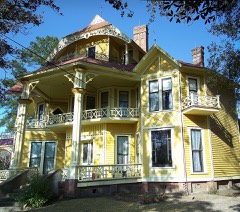 Lapham-Patterson HouseNational Historic Landmark · listed 1970
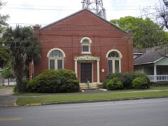 B'nai Israel Synagogue and Cemeterylisted 1997
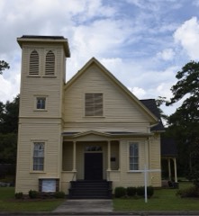 Bethany Congregational Churchlisted 1985
 Joe M. Beutell Houselisted 1991
 Birdwoodlisted 1986
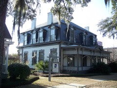 Dr. David Brandon Houselisted 1970
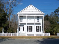 Hardy Bryan Houselisted 1970
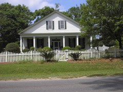 Burch-Mitchell Houselisted 1970
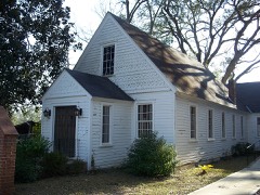 Church of the Good Shepherdlisted 1987
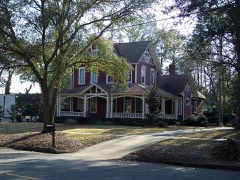 Dawson Street Residential Historic Districtlisted 1984
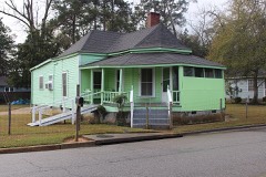 Dewey City Historic Districtlisted 2008
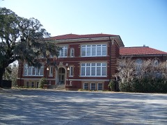 East Side Schoollisted 1977
Every listing in Thomas County
Surveyed buildings and structures 1 record
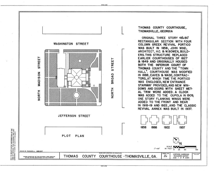
- Thomas County Courthouse, Broad Street, Thomasvillefederal building survey, 8 photographs
Population over time
2 figuresThomasville grew from 18,413 to 18,881 between 2010 and 2020. These are the recorded population figures Wikidata holds for this place, reached through the Geographic Names Information System number this page is keyed on rather than by name, so they belong to this place and not to another of the same name. Most are census counts, but not all are: an early figure may be a founding or settlement estimate, and an estimate published within five years of a census is left out. The change column is computed, and is left blank where more than 20 years separate a figure from the one before it, because a gap that long is not a change between two counts.
| Year | People | Change |
|---|---|---|
| 2010 | 18,413 | |
| 2020 | 18,881 | +468 (+3%) |
Topographic sheets covering this place
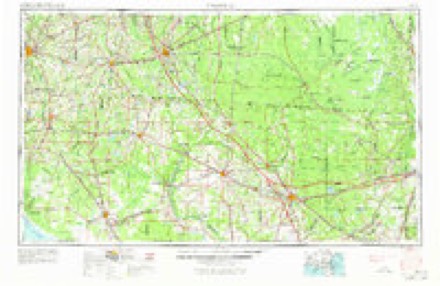
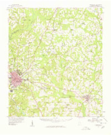
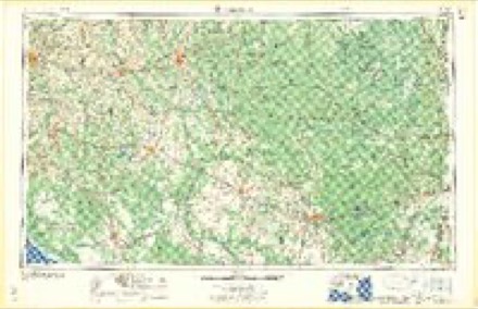
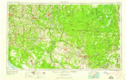
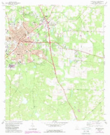
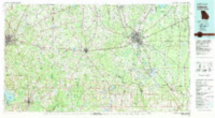
6 surveys from 8 printed sheetsMatched by testing this settlement's coordinate against the published boundary of every sheet in the United States Geological Survey's historical collection. Each opens the scanned sheet at the Survey.
- 1954 USGS Valdosta quadrangle1:250000, 2 printings
- 1957 USGS Thomasville quadrangle1:62500
- 1958 USGS Valdosta quadrangle1:250000
- 1959 USGS Valdosta quadrangle1:250000
- 1975 USGS Thomasville quadrangle1:24000, 2 printings
- 1981 USGS Valdosta quadrangle1:100000
Photographs
1 photograph,Taken for the Office of War Information and the Farm Security Administration, who photographed the country between 1935 and 1944. Works of United States government photographers, with no known restriction on use. Each opens its catalogue record.
Photographer not recorded. Library of Congress
Fires near this place
270 since 1992Regional context, not property-specific evidence. The federal wildfire occurrence database lists 270 fires within 5 miles of Thomasville between 1992 and 2020, burning about 1,062 acres in total. 1 started naturally. 43 were recorded as arson. Distance is straight-line from the map coordinates, so a fire counted here may appear on a neighbouring settlement's page as well.
| Reported cause | Fires |
|---|---|
| Debris and open burning | 171 |
| Arson/incendiarism | 43 |
| Equipment and vehicle use | 18 |
| Misuse of fire by a minor | 12 |
| Railroad operations and maintenance | 9 |
| Recreation and ceremony | 7 |
| Missing data/not specified/undetermined | 5 |
| Smoking | 4 |
| Natural | 1 |
The most recent of them, most recent first, with the day each was reported and the service that recorded it.
| Date | Cause | Size | Reported by | Name on the report |
|---|---|---|---|---|
| 9 September 1997 | Debris and open burning | under an acre | Georgia Forestry Commission | not named |
| 30 September 2019 | Debris and open burning | under an acre | Georgia Forestry Commission | FY2020THOMAS010 |
| 30 September 1993 | Arson/incendiarism | 2.6 acres | Georgia Forestry Commission | not named |
| 24 September 1999 | Arson/incendiarism | 1.4 acres | Georgia Forestry Commission | not named |
| 17 September 2010 | Debris and open burning | 3.8 acres | Georgia Forestry Commission | FY2011-THOMAS-006 |
| 10 September 2009 | Equipment and vehicle use | under an acre | Georgia Forestry Commission | not named |
| 5 August 1999 | Debris and open burning | under an acre | Georgia Forestry Commission | not named |
| 28 August 2011 | Debris and open burning | 1.6 acres | Georgia Forestry Commission | FY2012-THOMAS-005 |
Settlements close enough to share some of these fires:
Storms near this place
60 of 104 shownRegional context, not property-specific evidence. The National Weather Service names Thomasville in 104 storm reports between 1994 and 2025: 61 thunderstorm wind, 19 flash flood, 11 hail, 5 heavy rain. The reports record 1 death and 2 injuries. Each account below is quoted exactly as the forecast office filed it, from the NOAA Storm Events Database, and each date opens the federal record of that event.
| When | Event | Place named | Harm | What the report says |
|---|---|---|---|---|
| August 1999 | Lightning | Thomasville | 1 killed | A Valdosta State University student-athlete was struck and killed by lightning while pitching during a baseball game. |
| November 1995 | Tornado (F1) | Thomasville | 1 hurt, $50,000 | A brief tornado blew numerous trees down across GA 202 just south of U.S. 84 in Thomasville. One mobile home was totalled and one car was struck by a tree causing injury to the passenger. |
| December 2014 | Thunderstorm Wind | Thomasville | 1 hurt, $15,000 | Multiple trees were blown down across the county. One tree fell on a car and injured the woman inside. Monetary damage was estimated. |
| January 1995 | Hail | Thomasville | $650,000 | Numerous reports of hail ranging from 1.75 to 4.00 inches. Several cars were damaged. Hail also knocked down tree branches and power lines. In addition, broken windows were reported in several homes. |
| June 1994 | Thunderstorm Wind | Thomasville | $500,000 | Numerous reports of flooding up to four feet deep in the city of Thomasville. One business and several vehicles were flooded from excessive rainfall. The area with most severe flooding was on Smith Ave. in Thomasville. |
| June 1999 | Flood | Thomasville | $150,000 | Thomas County EMA reported up to 10 inches of water covered numerous streets and roads in Thomasville as slow-moving thunderstorms produced up to 8 inches of rain between 7 am and noon. Seven homes on Passmore St had up to six inches of water inside and six families were placed in a Red Cross temporary emergency shelter. |
| April 2022 | Tornado (EF1) | Thomasville | $100,000 | This tornado in Thomasville touched down near Wood Lakes Rd and S Pinetree Blvd. The tornado uprooted or snapped numerous trees in Balfour Park, along with causing minor roof damage to a home in vicinity of the park. The tornado caused significant damage to one of the baseball fields used by Thomas University adjacent to Varnedoe Street. A large concrete wall, reinforced with rebar was completely knocked over. The tornado was then in intermittent contact with the ground while traveling through residential areas along and south of Persimmon Street. Some minor damage to roofs occurred in this area along with a few uprooted trees. The tornado crossed a large wooded area, emerging along Gordon Avenue and uprooting and snapping several large pines, with one impacting a home near the intersection of Gordon Avenue and Longleaf Drive. The tornado caused a large pine to impact a home on Evergreen Drive, with additional large trees snapped along Millpond Road before dissipating. This tornado was rated an EF1 with max winds estimated at 100 mph. |
| January 2000 | Thunderstorm Wind | Thomasville | $100,000 | Thunderstorm winds peeled a metal roof off the Central Middle School and set it on the ground. The Thomas County EM received numerous reports of downed trees, limbs and power lines on Pavo Rd, U.S. 19 South and County Rd 122 in Metcalf. A tree fell on a house in the Holly Springs subdivision off County Line Rd. |
| February 2008 | Thunderstorm Wind | Thomasville | $50,000 | Several trees were blown down across the northern half of the county. An old barn was destroyed. Straight line wind damage was confined within this storm. In the northeast part of the county near Patten, two sheds were destroyed. One small grain silo was destroyed, with the debris strewn 200 yards. Phone lines were knocked out, with 200 homes without power. |
| January 2002 | Thunderstorm Wind | Thomasville | $35,000 | Numerous downed trees and power lines. A few businesses sustained minor roof damage. Some trees were set ablaze by downed live wires. Reported by the Thomas County EMA. |
| June 2015 | Thunderstorm Wind | Thomasville | $20,000 | A tree was blown down onto a vehicle in Thomasville. |
| May 2012 | Thunderstorm Wind | Thomasville | $5,000 | A tree was blown down onto a residence on Raleigh Avenue in Thomasville. Monetary damage was estimated. |
| January 2001 | Thunderstorm Wind | Thomasville | $5,000 | Numerous trees and power lines down. Reported by the Thomas County EMA. |
| July 2000 | Thunderstorm Wind | Thomasville | $5,000 | A toppled tree tore electric lines from a house on Peach Street and another tree fell onto electric lines on Remington Avenue. |
| June 1994 | Thunderstorm Wind | Thomasville | $5,000 | Numerous trees and power lines were downed straight line thunderstorm winds along U.S. Highway 19, seven miles south of Thomasville. |
| August 1994 | Thunderstorm Wind | Thomasville | $5,000 | Thunderstorm winds downed six large oak trees along U.S. Highway 19. |
| October 1994 | Thunderstorm Wind | Thomasville | $5,000 | A sheriff reported numerous tree limbs and power lines were downed. |
| December 2023 | Thunderstorm Wind | Thomasville | $3,000 | Pictures were posted on social media of trees and power lines down along Old Monticello Road in the Thomasville area. |
| July 2021 | Thunderstorm Wind | Thomasville | $3,000 | A tree was blown down at Old Monticello Road and Plantation Dr with power lines reported down in the same area. |
| July 2021 | Thunderstorm Wind | Thomasville | $3,000 | A tree was blown down at Magnolia Road near train tracks with power lines also down in the same area. |
| February 2017 | Thunderstorm Wind | Thomasville | $3,000 | Several trees and power lines were blown down across Thomas county. |
| June 2012 | Thunderstorm Wind | Thomasville | $3,000 | Multiple trees and power lines were blown down. Monetary damage was estimated. |
| July 2012 | Thunderstorm Wind | Thomasville | $3,000 | Trees were blown down along Rose Avenue along with a power line. Monetary damage was estimated. |
| September 2011 | Thunderstorm Wind | Thomasville | $3,000 | Power lines were blown down in Thomasville. The monetary damage figure provided is a rough estimate. |
| June 2008 | Thunderstorm Wind | Thomasville | $3,000 | Several trees and power lines were down just west of U.S. Highway 319 near Coolidge. |
| January 2022 | Thunderstorm Wind | Thomasville | $2,000 | A few trees and power lines were blown down in Thomasville. |
| July 2014 | Thunderstorm Wind | Thomasville | $2,000 | Power lines were blown down at Park and Broad Street in Thomasville. |
| February 2014 | Thunderstorm Wind | Thomasville | $2,000 | Numerous trees were uprooted and snapped on South Broad Street in Thomasville. |
| December 2012 | Thunderstorm Wind | Thomasville | $2,000 | Power lines were blown down on Jackson Street east of downtown Thomasville. Monetary damage was estimated. |
| June 2012 | Lightning | Thomasville | $2,000 | Lightning struck a gas station and caused a fire. Monetary damage was estimated. |
| June 2008 | Thunderstorm Wind | Thomasville | $2,000 | Numerous trees were down across the eastern half of the county. |
| June 2008 | Thunderstorm Wind | Thomasville | $2,000 | Numerous trees were down across the western half of the county. |
| June 2004 | Thunderstorm Wind | Thomasville | $2,000 | A large pine tree was uprooted and damaged other trees. It also destroyed a wooden privacy fence. Reported by the public. |
| August 1995 | Thunderstorm Wind | Thomasville | $2,000 | County emergency management reported several trees and power lines down. |
| August 2018 | Heavy Rain | Thomasville | $1,000 | There were some reports of trees leaning on power lines in Thomasville, likely due to a combination of saturated soils from recent heavy rain and winds gusts of 40-50 mph. Rainfall of 2.01 inches of rain fell in about 1 hour at mesonet station D2427 in Thomasville. |
| July 2012 | Thunderstorm Wind | Thomasville | $1,000 | A tree was blown down along Wimbledon Drive. Monetary damage was estimated. |
| July 2012 | Thunderstorm Wind | Thomasville | $1,000 | A tree was blown down near Mill Pond Road. Monetary damage was estimated. |
| July 2012 | Thunderstorm Wind | Thomasville | $1,000 | A tree was blown down in Thomasville. Monetary damage was estimated. |
| August 2007 | Thunderstorm Wind | Thomasville | $1,000 | Numerous trees were down across much of the county. |
| May 2003 | Thunderstorm Wind | Thomasville | $1,000 | A few trees and a power line down near Pavo. Reported by Thomas County 911. |
| June 1999 | Thunderstorm Wind | Thomasville | $1,000 | Few large trees down across Summer Hill Rd reported by the Thomas County EMA. |
| June 1998 | Thunderstorm Wind | Thomasville | $1,000 | Numerous trees down in the vicinity of and north of Thomasville. Trees and power lines down on GeorgiaHighway 33 about five miles south of Quitman. Some minor damage to buildings. |
| August 2014 | Thunderstorm Wind | Thomasville | $500 | A tree was blown down near Thomasville. |
| December 2012 | Thunderstorm Wind | Thomasville | $500 | A tree was blown down across a roadway in Thomasville with no other damage reported in the county. |
| July 1994 | Thunderstorm Wind | Thomasville | $500 | Thunderstorm winds downed several trees and power lines in the city of Thomasville which caused power outages for at least a couple of hours. |
| July 1994 | Thunderstorm Wind | Thomasville | $500 | Thunderstorm winds downed six large oak trees 5 miles southeast of Thomasville along U.S. Highway 19. |
| August 1994 | Thunderstorm Wind | Thomasville | $500 | A few large trees were downed by thunderstorm winds in Thomasville. |
| March 2025 | Thunderstorm Wind | Thomasville | - | Trees were blown down in Thomasville. |
| August 2024 | Flash Flood | Thomasville | - | The area around 609 Smith Ave was flooded and closed. |
| August 2024 | Flash Flood | Thomasville | - | The intersection of Remington Ave and Ben Grace Dr was flooded and closed. |
| August 2024 | Thunderstorm Wind | Thomasville | - | A tree was blown down in Thomasville. |
| May 2024 | Thunderstorm Wind | Thomasville | - | Trees were blown down along Metcalf Road near Pebble Point Drive. |
| July 2024 | Flash Flood | Thomasville | - | Flooding was reported near the Farmers Market on Smith Ave. |
| July 2024 | Flash Flood | Thomasville | - | Cars were stalling near the intersection of Remington Ave and Madison Street in downtown Thomasville. |
| July 2024 | Flash Flood | Thomasville | - | Flooding was reported on Pinetree Blvd near Gordon Ave and Longleaf Dr. |
| August 2024 | Flash Flood | Thomasville | - | The intersection of Clanton Street and Margaret Street was flooded and closed. |
| July 2024 | Flash Flood | Thomasville | - | Water was reported over the roadway on Smith Ave near the EOC. |
| January 2023 | Thunderstorm Wind | Thomasville | - | A tree was blown down on Springhill Road and Highway 319. |
| May 2023 | Flash Flood | Thomasville | - | Flooding was reported on Smith Ave just west of the Highway 19 and Highway 84 exit. The outer lanes were flooded and blocked with traffic rerouted. |
| May 2023 | Flash Flood | Thomasville | - | Tuxedo Drive and Executive Drive were flooded. |
Nearest settlements
The eight closest, with where each one stands in the county. Distances are straight-line, computed from the Geographic Names Information System coordinates.
| Map | Place | Distance | Sheets |
|---|---|---|---|
| Fletcherville | 0.4 miles | 8 | |
| McLoughlin Heights | 0.6 miles | 8 | |
| Theodore Heights | 0.9 miles | 8 | |
| Booker Heights | 1.0 miles | 8 | |
| Dewey City | 1.0 miles | 8 | |
| Homestead Park | 1.1 miles | 8 | |
| Pebble Hill | 2.8 miles | 12 | |
| Newark | 3.8 miles | 8 |
Elsewhere
Matched on this settlement's Geographic Names Information System number rather than its name, so it cannot be a different place of the same name in another state.
| Wikipedia article on Thomasville | An encyclopaedic summary. Its text is share-alike, so it is linked here rather than copied. |
| Wikidata item Q1192860 | The structured record the population and elevation above come from. Public domain (CC0). |
Provenance
This settlement is recorded in the Geographic Names Information System as feature 333216. The sheet list is computed by point-in-boundary test against the United States Geological Survey's historical topographic inventory. Both are works of the United States government and carry no copyright under 17 U.S.C. 105.
Wildfire. Short, Karen C. 2022. Spatial wildfire occurrence data for the United States, 1992-2020 [FPA_FOD_20221014]. 6th Edition. Fort Collins, CO: Forest Service Research Data Archive. https://doi.org/10.2737/RDS-2013-0009.6 Collected with United States Government funding and usable without additional permissions or fees.
Storms. NOAA National Centers for Environmental Information, Storm Events Database https://www.ncei.noaa.gov/stormevents/ A work of the United States government, no copyright under 17 U.S.C. 105. Narratives are quoted verbatim from the National Weather Service report and are not edited or summarised.