 Block
Jasper, Georgia
21 topographic sheets cover this place, the earliest surveyed in 1890 and the latest in 1997. It stands in the Jasper census division. It lies in ZIP code area 30143. It stands on Champion Creek. The Survey maps it on the Jasper quadrangle. 4,084 people lived here at the 2020 count. It stands 1,463 feet above sea level.
Research this city
On record in Jasper
Buildings and businesses the archive holds for this place. Each opens its own page, with the source record it came from.
On the National Register 3 records
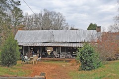 Griffeth-Pendley Houselisted 2008
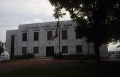 Pickens County Courthouselisted 2008
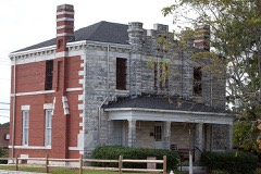 Pickens County Jaillisted 1984
Population over time
2 figuresJasper grew from 3,684 to 4,084 between 2010 and 2020. These are the recorded population figures Wikidata holds for this place, reached through the Geographic Names Information System number this page is keyed on rather than by name, so they belong to this place and not to another of the same name. Most are census counts, but not all are: an early figure may be a founding or settlement estimate, and an estimate published within five years of a census is left out. The change column is computed, and is left blank where more than 20 years separate a figure from the one before it, because a gap that long is not a change between two counts.
| Year | People | Change |
|---|---|---|
| 2010 | 3,684 | |
| 2020 | 4,084 | +400 (+11%) |
Topographic sheets covering this place
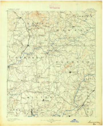
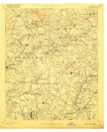
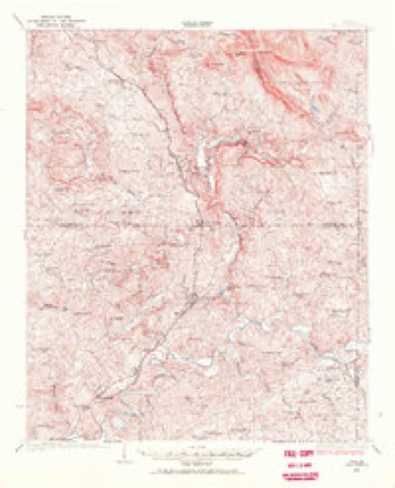
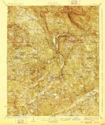
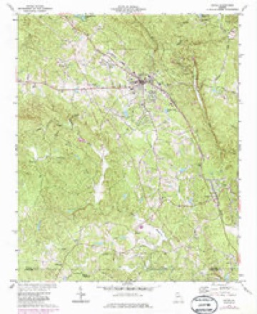
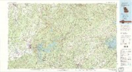
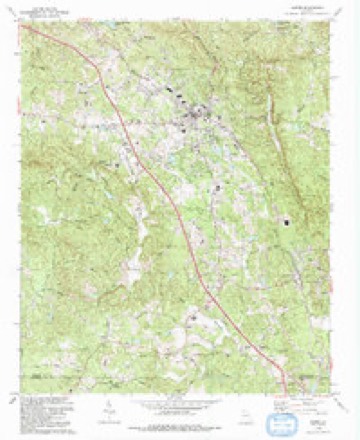
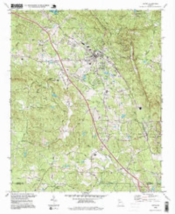
12 surveys from 21 printed sheetsMatched by testing this settlement's coordinate against the published boundary of every sheet in the United States Geological Survey's historical collection. Each opens the scanned sheet at the Survey.
- 1890 USGS Suwanee quadrangle1:125000
- 1894 USGS Suwanee quadrangle1:125000, 6 printings
- 1926 USGS Tate quadrangle1:62500
- 1928 USGS Tate quadrangle1:62500
- 1955 USGS Rome quadrangle1:250000
- 1958 USGS Rome quadrangle1:250000, 3 printings
- 1961 USGS Rome quadrangle1:250000
- 1963 USGS Rome quadrangle1:250000
- 1973 USGS Jasper quadrangle1:24000, 2 printings
- 1981 USGS Cartersville quadrangle1:100000, 2 printings
- 1992 USGS Jasper quadrangle1:24000
- 1997 USGS Jasper quadrangle1:24000




Fires near this place
352 since 1992Regional context, not property-specific evidence. The federal wildfire occurrence database lists 352 fires within 5 miles of Jasper between 1992 and 2020, burning about 1,931 acres in total. 5 started naturally. 74 were recorded as arson. Distance is straight-line from the map coordinates, so a fire counted here may appear on a neighbouring settlement's page as well.
| Reported cause | Fires |
|---|---|
| Debris and open burning | 165 |
| Arson/incendiarism | 74 |
| Missing data/not specified/undetermined | 26 |
| Railroad operations and maintenance | 26 |
| Equipment and vehicle use | 23 |
| Smoking | 14 |
| Misuse of fire by a minor | 14 |
| Recreation and ceremony | 5 |
| Natural | 5 |
The most recent of them, most recent first, with the day each was reported and the service that recorded it.
| Date | Cause | Size | Reported by | Name on the report |
|---|---|---|---|---|
| 8 September 1997 | Debris and open burning | under an acre | Georgia Forestry Commission | not named |
| 5 September 2002 | Arson/incendiarism | under an acre | Georgia Forestry Commission | FY2003-PICKENS-016 |
| 5 September 1999 | Missing data/not specified/undetermined | under an acre | Georgia Forestry Commission | not named |
| 4 September 2002 | Railroad operations and maintenance | under an acre | Georgia Forestry Commission | FY2003-PICKENS-013 |
| 4 September 2002 | Railroad operations and maintenance | under an acre | Georgia Forestry Commission | FY2003-PICKENS-012 |
| 4 September 2002 | Railroad operations and maintenance | 1.5 acres | Georgia Forestry Commission | FY2003-PICKENS-011 |
| 4 September 2002 | Railroad operations and maintenance | 1.0 acres | Georgia Forestry Commission | FY2003-PICKENS-010 |
| 4 September 2002 | Railroad operations and maintenance | under an acre | Georgia Forestry Commission | FY2003-PICKENS-009 |
Settlements close enough to share some of these fires:
Mines and quarries near this place
10 of 11 shownRegional context, not property-specific evidence. The federal mineral resources record lists 11 workings within 5 miles of Jasper: 5 past producers, 4 prospects, 2 producers. 2 still produce. What was taken out: Mica, Stone, Crushed/Broken, Iron, Flagstone. Distance is straight-line from the map coordinates, so a quarry counted here may appear on a neighbouring settlement's page as well.
| Where | Site | Commodity | Status | Recorded |
|---|---|---|---|---|
| North Georgia Quarry | Flagstone | Past Producer | ||
| Perseverence Quarry | Marble, Dimension | Past Producer | ||
| S.C. Tate Estate | Iron | Past Producer | Residual | |
| Mine Number 6 | Stone, Crushed/Broken | Producer | ||
| Pickens County Plant | Stone, Crushed/Broken | Producer | ||
| Unnamed Marble Quarry | Stone, Crushed/Broken | Past Producer | ||
| A V Reeves Prospect | Mica | Prospect | ||
| Allen Morton Prospect | Mica | Prospect | ||
| Davis Mine | Mica | Past Producer | ||
| W J Garrison Prospect | Mica | Prospect |
Storms near this place
51 since 1994Regional context, not property-specific evidence. The National Weather Service names Jasper in 51 storm reports between 1994 and 2026: 24 hail, 22 thunderstorm wind, 2 lightning, 2 flash flood. No death or injury is recorded in these reports. Each account below is quoted exactly as the forecast office filed it, from the NOAA Storm Events Database, and each date opens the federal record of that event.
| When | Event | Place named | Harm | What the report says |
|---|---|---|---|---|
| August 2006 | Lightning | Jasper | $500,000 | The Pickens County Progress of Jasper reported that lightning struck the Big Canoe Golf Shop. The building was a total loss, including a restaurant, pro shop, locker rooms, and a bar. Later investigations determined that lightning likely entered the building via a two-way radio antenna into the pro shop. Lightning also damaged several other buildings in downtown Jasper, including a lawyer's office, the Carriage House, and the Savor Restaurant. |
| July 2010 | Lightning | Jasper | $150,000 | The Atlanta Journal-Constitution reported that a double lightning bolt struck a 66-acre farm just north of Jasper killing four thoroughbred horses valued over $100,000. The lightning bolts apparently hit the pasture where the horses were grazing and traveled through a drainage pipe that ran underneath a dam where the horses were standing at the time of the incident. |
| August 2013 | Flash Flood | Jasper | $50,000 | The Pickens County emergency manager reported swift water rescues in progress at Sharptop Cove Young Life Camp off of Camp Hope Road northeast of Jasper. A portion of the road was washed out by Long Swamp Creek which was cutting off the camp. Two camp employees in a truck attempted to cross the flood waters and were washed downstream around 40 yards from the culvert. A portion of Tamarack Drive was completely washed out by the same creek around one quarter mile downstream from the camp. Another swift water rescue and evacuation from a home was in progress off of Price Creek Trail. Flood waters from Price Creek were threatening the home and first responders were having difficulty reaching the home due to a washed out road. A landslide around 100 feet wide and around 40 feet high closed one lane on a portion of Georgia Highway 136. In summary, 3 evacuations and 3 swift water rescues of people occurred. |
| April 2009 | Tornado (EF1) | Jasper | $25,000 | A damage survey conducted by the National Weather Service Forecast Office in Peachtree City confirmed than an EF1 tornado touched down in Pickens county, approximately one mile northeast of Jasper, near the intersection of Georgia Highay 136 and Old Grandview Road and continued on an eastward approximately 3.5 mile-long path before lifting. The maximum path width was determied to be 440 yards with maximum winds estimated at 90 mph. Damage was greatest along Old Grandview Road near the Grandview community. In this area, at least forty 18-inch and less diameter hardwood trees were either uprooted or snapped along the path of the tornado. A number of power lines were down in the area and several utility poles were snapped. While no direct fatalities or injuries were reported, one person was said to have suffered a heart attack because of anxiety during the event. Only minor structural damage was reported. |
| July 2008 | Thunderstorm Wind | Jasper | $25,000 | The Pickens County Emergency Management Director reported that a thunderstorm downburst resulted in a dozen trees being blown down in the area just west and south of Jasper, especially near Georgia Highway 53, where a large tree fell on and destroyed the deck of a home. Just south of Jasper, a large oak tree fell on a home causing damage to that structure. |
| August 2011 | Thunderstorm Wind | Jasper | $15,000 | The Pickens County 911 Center reported that at least two dozen trees were down throughout the Burnt Mountain area of northeast Pickens county, approximately three to four miles northeast of Jasper. Several power lines were also down in the area with widespread power outages noted in this community. The Burnt Mountain area has elevations generally above 3000 feet. More than a dozen trees were also down in the southeast part of the county around Marble Hill. A number of power outages were noted in this area as well. |
| July 2010 | Thunderstorm Wind | Jasper | $10,000 | A storm spotter reported that two large pine trees were snapped, numerous large branches were down, and more than 50 percent of the shingles were peeled from a home's roof. The spotter estimated that wind gusts were 60 mph or greater. |
| August 2014 | Thunderstorm Wind | Jasper | $8,000 | The Pickens County 911 Center reported numerous trees and power lines down across the entire county. |
| July 1997 | Thunderstorm Wind | Jasper | $7,500 | At least six trees were knocked down by thunderstorm winds. At least one tree was down on a house, however no damage to the home was reported. |
| June 2018 | Thunderstorm Wind | Jasper | $2,000 | The Georgia Dept. of Transportation reported a large tree blown down across Highway 136 near Grandview Road. |
| July 2001 | Thunderstorm Wind | Jasper | $2,000 | The Pickens county 911 center reported that some trees and power lines were blown down in Jasper. |
| May 2000 | Thunderstorm Wind | Jasper | $2,000 | The public reported trees blown down on the road, with one road blocked, and part of a tin roof blown off a cabin home. |
| March 2026 | Thunderstorm Wind | Jasper | $1,000 | The emergency manager relayed a report of trees down 6.1 miles ne of jasper. |
| March 2026 | Thunderstorm Wind | Jasper | $1,000 | The emergency manager relayed a report of trees down 2.9 miles ne of jasper. |
| July 2023 | Thunderstorm Wind | Jasper | $1,000 | Tree down at Turner Road between Refuge Rd and Turner Rd Exd. |
| June 2019 | Thunderstorm Wind | Jasper | $1,000 | A trained spotter reported a tree blown down near the intersection of East Church Street and Brittany Lane. |
| September 2008 | Thunderstorm Wind | Jasper | $1,000 | The Pickens County Emergency Management Director reported that four trees were down at various locations around the city of Jasper. |
| May 1998 | Hail | Jasper | $1,000 | Several reports indicated hail ranged from dime to ping pong ball size. |
| July 1995 | Thunderstorm Wind | Jasper | $1,000 | Thunderstorm winds blew several trees down onto power lines on Main Street, resulting in a power outage. Trees were also knocked down onto powerlines on Burnt Mountain road north of Jasper. |
| May 1996 | Thunderstorm Wind | Jasper | $1,000 | no account filed |
| February 2009 | Thunderstorm Wind | Jasper | $500 | The public reported that a tree was blown down onto a power line on Grandview Road. |
| April 2006 | Thunderstorm Wind | Jasper | $500 | The Pickens County 911 Center reported that a few trees had been blown down. |
| July 2004 | Thunderstorm Wind | Jasper | $500 | The Pickens County 911 center reported that a couple of trees had been blown down. |
| June 1994 | Thunderstorm Wind | Jasper | $500 | A few large trees were blown down 5 miles west of Jasper on Georgia Highway 53. |
| June 2001 | Thunderstorm Wind | Jasper | $500 | no account filed |
| June 2006 | Thunderstorm Wind | Jasper | $250 | The Pickens County 911 Center reported that one tree was blown down in the city. |
| March 2023 | Thunderstorm Wind | Jasper | - | Report of damaged home off of Burnt Mountain Rd. |
| July 2020 | Hail | Jasper | - | A trained spotter reported hail the size of quarters along Navaho Trail in Jasper. |
| July 2019 | Flash Flood | Jasper | - | HAM radio operator reported water around one foot deep at the intersection of Church Street and Pine Street. Radar estimates indicate that 4 to 6 inches of rain occurred over the area in a short period of time. |
| June 2011 | Hail | Jasper | - | The public observed quarter-sized hail between Jasper and Talmadge. |
| April 2011 | Hail | Jasper | - | The public observed penny-sized hail in the far southern central part of Jasper county, just south of Tate, along the Cherokee county line. |
| June 2007 | Hail | Jasper | - | The public reported nickel-sized hail in the Bent Tree community northeast of Jasper near the Gilmer county line. |
| April 2006 | Hail | Jasper | - | The public reported penny-sized hail. |
| March 2005 | Hail | Jasper | - | Numerous reports of hail, ranging in size from quarters to golf balls, were received from the public and an amateur radio operator. However, three reports of hail the size of baseballs were also received in the same area. |
| December 2005 | Hail | Jasper | - | The public observed nickel-sized hail. The hail covered a home deck within a five minute period. |
| December 2004 | Hail | Jasper | - | A trained spotter reported nickel-sized hail five miles west of Jasper and the public reported quarter-sized hail in Talking Rock. |
| April 2003 | Hail | Jasper | - | The Pickens county Emergency Manager reported nickel-sized hail in the Grandview community area northeast of Jasper, while the public reported quarter-sized hail in Marble Hill. |
| May 2003 | Hail | Jasper | - | The Pickens county 911 center reported penny-sized hail. |
| July 2002 | Hail | Jasper | - | The public reported dime size hail. |
| May 2000 | Hail | Jasper | - | The public and an off duty police officer reported dime to half-dollar size hail from 1 mile northwest of Jasper into the city of Jasper. |
| May 1999 | Hail | Jasper | - | The public reported dime size hail. |
| April 1998 | Hail | Jasper | - | no account filed |
| June 1998 | Hail | Jasper | - | no account filed |
| July 1998 | Hail | Jasper | - | no account filed |
| April 1998 | Hail | Jasper | - | no account filed |
| March 1996 | Hail | Jasper | - | no account filed |
| March 1995 | Hail | Jasper | - | no account filed |
| June 1995 | Hail | Jasper | - | no account filed |
| May 1994 | Hail | Jasper | - | no account filed |
| June 1994 | Hail | Jasper | - | no account filed |
| June 1994 | Hail | Jasper | - | no account filed |
Nearest settlements
The eight closest, with where each one stands in the county. Distances are straight-line, computed from the Geographic Names Information System coordinates.
| Map | Place | Distance | Sheets |
|---|---|---|---|
| Ruden | 0.8 miles | 21 | |
| West Brook | 2.2 miles | 21 | |
| Grandview | 2.7 miles | 21 | |
| Tate | 4.2 miles | 21 | |
| Cagle | 4.9 miles | 21 | |
| Daniels | 4.9 miles | 20 | |
| Talking Rock | 4.9 miles | 20 | |
| Marblehill | 5.5 miles | 20 |
Elsewhere
Matched on this settlement's Geographic Names Information System number rather than its name, so it cannot be a different place of the same name in another state.
| Wikipedia article on Jasper | An encyclopaedic summary. Its text is share-alike, so it is linked here rather than copied. |
| Wikidata item Q519096 | The structured record the population and elevation above come from. Public domain (CC0). |
Provenance
This settlement is recorded in the Geographic Names Information System as feature 316056. The sheet list is computed by point-in-boundary test against the United States Geological Survey's historical topographic inventory. Both are works of the United States government and carry no copyright under 17 U.S.C. 105.
Wildfire. Short, Karen C. 2022. Spatial wildfire occurrence data for the United States, 1992-2020 [FPA_FOD_20221014]. 6th Edition. Fort Collins, CO: Forest Service Research Data Archive. https://doi.org/10.2737/RDS-2013-0009.6 Collected with United States Government funding and usable without additional permissions or fees.
Mines and quarries. USGS Mineral Resources Data System (MRDS) https://mrdata.usgs.gov/mrds/ A work of the United States government, no copyright under 17 U.S.C. 105.
Storms. NOAA National Centers for Environmental Information, Storm Events Database https://www.ncei.noaa.gov/stormevents/ A work of the United States government, no copyright under 17 U.S.C. 105. Narratives are quoted verbatim from the National Weather Service report and are not edited or summarised.