 Block
Trenton, Georgia
23 topographic sheets cover this place, the earliest surveyed in 1886 and the latest in 1982. It stands in the Trenton census division. It lies in ZIP code area 30752. It stands on Town Creek. The Survey maps it on the Trenton quadrangle. 2,195 people lived here at the 2020 count. It stands 758 feet above sea level.
Research this city
On record in Trenton
Buildings and businesses the archive holds for this place. Each opens its own page, with the source record it came from.
On the National Register 1 record
 Dade County Courthouselisted 1980
Population over time
3 figuresTrenton grew from 1,942 to 2,195 between 2000 and 2020. These are the recorded population figures Wikidata holds for this place, reached through the Geographic Names Information System number this page is keyed on rather than by name, so they belong to this place and not to another of the same name. Most are census counts, but not all are: an early figure may be a founding or settlement estimate, and an estimate published within five years of a census is left out. The change column is computed, and is left blank where more than 20 years separate a figure from the one before it, because a gap that long is not a change between two counts.
| Year | People | Change |
|---|---|---|
| 2000 | 1,942 | |
| 2010 | 2,301 | +359 (+18%) |
| 2020 | 2,195 | -106 (-5%) |
Topographic sheets covering this place
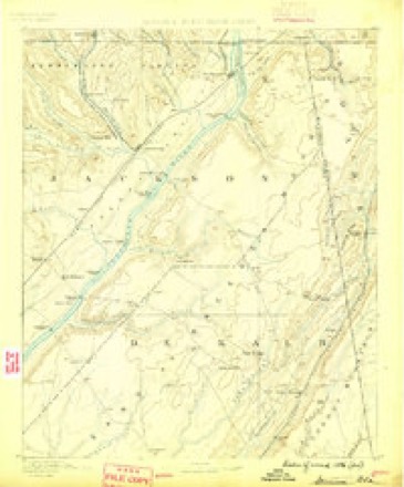
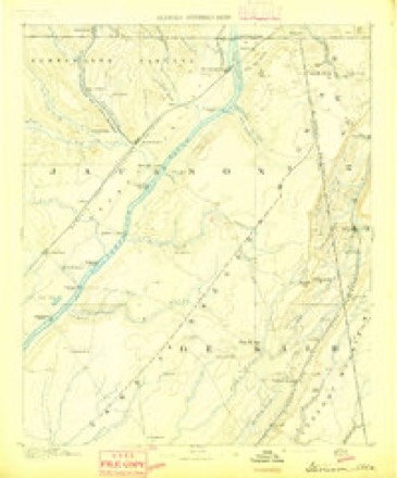
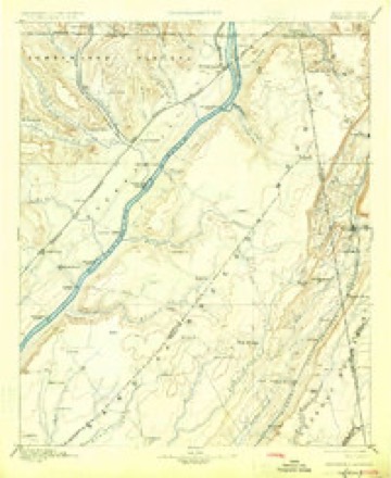
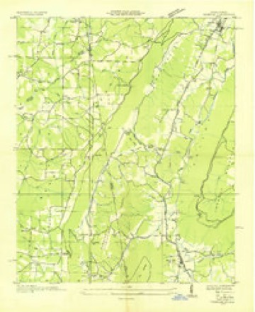
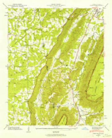
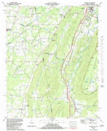
11 surveys from 23 printed sheetsMatched by testing this settlement's coordinate against the published boundary of every sheet in the United States Geological Survey's historical collection. Each opens the scanned sheet at the Survey.
- 1886 USGS Stevenson quadrangle1:125000
- 1892 USGS Stevenson quadrangle1:125000
- 1895 USGS Stevenson quadrangle1:125000, 6 printings
- 1936 USGS Trenton quadrangle1:24000
- 1946 USGS Trenton quadrangle1:24000, 5 printings
- 1955 USGS Rome quadrangle1:250000
- 1958 USGS Rome quadrangle1:250000, 3 printings
- 1961 USGS Rome quadrangle1:250000
- 1963 USGS Rome quadrangle1:250000
- 1981 USGS Chickamauga quadrangle1:100000, 2 printings
- 1982 USGS Trenton quadrangle1:24000




Fires near this place
601 since 1992Regional context, not property-specific evidence. The federal wildfire occurrence database lists 601 fires within 5 miles of Trenton between 1992 and 2020, burning about 4,501 acres in total. 1 started naturally. 175 were recorded as arson. Distance is straight-line from the map coordinates, so a fire counted here may appear on a neighbouring settlement's page as well.
| Reported cause | Fires |
|---|---|
| Debris and open burning | 343 |
| Arson/incendiarism | 175 |
| Equipment and vehicle use | 29 |
| Missing data/not specified/undetermined | 28 |
| Recreation and ceremony | 14 |
| Misuse of fire by a minor | 4 |
| Smoking | 4 |
| Railroad operations and maintenance | 3 |
| Natural | 1 |
The most recent of them, most recent first, with the day each was reported and the service that recorded it.
| Date | Cause | Size | Reported by | Name on the report |
|---|---|---|---|---|
| 7 September 2019 | Debris and open burning | under an acre | Georgia Forestry Commission | FY2020DADE005 |
| 6 September 2010 | Debris and open burning | under an acre | Georgia Forestry Commission | FY2011-DADE-002 |
| 6 September 2002 | Debris and open burning | under an acre | Georgia Forestry Commission | FY2003-DADE-006 |
| 5 September 2002 | Debris and open burning | under an acre | Georgia Forestry Commission | FY2003-DADE-005 |
| 4 September 2011 | Recreation and ceremony | under an acre | Georgia Forestry Commission | FY2012-DADE-018 |
| 30 September 2008 | Arson/incendiarism | under an acre | Georgia Forestry Commission | not named |
| 30 September 2007 | Equipment and vehicle use | 1.5 acres | Georgia Forestry Commission | not named |
| 30 September 2007 | Arson/incendiarism | 1.0 acres | Georgia Forestry Commission | not named |
Settlements close enough to share some of these fires:
Mines and quarries near this place
7 within 5 milesRegional context, not property-specific evidence. The federal mineral resources record lists 7 workings within 5 miles of Trenton: 7 past producers. None of them still produces. What was taken out: Iron, Stone, Dimension. Distance is straight-line from the map coordinates, so a quarry counted here may appear on a neighbouring settlement's page as well.
| Where | Site | Commodity | Status | Recorded |
|---|---|---|---|---|
| Progressive Industries Quarry | Stone, Dimension | Past Producer | ||
| Phoenix Iron & Coal Mines | Iron | Past Producer | Strataform, Concordant | |
| Sutton & Austin Mines | Iron | Past Producer | Strataform, Concordant | |
| Unnamed | Iron | Past Producer | Strataform, Concordant | |
| Unnamed, Lot 117, 10th District | Iron | Past Producer | Strataform, Concordant | |
| Unnamed, Lot 251, 10th District | Iron | Past Producer | Strataform, Concordant | |
| Unnamed, Lot 37, 11th District | Iron | Past Producer | Strataform, Concordant |
Storms near this place
60 of 73 shownRegional context, not property-specific evidence. The National Weather Service names Trenton in 73 storm reports between 1993 and 2024: 40 hail, 31 thunderstorm wind, 2 lightning. The reports record 4 injuries. Each account below is quoted exactly as the forecast office filed it, from the NOAA Storm Events Database, and each date opens the federal record of that event.
| When | Event | Place named | Harm | What the report says |
|---|---|---|---|---|
| April 2003 | Thunderstorm Wind | Trenton | 2 hurt, $100,000 | The Dade county Emergency Management Director reported that a microburst or downburst caused considerable damage to three structures on the west side of Trenton, as well as blowing down a number of trees and power lines in the area. A woman and her child were driving along Back Valley Road, just south of Georgia Highway 136 near Gass, when a tree broke off some 10 to 15 feet above the ground and fell on their minivan. The child was trapped in the vehicle and had to be rescued. Both received injuries from the incident. A third person was trapped in his vehicle at a MAPCO gasoline service station in Trenton when the awning from the station was ripped loose from the building, pinning the man in his vehicle. Although the man had to be rescued from his vehicle, he did not suffer any injuries. Along Georgia Highway 136 near Gass, west of Trenton, a fruit and vegetable stand suffered extensive damage. The facade of the main building of the business was destroyed. A secondary building, including its contents, was completely destroyed, and a carport structure, that was also part of the facility, was thrown across the highway by thunderstorm winds. Next door at a service station, one of the gasoline pumps was damaged, two windows were broken, and some of the goods inside were knocked over and damaged or destroyed. Behind the service station, a lumber and salvage yard also suffered damage from the thunderstorm winds. Metal was blown through the front door and some materials stacked up outside were either damaged or blown away. Although there were reports of funnel clouds and tornadoes in the area, the Dade Emergency Manager detected no rotation in the damage area and concluded that the damage was caused by a microburst, not a tornado. He indicated that the damage area was one-half to one mile long and all mostly within a 100 yard wide area. |
| April 1998 | Thunderstorm Wind | Trenton | 2 hurt, $75,000 | A downburst from a severe thunderstorm in the West Brow community destroyed one house, damaged another, and overturned a trailer. A man suffered a broken leg and his wife had cuts and bruises. Numerous trees were knocked down. A spotter reported dime size hail and winds estimated at 60 mph. |
| April 2011 | Thunderstorm Wind | Trenton | $500,000 | The Dade County Emergency Management Director reported that over 50 trees were down in the north central and northwest part of the county, especially along Georgia Highway 299. Numerous trees were also down just southwest of Trenton with extensive damage along North Woods Lane. This was the same neighborhood to be struck by an EF1 tornado at 840 am EDT and an EF3 tornado later the same day. This neighborhood was literally devastated by these multiple events tracking over the same area. |
| June 2010 | Thunderstorm Wind | Trenton | $150,000 | The Dade County Emergency Management Director reported that a thunderstorm downburst or microburst caused considerable damage around Trenton. Approximately 50 trees were blown down in the Edgewood and Piney communities. A home in the Edgewood community was destroyed from downed trees and another sustained minor to moderate damage. A trailer home in the Piney community was also damaged from downed trees, while several outbuildings were heavily damaged or destroyed. A number of power lines and phone lines were also down throughout this area. The Emergency Manager estimated wind gusts at 50 to 60 mph. |
| June 1994 | Thunderstorm Wind | Trenton | $50,000 | Thunderstorm winds downed several trees, power lines and moderately damaged a few homes in the New Home community atop Sand Mountain, seven miles west of Trenton. Nearly 150 homes were without power for up to eight hours from downed power lines. |
| June 2003 | Lightning | Trenton | $25,000 | The Dade county 911 center reported that a house was set on fire by lightning. |
| April 2009 | Thunderstorm Wind | Trenton | $20,000 | The Dade County Emergency Management Director and 911 Center reported that many trees were blown down across the county, the majority of which occurred in the New Home community. One home in this community was damaged when the tree fell on the structure. |
| July 2000 | Thunderstorm Wind | Trenton | $15,000 | A storm spotter report was relayed through the Morristown, TN National Weather Service office indicating that roof damage was sustained to the roof of the Piney Grove Baptist Church at the intersection of Burkhalter Gap Road and Lookout Mountain Scenic Highway. The spotter also spotted a funnel cloud in the same general area. In Trenton, an amateur radio operator reported 2 medium size trees down. |
| November 2002 | Lightning | Trenton | $10,000 | The Dade county Emergency Management Director reported that lightning struck and completely destroyed a small garage outbuilding located near Georgia Highway 136 at the foot of Lookout Mountain. The contents, which included numerous tools and implements, were destroyed as well. |
| May 2002 | Thunderstorm Wind | Trenton | $5,000 | The Dade county 911 center reported that trees and power lines were down. |
| November 2000 | Thunderstorm Wind | Trenton | $5,000 | An amateur radio operator reported that strong winds, accompanying a strong cold front and squall line, knocked down trees and power lines on Sun and Lookout mountains. |
| November 2002 | Thunderstorm Wind | Trenton | $3,000 | The Dade county 911 center reported that numerous trees were down in the Trenton area. |
| July 2000 | Thunderstorm Wind | Trenton | $3,000 | The Dade county 911 center reported some trees down in the road and on a power line. |
| May 1997 | Thunderstorm Wind | Trenton | $2,500 | Thunderstorm winds knocked down trees throughout the county. Power outages were also reported as several power lines snapped as limbs fell on them. |
| August 2014 | Thunderstorm Wind | Trenton | $2,000 | The Dade County 911 Center reported numerous trees down across the county. |
| February 2009 | Thunderstorm Wind | Trenton | $2,000 | The Dade County Emergency Management Director reported that two power lines and three trees were blown down. Two of the trees were down in Trenton, while the other was northwest of Trenton in the Dogwood community. One of the power lines was down northwest of Trenton and the other in Trenton. |
| June 1999 | Thunderstorm Wind | Trenton | $2,000 | The Dade county sheriff reported trees and power lines down. |
| July 1997 | Thunderstorm Wind | Trenton | $2,000 | Thunderstorm winds knocked down trees and power lines. |
| February 2014 | Thunderstorm Wind | Trenton | $1,500 | The Dade County 911 Center reported that several trees were blown down along Highway 11 South. |
| November 2022 | Thunderstorm Wind | Trenton | $1,000 | Report of tree down at the intersection of Brow Road and Cagle Rd. |
| August 2014 | Thunderstorm Wind | Trenton | $1,000 | The Dade County 911 Center reported 4 large trees down across the county. |
| November 2003 | Thunderstorm Wind | Trenton | $1,000 | The Dade county 911 center reported that a few trees were blown down on Porter Road west of Stephensville. |
| May 1998 | Hail | Trenton | $1,000 | The Dade county EMA director reported golf ball size hail damaged a house. Tree limbs were also knocked down. |
| July 1998 | Thunderstorm Wind | Trenton | $1,000 | A Trenton fire station reported several trees blown down. |
| June 2014 | Thunderstorm Wind | Trenton | $500 | The Dade County 911 Center reported two trees down. |
| June 2014 | Thunderstorm Wind | Trenton | $500 | The Dade County 911 Center reported that a couple of trees were down in Trenton, with several power outages. |
| June 2008 | Thunderstorm Wind | Trenton | $500 | The Dade County 911 Center reported that a tree was blown down onto a power line on Burkhalter Gap Road near Lookout Mountain Scenic Highway northeast of Trenton. |
| June 1998 | Thunderstorm Wind | Trenton | $500 | Dade county 911 reported trees down across a road. |
| July 2006 | Thunderstorm Wind | Trenton | $250 | The Dade County 911 Center reported that one tree was blown down on the north side of Trenton. |
| February 2005 | Thunderstorm Wind | Trenton | $250 | The Dade County 911 Center reported that one tree was blown down. In additon, they also reported pea-sized hail. |
| December 2004 | Thunderstorm Wind | Trenton | $250 | The Dade County Emergency Management Director reported that one tree was blown down onto New Home Road. |
| July 2003 | Thunderstorm Wind | Trenton | $250 | The Dade county Assistant 911 Director reported that a couple of small trees were down. He estimated wind gusts between 40 and 50 mph. |
| August 2024 | Hail | Trenton | - | Hail from the size of pennies to quarters was reported at the intersection of hickory street and poplar avenue. |
| May 2022 | Thunderstorm Wind | Trenton | - | Several trees reported downed in Trenton: Wren Ave, Poplar St, Bond Ave, and Jeffery Town Rd. |
| March 2017 | Hail | Trenton | - | Quarter size hail was reported at a restaurant along Barton Avenue north of Trenton. |
| March 2017 | Hail | Trenton | - | The public reported quarter size hail. |
| February 2011 | Hail | Trenton | - | A storm spotter observed nickel-sized hail approximately one mile east of Trenton. |
| May 2011 | Hail | Trenton | - | The Dade County 911 Center relayed a report of penny-sized hail on the northwest side of Trenton. |
| June 2010 | Hail | Trenton | - | The public observed nickel-sized hail west of Trenton. Radar data supports that hail of similar size continued to just north of Trenton. |
| July 2008 | Hail | Trenton | - | The Dade County 911 Center reported penny-sized hail on the west side of Trenton. A tree was also blown down south of Trenton in Rising Fawn and another north of Trenton in Wildwood. |
| April 2007 | Hail | Trenton | - | The public reported penny-sized hail on the west side of Trenton. The Dade County Emergency Management Director observed pea-sized hail near Rising Fawn. |
| July 2007 | Hail | Trenton | - | The public reported penny-sized hail on Hartline Road. |
| April 2006 | Hail | Trenton | - | The Dade County Emergency Management Director reported penny to quarter-sized hail. |
| April 2006 | Hail | Trenton | - | The Dade County 911 Center reported penny-sized hail. A spotter estimated wind gusts at 45 mph during the same storm. |
| May 2006 | Hail | Trenton | - | Several reports of penny, and in one instance nickel-sized hail, were received from the public. |
| May 2006 | Hail | Trenton | - | The Dade County 911 Center reported nickel-sized hail. |
| May 2006 | Hail | Trenton | - | The Dade County 911 Center reported penny-sized hail in Trenton and the Cloudland State Park area east of Trenton. |
| November 2006 | Hail | Trenton | - | An employee of the Dade County 911 Center observed penny-sized hail for about a one-mile stretch of roadway beginning one mile south of Trenton. |
| April 2005 | Hail | Trenton | - | The Dade County 911 Center reported ping-pong ball-sized hail. The public reported nickel-sized hail, which covered the ground in some locations. |
| May 2005 | Hail | Trenton | - | The public reported penny-sized hail in Trenton and golf ball-sized hail four miles southeast of Trenton. |
| May 2005 | Hail | Trenton | - | The public reported yet another round of golf ball-sized hail with a second thunderstorm at the same location. |
| May 2004 | Thunderstorm Wind | Trenton | - | An amateur radio operator reported a measured wind gust of 60 mph in Trenton. |
| August 2003 | Hail | Trenton | - | The Morristown, Tennessee National Weather Service (NWS) Forecast Office relayed a report they had received from the public of penny-sized hail. |
| November 2002 | Hail | Trenton | - | The Dade County 911 center reported nickel to quarter size hail. |
| May 2002 | Hail | Trenton | - | The Dade county 911 center reported dime size hail. |
| June 2001 | Hail | Trenton | - | The Dade County 911 center reported dime size hail. |
| June 2001 | Hail | Trenton | - | The public reported dime size hail near Lookout Mountain Scenic Highway, Georgia 189, east of Trenton. |
| March 2000 | Hail | Trenton | - | A public report indicated dime size hail lasted for about 10 minutes. |
| September 2000 | Hail | Trenton | - | A trained spotter reported dime size hail in Trenton. |
| November 2000 | Hail | Trenton | - | An amateur radio operator reported dime size hail. |
Nearest settlements
The eight closest, with where each one stands in the county. Distances are straight-line, computed from the Geographic Names Information System coordinates.
| Map | Place | Distance | Sheets |
|---|---|---|---|
| Union | 2.0 miles | 23 | |
| Avans | 2.1 miles | 25 | |
| Gass | 2.2 miles | 23 | |
| Tatum (historical) | 2.4 miles | 23 | |
| New England | 3.1 miles | 26 | |
| Cedar Hill | 4.4 miles | 23 | |
| Stewart Town | 4.5 miles | 23 | |
| Morganville | 5.3 miles | 26 |
Elsewhere
Matched on this settlement's Geographic Names Information System number rather than its name, so it cannot be a different place of the same name in another state.
| Wikipedia article on Trenton | An encyclopaedic summary. Its text is share-alike, so it is linked here rather than copied. |
| Wikidata item Q2856209 | The structured record the population and elevation above come from. Public domain (CC0). |
Provenance
This settlement is recorded in the Geographic Names Information System as feature 333261. The sheet list is computed by point-in-boundary test against the United States Geological Survey's historical topographic inventory. Both are works of the United States government and carry no copyright under 17 U.S.C. 105.
Wildfire. Short, Karen C. 2022. Spatial wildfire occurrence data for the United States, 1992-2020 [FPA_FOD_20221014]. 6th Edition. Fort Collins, CO: Forest Service Research Data Archive. https://doi.org/10.2737/RDS-2013-0009.6 Collected with United States Government funding and usable without additional permissions or fees.
Mines and quarries. USGS Mineral Resources Data System (MRDS) https://mrdata.usgs.gov/mrds/ A work of the United States government, no copyright under 17 U.S.C. 105.
Storms. NOAA National Centers for Environmental Information, Storm Events Database https://www.ncei.noaa.gov/stormevents/ A work of the United States government, no copyright under 17 U.S.C. 105. Narratives are quoted verbatim from the National Weather Service report and are not edited or summarised.