 Block
From the record
One of 18 National Register listings published here for Gwinnett County · listed in 1980 · category: District.
Sources: the case file at the National Archives · the National Register database, National Park Service
Listed on the National Register of Historic Places in 1980.
One of 18 National Register listings published here for Gwinnett County · listed in 1980 · category: District.
Sources: the case file at the National Archives · the National Register database, National Park Service
Regional context, not property-specific evidence. The federal wildfire occurrence database lists 44 fires within 5 miles of Norcross Historic District between 1992 and 2011, burning about 116 acres in total. 1 started naturally. 22 were recorded as arson. Distance is straight-line from the map coordinates, so a fire counted here may appear on a neighbouring settlement's page as well.
| Reported cause | Fires |
|---|---|
| Arson/incendiarism | 22 |
| Debris and open burning | 9 |
| Recreation and ceremony | 5 |
| Equipment and vehicle use | 3 |
| Misuse of fire by a minor | 2 |
| Smoking | 1 |
| Missing data/not specified/undetermined | 1 |
| Natural | 1 |
The most recent of them, most recent first, with the day each was reported and the service that recorded it.
| Date | Cause | Size | Reported by | Name on the report |
|---|---|---|---|---|
| 13 September 1993 | Arson/incendiarism | 1.9 acres | Georgia Forestry Commission | not named |
| 23 August 2000 | Debris and open burning | 2.0 acres | Chattahoochee River National Recreation Area | CHAT004217 |
| 21 August 1993 | Recreation and ceremony | 1.6 acres | Georgia Forestry Commission | not named |
| 2 August 1995 | Debris and open burning | under an acre | Georgia Forestry Commission | not named |
| 27 July 1993 | Natural | under an acre | Georgia Forestry Commission | not named |
| 26 July 1995 | Arson/incendiarism | under an acre | Georgia Forestry Commission | not named |
| 23 July 1993 | Arson/incendiarism | under an acre | Georgia Forestry Commission | not named |
| 5 June 1994 | Arson/incendiarism | under an acre | Georgia Forestry Commission | not named |
Regional context, not property-specific evidence. The federal mineral resources record lists 2 workings within 5 miles of Norcross Historic District: 2 producers. All of them still produce. What was taken out: Stone, Crushed/Broken. Distance is straight-line from the map coordinates, so a quarry counted here may appear on a neighbouring settlement's page as well.
| Where | Site | Commodity | Status | Recorded |
|---|---|---|---|---|
| Norcross Quarry | Stone, Crushed/Broken | Producer | ||
| Norcross Shops | Stone, Crushed/Broken | Producer |
Regional context, not property-specific evidence. The National Weather Service names Norcross, the town this property stands in, in 70 storm reports between 1995 and 2025: 30 thunderstorm wind, 24 hail, 7 lightning, 5 flash flood. The reports record 1 death and 13 injuries. Each account below is quoted exactly as the forecast office filed it, from the NOAA Storm Events Database, and each date opens the federal record of that event.
| When | Event | Place named | Harm | What the report says |
|---|---|---|---|---|
| September 2009 | Flash Flood | Norcross | 1 killed, $630,000 | Catastrophic flash flooding began to unfold across portions of Gwinnett county during the early morning hours of the 21st as a secondary area of very heavy rain and thunderstorms began to expand across the eastern Atlanta metropolitan counties. Rainfall exceeded 12 inches in portions of the county during the night and early morning hours. USGS stream gages verified that significant flooding was underway. Crooked Creek at Norcross exceeded its flood stage of 11 feet at 306 am EDT. Pew Creek near Lawrenceville reached its flood stage of 11 feet at 418 am EDT. Many roads became flooded and impassable as they were submerged by several feet of water in some areas. A 39-year old female lost her life as her vehicle was washed off Desiree Drive and she was carried away in the flood waters of a small tributary feeding into the Yellow River. Many homes, apartments, businesses and roads from Norcross to Lawrenceville to Lilburn were flooded during this time frame. Monetary damage to roads and property during this period was estimated to exceed $600,000. |
| April 1998 | Tornado (F2) | Norcross | 10 hurt, $50,000,000 | Significant widespread damage continued into Gwinnett county in a path from Norcross through Duluth and Suwanee to north of Lawrenceville. Large trees were knocked down or snapped. Many of them fell on homes and apartments causing damage. Roofs were torn off of houses. At least 5000 homes were affected. Ten people at an apartment complex were treated for minor injuries. |
| May 2004 | Thunderstorm Wind | Norcross | 3 hurt | The Gwinnett Daily-Post of Lawrenceville reported that three people were injured at Thrasher Park when a dead tree was blown over onto them by wind gusts associated with a thunderstorm. |
| February 2005 | Hail | Norcross | $5,000,000 | The Gwinnett County SkyWarn coordinator reported golf ball-sized hail in Lilburn. The public reported nickel-sized hail in the eastern portions of Norcross/western portions of Lilburn near Interstate-85. The Gwinnett Daily-Post reported that 90 percent of the vehicles parked at the Mall of Georgia were damaged by the hail. |
| April 2011 | Hail | Norcross | $3,150,000 | Amateur radio operators and the public reported hail up to the size of half-dollars and ping-pong balls, possibly some as large as golf balls, across far northwest and north central Gwinnett county from Norcross, to Sugar Hill and Buford. Several reports of penny to quarter-sized hail were also received from this same general area. WSR-88D radar data suggests that the largest hail likely fell near Norcross. |
| September 2004 | Heavy Rain | Norcross | $500,000 | The Atlanta Journal-Constitution reported that nearly 3 inches of rain fell during the evening hours. Sixteen to 20 apartments that were under renovation were flooded and sustained heavy damage when roof damage allowed water to leak into the apartments. Seventy-five to 100 residents had to evacuate as a result. |
| April 2011 | Lightning | Norcross | $300,000 | The Gwinnett County 911 Center reported that at least two homes in the Norcross area were struck by lightning. One of these, a two-story home, was set on fire and completely destroyed. |
| April 2011 | Thunderstorm Wind | Norcross | $250,000 | Numerous reports of thunderstorm wind damage were received from the Gwinnett County 911 Center, amateur radio operators, and the public across the entire county. At least two reports of wind gusts near 58 mph were also received. Wind damage was widespread with dozens of trees and power lines down throughout the county from Norcross to Lilburn, Lawrenceville, Dacula, and Grayson. Less damage was noted in the northern part of the county. The most significant damage appeared to be in the Lilburn area, where several homes suffered structural damage from downed trees. |
| March 2005 | Lightning | Norcross | $225,000 | The Atlanta Journal-Constitution reported that lightning struck four homes in Gwinnett county, three of which suffered fire and smoke damage. One home was set on fire by lightning on Birkhill Way in Lawrenceville. The fire was confined to the attic. However, a firefighter was treated for smoke inhalation. Another home on Tribble Circle in Grayson was struck by lightning. This home sustained minor damage. A third home on Alamosa Court in Lawrenceville was struck, but no significant damage was reported. The fourth home struck by lightning in the county was on Kimberly Lane in Norcross. This home suffered extensive damage from the resulting fire. |
| August 2007 | Lightning | Norcross | $200,000 | The Gwinnett Daily Post of Lawrenceville reported that two homes were struck and set on fire by lightning. One was on Wedgewood Chase Drive and the other on Williamsport Drive near East Jones Bridge Road, of which the roof was completely burned. |
| August 2005 | Lightning | Norcross | $150,000 | The Gwinnett Daily Post of Lawrenceville reported that lightning struck a home on Crooked Creek Road in the Norcross area setting the structure on fire. The home suffered extensive damage. One tree was also down in the area from thunderstorm winds. |
| July 2016 | Thunderstorm Wind | Norcross | $100,000 | The Gwinnett County Emergency Manager reported numerous trees and power lines blown down across the county. Some locations include Castlerock Way at Blarney Way, Windward Lane, Whitegrass Way, Pleasant Hill Road, Hale Drive, Hewatt Road, Greenvalley Road, Applewood Road, East Morningside Drive, Slew Avenue and Lake Lucern Drive. Downed trees damaged houses and vehicles in the Lawrenceville area, Snellville and Lilburn. |
| May 2021 | Thunderstorm Wind | Norcross | $40,000 | The Gwinnett County Emergency Manager reported several trees blown down from the Norcross are to Mountain Park. Trees fell on homes on Bussell Place in Norcross and Tarleton Drive in Lilburn. |
| July 2007 | Thunderstorm Wind | Norcross | $30,000 | WXIA Television of Atlanta reported that a couple of trees were down on homes in the western part of the county. |
| July 2010 | Lightning | Norcross | $25,000 | The Gwinnett County Emergency Management Director reported that lightning struck the electrical line of a home on Ivy Park Lane in Norcross. The lightning strike traveled through the dryer vent into the house. Firefighters found heavy smoke in the structure upon arrival, but no fire. |
| June 2020 | Thunderstorm Wind | Norcross | $20,000 | Several reports were received from the public of trees and power lines blown down from Norcross to east of Snellville. |
| March 2017 | Thunderstorm Wind | Norcross | $20,000 | The Gwinnett County Emergency Manager reported trees blown down across the northern side of the county, including on Dacula Road in the vicinity of Bailey Woods Road and on Williamsport Drive Northwest where a tree landed on a house. No injuries were reported. |
| November 2016 | Thunderstorm Wind | Norcross | $20,000 | An Atlanta area television news station reported a large tree blown down onto North Peachtree Street near Sunset Drive and a large tree blown down onto a house on Tina Court. |
| June 1998 | Thunderstorm Wind | Norcross | $20,000 | Trees were knocked down on a few houses and power lines in Norcross, Suwanee, Lawrenceville, and Dacula. |
| June 2016 | Thunderstorm Wind | Norcross | $18,000 | The Gwinnett County Emergency Manager reported trees blown down on houses on Lancelot Drive and Audubon Place in Norcross. |
| April 1998 | Thunderstorm Wind | Norcross | $15,000 | Lots of trees were knocked down, one large one fell on an apartment building. A porch was blown off a house. Larger than dime size hail was also reported. |
| July 2017 | Thunderstorm Wind | Norcross | $12,000 | The Gwinnett County Emergency Manager reported numerous trees and power lines blown down across the northern and western portions of the county. Some locations include Edgewood Lane in Stone Mountain; around the intersections of Steve Drive and Buford Highway and Amwiler Road at Humphries Way in Norcross; Pleasant Hill Road at Hill Drive and along Old Norcross Road in Duluth; and along Suwanee Creek Road near Buford Highway in Suwanee. |
| August 1999 | Lightning | Norcross | $10,000 | Lightning, and the fire it caused, damaged the upper part of a house in the Avocet subdivision at South Old Peachtree Road and Peachtree Industrial Boulevard. |
| June 2011 | Thunderstorm Wind | Norcross | $7,000 | The Gwinnett County 911 Center reported that a number of trees were down across the county. The damage was the result of two lines of severe thunderstorms that moved through the county, especially the southern half. The first line of severe thunderstorms tracked across much of the county between 642 pm EDT and 715 pm EDT, while the second line moved through mainly the southern part of the county between 725 pm EDT and 740 pm EDT. |
| July 2000 | Thunderstorm Wind | Norcross | $5,000 | The Gwinnett county 911 center reported trees down from Norcross, to Duluth, to Lawrenceville. |
| June 1998 | Thunderstorm Wind | Norcross | $5,000 | The public reported trees down on a house at Peachtree Corners. |
| August 2019 | Thunderstorm Wind | Norcross | $4,000 | The Gwinnett County Emergency Manager reported a large tree and power lines down around the intersection of Spalding Drive and Frank Neely Road. |
| July 2010 | Flash Flood | Norcross | $3,000 | The USGS stream gage on Sweetwater Creek at Club Drive (STWG1) reached its flood stage of 11.0 feet at 730 pm EDT. The creek remained in flood until 935 pm EDT. Damage was confined to minor debris removal near the creek. |
| August 2014 | Thunderstorm Wind | Norcross | $2,000 | The Emergency Manager reported Power lines down on John Drive and Summertown Drive. |
| July 2012 | Thunderstorm Wind | Norcross | $2,000 | Gwinnett police reported that numerous trees were blown down in Norcross. |
| August 2010 | Thunderstorm Wind | Norcross | $2,000 | The public reported that several trees were down in and near Duluth, especially near the Chattahoochee River. |
| April 1997 | Thunderstorm Wind | Norcross | $2,000 | no account filed |
| July 2012 | Thunderstorm Wind | Norcross | $1,500 | The Gwinnett County 911 Center reported that seven trees were down including a few at Thrusher Park and Academy Road. |
| April 2025 | Thunderstorm Wind | Norcross | $1,000 | Tree down at technology parkway and westech drive. |
| April 2025 | Thunderstorm Wind | Norcross | $1,000 | Tree down on allenhurst dr near broxton cir nw. |
| August 2024 | Thunderstorm Wind | Norcross | $1,000 | Tree on gas station at 2300 block of beaver ruin rd . |
| July 2017 | Lightning | Norcross | $1,000 | The Gwinnett County Emergency Manager reported a house struck by lightning on Yarrow Bluff. No fire was found. |
| July 2013 | Thunderstorm Wind | Norcross | $500 | The Gwinnett County 911 Center reported that a tree was blown down at Plantation Lane, and another tree was blown down onto Sterling Road. |
| September 1999 | Thunderstorm Wind | Norcross | $500 | A citizen reported dime size hail and several trees down. |
| January 2006 | Flash Flood | Norcross | $100 | The National Weather Service river gage on Crooked Creek along the Fulton/Gwinnett county line, or about 4 miles west-northwest of Norcross indicated that the river had exceeded flood stage at 8:35 AM EST and fell below flood stage at 11:45 am EST. No property damage was reported. |
| January 2006 | Flash Flood | Norcross | $100 | Official National Weather Service river gage readings indicated that Crooked Creek along the Gwinnett/Fulton county line just south-southeast of Newton reached flood stage of 9.0 feet at 108 pm EST, crested at 10.6 feet at 230 pm EST, and then fell below flood stage at 550 pm EST. This creek is in an urbanized area and the area is subject to flash flooding from the creek during periods of heavy rainfall. Rainfall on the order of 2.0 inches or more fell across the area from late morning through mid-afternoon. The ground was already saturated from previous heavy rains in recent weeks. The flooding was basically a nuisance and no damage was reported to any property in the area. |
| June 2025 | Hail | Norcross | - | Picture with hail next to quarter from public near the intersection of N Peachtree Rd and Starcross Ct. |
| July 2025 | Thunderstorm Wind | Norcross | - | Tree down on vehicles along Jimmy Carter Boulevard near Atlantic Drive. |
| August 2023 | Thunderstorm Wind | Norcross | - | Tree on a house along Cobb Branch Drive . |
| March 2023 | Hail | Norcross | - | Report of ping pong ball size hail near the intersection of I-85 and Jimmy Carter Blvd. |
| June 2022 | Thunderstorm Wind | Norcross | - | A tree was downed onto a home on Danbury Dr NW. |
| June 2022 | Thunderstorm Wind | Norcross | - | A tree was downed onto a home on Westberry Ln NW. |
| August 2021 | Flash Flood | Norcross | - | The Broadcast Media reported significant flooding along I-85 near Jimmy Carter Boulevard. Parts of the interstate were shut down due to high water over the roadway. Radar estimates indicate that 1.5 to 2.5 inches quickly fell over the area, causing the flash flooding. |
| April 2005 | Hail | Norcross | - | Several reports of penny to nickel-sized hail were received from the public in Norcross, Lilburn, and Berkeley Lakes. |
| May 2004 | Hail | Norcross | - | The public reported penny-sized hail. |
| May 2004 | Heavy Rain | Norcross | - | A SkyWarn storm spotter reported that very heavy rain had resulted in minor flooding on roadways. |
| August 2003 | Hail | Norcross | - | A SkyWarn Spotter reported penny-sized hail. |
| March 2002 | Flood | Norcross | - | An amateur radio operator reported that 1 to 1 1/2 inches of rain fell in a 30 minute period during a thunderstorm causing some minor street flooding on the east side of Norcross. |
| May 2002 | Hail | Norcross | - | An amateur radio operator reported dime size hail. |
| July 2002 | Hail | Norcross | - | A storm spotter reported nickel size hail. |
| July 2002 | Hail | Norcross | - | The public reported dime size hail. |
| May 2000 | Hail | Norcross | - | Several reports of dime to quarter size hail were received from the public from the south side of Norcross and from the Peachtree Industrial Boulevard area of Norcross. |
| June 2000 | Hail | Norcross | - | The public reported dime size hail in the Peachtree Corners area of Norcross. |
| June 2000 | Hail | Norcross | - | The public reported quarter size hail. |
| May 1999 | Hail | Norcross | - | The public reported golf ball size hail 4 miles west of I-85. |
No historic map-sheet match is published for this property yet. That does not mean no map exists. This record needs a coordinate-quality review before it can be joined to a sheet boundary. Browse the county's mapped places while that work is pending.
Other National Register properties close enough to walk or drive between, ordered by distance from this one. Both positions come from the same geocoding pass that matched these properties to their map sheets.
| Photograph | Property | Distance | Listed |
|---|---|---|---|
 | Mechanicsville School | 2.3 miles | 1980 |
 | Superb, The | 4.5 miles | 1999 |
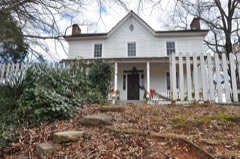 | Thomas Wynne House | 5.2 miles | 1977 |
| National Archives record | The nomination case file for reference 80001086 in Record Group 79. |
| Gwinnett County | All 18 listed properties in this county. |